|
I would like to thank everyone who has made financial contributions so far. My current deficit for the year is $1000. This money pays the bills for forecast data, this website, and for a stipend for the college meteorology students who work with me during the summer and winter break. No contribution is too small. Patreon at $5 a month goes a long way with me. Donations via VENMO or by sending a check work also. You can click on the banner below or click on DONATE to direct you for more information. Your support financially and through sharing my efforts with others means everything to me. Thank you! A bit of a snap in the air to remind us it's November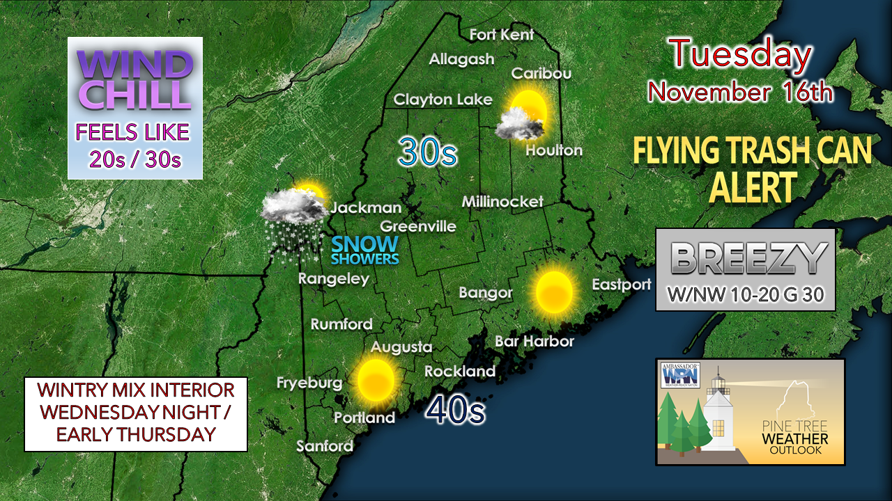 A few early morning snow showers over interior eastern areas should depart soon after sunrise. A west/northwesterly breeze which could gust in the 30+ mph range in spots may tip a few trash cans over and knock about 10° off the actual temperature. Cold air advection generates upslope snow showers for the mountains. The wind settles down this evening, any clouds around clear out, and the coldest night of the season so far greets us for Wednesday, with lows in the teens to mid-20s. A light mixed bag on the way Wednesday night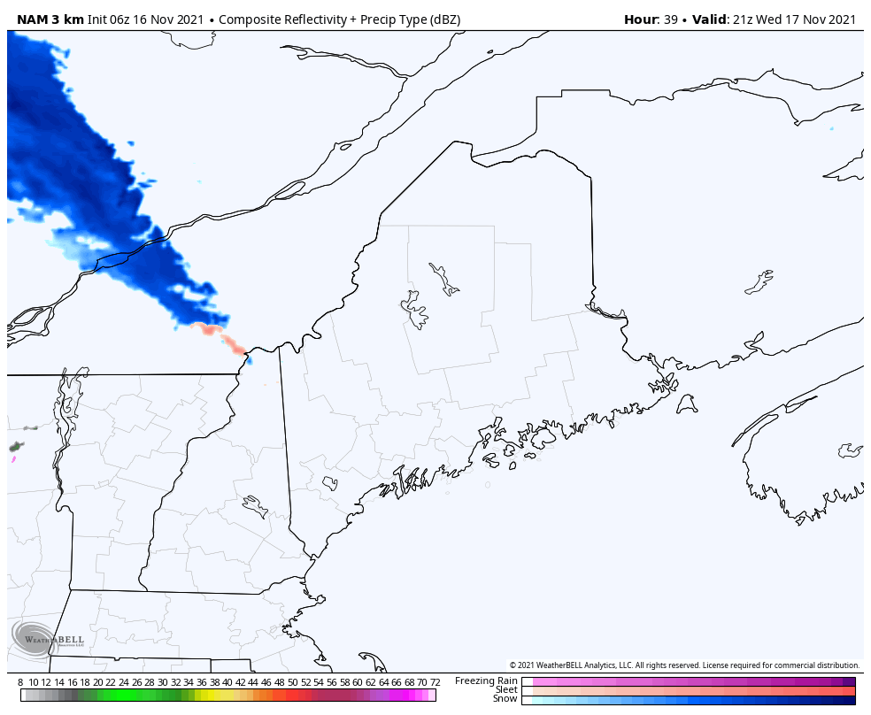 Wednesday 4 PM - Thursday 1 PM - An upper-level ridge moves into the region from the west. As warm air works in aloft, several types of precipitation form, with snow at the onset, then potential for sleet and pockets of light freezing rain, then changing to all rain unless cold air damming gets the last laugh in the far north. Southern areas are on track to enjoy the warmth the ridge provides with temperatures topping out in the 60s on Thursday. 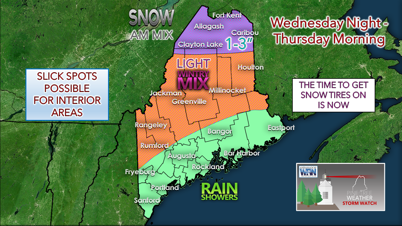 The rooftop of the state has the best chance for snow accumulation before the mixing arrives. While I expect precipitation amounts to be light over the interior south of the crown, it could be enough to cause some slick spots Wednesday night into the Thursday morning commute. Cold front passes through early Friday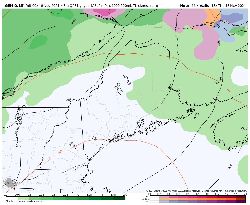 Thursday 1 PM - Friday 7 PM - A cold front approaches the region bringing rain showers along with it Thursday night, passing through in the wee hours of Friday. The steady rainfall is on track to end prior to sunrise for most areas. It is on track to be another breezy day with upslope snow showers for the mountains through the day. Snow showers end Friday night as the wind settles down.  Temperature outlook through SundayThe weekend looks clear of any precipitation with temperatures roughly around normal for this time of year. The next storm of significance may come early next week. Given the erratic ideas, it's too early to get into any specifics on what may come from that. 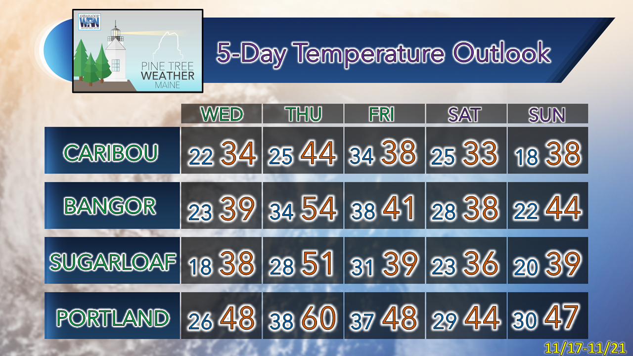 Winter travel safety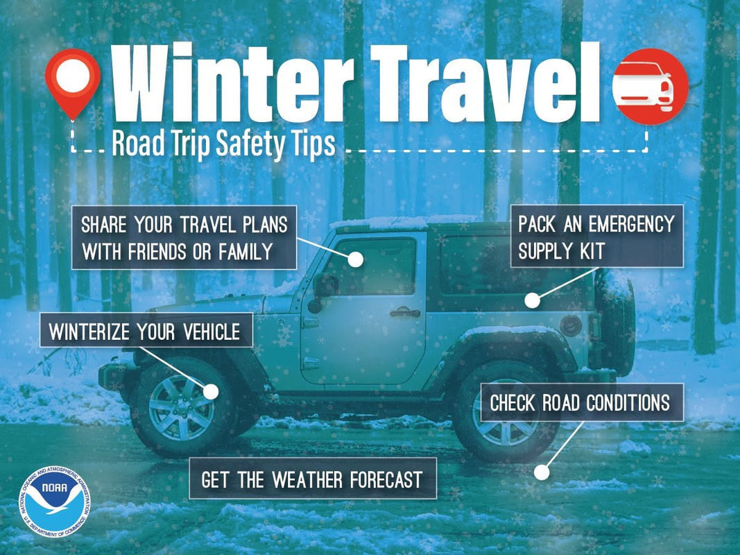 If you’re going to be driving this winter, know how to stay safe. Winterize your vehicle and pack an emergency supply kit. Share your travel plans with friends and family. Before leaving, check road conditions and the weather forecast so you know to expect. weather.gov/safety/winter Be prepared to receive alerts and stay updated!
 For more information in between posts, please follow Pine Tree Weather on Facebook and Twitter.
Thank you for supporting this community-based weather information source which operates by reader supported financial contributions. Stay updated, stay on alert, and stay safe! - Mike |

Mike Haggett
|