
Wind Advisory StatewideThe National Weather Service in Gray has joined the Caribou office and has issued a wind advisory for the entire state of Maine. The rooftop of Maine is under winter weather advisory. You can check my earlier post for thoughts on that. Two differing ideas on windThe ideas are slightly different. The difference is important to know. In regards to the wind, the outcome of this storm is going to be decided at 20,000 feet above sea level. If wind comes in higher, you will know why. If it comes on on target or slightly lower, you will know why, also. 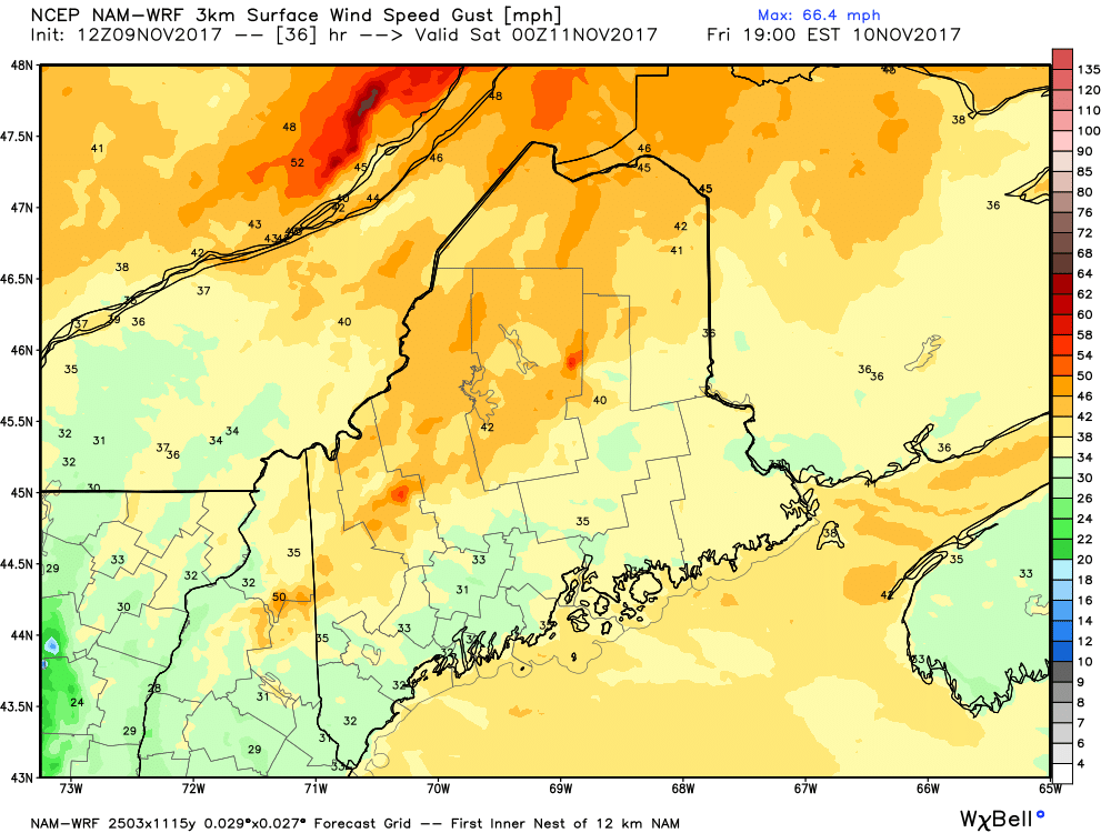 This is the NAM-WRF short range model idea for peak wind gusts at 7 PM Friday. Wind will be streaming in from the west-northwest at 10-20 mph with gusts in the 30-45 mph range, depending on region. 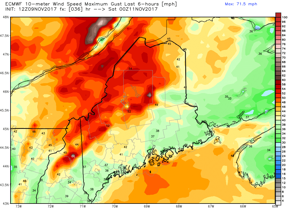 This is the European model for the same time, at the same model data collection point of 12z/7 AM Thursday morning.. It varies to roughly 5-10 mph faster than its American counterpart. Important to note, this is the absolute maximum gust speed the model is predicting. You may have seen something similar to this floating around social media leading up to the Late October Gale. You need to know that it was too high, overall. That said, it does have potential. What happens at the surface is going to be dictated on what happens 20,000 feet above us. Back to the NAM idea... 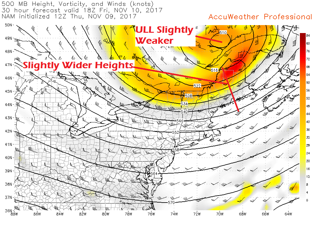 The NAM idea is thinking the upper level energy will be slightly weaker. The height falls are a bit wider. Height falls are like looking at isobars on mean sea level pressure chart. The same rules apply: the tighter the isobars, the stronger the wind. In this case, the tighter the height falls, the stronger the wind. For the air to be as cold as it is coming in, it doesn't happen without height falls. 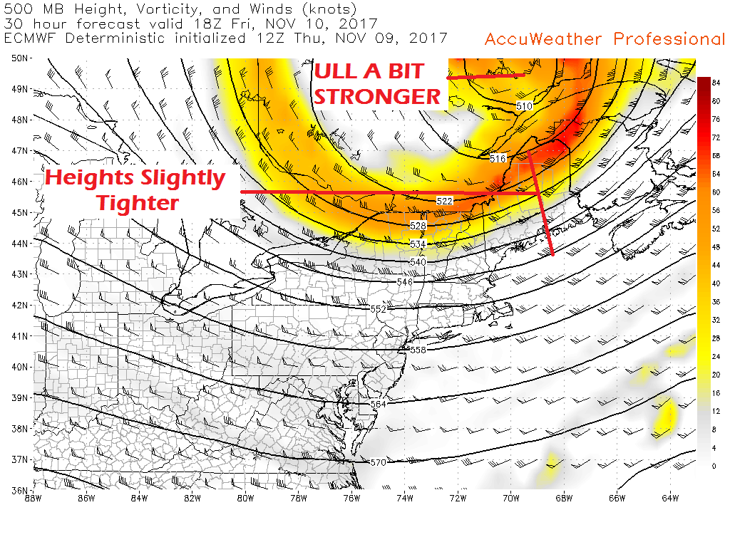 The European idea shows a slightly stronger upper level low, and consequently, slightly tighter heights to go along with it. To the naked eye, it may not appear like much. Given the strength of the upper low, however, it's a bigger deal. This will decide the final outcome of how strong the wind gets. A weaker upper low will bring lower wind speed. A stronger upper low, higher wind speed. To give this perspective, if it were not for the Late October Gale that knocked roughly half of the power grid offline in the state, this wind may not cause as much concern. Trees grow to withstand the brunt of northwest, north, and northeast wind. This front is as concern because the strong southeasterly winds did a number on the branches and root systems. Wind storms are really nothing new for the area this time of year. The odd wind direction from the Gale is a rarity. I am not predicting a repeat event of the recent big storm. What I am saying is there is a threat for at least some power outages. How many outages will be indicative of how strong the wind gets, hence why I have explained this so you can better understand why. You can bet that any storms that happen this winter with wind gusts greater than 35 mph will likely have power outage impacts as a result of the Gale. We're only getting started here. This could be a long winter. And about that long winter idea...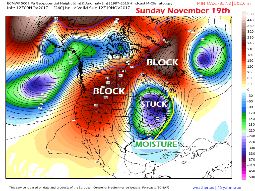 I don't normally post a lot of long range operational or deterministic model ideas because they are flawed as they reach the tail end of their runs. I am sure you have seen the 240 hour or 384 hour epic snow dump charts and science fiction of big storms that never come to fruition. This is a bit different.
The GEFS ensembles were showing this idea recently and now the European has picked up on it. Two strong blocking ridges, and a component of well below normal cold stuck in between. This is a recipe for snow storms, and Nor'Easters at that. This does not mean that it will happen, but let's say for now that this has potential. It's a week and a half out. For now, it's a signal, and that is all it is. Stay tuned for more on this in the coming days. - Mike |

Mike Haggett
|


