|
A quick personal note to get started here. I just finished my third semester in school this week. I have one more semester to go, which I am excited about. My wife and I had planned time over this coming weekend to get away for a night, do some Christmas shopping and time to unwind and relax a bit. This will be my last website update until Monday. The forecast looks pretty straight forward at this point, and I don't expect any huge surprises. Thank you to those who have sent checks, sent money via VENMO and my monthly Patreon donors. I am about 70% funded for the year. If you have yet to donate, I humbly ask that you please consider that. You can message me if you have any questions. Cloudy but warmer for Friday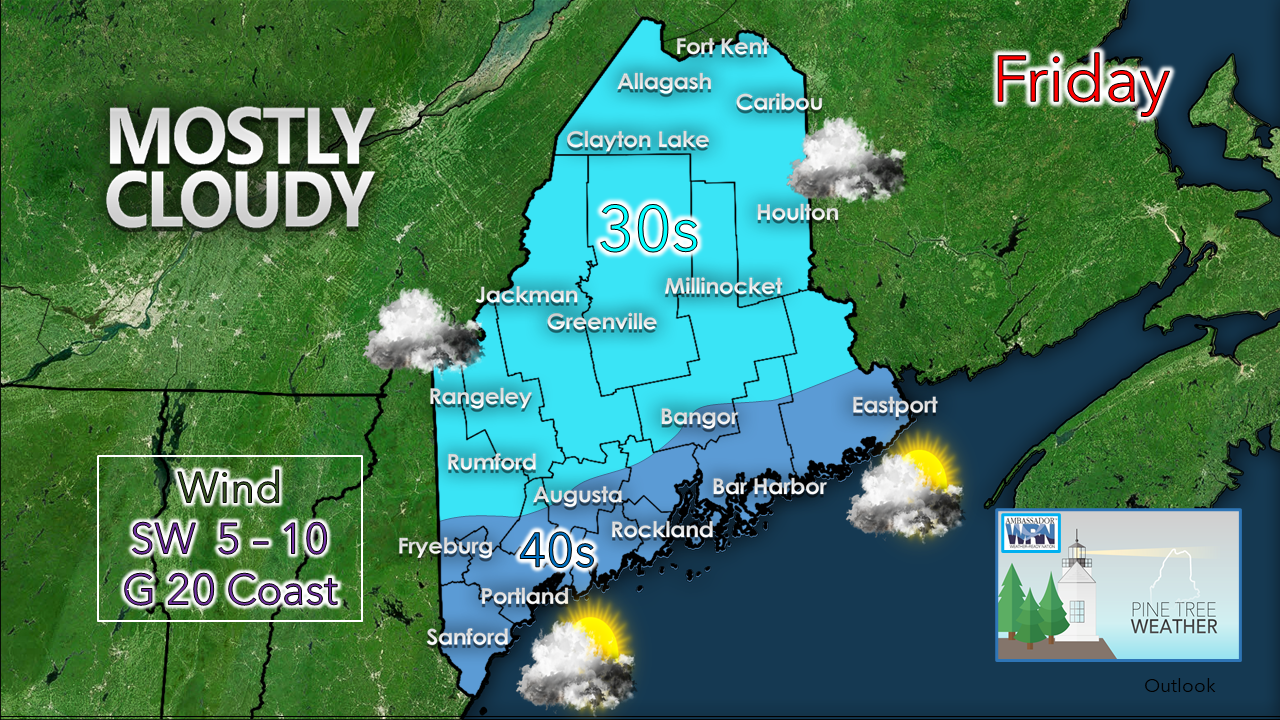 Mid level clouds will dim the sun today as low level disturbances pass through the region. Best chance for precipitation would come in the form of a late day flurry or snow shower in the far north, but that appears it. A bit more melting for the day as temperatures rise above freezing in most locations. A southwesterly breeze will be strongest along the shorelines. Temperatures fall back to the 20s to start Saturday morning. A messy weekend event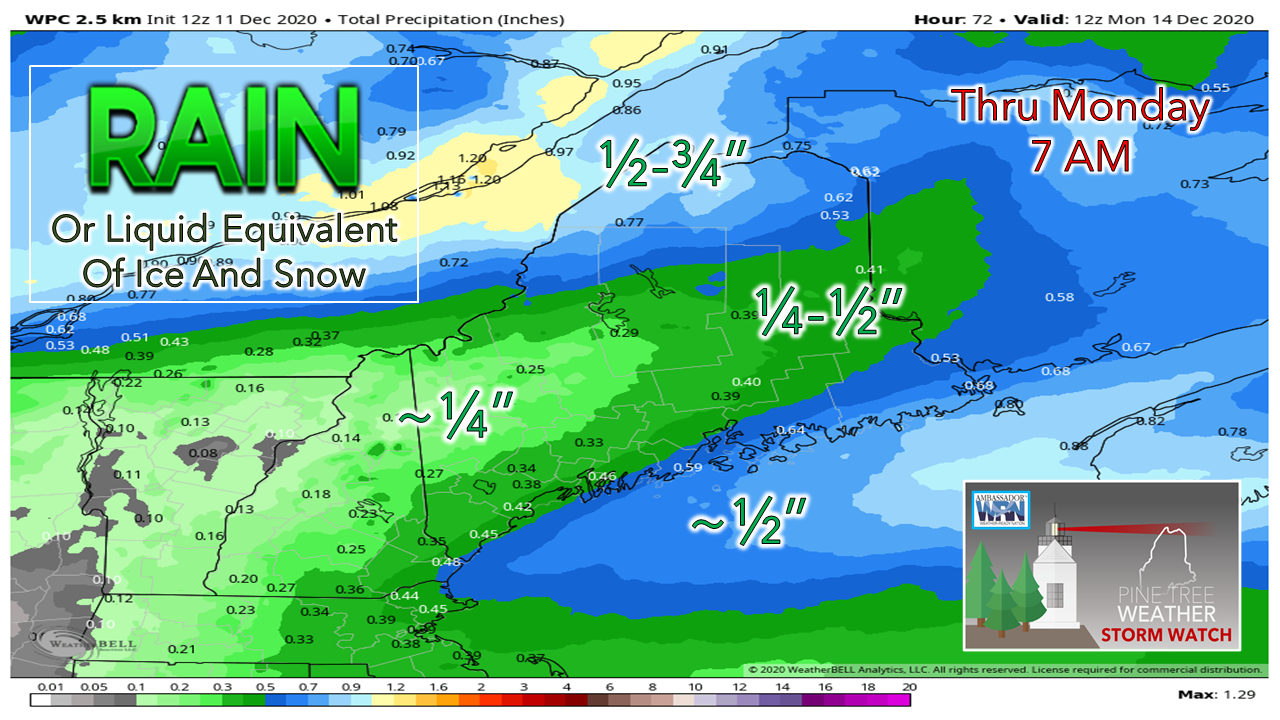 Looking at the entire precipitation angle of this, as far as amounts go, there isn't a whole lot of liquid involved here. The question is how much liquid freezes on contact and what reaches the ground in flake form. 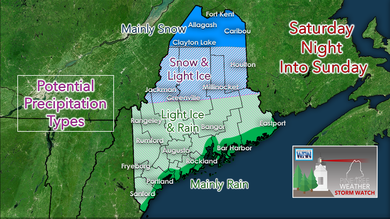 My thinking posted here on Thursday has not changed much. Warm air will move in aloft, which means Mount Washington could be the warm spot Saturday night into Sunday. Cold air damming will dictate how long the freezing rain and/or drizzle lasts. High pressure over Labrador appears that it will be strong enough to leak the below freezing temperatures in and hold them for a while. I am not expecting enough ice to cause power outages. I am expecting enough ice to make travel slick, whether by car or by foot. 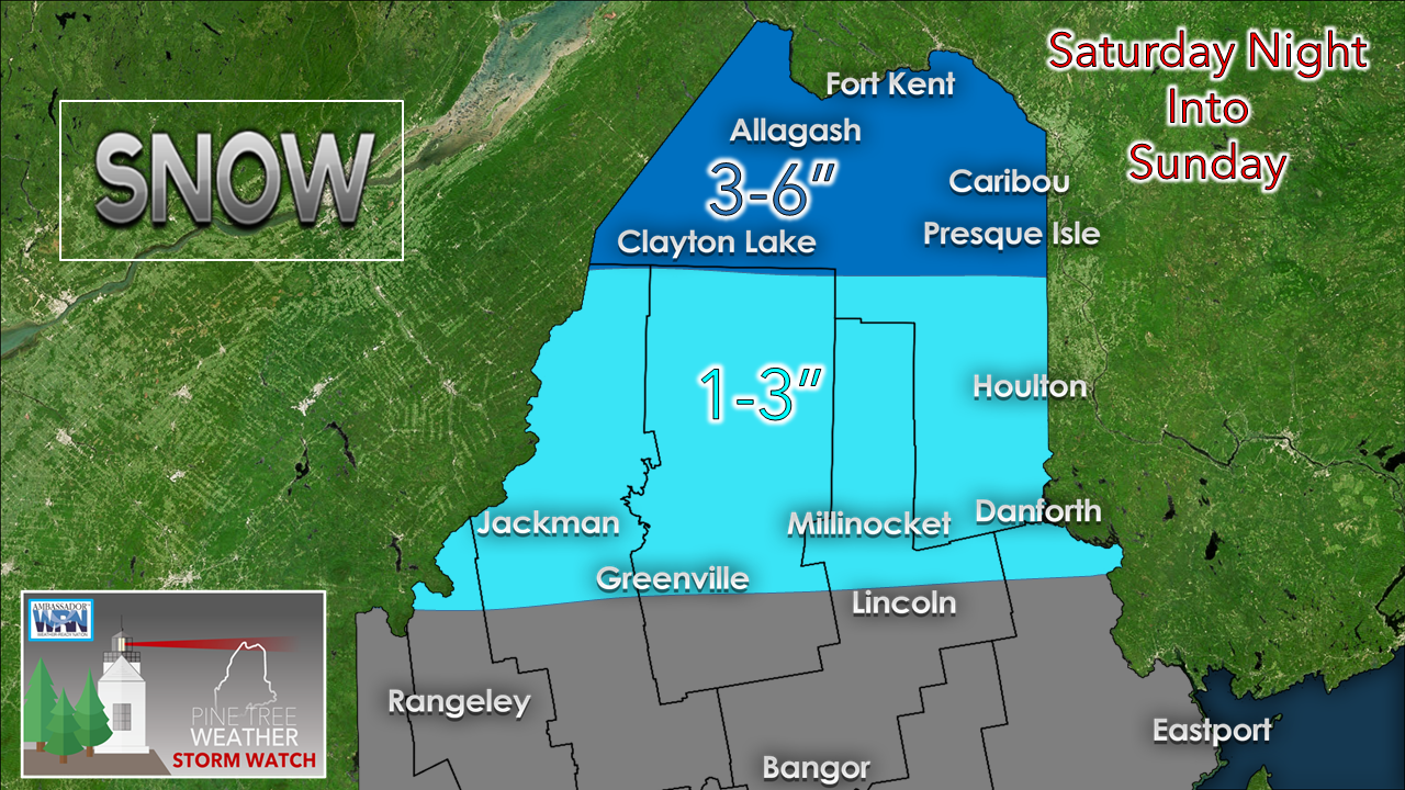 A winter storm watch has been posted for northwest Aroostook. It's a reasonable bet the rooftop gets mainly snow and 3-6" or slightly more. Highest accumulations in the far north. The cut off between who sees snow south of Greenville appears quite sharp. While the western mountains may see a few flakes early, this event is not a snowmaker for the ski hills. Timing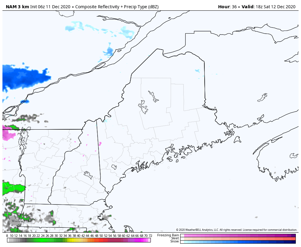 NAM3 model idea of radar reflectivity from 1 PM Saturday to 1 AM Sunday As is stands as of Friday morning, the onset of precipitation holds off until Saturday afternoon. While this radar loop says the greens of rain move up into the foothills, I would use caution on that. The safe bet is to anticipate freezing rain and drizzle with this, and expect the roads, sidewalks and parking lots become slick Saturday afternoon into Saturday night. 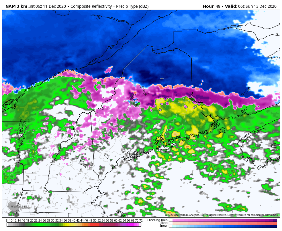 NAM3 forecast idea of radar reflectivity from 1 AM to 1 PM Sunday I do expect the above freezing air to win out for all but northern areas heading into Sunday. For western and southern areas, watch out for patchy freezing drizzle and fog overnight. Steady precipitation ends for northern areas by late morning. Isolated areas of mixed precipitation, rain or snow showers is possible Saturday afternoon.  Potential storm midweekModel silly season is coming into focus as we head towards the first official day of winter in 10 days. Guidance has been playing around with the idea of a potential snow event next week. As usual, the hype train has already begun to take over social media. The only thing there is confidence on at this point is it will be cold enough for snow. 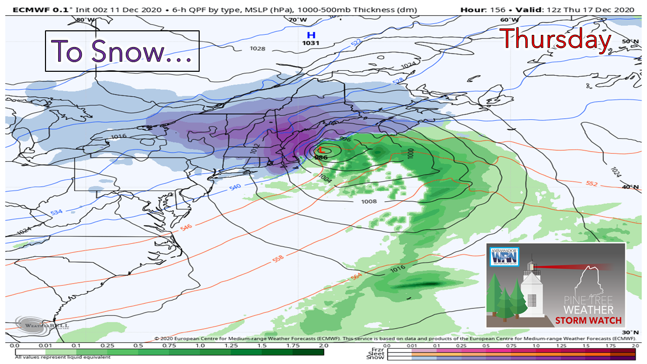 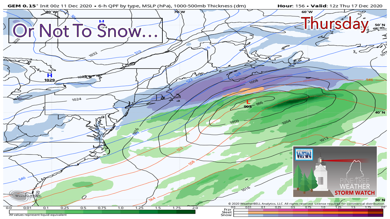 Whether or not we get any, is yet to be seen. I will update on this when I return on Monday. Temperature outlook through ThursdayAfter a brief warm up for the weekend, temperatures fall as we head into the middle part of next week. 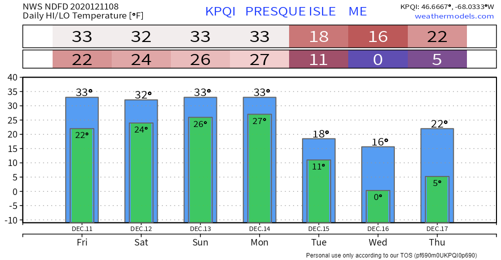 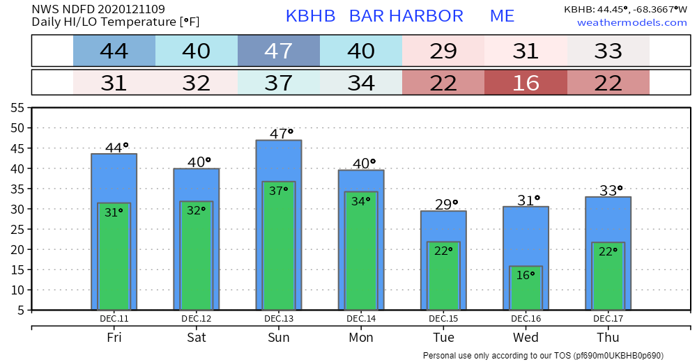 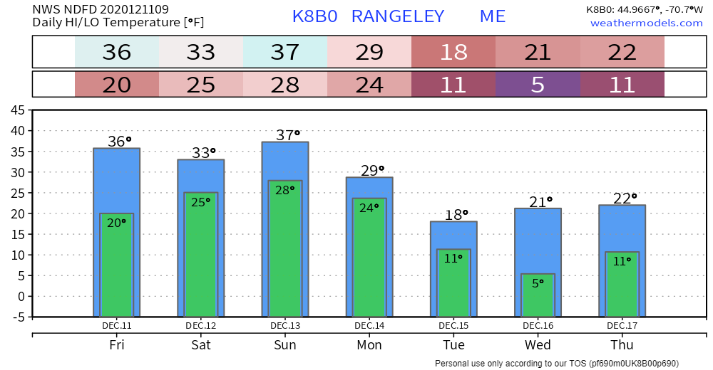 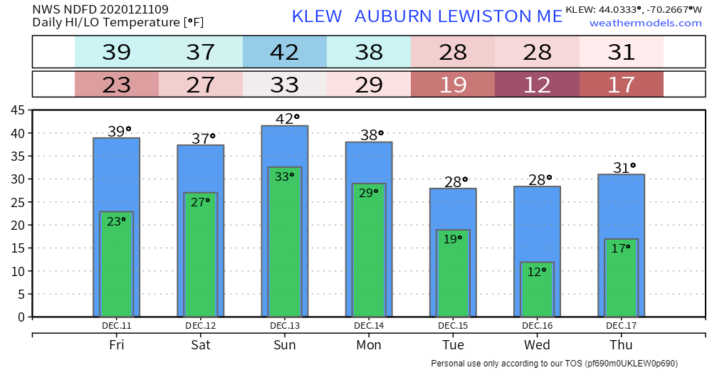 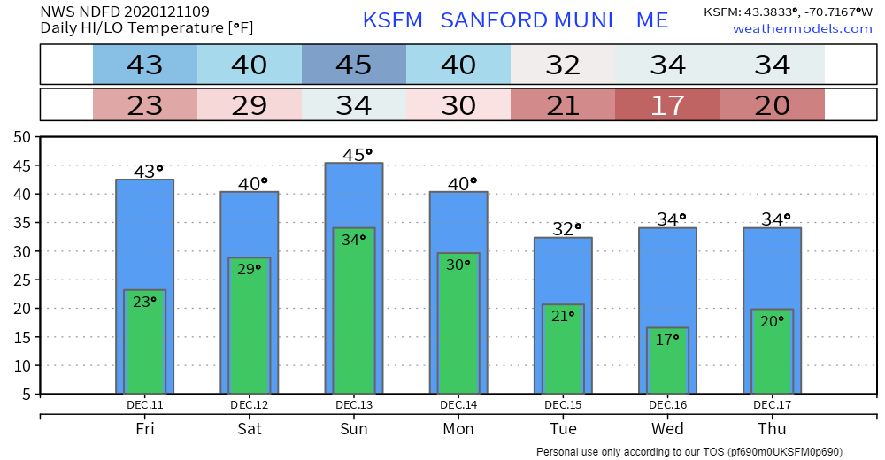  Be prepared to receive alerts and stay updated!
For more information, please follow Pine Tree Weather on Facebook and Twitter.
** FUNDING NEEDED FOR 2021 ** Thank you for supporting this community based weather information source that is funded by your financial contributions. Stay updated, stay on alert, and stay safe! - Mike |

Mike Haggett
|