Cold and windy to start off the week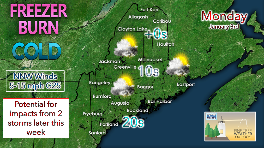 After the passing of the cold front on Sunday, high pressure works its way into the region on Monday allowing for cold, Canadian air to be transported into the region. Temperatures will be coldest in the north and in the mountains, sticking around the single digits throughout the day. Conditions should be a bit warmer towards the south, reaching the teens in central Maine and 20s in the southwest. The wind chill is the big story of the day, with gusty winds making the air feel 10-20 degrees colder than what the thermometer reads. Below average temperatures on Tuesday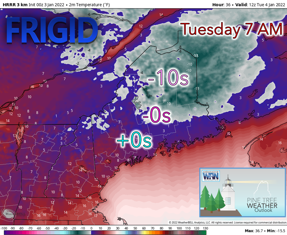 Tuesday will be off to a cold start as high pressure stays in place, with some areas seeing the coldest temperatures of the season yet. Temperatures should warm slightly, reaching the teens towards the north and 20's farther south as mostly sunny skies prevail. Wind chills are once again likely to be an issue with winds 5-15 mph and gusting over 20 resulting in the temperature feeling like it is 10-20 degrees less. Wind chills may not get above 0 in northern regions. Low pressure arriving Wednesday brings rain and snow through Thursday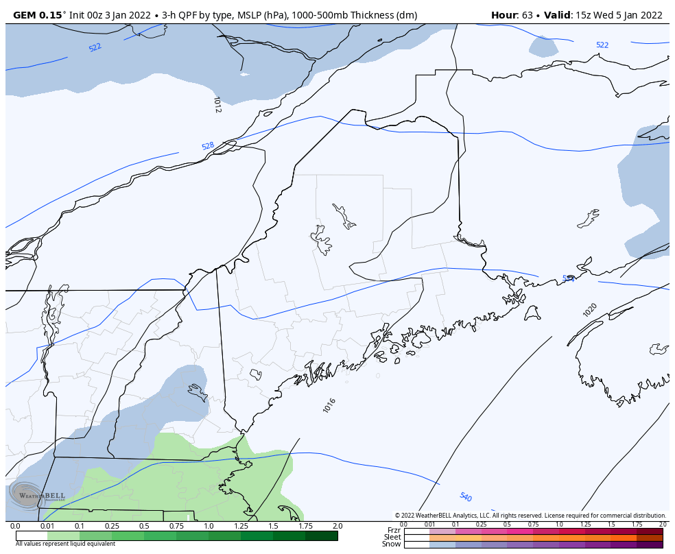 Another storm to bring a mix of precipitation types to the state looks to arrive early Wednesday afternoon. As of right now, global models are fairly consistent with the setup, showing rain closer to the coast and in central regions while precipitation stays mostly as snow farther north and west, especially over the mountains. Some freezing rain is possible but more unlikely with this storm. The low exits overnight Wednesday and snow showers develop behind the low over the mountains through Thursday. Increased details will come from the high resolution models on the setup of the snow and rain as the storm nears. Light precipitation expected Wednesday and Thursday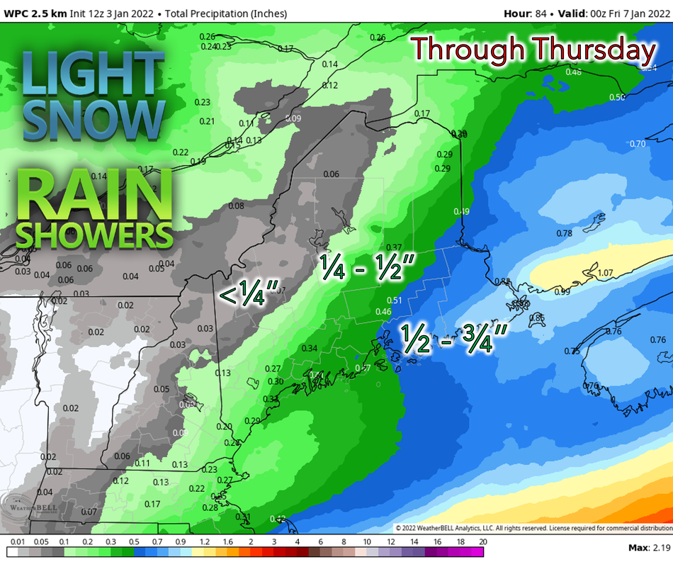 The system passing through the state on Wednesday and Thursday should not bring any major impacts to the region and instead, most of the precipitation should be light rain or snow. Temperatures are likely to be mild, reaching the 30's and even 40's along and just inland of the coast while staying below freezing over much of the northern parts. The warm can be attributed to a southerly wind blowing off the ocean, transporting warmer air north. This should make for some breezy conditions near the shore, but winds should otherwise be light in the interior. The possibility of a classic nor'easter still remains for Friday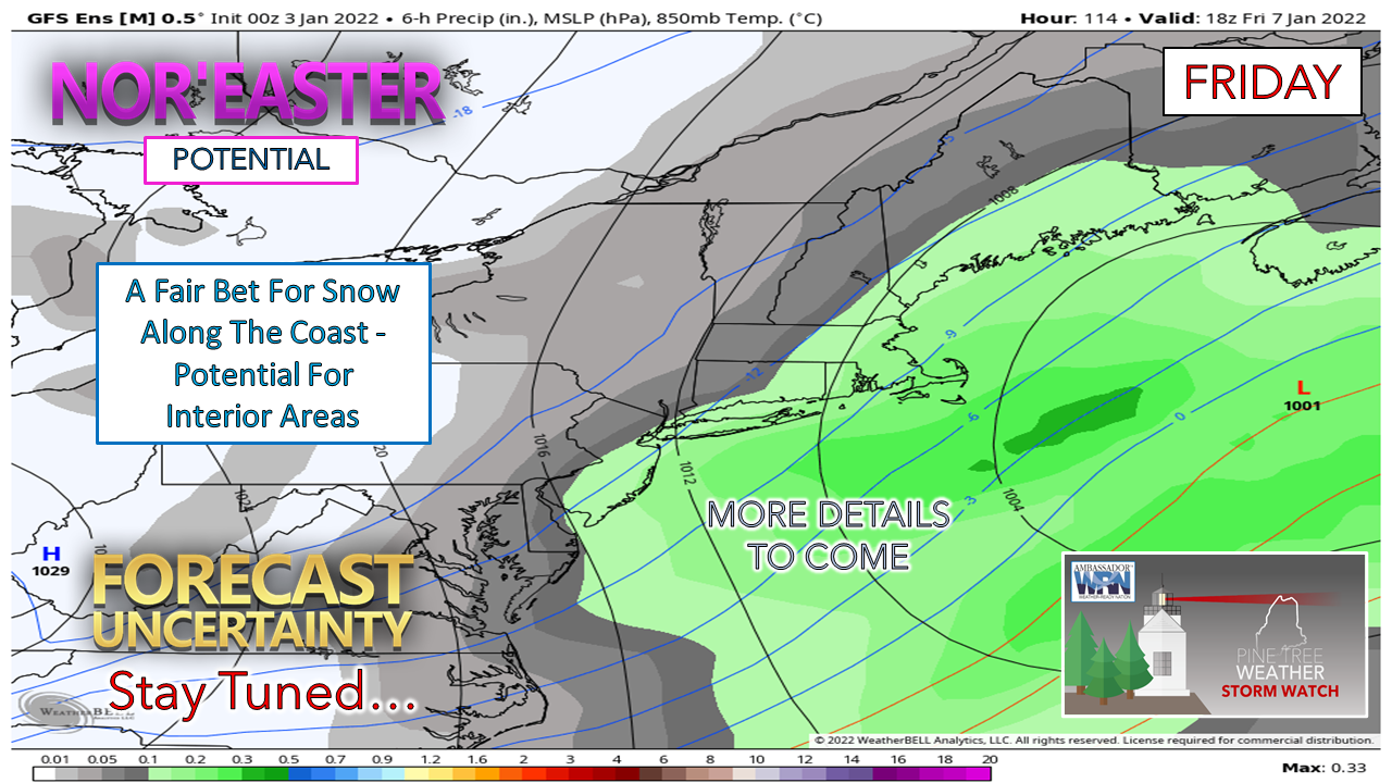 Models are still showing the possibility of strong nor'easter bringing significant snowfall for the region. However, there still exists substantial disagreement in if and how it will play out. The strength and position of high pressure over the North Atlantic and how it will interact with the low will be critical and a weaker high may result in the low remaining too far off the coast for any substantial impacts. While the European and Canadian models are still in agreement for an impactful storm, there is still a lot of time before accurate conclusions can be made.  Temperature outlook through Saturday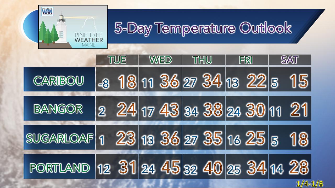 Cold Weather Cold weather can be life-threatening. If you can’t avoid being outside, remember to follow these 3 steps and make sure to always tell someone where you’re going. weather.gov/safety/cold Be prepared to receive alerts and stay updated!
 For more information in between posts, please follow Pine Tree Weather on Facebook and Twitter. Thank you for supporting this community-based weather information source which operates by reader supported financial contributions.
|

Mike Haggett
|