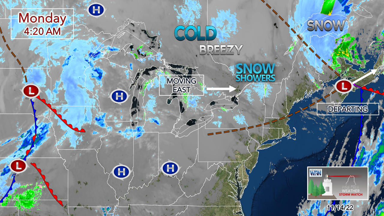
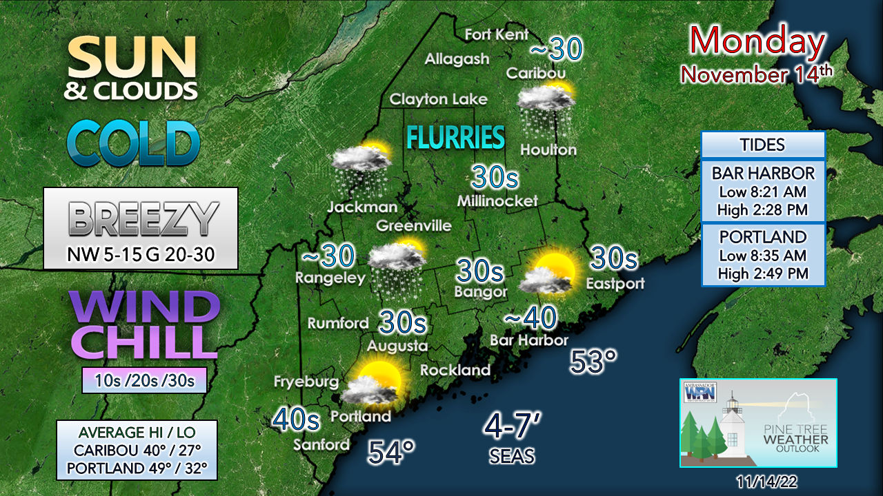
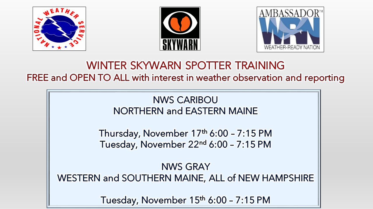
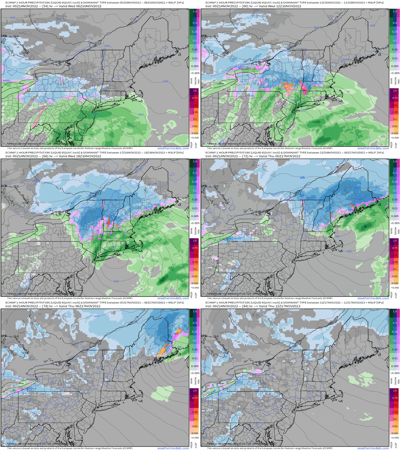
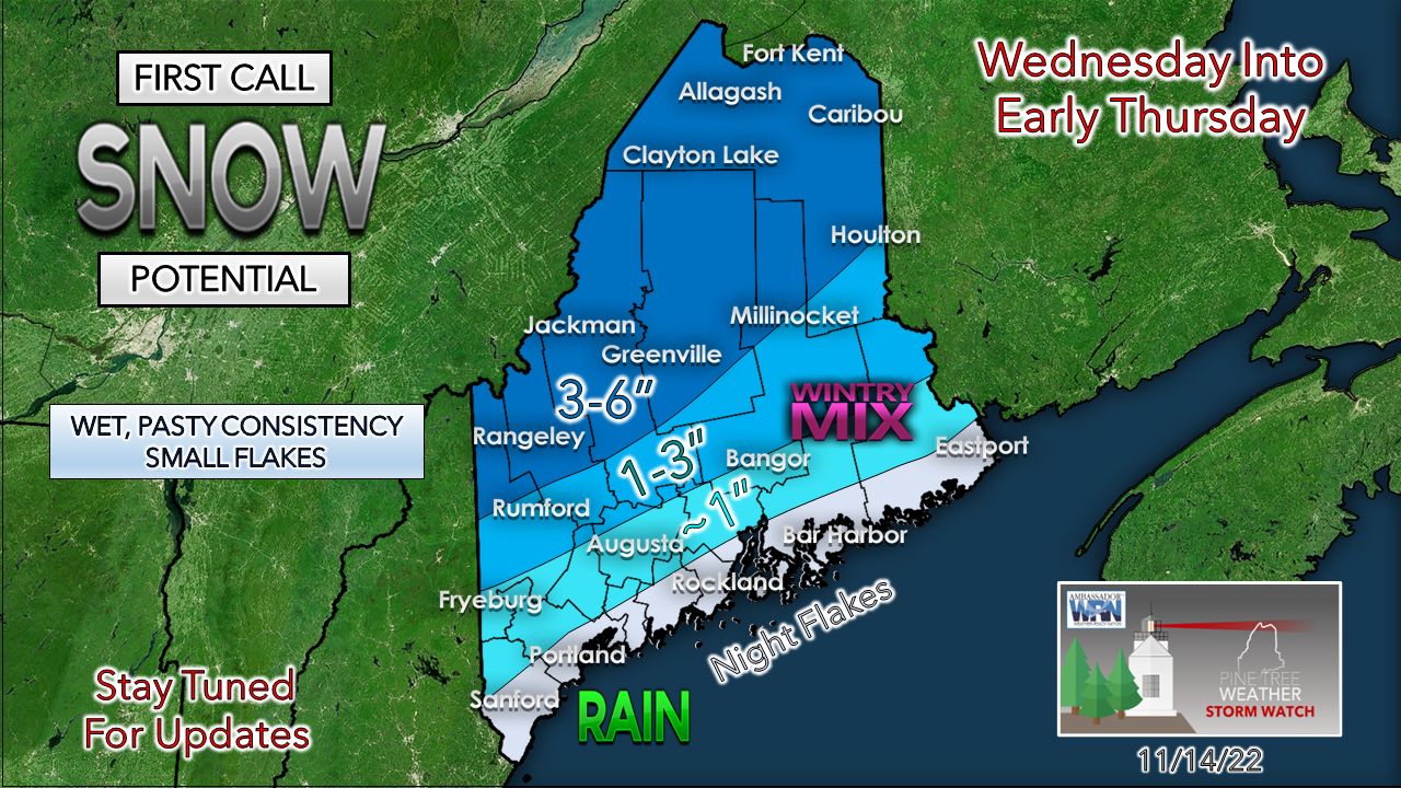
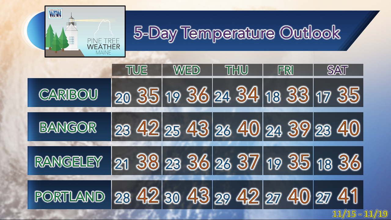
It's bundle up MondayLow pressure that brought rain and snow to the region Sunday and Sunday night departs to the northeast. With the region on the backside of system, a northwest wind picks up to give the region a slap in face of reality after the recent warm spell. Wind chills ranging from the teens in the mountains to the 30s along the coast are expected as gusts from the northwest range from 20-30 mph, with gusts to 35 to 40 for the higher elevations. Upslope flurries and snow showers are possible over the interior. Daily high temperatures are expected to be 5-10° below normal. Expect the breeze to diminish over southwestern areas south of the mountains Monday evening, The wind drops for the rest of the region Tuesday morning. Winter weather spotters needed!These sessions are fun, fast paced, and information filled. If you are reading this post, you are qualified to be a spotter. The weather community in the area needs you! Last call for the winter weather SKYWARN spotter virtual training session for NWS Gray is Tuesday at 6 PM. If you are in western or southern Maine or New Hampshire, click here to register. For those in northern and eastern Maine, there are two sessions remaining, this Thursday and next Tuesday. Click here to register with NWS Caribou. If you are not sure which office to participate with, message me on Facebook or send me a tweet. The first wintry NorEaster of the season WednesdayWednesday 1 AM to Thursday 7 AM - Guidance has come to a reasonable consensus of a coastal hugger, which brings mainly wet snow for the mountains and north, a mix of rain and snow for the interior, and mainly rain for the coast. The morning commute appears all right, but conditions north of Route 2 deteriorate by the time of the evening drive. Precipitation ends from southwest to northeast Wednesday night into early Thursday morning. Wind appears to be manageable with this one. Gusts in the 20-30 mph range are expected to be most common, with gusts to 40 possible MidCoast and DownEast shorelines. These early season storms with marginal cold, a shoreline track dragging in warm moisture off 53° water during the day along with strong wind shear, a short dendritic (snow) growth zone aloft, and potential for dry slotting raises all kinds of red flags for me for accumulations. South of Route 2 may only see some accumulation on grassy surfaces and maybe some slush on the roads. The ski hills should get a little something, but I am not bullish on a big event there. The summits may pick up 6-8", which isn't too shabby, but there are a lot of things working against a big dump. That said, it's a start. Temperatures will remain cold enough for the mountains to make snow through the week, and there will be something to start for the first tracks for opening weekend. There is about ½-¾" of liquid equivalent expected with this event. Stay tuned for updates. The future of Pine Tree Weather is your call...Temperature outlook through SaturdayThank you as always for your support! Stay updated, stay on alert, and stay safe! - Mike NOTE: The forecast information depicted on this platform is for general information purposes only for the public and is not designed or intended for commercial use. For those seeking pinpoint weather information for business operations, you should use a private sector source. For information about where to find commercial forecasters to assist your business, please message me and I will be happy to help you |
Mike Haggett
|

