A cool and breezy outlook thru the week; high elevation snow possible heading into the weekend5/4/2020 Before I get into the forecast, there a couple things of weather interest to pass along. First, this article posted by CTV News in Canada discusses the impact of less airplanes in the sky and how that may effect weather forecasts. It certainly has impact on aviation weather forecasters since they are getting far less reports from the sky. Airplanes, much like ships at sea, marine buoys, and some personal weather stations all feed data into forecasting, whether short term or a few days out. Forecasts are generated from the stratosphere to the floor, not the other way around. What happens between 20-40,000 feet above sea level has direct impact on surface. To have critical weather data from planes missing from the picture is something to consider when your rainy Saturday forecast on Wednesday ends up bright and sunny. Right, we just had one of those. How about some fun? Since I know most of my followers are age 40+, this is for you. Those of us that remember The Weather Channel when it first began in the early 1980's remember the graphics used for "Local On The 8's". This was done by use of a WeatherSTAR satellite information system that was used by local cable companies to relay on local observations and forecasts. For those looking for a bit of remember when back then, you can re-create those same images with current data from the WeatherStar 4000 site. All you need to do is plug in the zip code or name of the town, then click on go. It will load up and play a continuous loop, complete with light jazz music to go along with it. You can play around with three different color schemes, get NOAA's forecast, travel outlook, and most if not all of the same local content you saw in the loops back then. Check it out, have some fun with it, and remember when TWC was all about weather. I miss those days. A breezy Tuesday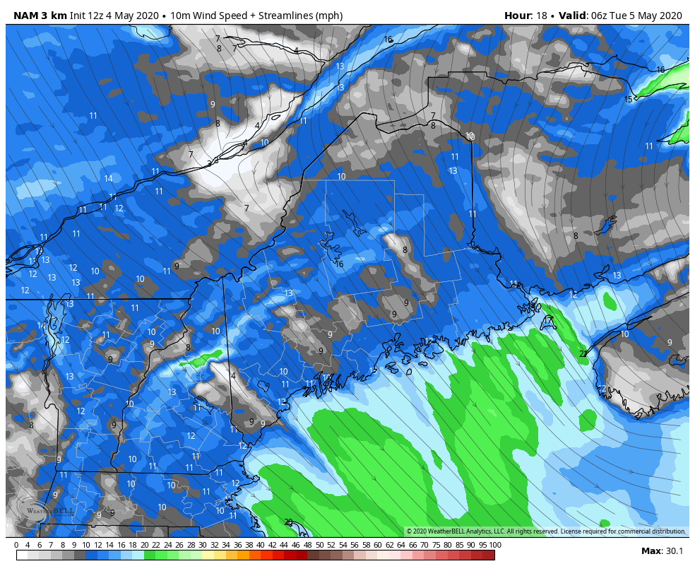 NAM model sustained wind speed and direction forecast from 2 AM Tuesday to 2 AM Wednesday An upper level trough works through the region on Tuesday, bringing a north/northeast breeze and a variable amount of clouds to the region. Cold air advection keeps the mountains cool and warms the coastal plain. Wind gusts could reach the 20-30 mph range, which could blow a few trash cans around. After a seasonable start with 30s north/mountains to around 40° for the coastal plain, temps stay cool in the 40s for upcountry, 50s for the foothills / eastern interior to around 60° for the coast. Wednesday not quite breezy, but it continues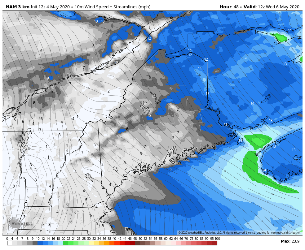 NAM model sustained wind speed and direction forecast from 8 AM to 8 PM Wednesday Wednesday appears to feature the most sun and warmth statewide until next week. That said, there will be a few clouds around at times in areas. After a start in the 30s, temperatures rise into the 50s for most of the region, with low 60s possible for some interior areas. A northwest breeze keeps the north and eastern areas in the 50s, as does an onshore breeze along the coast. Winter continues into MayI can tell by the reactions I get on social media posts that people have had enough of winter in general, although there are a few of you who adore snow, even now. Regardless of which side of the fence you sit on with that, it's not over yet. I am getting asked "Is it safe to plant my garden?" and the answer for now is no. You can, but have coverings on the ready, because chances are you'll need them, unless you are smelling salt from the ocean in the air from your garden. Frost and snowflakes are likely to be apart of weather concerns going into the middle part of the month, and frost concerns could go all the way to June, if not beyond. With the average last frost date of June 1st for northern Maine, it appears that could be pushed to the limit and perhaps after. The good news? We have two months to go before people complain about how hot it is. 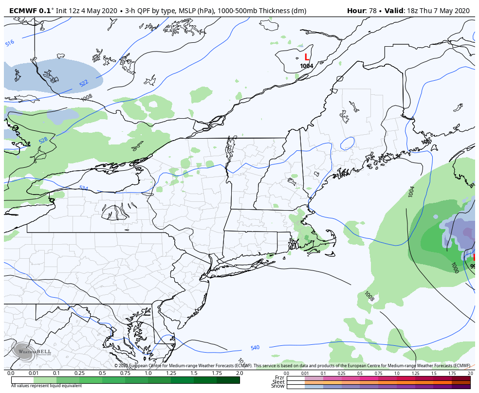 Thursday gives us 30s to start off with and 50s for most areas for highs with clouds on the increase ahead of a weak area of low pressure that could bring a snow/rain event Thursday night into Friday. Cooler air falls in behind the system for Friday, and it drops daily highs back a few degrees with 20s for the north country and 30s for the rest to start off, with 40s/50s the high point for the day. The phrase forecasters have used often in the past few weeks "dynamic cooling" could play a factor in precipitation as an intensifying area of low pressure works through the region Friday afternoon into Saturday. It's a bit early to nail down a track and precipitation amounts, but this idea has been on discussion table since late last week and it's still there like the salt and pepper shakers. 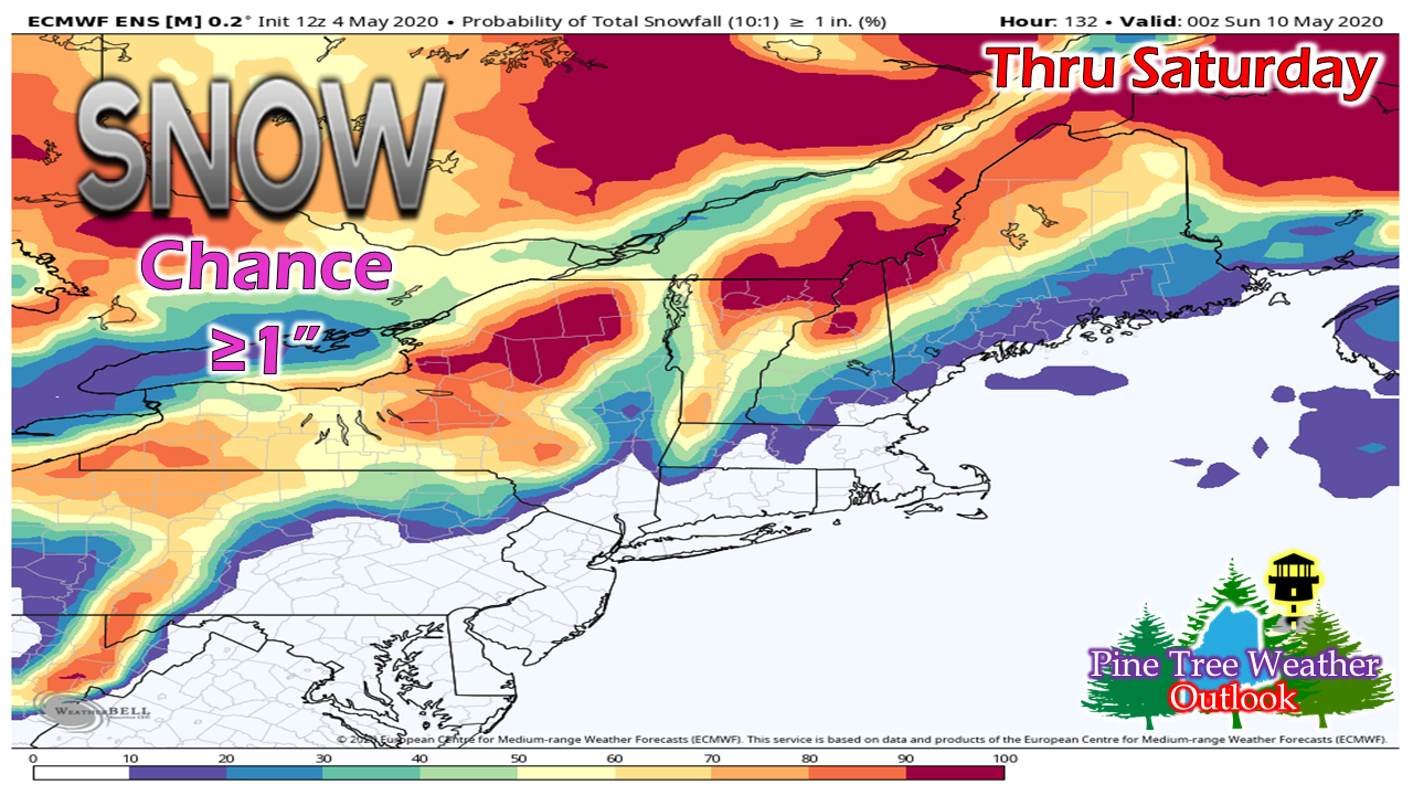 Taking the 10:1 snowfall maps and throwing them in the trash since it's May, most of the snow is gone and ground temperatures have warmed up, the safe call at this point is looking at ensemble ideas, and this makes sense. The best chance for accumulating snow at this point is roughly from Bethel to roughly Houlton, north. Higher elevations will see the most amounts. Time will tell how low in elevation the snow will go. There is still a lot of questions and plenty of time for changes with this one. I will track and update. Help the weather community and stay informed!
► ► For the latest official forecasts, bulletins and advisories, please check in with the National Weather Service in Gray for western and southern areas, or Caribou for northern and eastern parts of Maine.
Thanks as always for your support! - Mike |

Mike Haggett
|