
A pleasant day ahead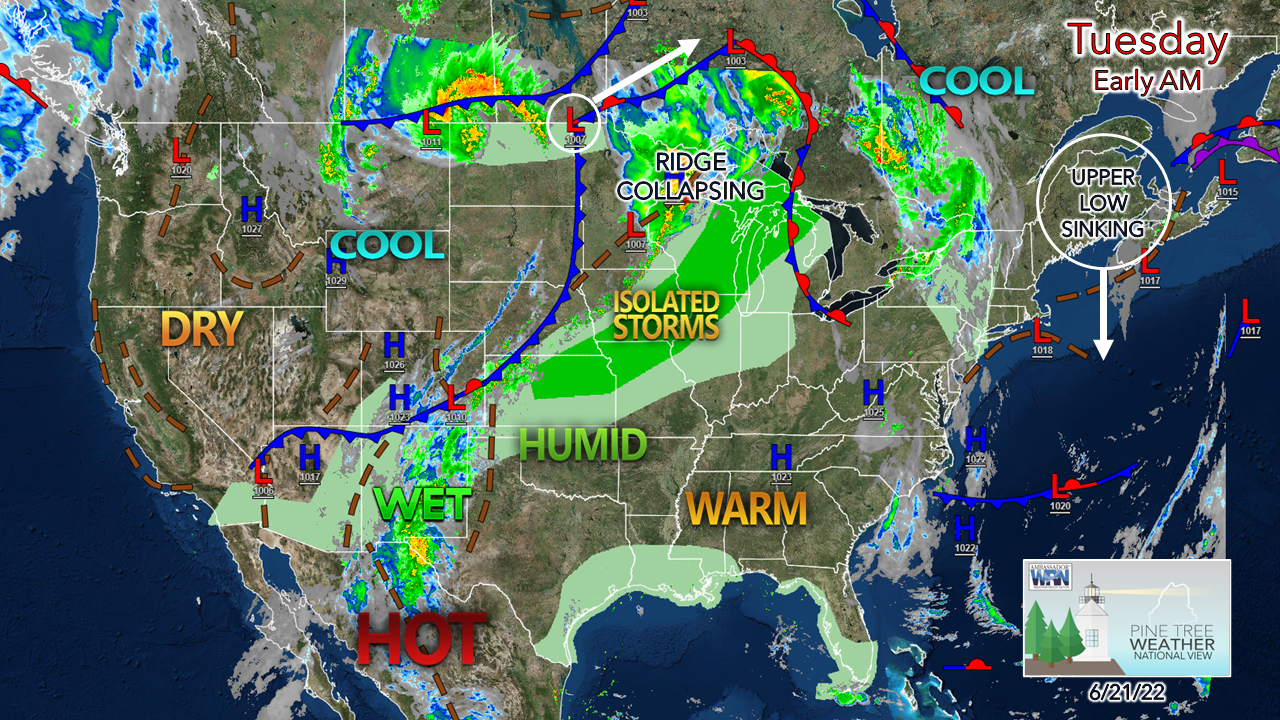 For the longest day of the year, it's shaped up to be a great one. An upper level low just to the east is holding high pressure over the region. A warm front to the west wants to work into the region but has hit a roadblock and will be stuck over New York and western New England through Tuesday. As the upper low drops to the south and then pivots southwest, that opens the door for some light shower activity to creep into western and southern areas Wednesday into early Thursday. 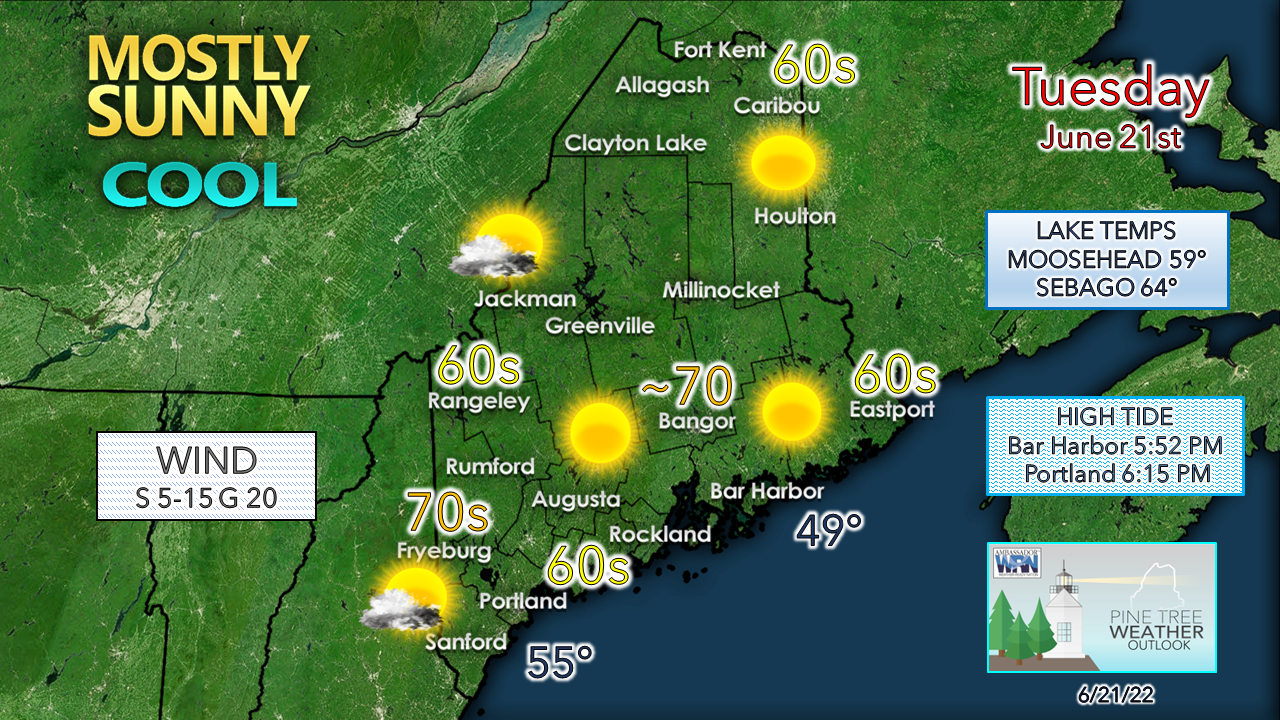 The warm spot for the day is expected over the western interior which will be sheltered from the onshore flow. Shoreline counties are likely to get the most breeze and thus cooler temperatures. The recent cool snap has chilled the lakes and ocean a bit, expect those temps to rebound with the expected warm up on the way for the weekend. If you are headed to the beach, low tide just before noon allows for plenty of room for a nice afternoon walk, but dress for chill of the breeze. Outlook through late week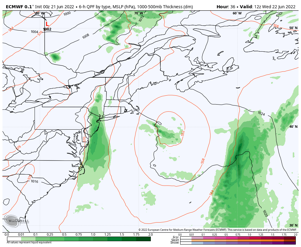 Wednesday 8 AM to Saturday 8 AM - The upper low that has brought the recent cool temperatures is morphing into a block for warmer and more humid air to work into the region and appears to do that through late week. As a result, it is keeping shower chances to a minimum for northern and eastern areas. As the upper low sinks south, a weak frontal boundary tries to work into the region Wednesday. Sprinkles or light showers are possible Wednesday, expected to become widely scattered Wednesday night, then as the front fizzles out, end on Thursday. The upper-level low holds a developing ocean low to the southeast, and the two features walk each other out of the region on Friday. 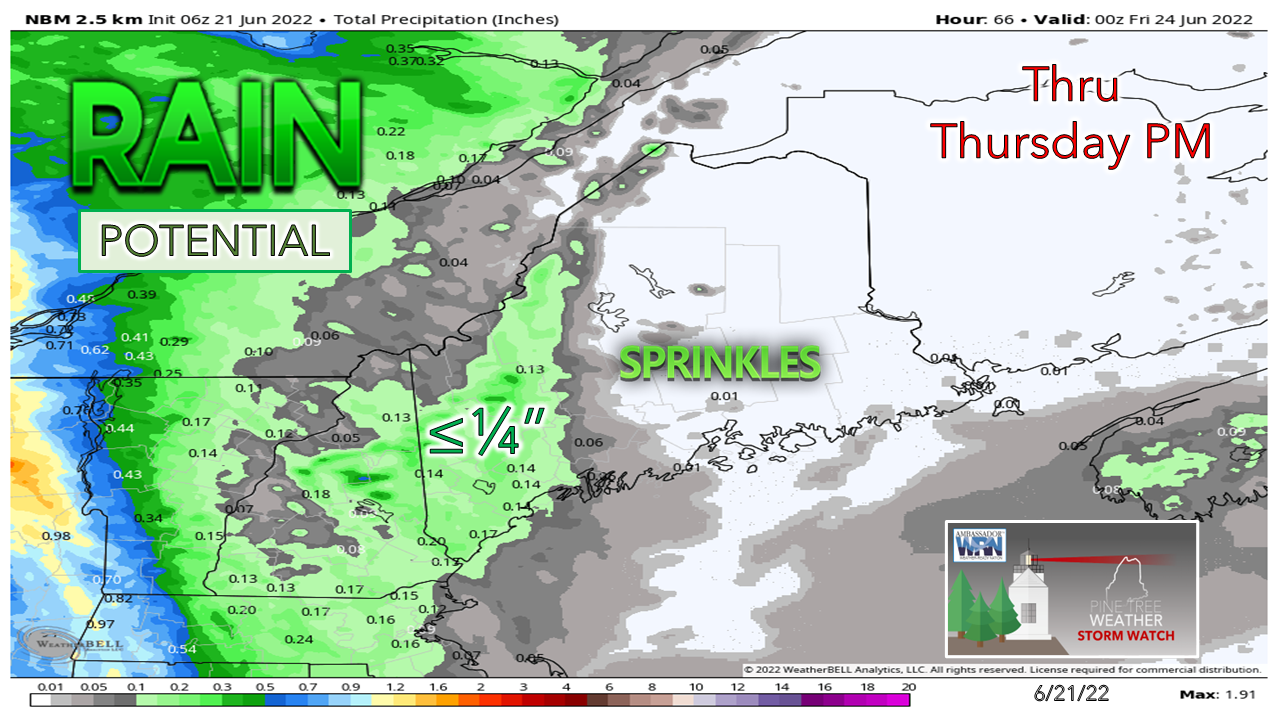 Not much in the way of rainfall is expected from the frontal boundary, and some areas to the north and east may not get anything at all. For you farmers looking to cut hay, your window of opportunity is here. At this point, the next chance for rainfall after this comes Monday into Tuesday. Temperature outlook through the weekendThe pattern of cool upper lows and troughs takes a break as an upper ridge brings warmer, more humid conditions are expected heading into the weekend. The region goes from below normal to above normal by Saturday. 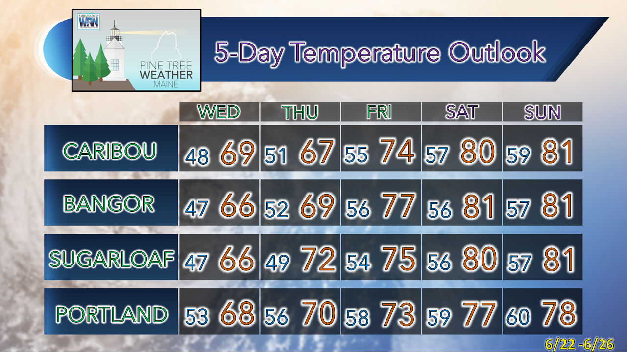 Thank you for supporting this community-based weather information source which operates by financial contributions from people like you. Stay updated, stay on alert, and stay safe! Have a great day! - Mike NOTE: The forecast information depicted on this platform is for general information purposes only for the public and is not designed or intended for commercial use. For those seeking pinpoint weather information for business operations, you should use a private sector source. For information about where to find commercial forecasters to assist your business, please message me and I will be happy to help you. |

Mike Haggett
|


