|
A quick scheduling note... since I have been on stretch of 2:30 AM wake up calls to post updates over the last several days, I am going to take a break for a couple nights and get caught up on rest since the pattern in favorable for that. I will post updates on the Facebook page and my Twitter feed (links at the bottom) as time permits. Breeze relaxes Sunday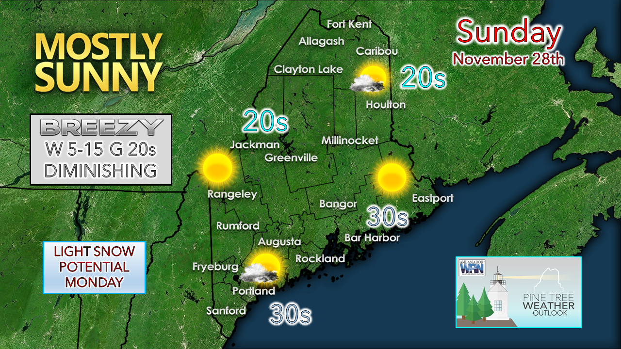 All in all, a cool but nice day ahead. Clouds over the mountains dissipate as the sun rises which brings bluebird skies to the ski hills in the western mountains. A few flurries are possible in the north. The storm responsible for the breeze is located south of Labrador as of Sunday morning and will depart to the northeast and calm the wind as the day moves along. Clouds from the west filter the sun in the afternoon as our next system approaches the region. Light snow possible for Monday Sunday 8 PM - Monday 8 PM - Snow showers begin to enter the coastal plain Sunday night. There is a fair chance that most of that region picks up a dusting to 1" in time for the Monday morning commute. Snow ends over southern areas between 10 AM to noon. Snow showers persist over northern and eastern areas Monday night into early Tuesday. 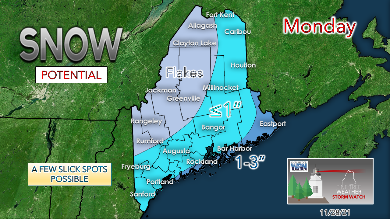 With the timing and track of the developing low expected further to the south, that cuts down on potential snow amounts. The ski hills may get flurries if anything. MidCoast areas and the DownEast shorelines may pick up a couple of inches out of this. 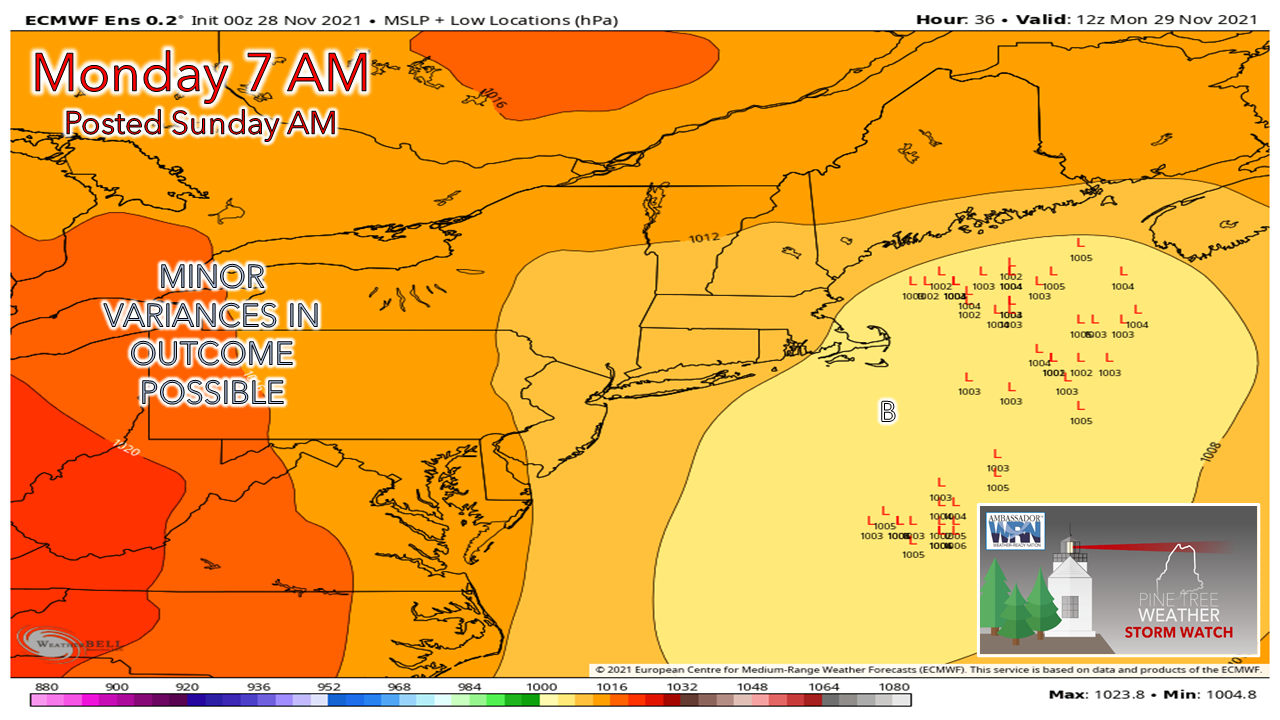 There is still a fair amount of wiggle room with this system. I've seen ideas that bring 1-3" over a good portion of interior areas as well as nothing at all from the deterministic and short-range models. For a nuisance storm, there is still a fair amount of bust potential as guidance struggles on the position of the incoming trough and where that steers the precipitation. Current financial deficit for 2022 - $900 Next storm possible on Thursday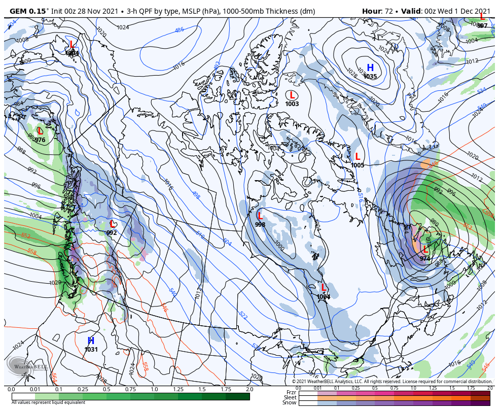 Tuesday 7 PM to Friday 7 PM - After Monday's storm departs, it intensifies over the Canadian Maritimes and brings breezy conditions for the region Tuesday. A few snow showers are possible Tuesday and Wednesday to the Quebec border regions. Another shot of upper-level energy fires a storm up over the Canadian Prairies and taps into some moisture streaming up from the south which could bring a snow to rain event for Thursday. Breezy conditions are possible for Friday. 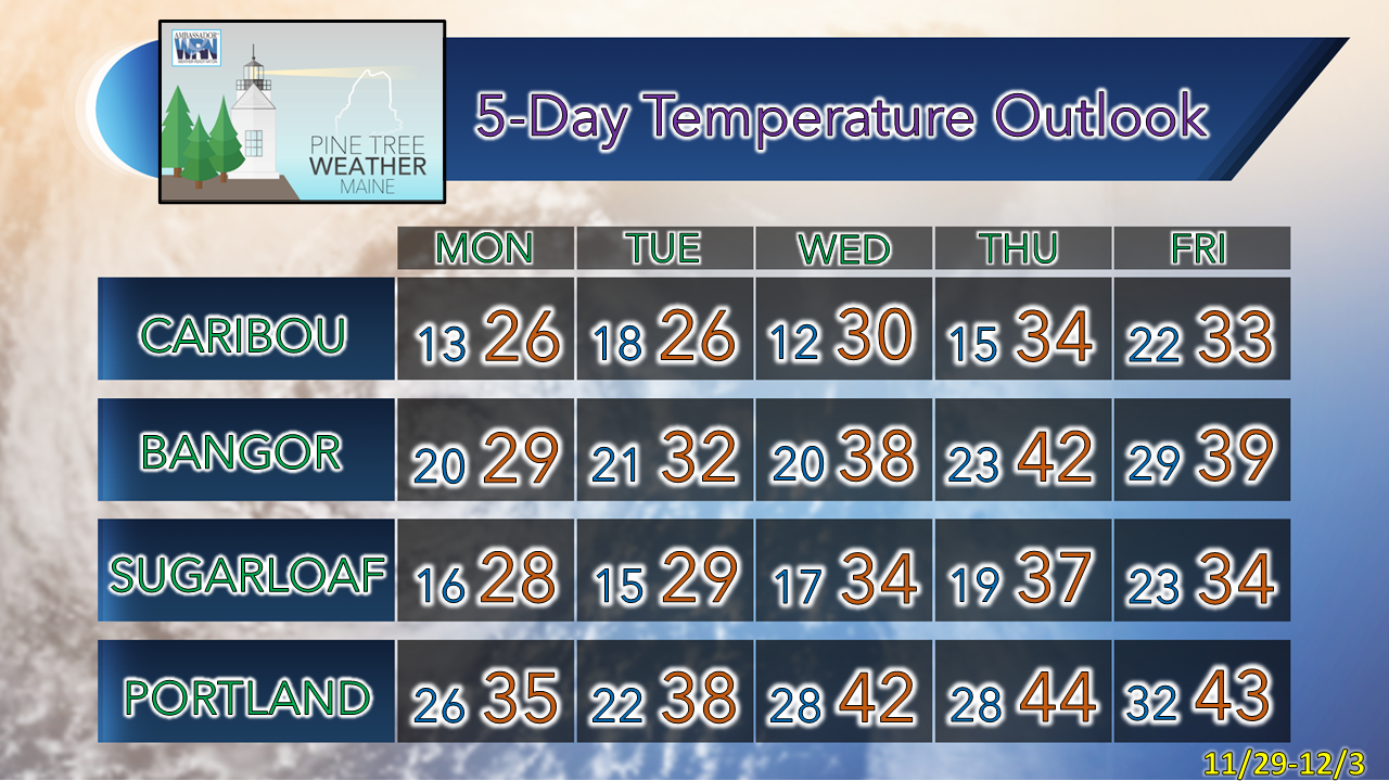 First Snow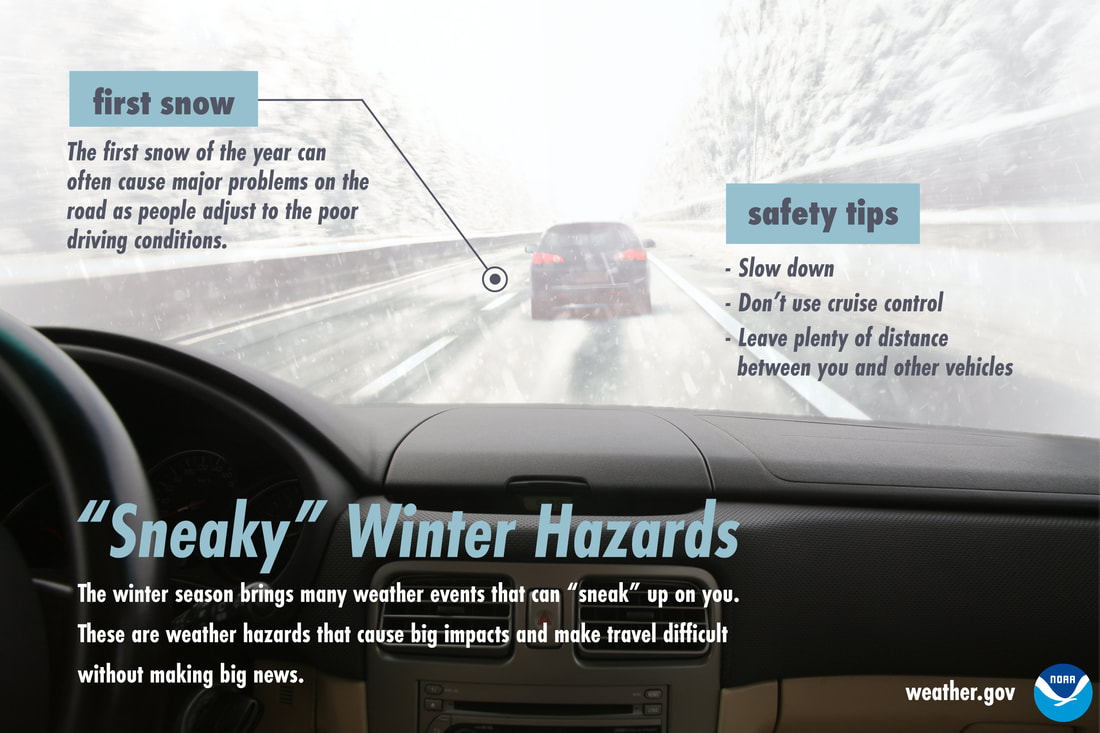 While lots of snow in the middle of winter can certainly cause dangerous travel conditions, many times it’s the first little bit of snow of the season that can cause accidents. Be extra careful as you and other drivers adjust to driving in poor conditions. Slow down, don’t use cruise control, and keep your distance from other vehicles. Don’t let the first snow sneak up on you! Be prepared to receive alerts and stay updated!
 For more information in between posts, please follow Pine Tree Weather on Facebook and Twitter.
Thank you for supporting this community-based weather information source which operates by reader supported financial contributions. - Mike |

Mike Haggett
|