
A slight warm up for TuesdayTemperatures will begin to rise a little on Tuesday as a southwesterly flow will help nudge the needle a bit into the teens north, 20s west and east, and around 30° over southern areas. Clouds will increase during the afternoon ahead of the system on the way for Wednesday. Light snow for Wednesday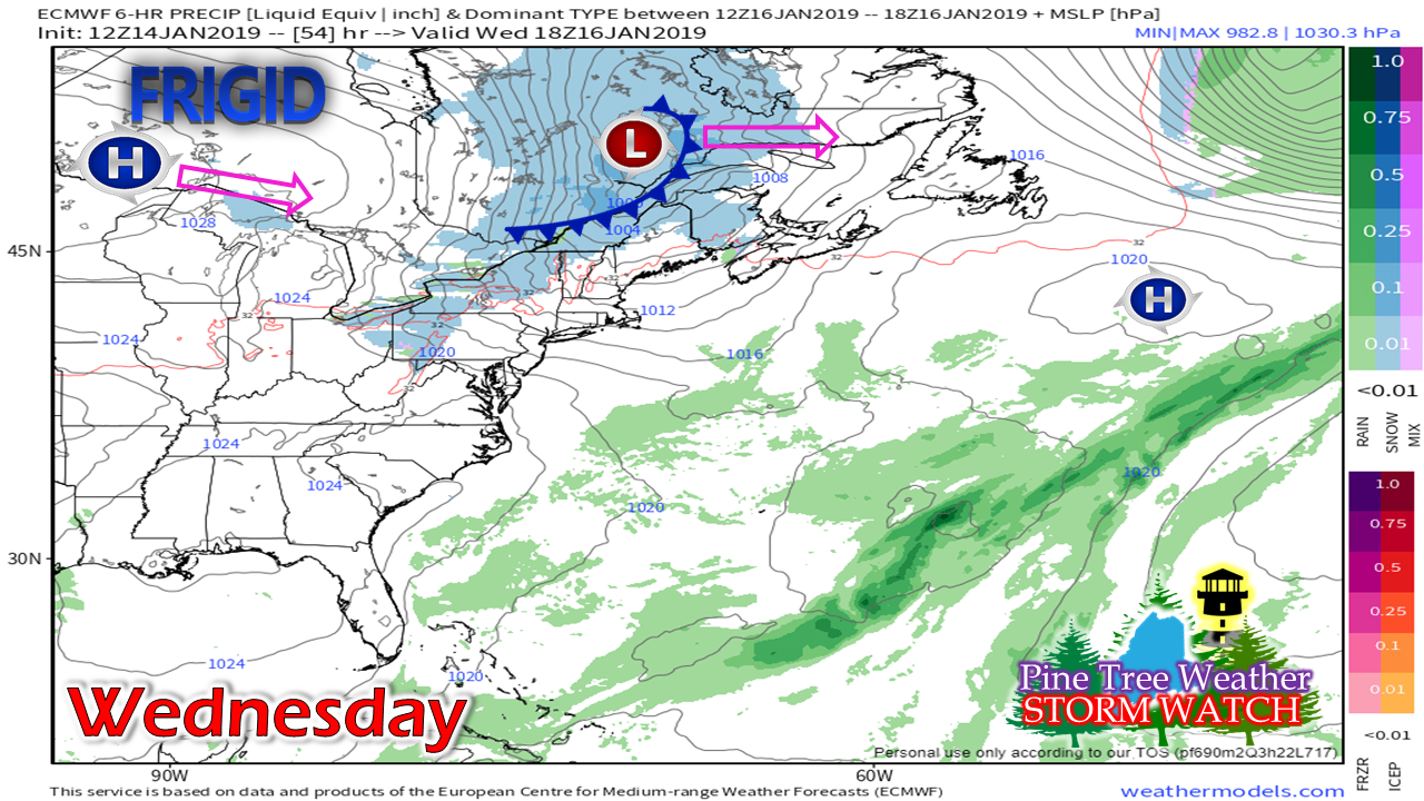 A weak area of low pressure will cut across central Quebec. An attached frontal boundary will bring snow showers out ahead of it, and another arctic chill behind it. 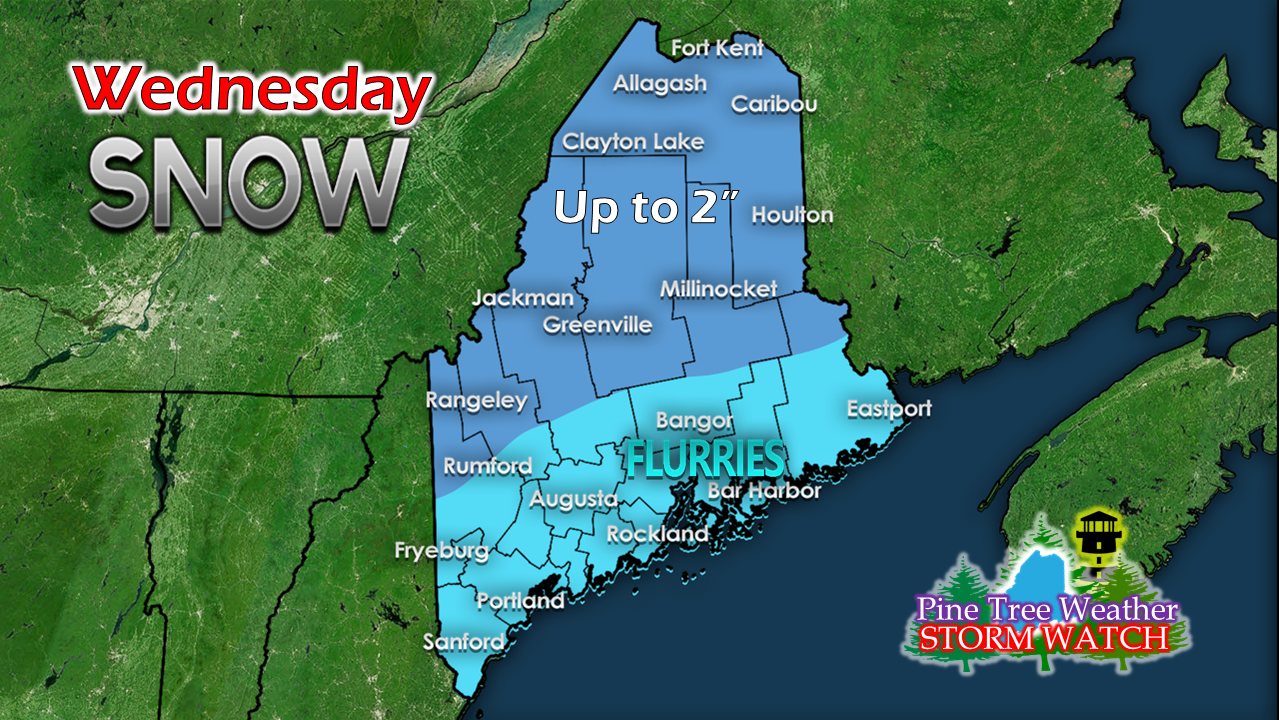 This is mainly and upper elevation event. The ski hills could pick up a couple of inches of snow. Areas of snow squalls may bring some gusty winds and brief white out conditions which could drop a quick inch or in spots. High pressure returns for a brief visit on Thursday. Friday commute could be messy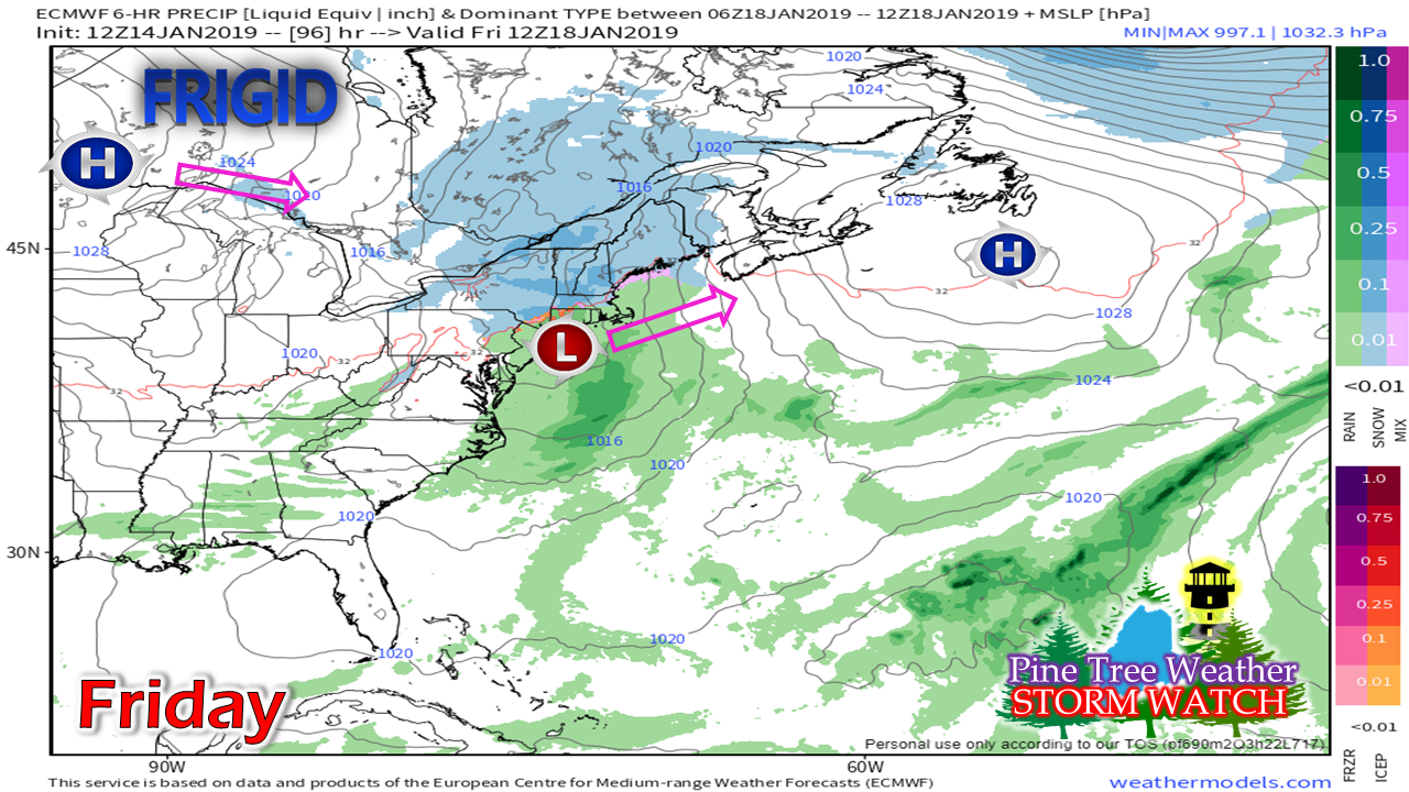 An area of low pressure slides off the Mid-Atlantic shorelines overnight Thursday into early Friday morning. A bit early to get into specifics with this one, but it appears to bring enough snow for the interior and a snow/mix for the coast to bring 1-3" of accumulation and a greasy morning commute. The storm quickly exits into the Canadian Maritimes Friday night. An arctic high moves in for Saturday, which sets the stage for another storm to close out the weekend. Models are still varying in ideas of solutions for Saturday night into early Monday. Precipitation type, amounts, storm track and timing are still a couple days away from being figured out. Outlook through Saturday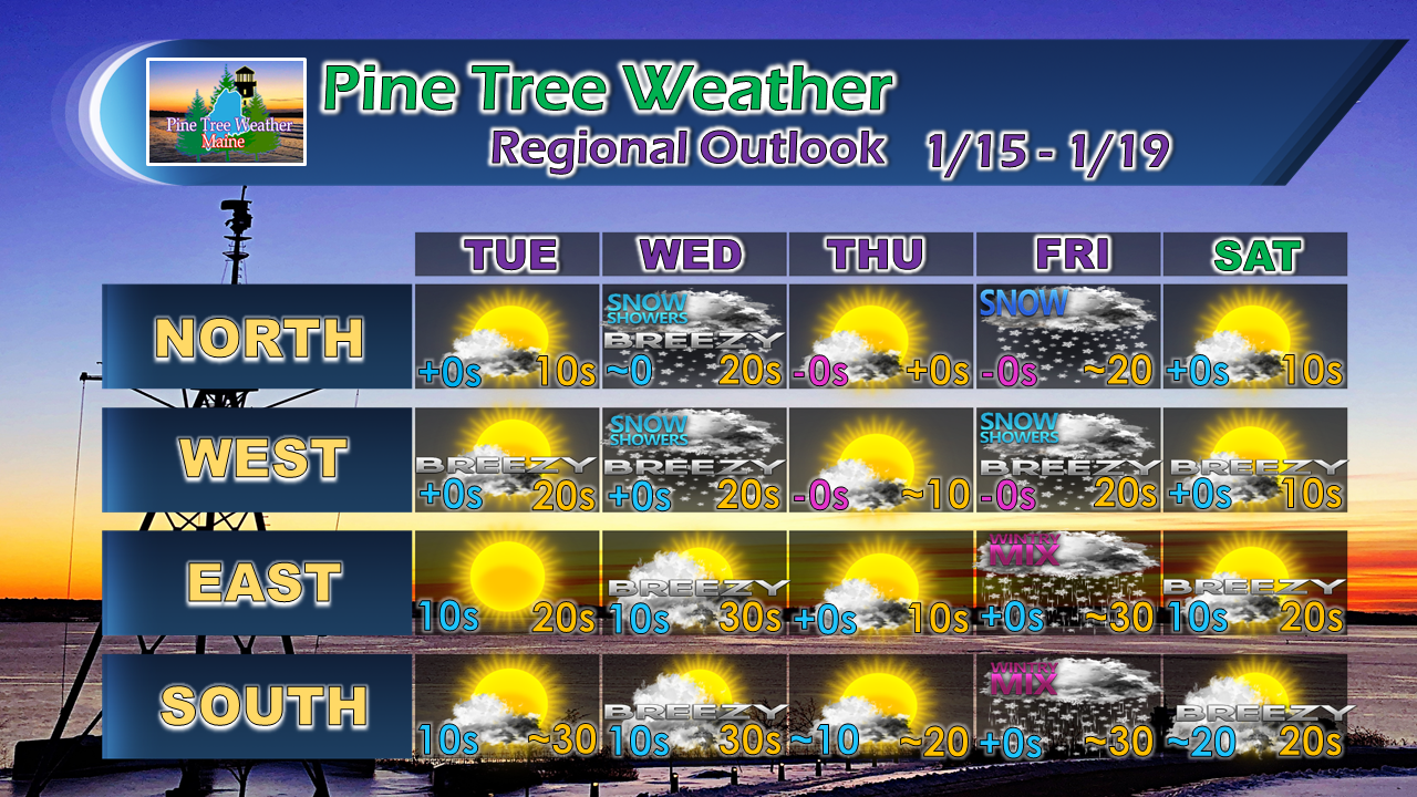 For the latest official forecasts, bulletins and advisories, please check in with the National Weather Service in Gray for western and southern areas, or Caribou for northern and eastern parts of Maine.
For more information from me, please follow the Pine Tree Weather Facebook page and my Twitter feed. Your financial donations are much appreciated to keep this site funded and for further development. I sincerely appreciate your support. Always stay weather aware! - Mike |

Mike Haggett
|


