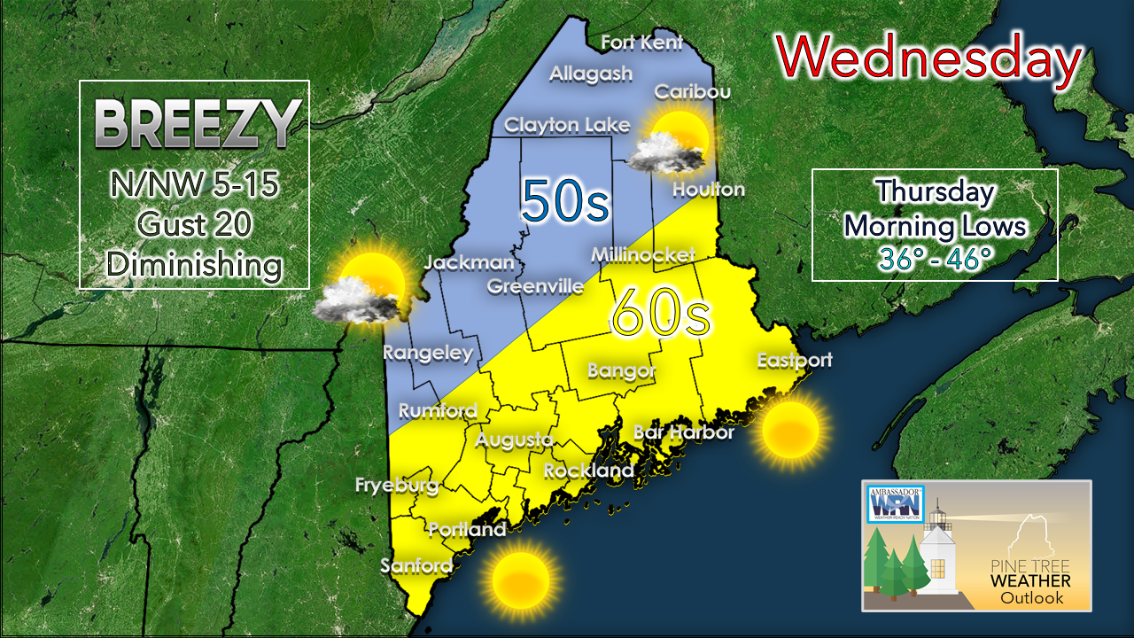
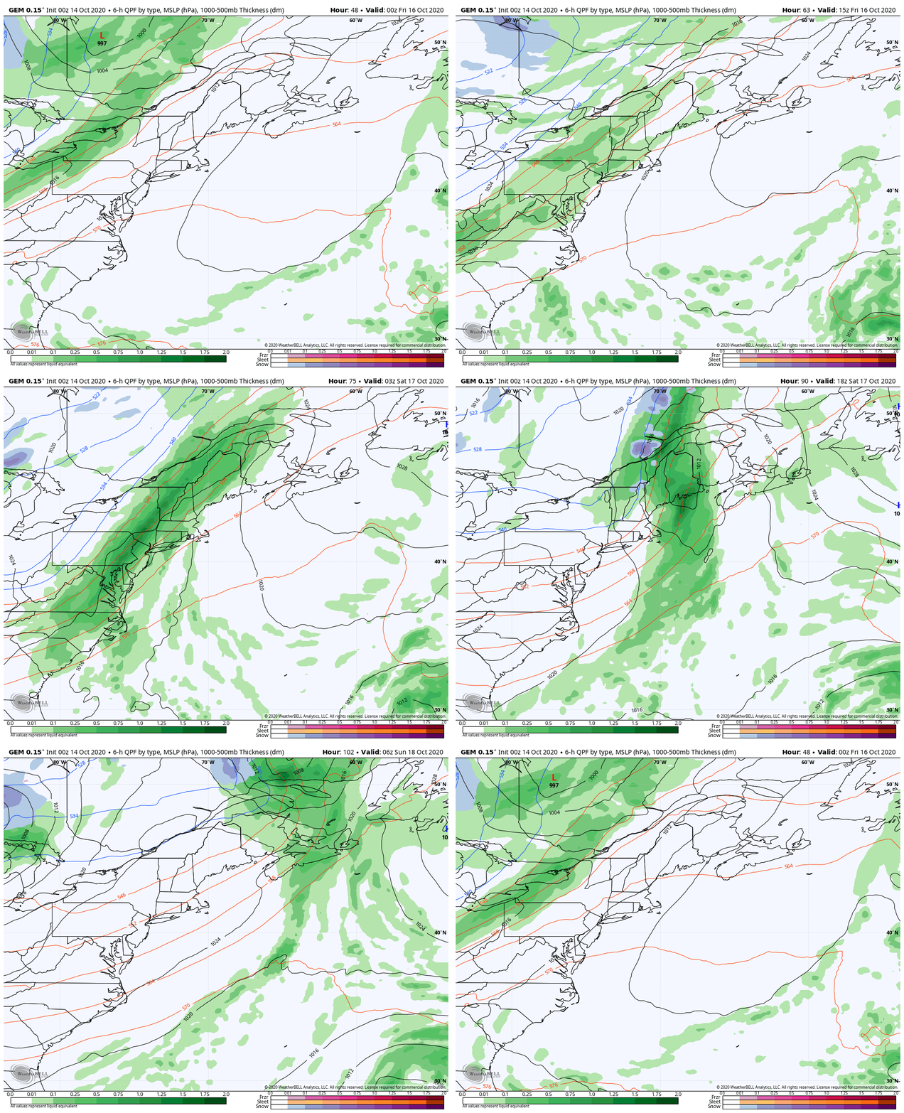
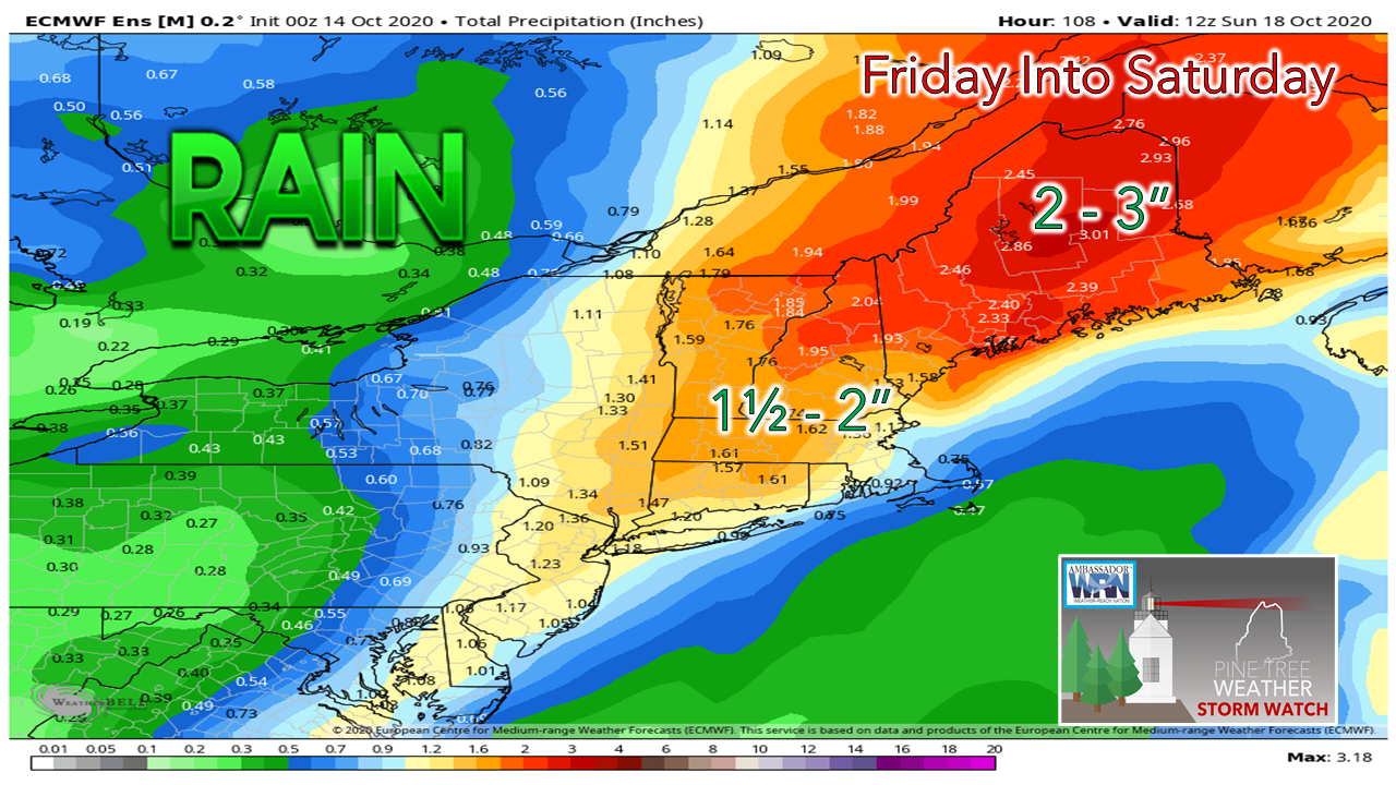
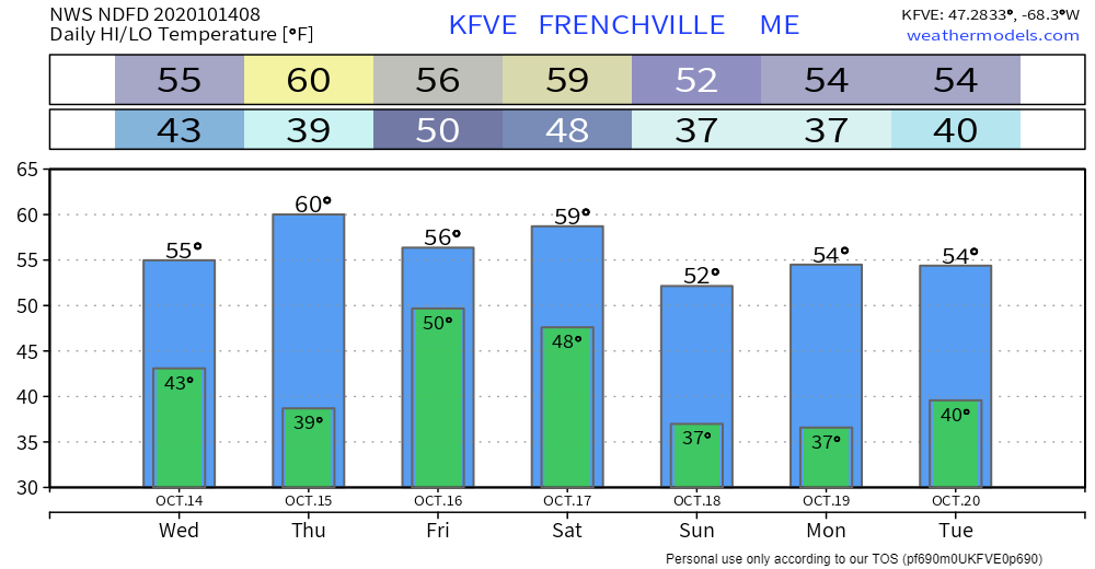
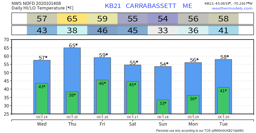
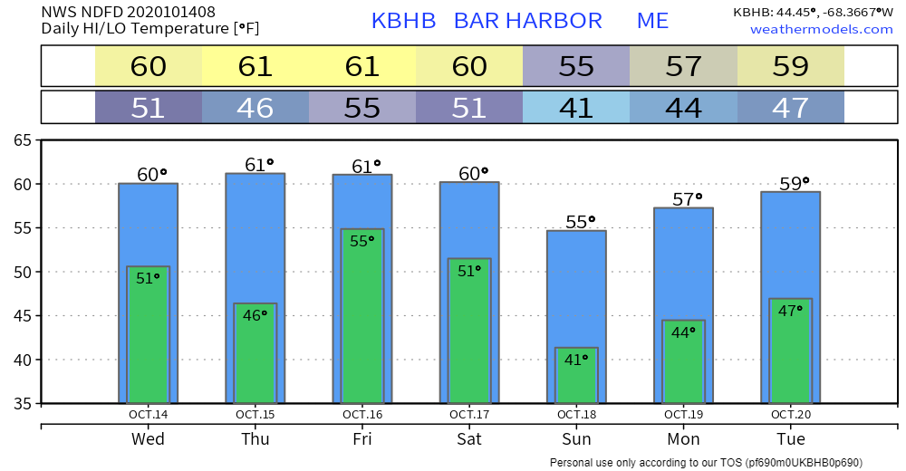
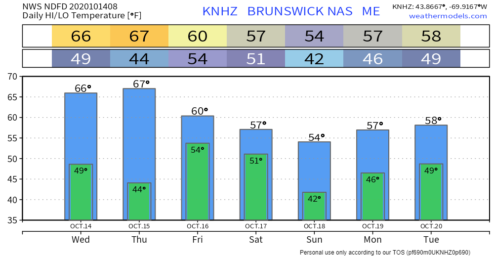
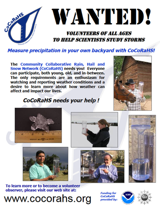
A quiet WednesdayAs the storm pulls away, the sky will clear out as the day progresses. Northern areas may be stuck in the clouds through midday, but sun should work into the region there. The western mountains may be dealing with periods of clouds and sun through the day. For the coastal plain, it will be a sunny day overall. A north/northwest breeze keeps the northern areas on the cool side and warms the shorelines. Southwest coastal areas may flirt with 70°. With a clear sky, temperatures are likely to chill. Frost is possible in areas of the north and west, but most areas stay above freezing, with coastal areas in the 40s to start Thursday. Another soaker on the way Friday into SaturdayAfter another dry day Thursday, a long wave frontal boundary arrives for Friday. A negatively tilted upper level low appear to fire up an area of low pressure along it. That will help draw in moisture from the south. Friday sees rain chances increase through the day. Rain becomes heavy at times Friday night into Saturday. The weekend starts off wet, with Sunday being the pick of the day for any outdoor activities. This system will drag some cold air into it and may bring a light accumulation of snow to the mountains as the system departs Saturday afternoon into the evening. Model ensemble ideas at this point have the region looking at 1½-3+" of rainfall from this event. Another welcome sight to put water in the ground, and take the edge off the ongoing drought. Temperature outlook through TuesdayTemperatures generally run above normal through the period. Sunday appears to be the day where the thermometer will be close to normal for the time of year. Precipitation measurements wanted!Ever wanted to take rain or snow measurements? Join CoCoRaHS or Community Collaborative Rain, Hail, and Snow Network. This volunteer network of observers measures precipitation from their backyards. Any age can volunteer. Data is used by NWS meteorologists to help with forecasts. Check out the CoCoRaHS Maine website! Feel free to ask me any questions about the program! Be prepared to receive alerts and stay updated!
For more information, please follow Pine Tree Weather on Facebook and Twitter.
** FUNDING NEEDED FOR 2021 ** Thank you for supporting this community based weather information source that is funded by your financial contributions. Stay updated, stay on alert, and stay safe! - Mike |
Mike Haggett
|

