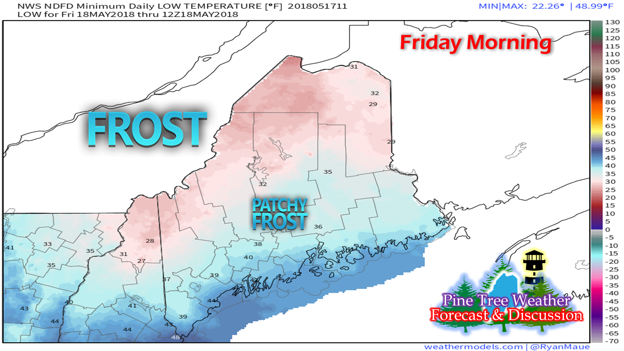
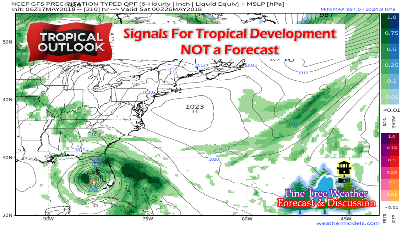
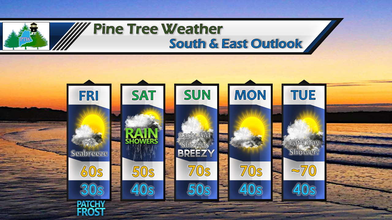
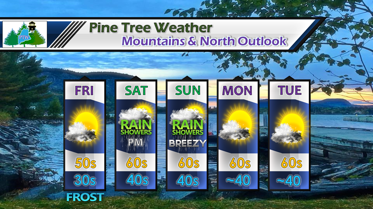
Frost potential Friday & Saturday morningThe calendar may read mid-May but the current pattern of the atmosphere could care less. High pressure moves southeastward from Quebec and settles in overnight Thursday into Friday morning. There may be a bit of a breeze and enough of it to prevent frost from forming, but it would be wise to cover up the plants over the interior Thursday night. As high pressure takes over for the day on Friday, there is a better chance for frost to develop Friday night into Saturday morning. After that, overnight temps moderate to warmer levels as we head into next week. Watching The TropicsThe North Atlantic hurricane season is upon us and guidance has been sniffing around with different scenarios in the past week. As we see in winter with doomsday model snowfall outputs which spread around on social media, this game gets played in the summer with potential tropical events. There is no question that the pattern is conducive for some sort of tropical system to develop in coming days. Warm sea surface temperatures and wind patterns over the tropics are certainly there. It is definitely something to keep an eye on for those with interests in the south. Whether or not any feature can make it north, time will tell. The Bermuda High appears more prevalent in guidance ideas than in times past, which is an indicator for a warmer trend for northeast region. It's that high that brings not only the warmth, but also humidity. For now, model ideas are but science fiction until a storm pieces together. It's buyer beware for those social mediums that display gloom and doom. Chose your sources wisely. The best source is checking in with The National Hurricane Center. Five Day Outlook - South and EastFor Friday, it will likely be the tale of the shorelines versus the interior coastal plain temperature wise. The immediate coast may struggle to reach 60°, and areas like Rockland may have a hard time reaching the mid-50s. Showers arrive Saturday from southwest to northeast, with steadier rain arriving in the afternoon (south) and evening (east). After the warm front passes through, there may be a few showers early Sunday, but the sun should come out in areas and generally be a fair day. Shower return Sunday evening as a cold front sweeps through, ending early Monday. Another system approaches from the west Tuesday into Wednesday. Five Day Outlook - Mountains and NorthFor the north country, outside of frost/freeze threat through Saturday morning, the trend is quiet and cool. Showers arrive Saturday afternoon in the mountains, and in the evening for the far north. Northern areas will have a decent day overall to start the weekend. Steadier rain arrives for all areas Saturday night, and there may be a few lingering showers into Sunday morning. There appears to be a bit of a break Sunday before the cold front arrives Sunday afternoon into the evening, bringing another round of shower activity. The first of the week appears dry and comfortable, with the next rain maker arriving Tuesday night into Wednesday.
As always, stay up to date with the National Weather Service in Gray for western and southern Maine and the National Weather Service in Caribou for eastern and northern areas. I have a bit of family business to attend to on Friday and Saturday. I will do my best to do a short term update at the very least either on Twitter or on Facebook pending on the time I have. Thanks as always for your support! - Mike |
Mike Haggett
|


