
High pressure in control for Wednesday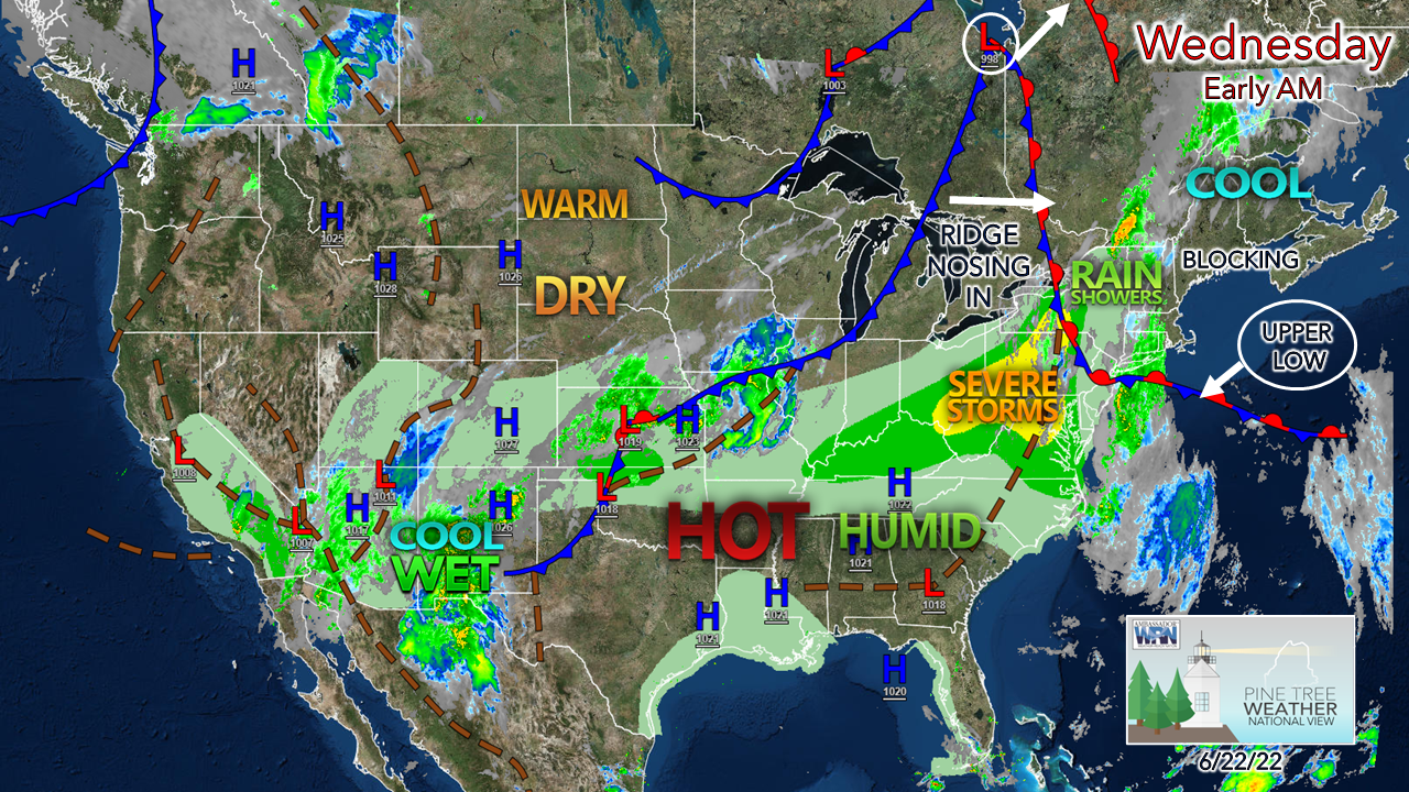 The upper low to the southeast of the region in conjunction with high pressure over the Canadian Maritimes, the combination has set up a block which is allowing for another fair, but slightly cool day for Maine. An area of low pressure near St. James Bay heads for northern Quebec. It wants to try to drag a frontal boundary into the region but will lose out thanks to the trough controlled by the upper low. Folks in New Hampshire may see some showers, with a better chance for western areas near the Connecticut River valley region. 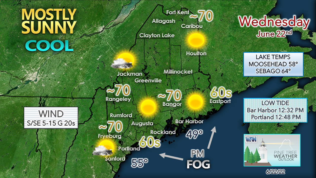 Western areas have a better chance to see some clouds associated with the stationary front parked near Lake Ontario. As the upper low drifts to the southwest, a southerly flow develops and pumps moisture in at the low level, which sets up fog potential late Wednesday afternoon into the evening. Shorelines are expected to be cooler for the day as a southeast breeze kicks up. The breeze turns more to the south over the interior as airflow works clockwise around the low to the east. Showers for western areas to round out the week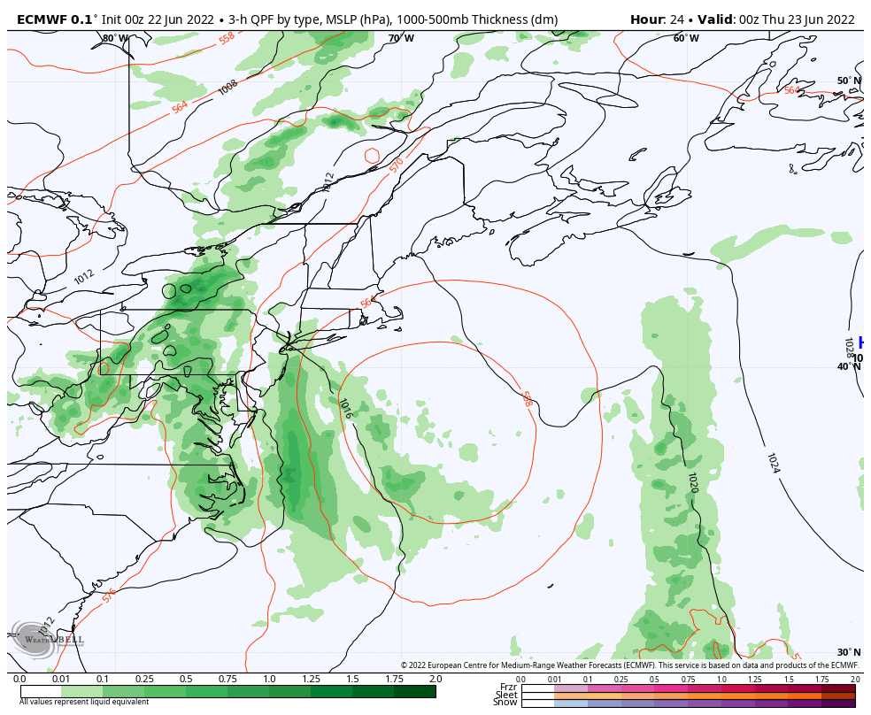 Wednesday 8 PM to Friday 8 PM - With the low over St. James Bay heading into northern Quebec and the upper low pivoting to the southwest, the moisture flow from the south cuts off and allows the approaching front to enter the region as it is fizzling out. Western and southern areas may see some light shower activity Thursday into Friday, but it appears that it may not amount to any benefit with light accumulation of a tenth of an inch or less. The upper low heads north into Maine early Friday and carries what moisture is left with it as it departs to the northeast Friday afternoon. Outlook through MondayAs the upper low departs, the warmup comes. While I do not expect humidity or heat to be oppressive, it will be noticeable. With the increase of dew points comes the risk of fog for the shorelines over the weekend. A cold front approaches the region Monday which sweeps out the humidity and brings the next chance for rain and potentially thunderstorms pending on the timing of arrival. 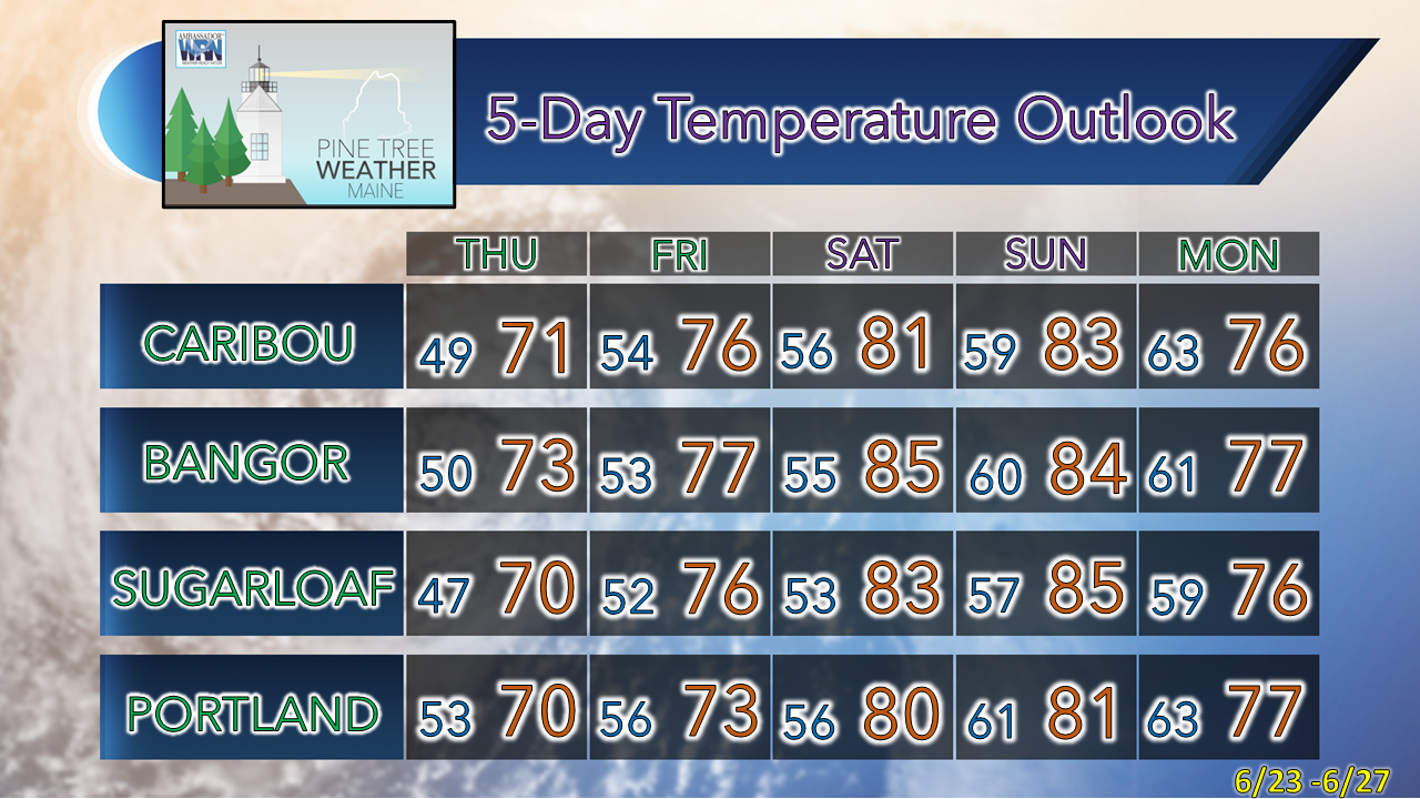 Thank you for supporting this community-based weather information source which operates by financial contributions from people like you. Stay updated, stay on alert, and stay safe! Have a great day! - Mike NOTE: The forecast information depicted on this platform is for general information purposes only for the public and is not designed or intended for commercial use. For those seeking pinpoint weather information for business operations, you should use a private sector source. For information about where to find commercial forecasters to assist your business, please message me and I will be happy to help you. |

Mike Haggett
|


