A taste of fall for Tuesday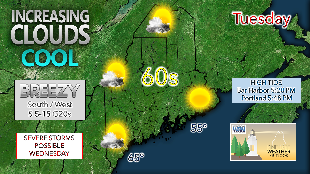 For those that appreciate a light sweater day, today is your day. A cool Canadian high-pressure system brings a sunny start to the day. As that moves east, a southerly air flow develops which will be noticeable over southern and western areas Tuesday afternoon. Clouds and humidity increase heading into the evening, with far eastern areas enjoying a mainly clear sky until Tuesday night. Concern for potent severe storms Wednesday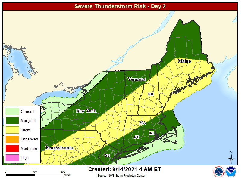 The Storm Prediction Center continues its idea for slight risk of severe storms over the region Wednesday afternoon for the third day in a row, which is a rarity for this part of the country. While not a common occurrence, the dynamics this late summer cold front sets the stage for atmospheric drama. All the ingredients of sharp temperature lapse rates, mid to low level wind shear, lift of the warm air from the surface into the approaching cold air aloft, along with enough convective available potential energy to touch off severe storms appear all in the mix. Where at first glance the threat could be cloud dependent, this front appears sharp enough to generate strong to severe storms with little help from surface heating. 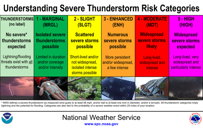 The potential impacts of the severe weather threat for Wednesday check off all the boxes. Damaging wind, loud and frequent lightning is the main concern. Hail and tornadic activity are possible, along with downpours which could cause localized flash flooding. Supercell storms could form which if they do occur would bring quite a punch. Please make sure you have multiple ways to receive weather alerts and be prepared to take action when a severe storm is called. 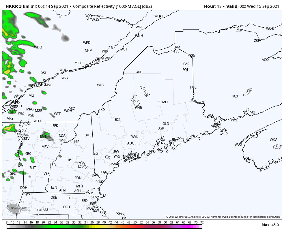 Tuesday night into 6 AM Wednesday sees a good chance for a shower and overnight rumbles of thunder for the north woods and Allagash region, with a scattered shower possible to the south. 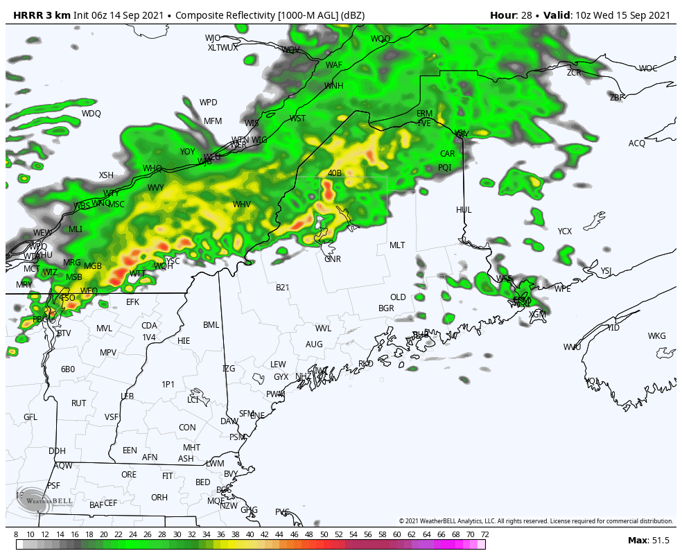 Steady showers to the north clear out from west to east Wednesday morning by around noon. Heading into the afternoon as the cold front approaches is where the concern for severe storms becomes elevated. By late afternoon, storms are expected to generate over the western mountains and foothills and approaching eastern areas. 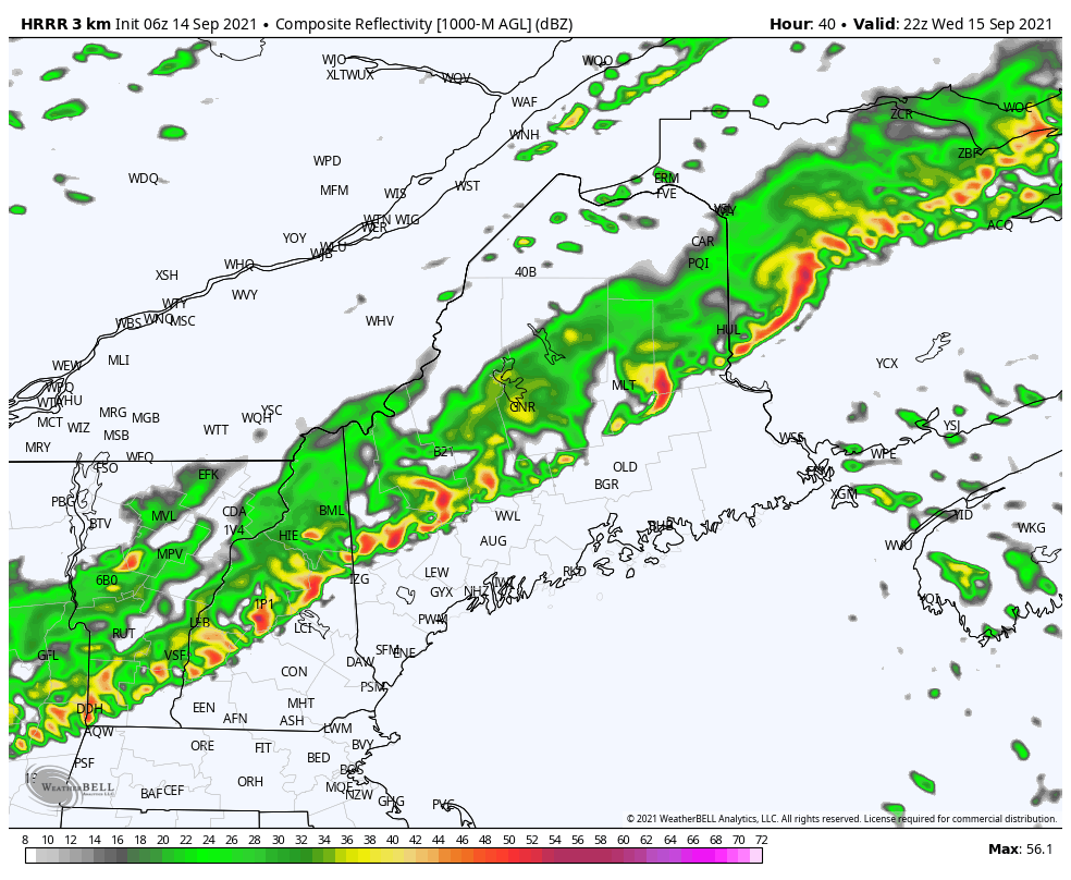 Storms approach southern, central, and eastern areas from 6 PM to 8 PM, with scattered showers exiting the shorelines in the wee hours of Thursday morning. The greatest threat for severe storms appears over the southwestern region, western foothills, Capitol District and MidCoast areas from 2 - 8 PM. Fine tuning on timing will come Wednesday morning. Spending Time Outdoors Spending time outdoors? Be on the lookout for thunderstorms! Keep up with the latest NWS forecast before you head out and know how you will receive a thunderstorm warning if one is issued. Identify where the nearest shelter is located, and if the skies turn threatening, seek shelter immediately. weather.gov/safety/thunderstorm  Outlook for the rest of the week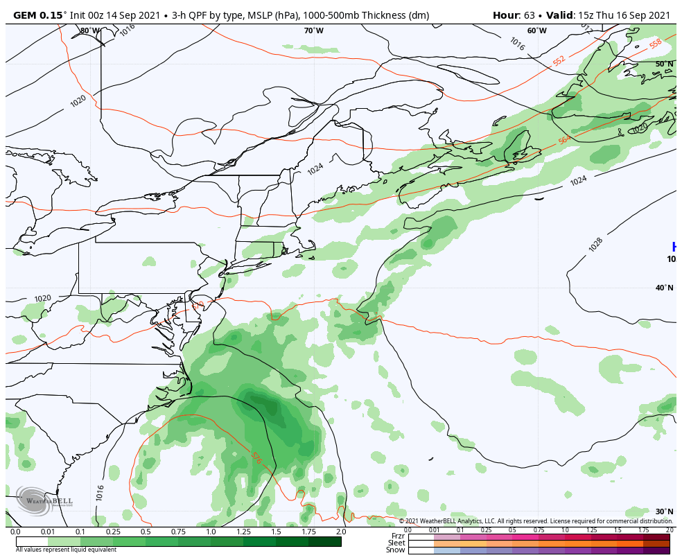 Thursday may see a shower early, but otherwise it appears to be a dry day with comfortable humidity levels. Friday sees the approach of a tropical disturbance from the south and the rise of dew points. While the storm is not expected to bring any real concern, pre-frontal moisture may fetch out ahead of it and bring areas of fog, drizzle and light showers for the coastal plain. The storm is expected to move south of Nova Scotia on Saturday. Weak disturbances in its wake may bring a isolated shower / thunderstorm over the weekend, and a reduction of humidity on Sunday. Temperature outlook through Sunday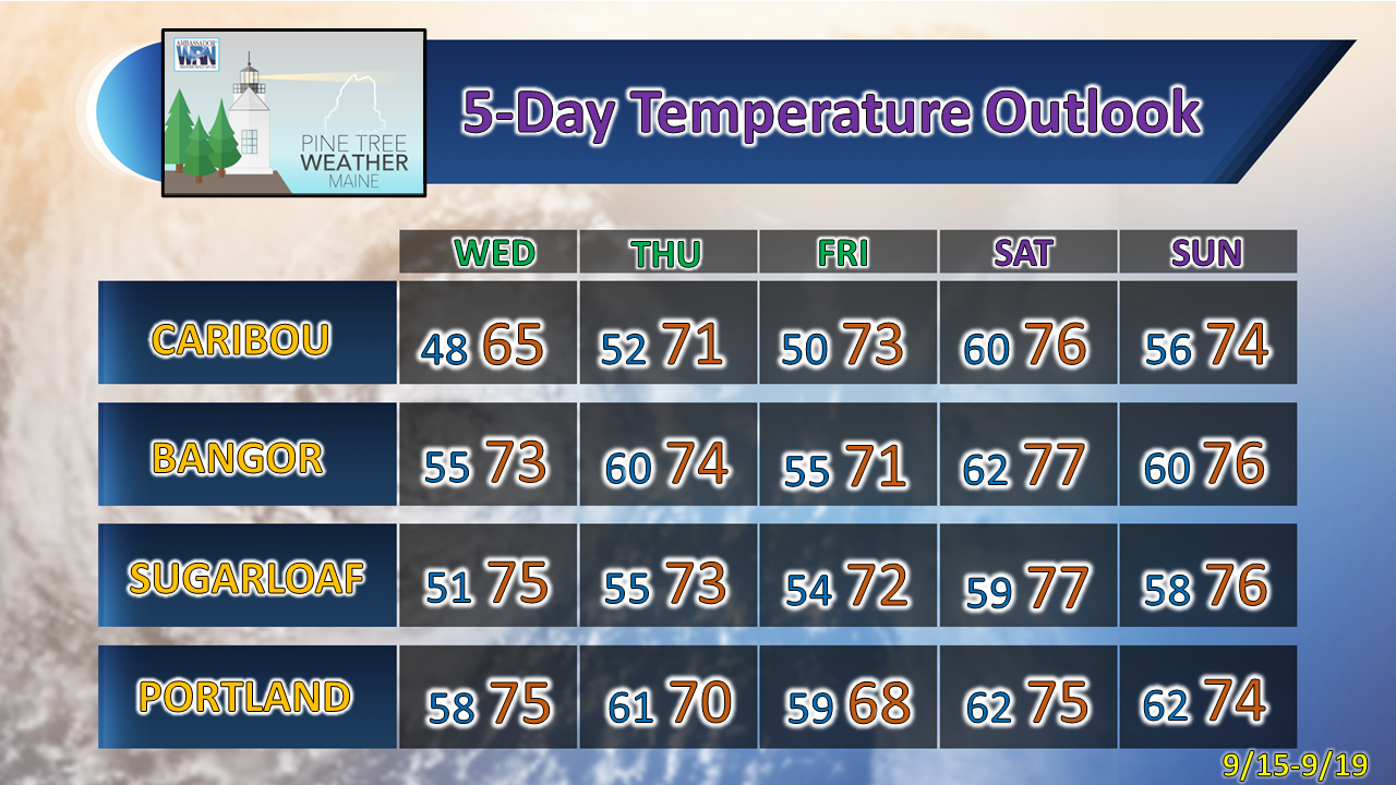 Be prepared to receive alerts and stay updated!
For more information in between posts, please follow Pine Tree Weather on Facebook and Twitter.
Thank you for supporting this community-based weather information source which operates by reader supported financial contributions. Stay updated, stay on alert, and stay safe! - Mike |

Mike Haggett
|