
Sun increases through the day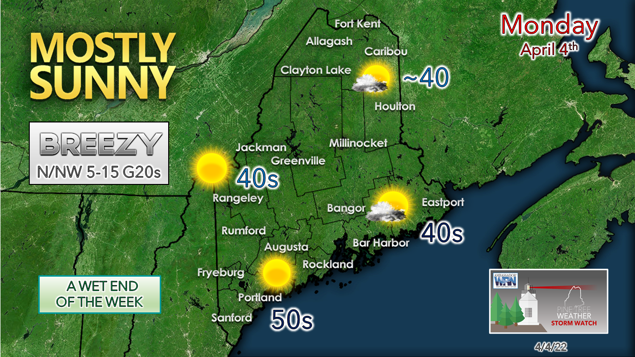 Low pressure to the south of Nova Scotia moves eastward on Monday. Eastern Washington County may see some snow shower activity to start the day but should end by mid-morning. The low intensifies as it tracks south of Newfoundland and increases wind speeds over the region in its wake. A north/northwest wind could bring gusts in the 20-30 mph range through the day and bring a bit of a chill with it. The sky clears out from west to east during the day as high pressure moves in, with a mainly sunny sky for all by mid-afternoon. With a clear sky and winds settling, temperatures tumble in the teens and 20s for the interior to around freezing at the coast to start Tuesday. High pressure brings a blue sky and quiet day for Tuesday. Light rain possible south for Wednesday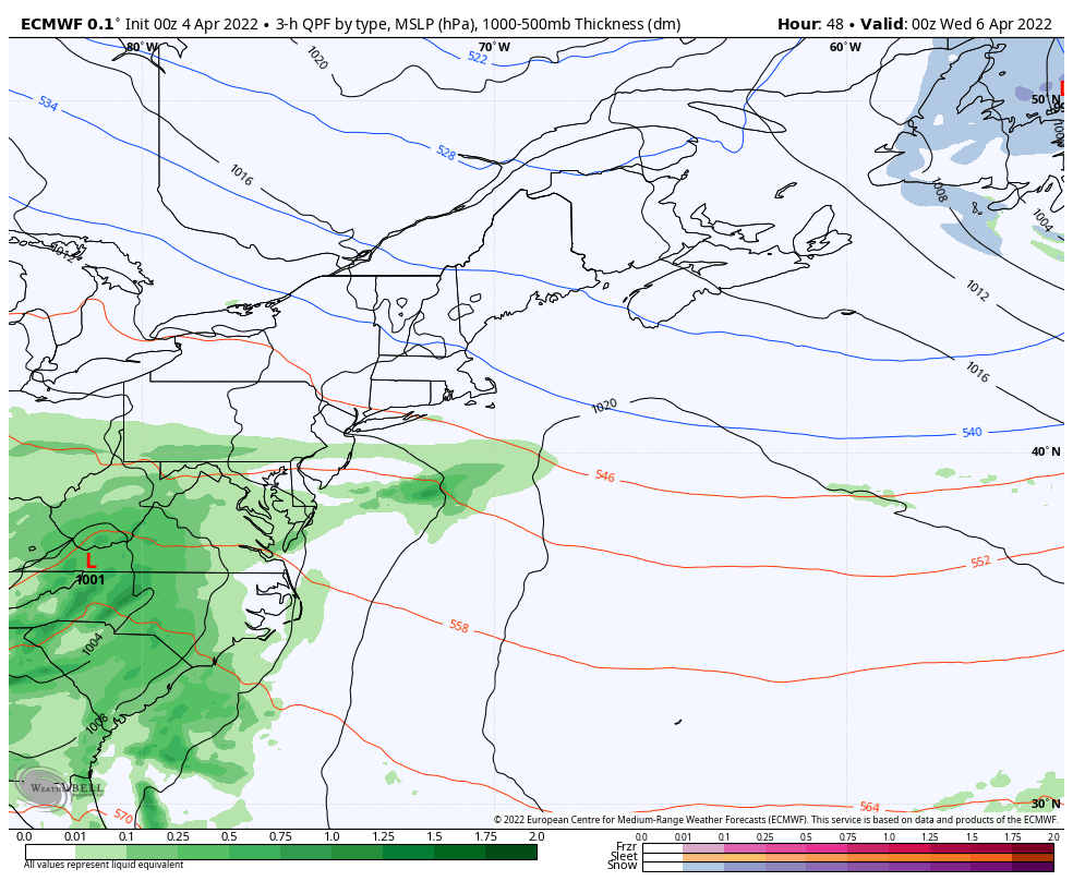 Tuesday 8 PM to Wednesday 8 PM - High pressure tracks northeastward early Wednesday morning. Low pressure exits the Mid-Atlantic coast during the day. Clouds increase over southwestern areas through the morning. At this point, it appears far southern areas may get clipped with a sprinkle or a light shower. The storm could track further south and bring nothing but clouds and a bit of a northeast breeze to the shorelines south of Rockland. Either way, any rainfall is expected to be light. The storm quickly exits to the east on Wednesday afternoon, any light rain ends and the sky clears out by sunset. A soggy end to the week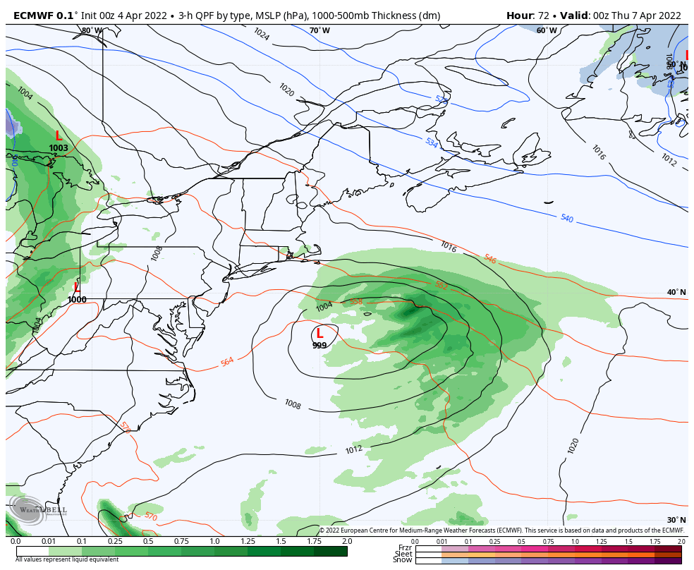 Wednesday 8 PM to Saturday 8 AM - A strong ridge is expected to surge in from the southwest heading into Thursday. The attendant warm front could bring some snow and/or a wintry mix for interior areas and rain Thursday afternoon into the evening. When interior areas flip to rain is dependent on how long cold air damming hangs on. Low pressure riding along a cold front passes through the region Friday afternoon into Friday night. Residual moisture with a trough settling in keeps light precipitation chances possible for Saturday. 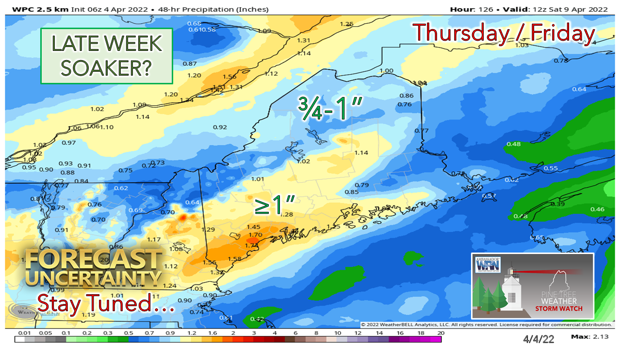 Far northern areas could pick up a few sloppy inches of wet snow out this, but for most of the region, this is a rain event. Recent history indicates guidance tends to be rather juicy in the long-term outlooks and tends to become leaner with precipitation amounts closer to the event. Time will tell if that trend continues. Temperature outlook through SaturdayThe normal high and low for Caribou for April 4th is 42° and 24°. For Portland, 49° and 32°. Forecast temperatures indicate slightly above average overall through the next five days. 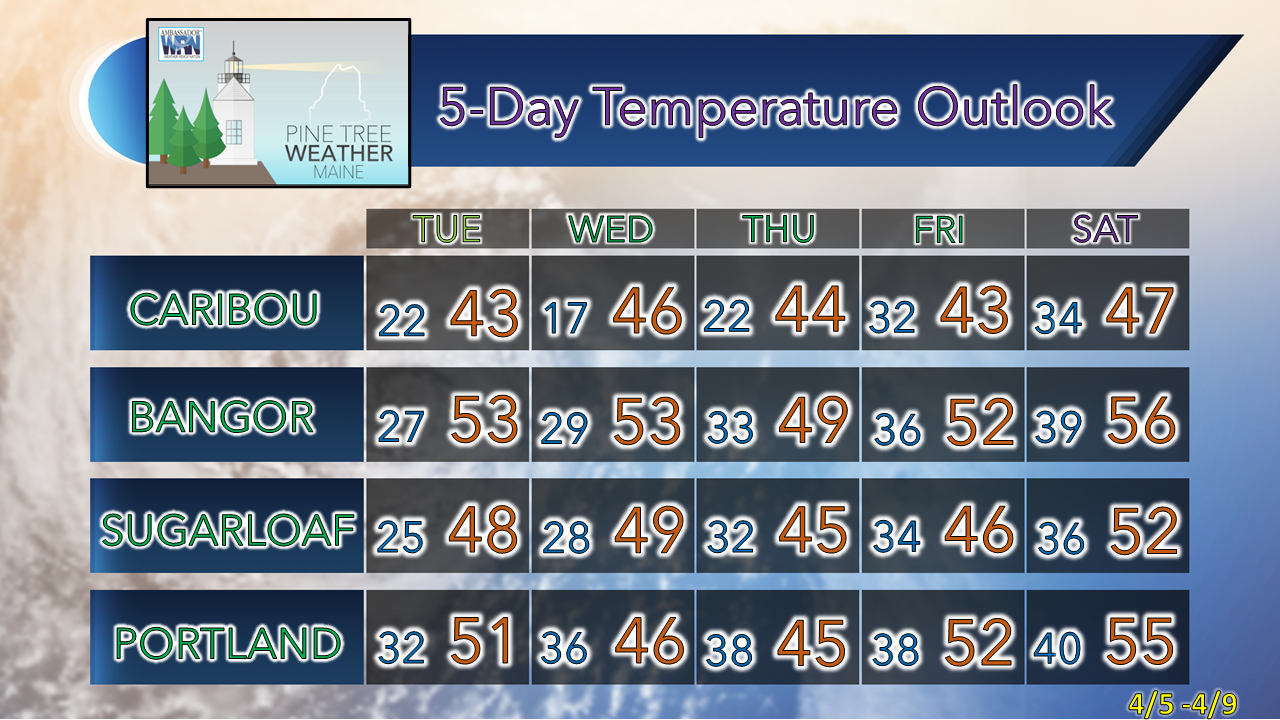 Be prepared to receive alerts and stay updated!
 For more information in between posts, please follow Pine Tree Weather on Facebook and Twitter. Thank you for supporting this community-based weather information source which operates by reader supported financial contributions. Thank you as always for your support! - Mike NOTE: The forecast information depicted on this platform is for general information purposes only for the public and is not designed or intended for commercial use. For those seeking pinpoint weather information for business operations should use a private sector source. For information about where to find commercial forecasters to assist your business, please message me and I will be happy to help you.
|

Mike Haggett
|


