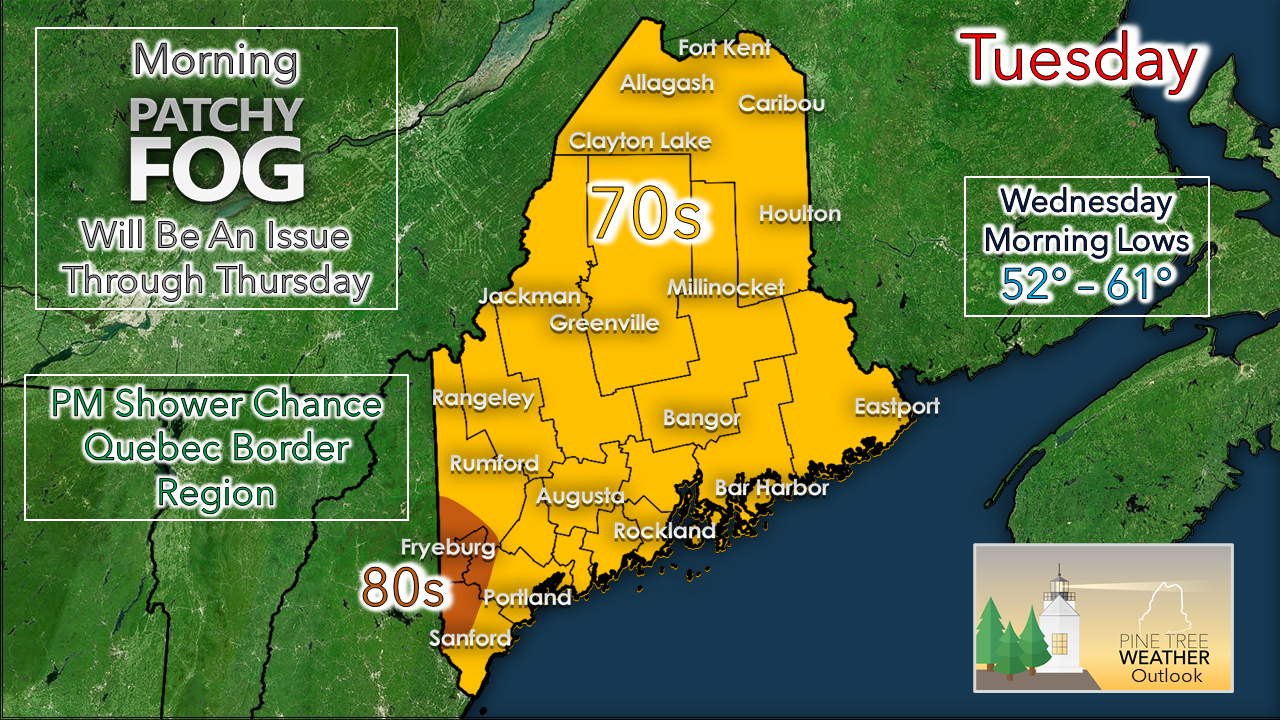
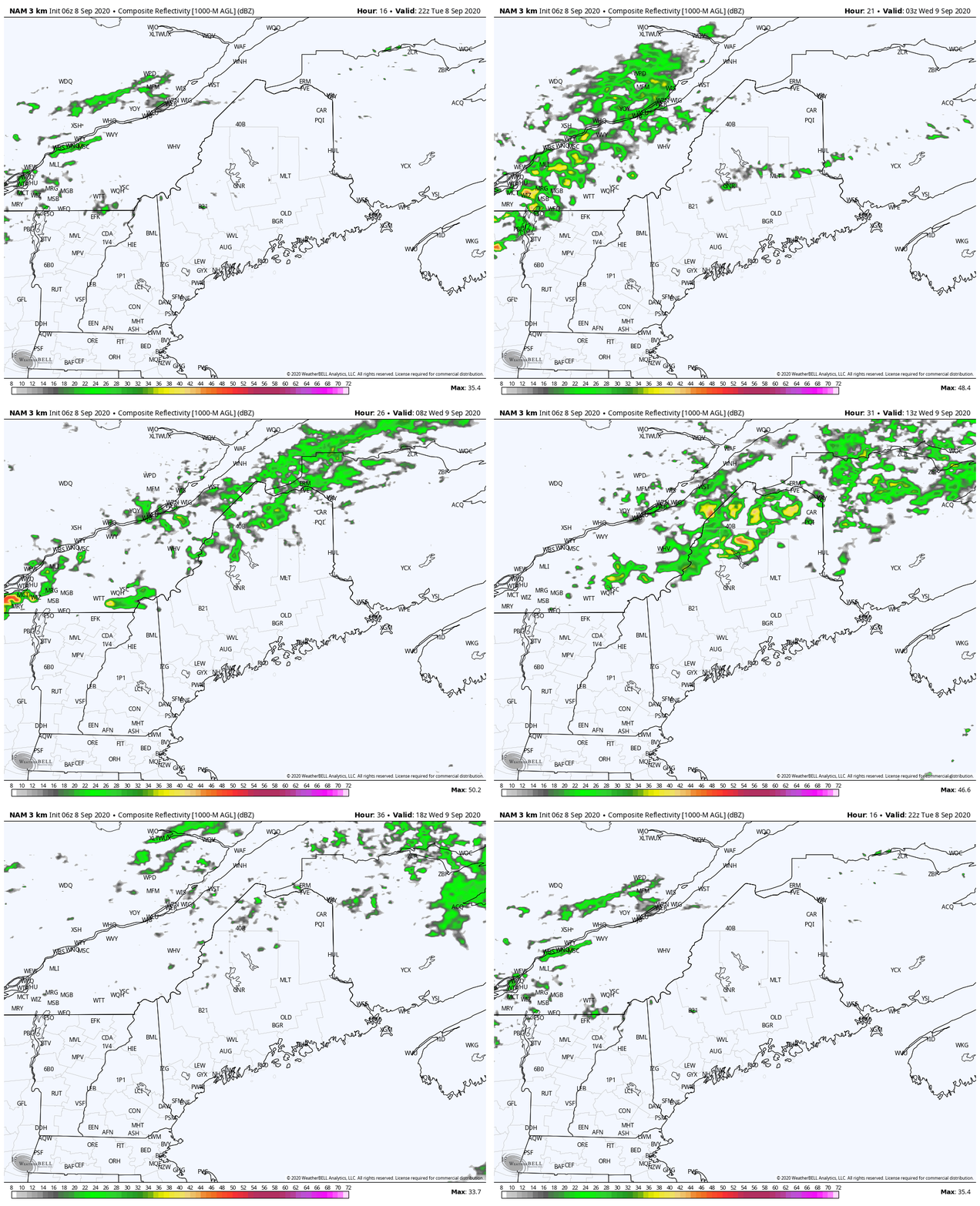
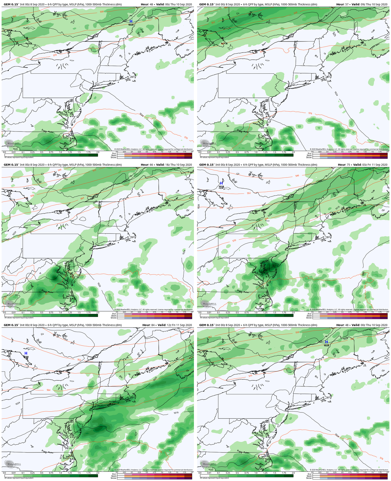
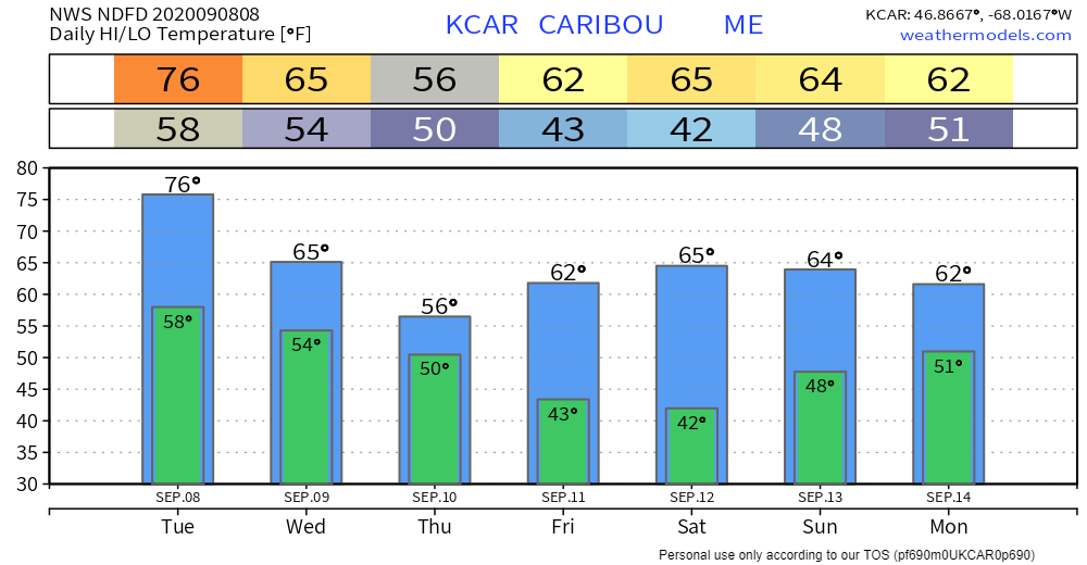
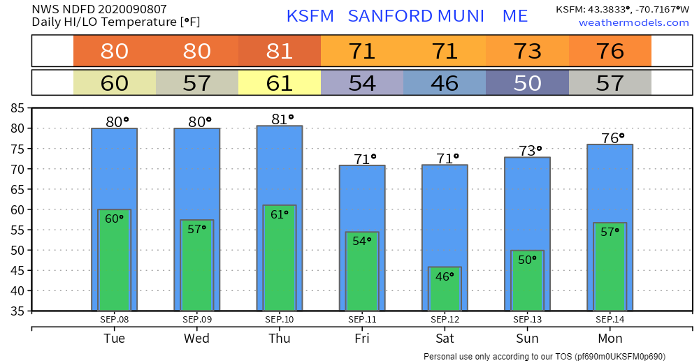
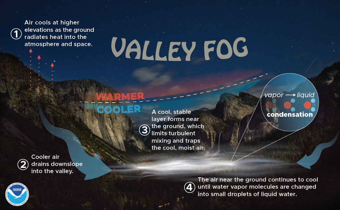
Cloud cover to dictate temperaturesHigh pressure has moves off to the east. A southerly air flow will bring a gradual uptick in humidity levels through Thursday. A slow moving cold front hangs off to the northwest. The wind of yesterday has settled, but it could be a bit breezy along the coast and in northern parts of the state. Cloud cover will dictate how high temperatures go. Areas away from the shorelines could see 80s in places like Augusta, Waterville, Bangor, Millinocket over to Calais if the clouds stay away. Northern areas benefit for rain through ThursdayThe rooftop of the state has the best chance for showers starting Tuesday night into Wednesday as a weak area of low pressure rides along very slow moving cold front draped across the St. Lawrence River. Areas from Jackman, Greenville over to Houlton northward may pick up an tenth or two of rain accumulation through Wednesday evening. The cold front begins to slide through the region Wednesday night into Thursday. At this point, showers appear more numerous over northern areas, and more widely scattered in southern areas through Thursday night into early Friday morning. By Friday the humidity will be gone and drier air will be around to start the first half of the weekend. Saturday looks fair, with showers possible statewide for Sunday. Temperature outlookFolks in northern and mountain areas should be aware of patchy frost potential Friday night. The science of valley fogDo you know how valley fog is created? First, air at higher elevations cools down, which then drains downslope into the valley. From there, a cool, stable layer forms near the ground, which limits turbulent mixing and traps the cool, moist air. Finally, the air near the ground continues to cool until water vapor molecules are changed into small droplets of liquid water. weather.gov/safety/fog-mountain-valley Stay prepared to receive alerts and stay updated!
For more information, please follow Pine Tree Weather on Facebook and Twitter.
** FUNDING NEEDED FOR 2021 ** Thank you for supporting this community based weather information source that is funded by your financial contributions. Stay updated, stay on alert, and stay safe! - Mike |
Mike Haggett
|

