
Enough of a concern for storms to stay aware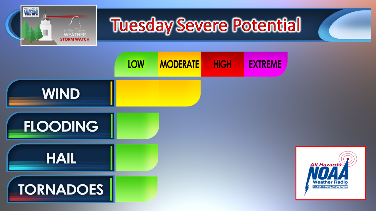 For those of you that have followed me for a while know that I don't get fired up about much unless it is warranted. My ideas around the dynamics of the day have not changed since the Monday morning post here and the afternoon follow up post when the Storm Prediction Center heightened status to slight risk. Damaging wind is the main concern of the activity of the day, along with localized flash flooding from downpours and training storms, hail, and an isolated tornado cannot be ruled out. 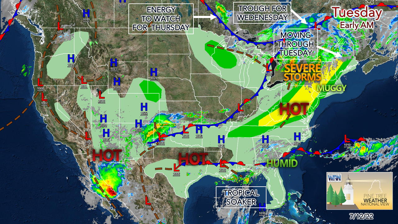 The frontal boundary moving through the region Tuesday has some spice to it. With a southwest flow pumping dew points to uncomfortable levels, the humidity becomes gasoline for storms. Add some good wind shear thanks to rather stiff low level jet stream, warm air rises into cold and then convection fires up. 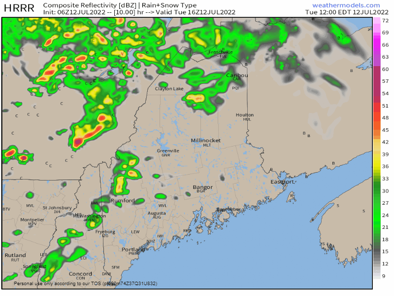 Tuesday Noon to Wednesday Midnight - Morning showers are possible as outflow ahead of the front passes through. Cloud debris from that may play a factor in how the afternoon and early evening plays out. The heating of the day is the key element here. One key law in meteorology is warm air rises and cold air sinks, Capping inversions can hold off the rise of warm and the fall of cold, but with ample wind shear, that acts as a rising funnel of warm air into the cold. That is the likely result here. The best chance for stronger storms appears north and west of Portland - Bangor - Danforth as the southwest wind direction brings cooler temperatures in off the water to the east, stabilizing the air there. This isn't to say some rumbles may occur there, but the snarkier storm threat is over the interior. Coastal York County may get in on a stronger storm. Beachgoers be aware. 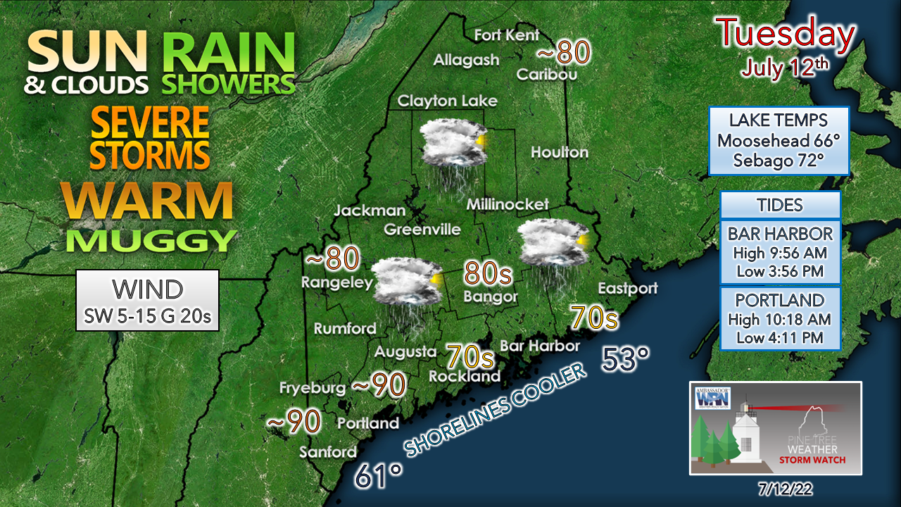 The difference in high temperatures between Fryeburg and Rockland could range at least 20° due to the southwest flow. The forecast high for Mount Washington is expected to be in the mid-50s, which indicates a difference of 30° or more. Steep temperature lapse rates in pockets of afternoon sun light the fuse for storms to erupt. While not a widespread severe set up, the bottom line is a few places are going to get hammered. The further inland you are, the better the chance. Folks camping out should pay close attention. Have multiple ways to receive alerts, including a NOAA weather radio. If you plan to head to one of the more popular beaches, have an evacuation plan in place and beat the crowd out once you see clouds bubble up. A few showers around for Wednesday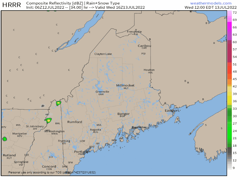 Wednesday Noon to Thursday Midnight - An upper-level trough works in for Wednesday. While the humidity levels modify somewhat from Tuesday, it appears that it will remain fairly muggy for much of the region south and east of the mountains. With a weak disturbance riding along the boundary, that sets up the risk of an isolated pop-up shower and/or thunderstorm. Another disturbance could bring showers Thursday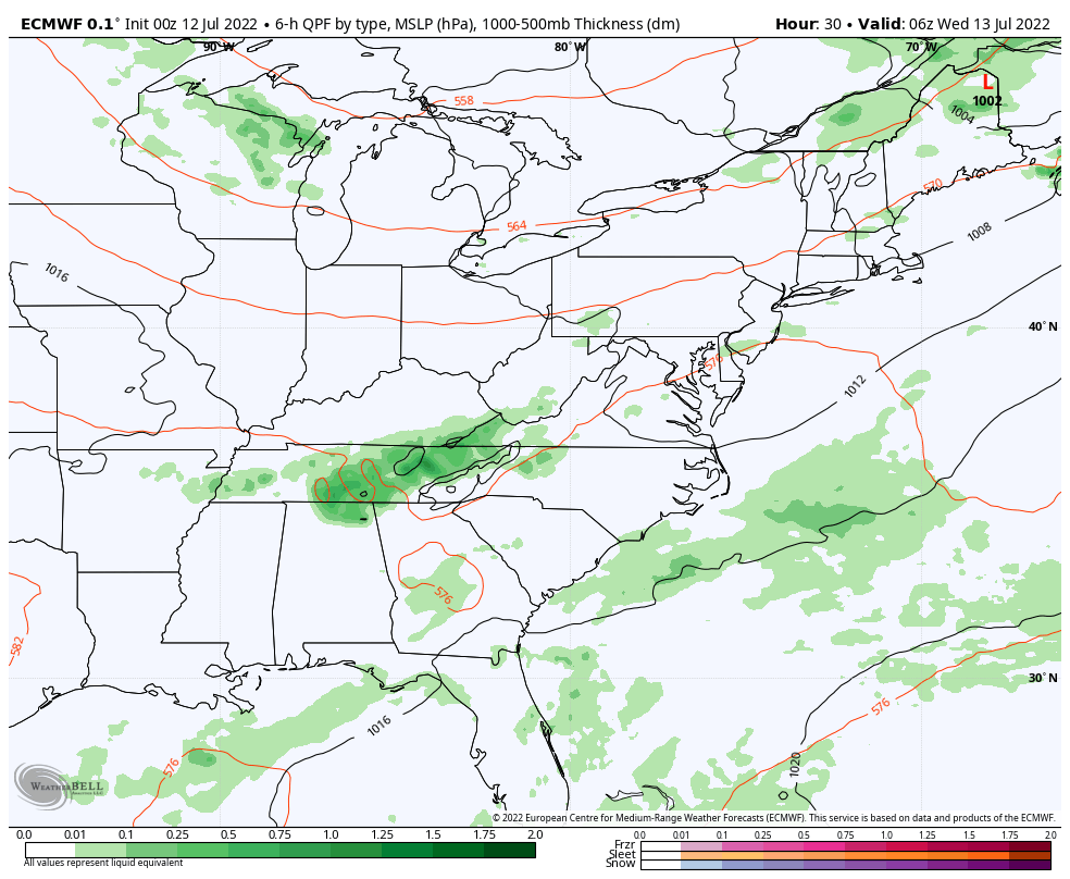 Wednesday 8 AM to Friday 8 AM - As the trough settles in, it hits the ridge to the south and stalls out. A weak disturbance works in from the Great Lakes and gets an injection of moisture from the southwest which could bring widely scattered showers and storms to the region for Thursday. One can hope that guidance is underperforming on the moisture as presented here and brings some rain of benefit to the coast. Time will tell. Some morning showers are possible for eastern areas Friday. Saturday appears precipitation free. The humidity rises Sunday, with isolated showers and storms possible for Monday. 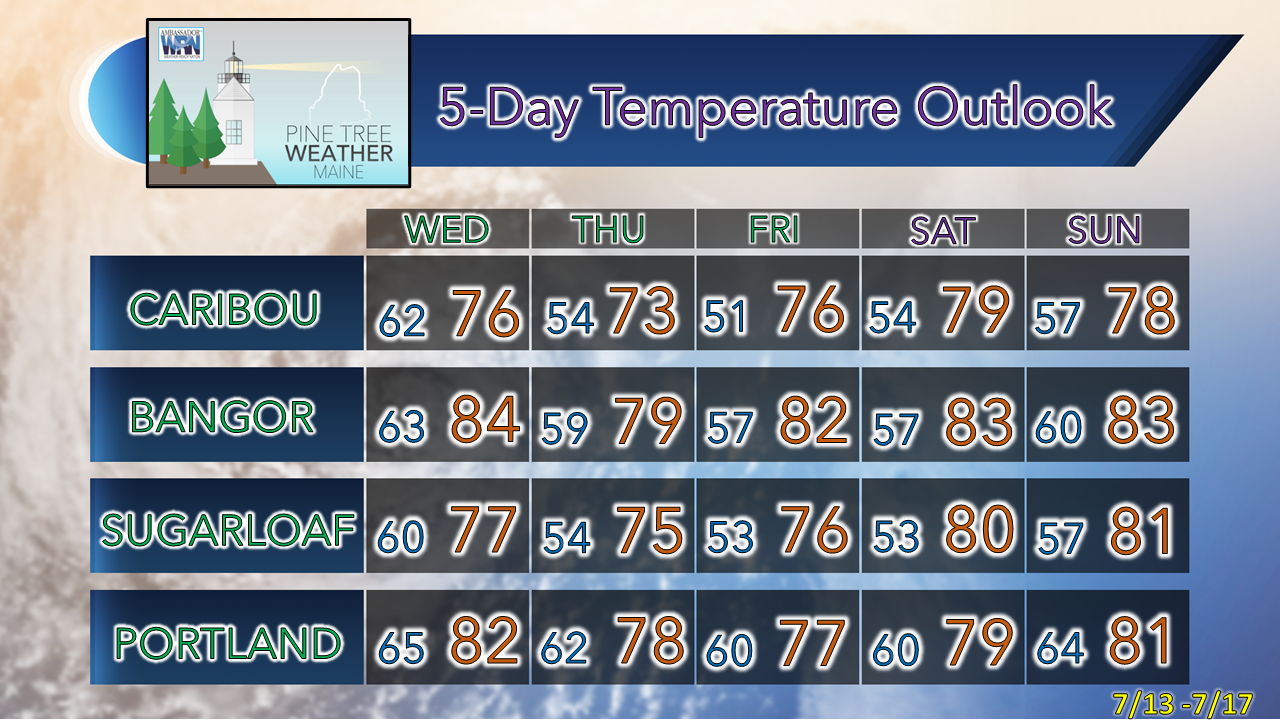 Thank you for supporting this community-based weather information source which operates by financial contributions from people like you. Stay updated, stay on alert, and stay safe! NEXT UPDATE: THURSDAY - Mike NOTE: The forecast information depicted on this platform is for general information purposes only for the public and is not designed or intended for commercial use. For those seeking pinpoint weather information for business operations, you should use a private sector source. For information about where to find commercial forecasters to assist your business, please message me and I will be happy to help you. |

Mike Haggett
|


