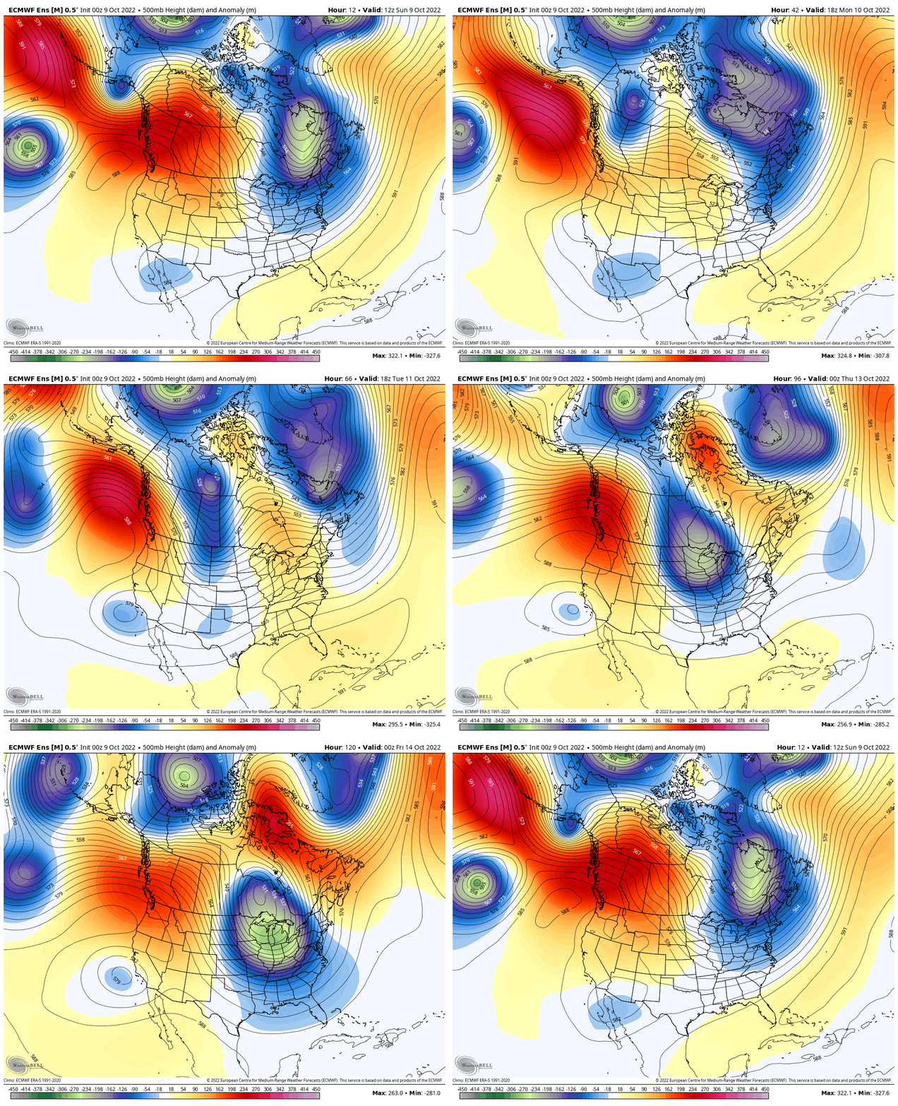
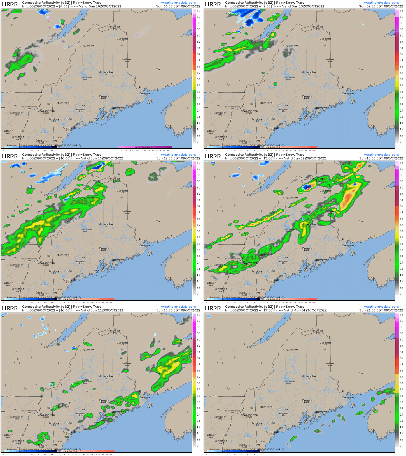
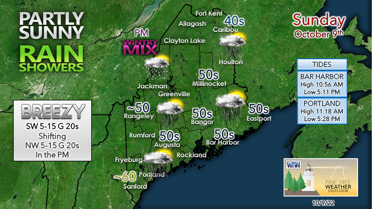
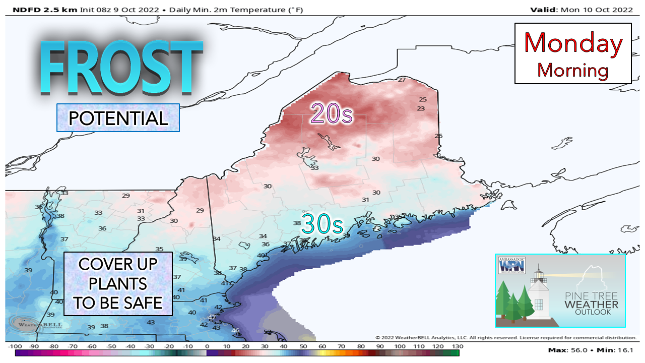
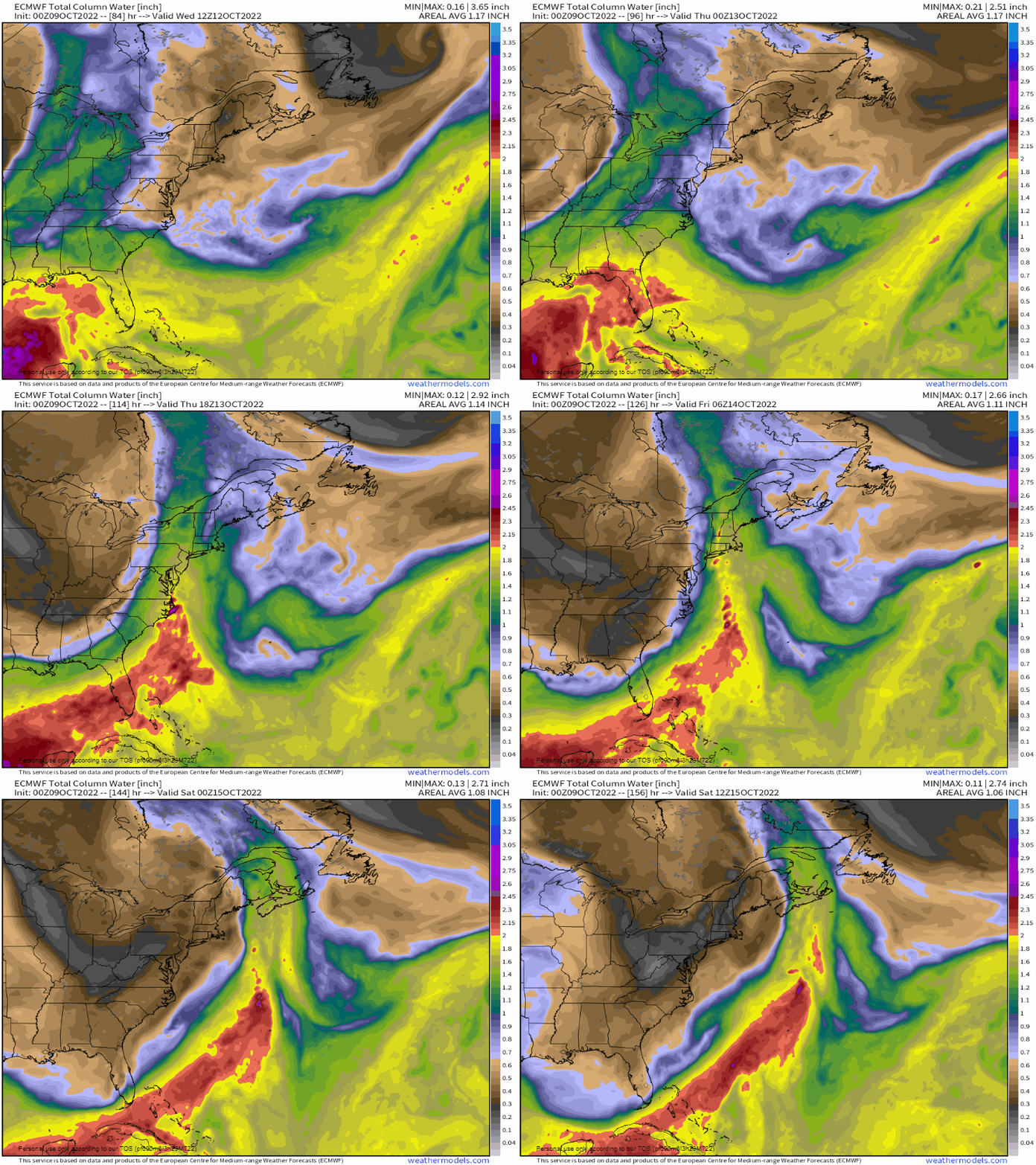
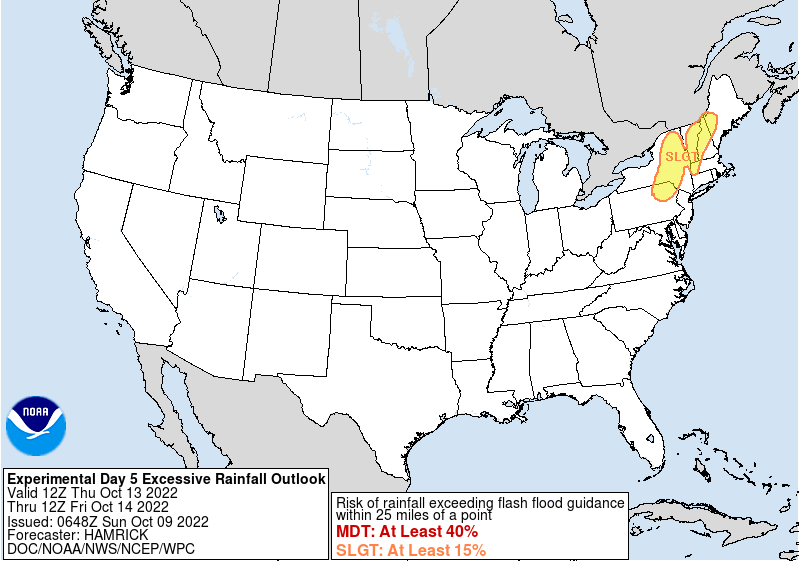
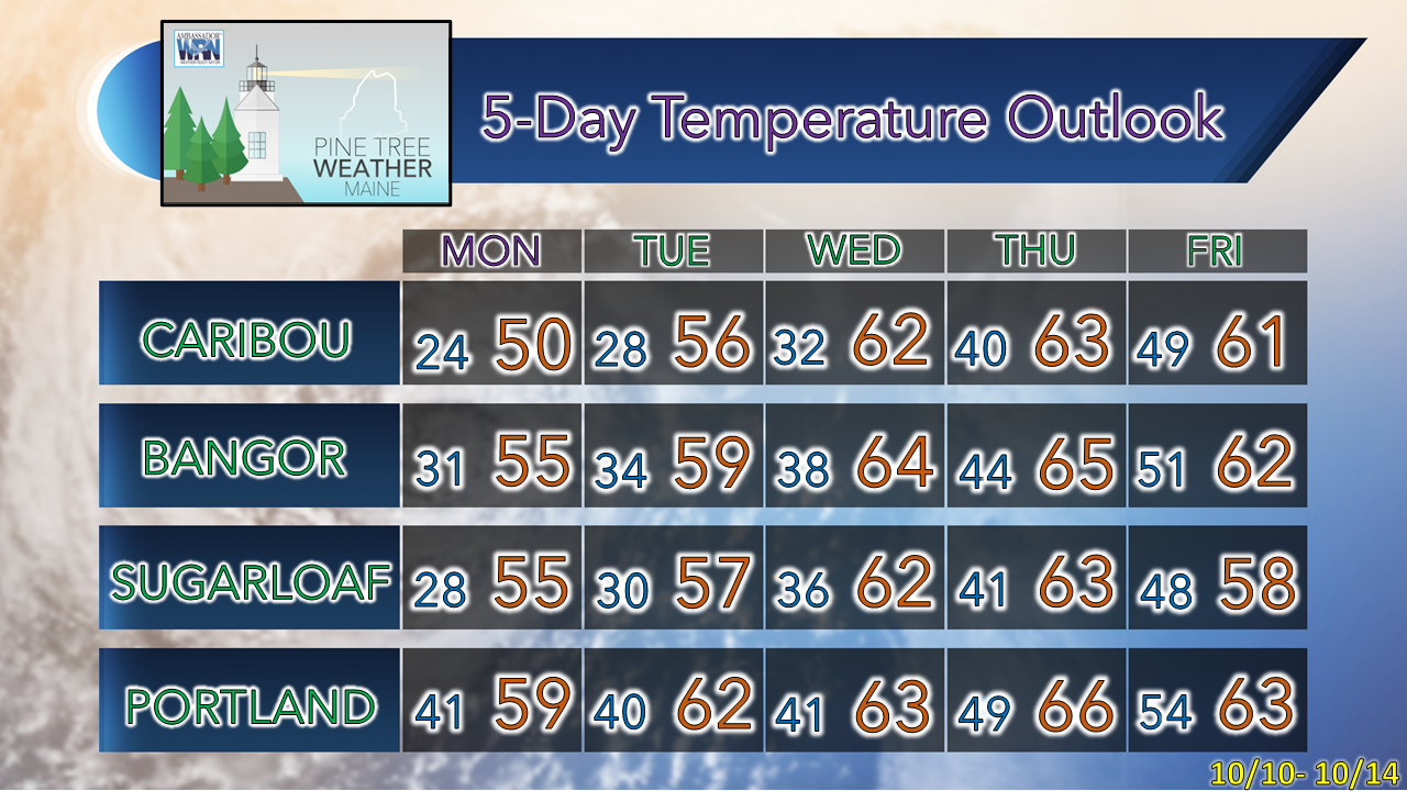
Fall-like pattern continuesThe overall cool and dry pattern the region has experienced since late September is expected to continue until late week. As far as growing season goes, it's over. If the Sunday morning frost over the interior doesn't end it, Monday morning's frost likely will, with the possible exception for the shorelines. A look at the forecast 500mb (steering level) anomalous heights through Friday shows the shortwave trough sweeping through the region Sunday into Monday. A ridge builds in for the middle part of the week, then a deep trough is expected to develop over the eastern part of the country by late week. That deep trough sets up a long wave frontal boundary that brings a stormy end to the workweek. Shortwave front passes through SundaySunday 6 AM to 9 PM - An idea of potential radar reflectivity from the 06z (2 AM) HRRR model shows potential for some light to moderate scattered showers passing through the state, mainly in the afternoon into the early evening. The best chance for precipitation is for the mountains and north. The boundary loses what little juice it has as it approaches the coastal plain later in the day. Southern areas may escape with just a light shower or sprinkle. The higher elevations and north may see a flip to a light wintry mix and/or snow showers as cooler air works in behind the front. Precipitation is expected to end by mid-evening everywhere. Southern areas see the most sun for the day, and the warmest temperatures. The north and mountains see more clouds to start off, with a chance for sunny breaks later in the afternoon. As the front approaches, a southwest breeze picks up then shifts to the northwest after the passage. Breeze continues into Sunday evening, then settles overnight as high pressure moves in by Monday morning. Another nippy start MondayFor many areas, Monday could be the coolest start of the season thus far with The County and the mountains starting off in the 20s. I suspect many well protected pockets over the foothills and near the shorelines may also bottom out in the upper-20s as well. For my Kennebunk followers, the last sub-30° start here was back on April 23rd. That streak of 170 days may end. Late week storm may pack a punchThe deal with long wave frontal boundaries associated with deep troughs over the eastern half of the country is that they tap into tropical moisture and pump it to the north. That is the potential set up going on here. Not only is there a threat of heavy rain, but also of wind as well. We usually get a leaf stripper storm in mid- to late October. This has potential to do just that. The precipitable water loop from 8 AM Wednesday to 8 AM Saturday shows the potential moisture pump and presents an estimate on the timing of the rain, which at this point appears Thursday afternoon into Friday. The potential of heavy rain has caught the eye of the Weather Prediction Center, as they have highlighted western Maine in the slight risk category for excessive rainfall. This indicates the potential for scattered flash flooding potential. With heavy rain and wind which would cause leaf drop comes the potential for urban street flooding from clogged storm drains. A rough idea of 2-4" of rain statewide appears possible. Timing of the low-level jet, potential for an area of low pressure to form along the front all factor into wind potential, which may reach wind advisory criteria if it lines up right, and there is a fair chance of that. Power outage potential is there. If you have not yet checked your storm supplies and tested your generators, it wouldn't be a bad idea to do so. Please stay updated on this storm this week. Temperature outlook through FridayThe normal high and low for Caribou for October 9th is 58° and 36°. For Portland, 62° and 43°. Temperatures start off the week on the cool side before turning above normal mid-week. Thank you for supporting this community-based weather information source which operates by financial contributions from people like you. Stay updated, stay on alert, and stay safe! - Mike NOTE: The forecast information depicted on this platform is for general information purposes only for the public and is not designed or intended for commercial use. For those seeking pinpoint weather information for business operations, you should use a private sector source. For information about where to find commercial forecasters to assist your business, please message me and I will be happy to help you. |
Mike Haggett
|

