|
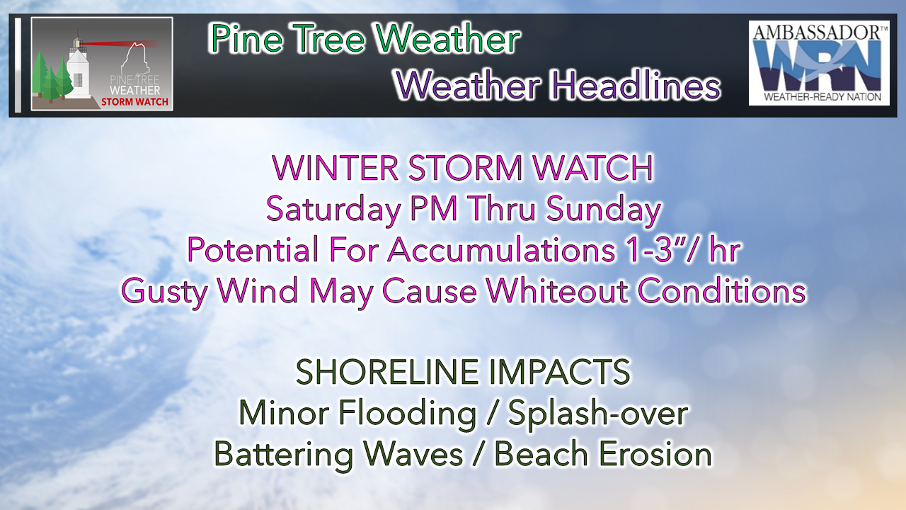
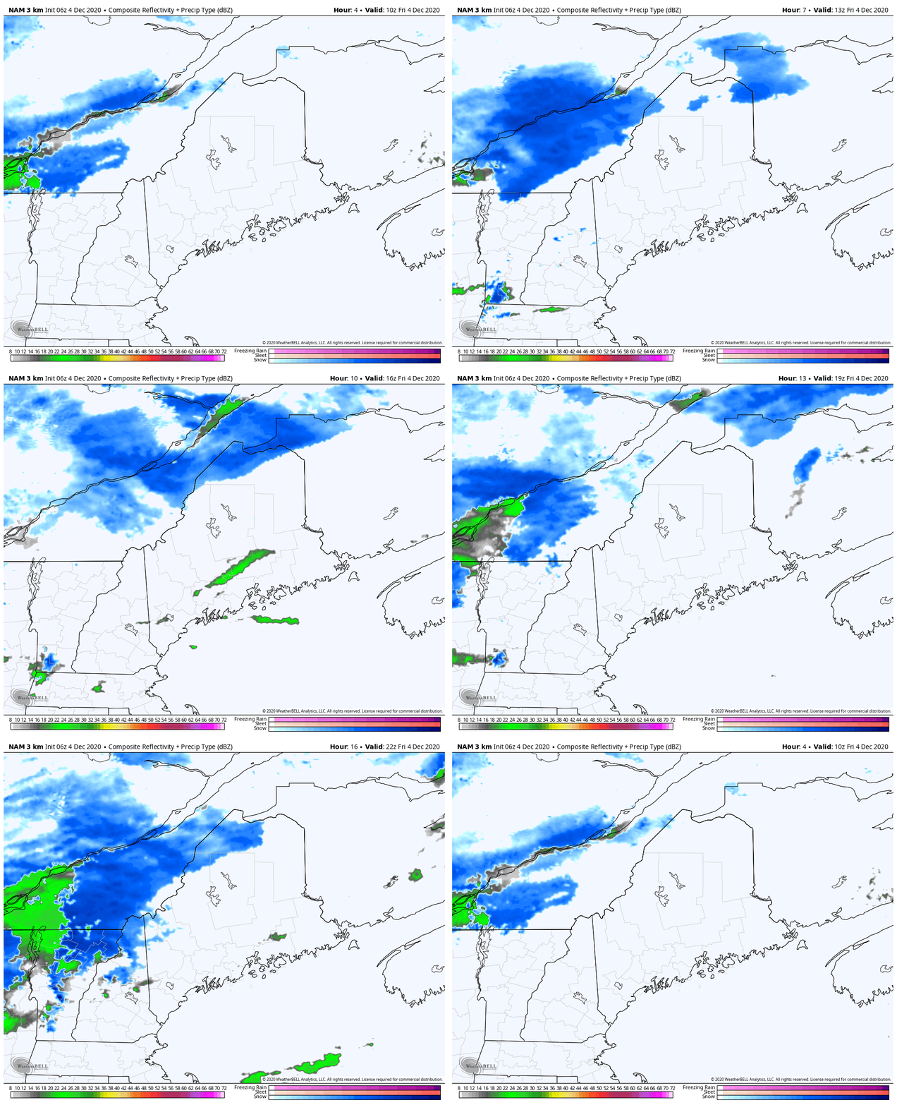
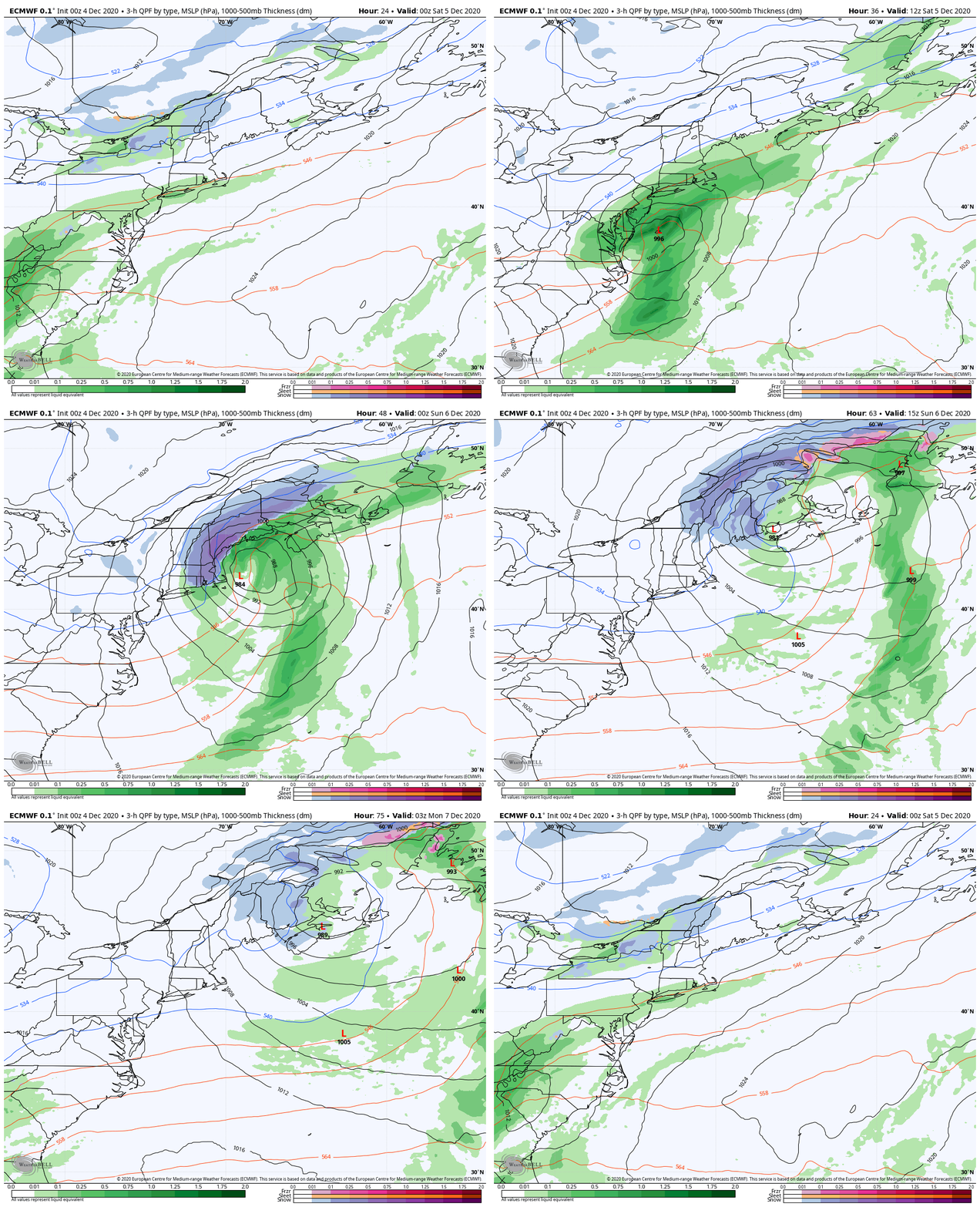
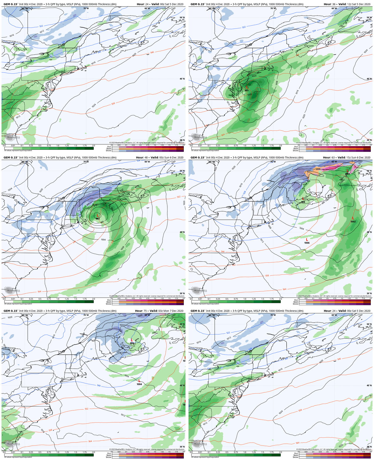
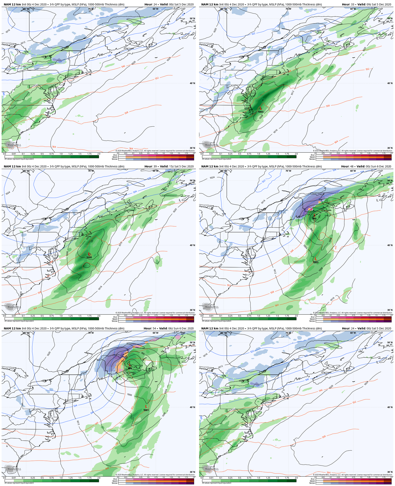
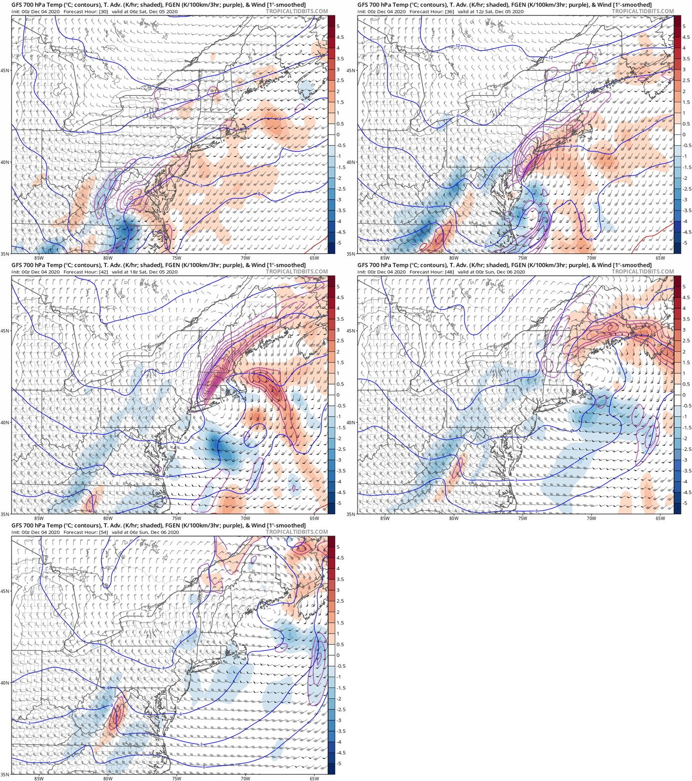
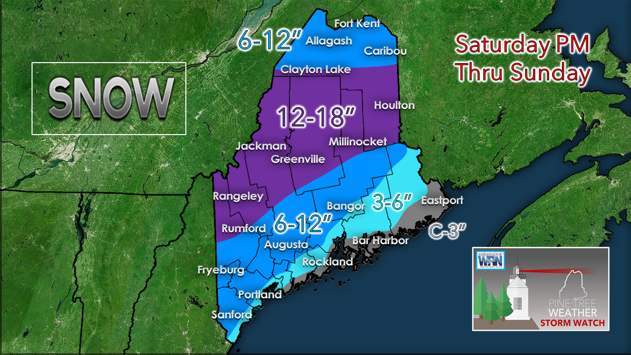
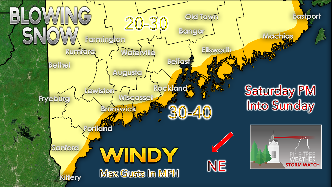
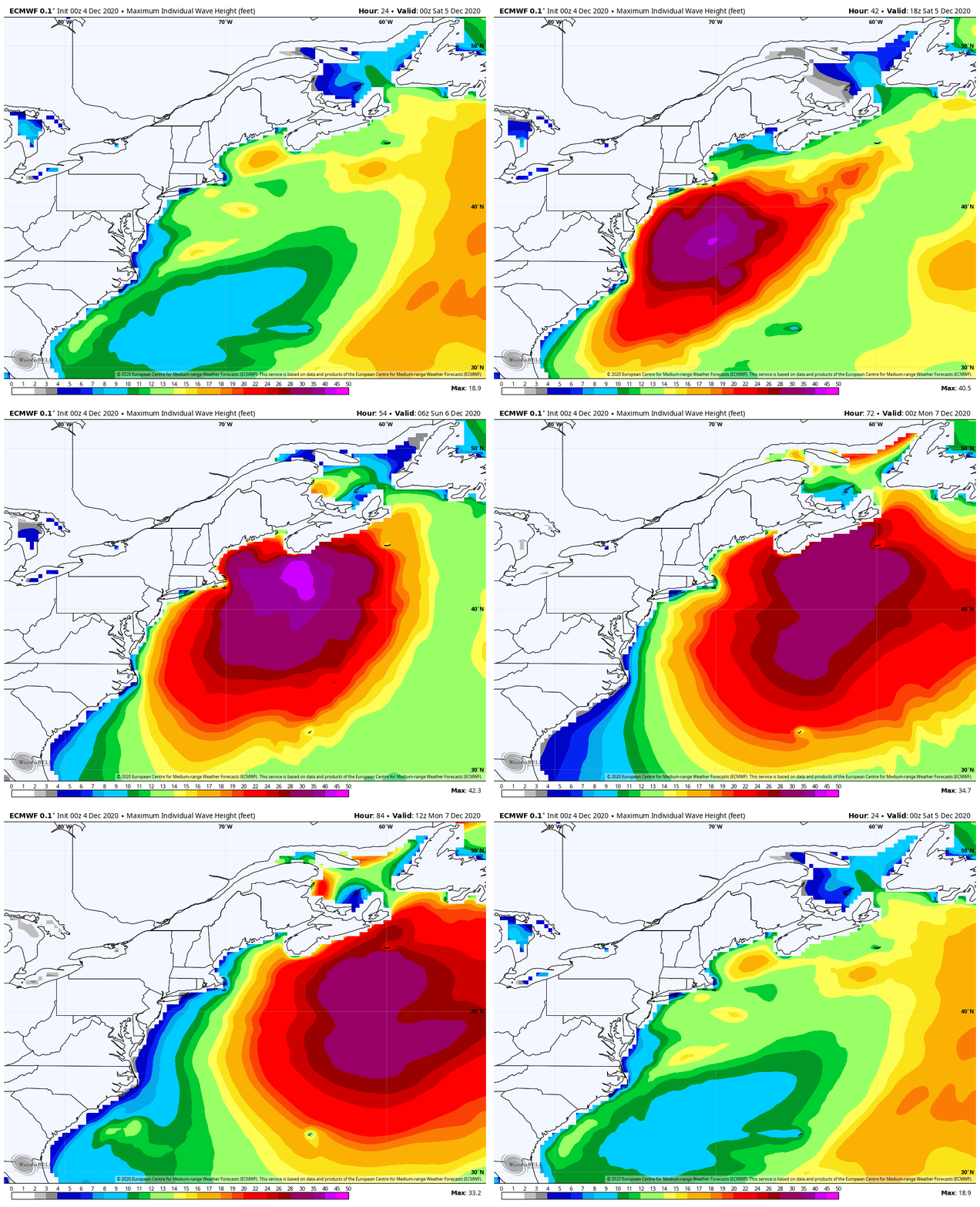
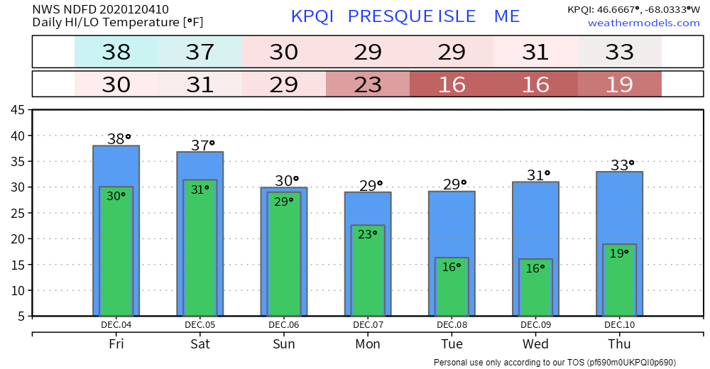
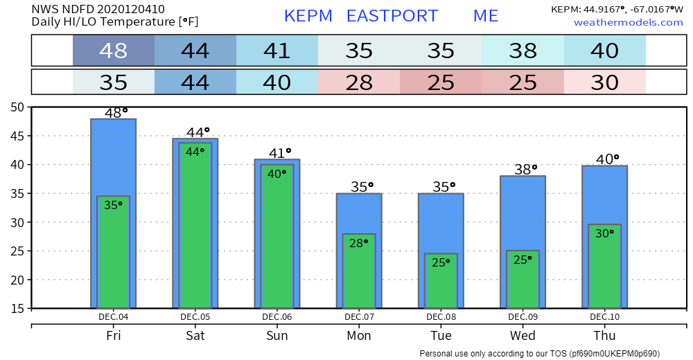
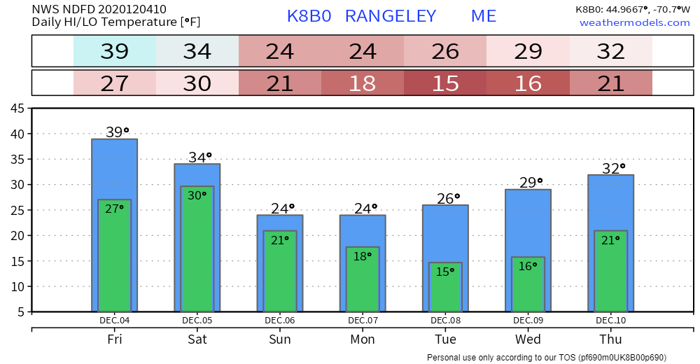
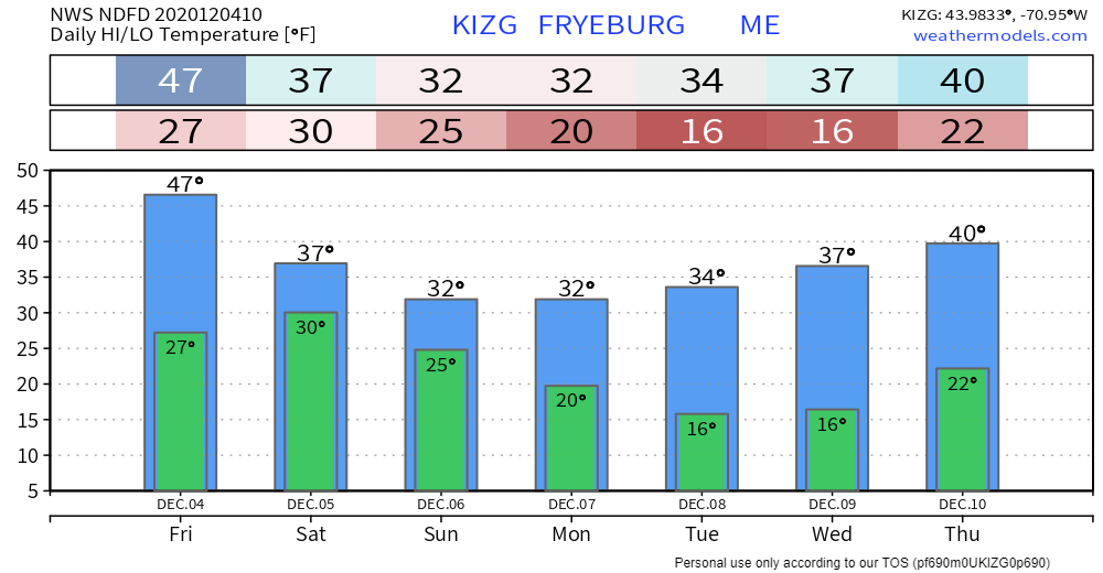
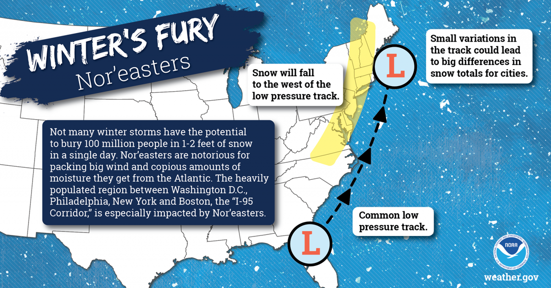
I will say that it is rather odd that inside of 48 hours ahead of a potential storm where there are model discrepancies enough to rise both eyebrows. In the days before my meteorological pursuit, I would hear "low confidence forecast" and would scowl at it. "What is the deal?!" I would mutter. Well, here I am, relaying on the same message to you, and you asking the same question to me. The old adage applies... what goes around, comes around. I will say that confidence is increasing, but there are outlying ideas going around that cannot be completely ignored. The term "potential" is going to get a liberal use. A few rain / snow showers around FridayA trough to the northwest which sets up the cold air on the way for the weekend storm advances southeast as the ridge breaks down. This will set up a southwest flow, bring in clouds, along with a chance of a rain shower/ sprinkle over the south and a snow shower / flurry over the north and western higher terrain at times through the day and into Friday night. High temperatures for the day range from the 30s north and higher elevations in the west, 40s for the western foothills over into interior eastern areas, and potentially 50° for the shorelines. Clouds will fill in as we head into the overnight hours into early Saturday morning. Overnight lows fall to the 20s north and 30s south. NorEaster scenariosI've stressed the idea of consistency in my updates here over the past couple of days, and by-in-large at this point there is that. Phasing of the polar jet from the north and the subtropical jet from the south has given guidance fits with this. Part of the reason may be that radiosondes (aka weather balloons) have not been able to accurately sample the energy with the polar jet due to the remote location in Canada where it is coming from. Certainly, there are model biases with the subtropical jet originating from the southwest, which factor into that, also. My hope is this isn't going to be the norm in the season ahead, and this is an isolated situation. Time will tell on that. Three factors which will make or break the forecast, the phasing of the two streams, how quickly the storm intensifies, and forecast track. The European idea above shows the phasing coming together a bit later. That means more cold air, and more frozen type precipitation for southern areas, all the way to the shorelines. The Canadian idea here shows an earlier phase, which brings a mix of snow and rain to the southwestern shorelines, and perhaps some sleet for eastern areas. Both ideas bring a solid snow event for the interior, mainly rain for DownEast shorelines areas, and a healthy cyclone into the Gulf of Maine. The Euro is a bit inside of benchmark 40° N/ 70°W but with the later phase funnels more cold air in. The Canadian hits close to the benchmark location before turning sharply north on its way into the Bay of Fundy. Then comes the idea of bust potential... The phasing of the NAM idea is like a Sunday drive on a logging road. It doesn't come together until very late in the evolution process. It brings nothing to western areas, showers for southern areas and snow for southeastern areas. It's a complete outlier. I bring this into the discussion due to the erratic handling of guidance with this storm. If this storm busts, you'll know why, and will not be surprised. I will proceed as if this is game on. Anytime there is a rapidly intensifying storm of this nature, that brings in a couple of things. First is the cooling of the atmosphere from the northeast wind flow, the other is intense deformation bands which bring snow accumulations 1-3" an hour. This idea of the GFS model indicates the potential for frontogenesis, which is a meteorological process of tightening of horizontal temperature gradients to produce fronts. Where these bands set up dictates who gets the big snow (or rain) and who does not. It is always difficult to forecast these. This is another key feature as to why precipitation forecasts boom or bust. A handful of miles is the difference in some cases between who gets 6" and 12". This idea above says banding is very likely, so that has to be taken into account for the forecast. The further north, the more powder, closer to the coast, the wetter. If the pieces all come together, this is solid snow event for the interior, which will be good news for ski country, and start to build a base for the snowmobilers. For those along the coastal plain where the wetter snow comes, there are concerns for power outages. Heavy bands at 1-3" / hour snowfall rates and wind will cause blowing and drifting of snow for the interior. Along the coastal plain as the snow sticks to everything, it sets up the scenario of bringing tree limbs and power lines down. Perhaps more of a concern will be the gusty northwest wind on the backside of this which may come in with similar or slightly higher speeds Sunday into Monday. And for the shorelines, expect waves to build to 8-13 feet in close at the height of the storm overnight Saturday into early Sunday morning. Thankfully astronomical tides are not an issue here. There could be some minor flooding / splash-over with the high tides around 3 AM / 3 PM Sunday, along with battering waves causing some beach erosion. The ocean will boil through Sunday night and start to settle on Monday. Outlook through ThursdayAfter this storm passes, another forms to the southwest Sunday into Monday, but appears to stay well to the southeast. Our next chance for any widespread precipitation may not come until late next week. Winter’s Fury: Nor’eastersNot many winter storms have the potential to bury 100 million people in 1-2 feet of snow in a single day. Nor’easters are notorious for packing strong winds and copious amounts of moisture they get from the Atlantic. The heavily populated region between Washington D.C., Philadelphia, New York City, and Boston -- the “I-95 Corridor” -- is especially impacted by Nor’easters. weather.gov/safety/winter-noreaster Be prepared to receive alerts and stay updated!
For more information, please follow Pine Tree Weather on Facebook and Twitter.
** FUNDING NEEDED FOR 2021 ** Thank you for supporting this community based weather information source that is funded by your financial contributions. Stay updated, stay on alert, and stay safe! - Mike |
Mike Haggett
|

