
Here we go again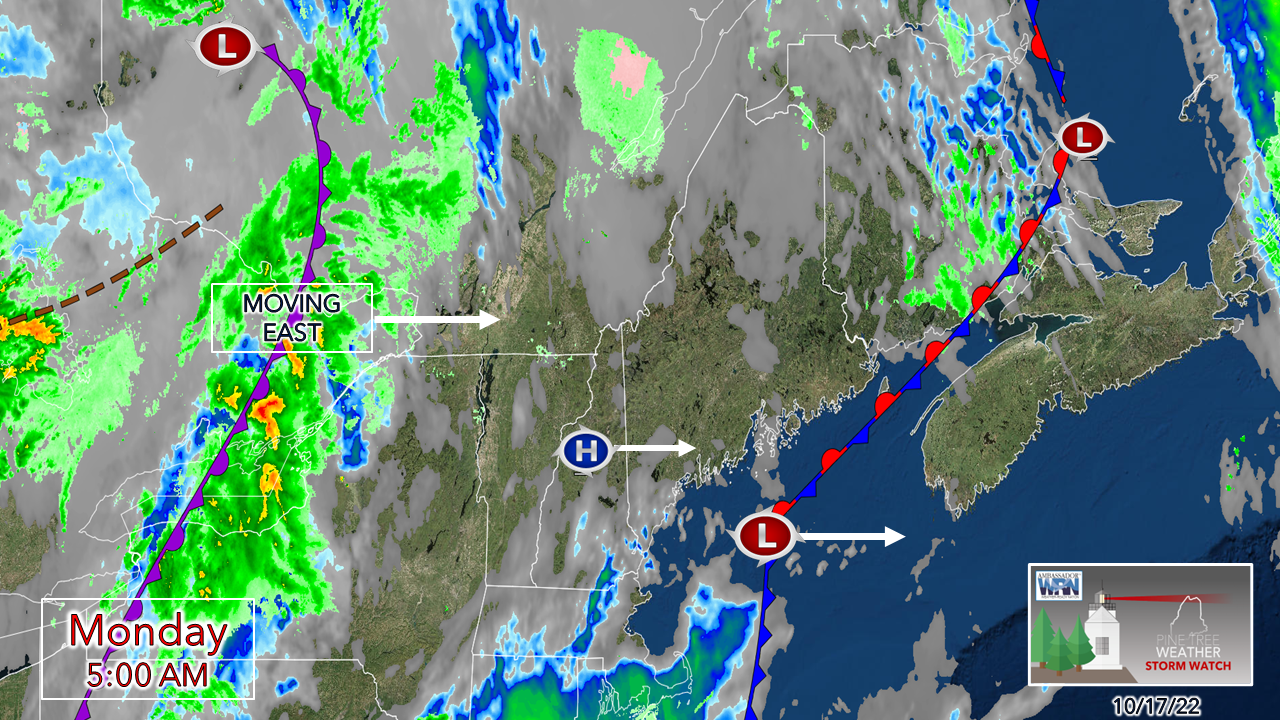 A weak area of high pressure passes east early Monday morning. With clockwise rotation, which will spin up moisture from the southwest and bring showers over western and southern areas. 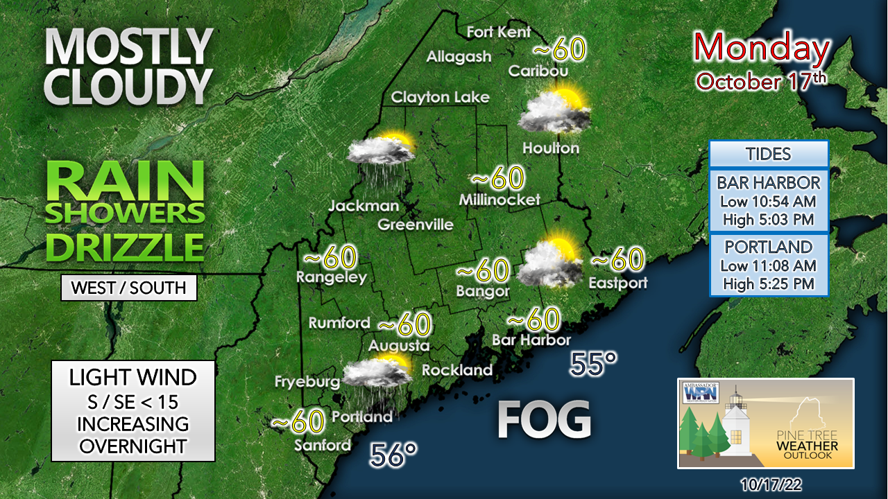 Fog as thick as molasses in areas along the coastal plain may be stubborn in dissipating. Visibility should improve heading into midday. There is not much breeze to push it around and may hang on all day in spots to the east of Penobscot Bay. Here we go again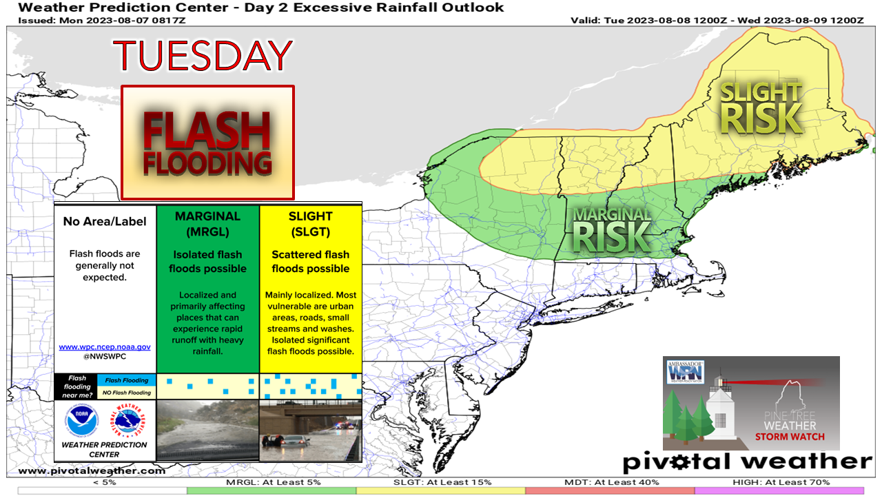 I mentioned in Sunday's update here that the trend of projected heavy rainfall was trending west and that continues to be the case. Guidance is having difficulty solving a stubborn blocking ridge to the northeast over Greenland. An atmospheric traffic jam brought the heavy rain to the area on Friday, and the same scenario is play through Wednesday.  Tuesday Midnight to Wednesday Midnight - The chance for showers increases through Monday afternoon into late evening. Rain activity begins to pick up heading into Tuesday morning. Rainfall rates could be moderate to heavy at times, and there is the risk of thunder. 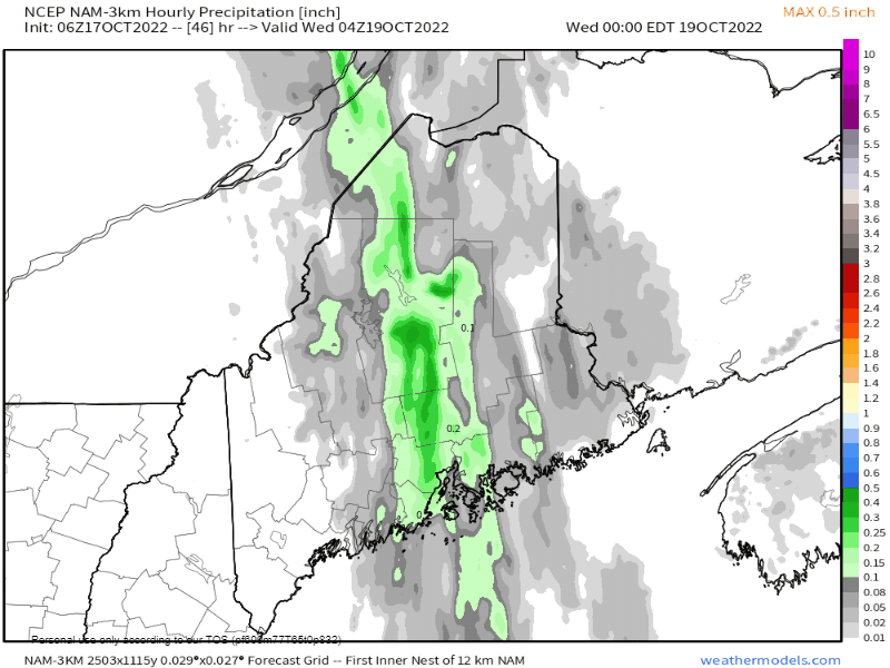 Wednesday Midnight to 1 PM - For now, model ideas are in fair agreement for the end time of rainfall. Time will tell what the blocking ridge over Greenland thinks of that idea. Southern and western areas see showers taper off Tuesday night. For eastern and northern areas, it appears for now end around late morning to mid-afternoon pending on locale. 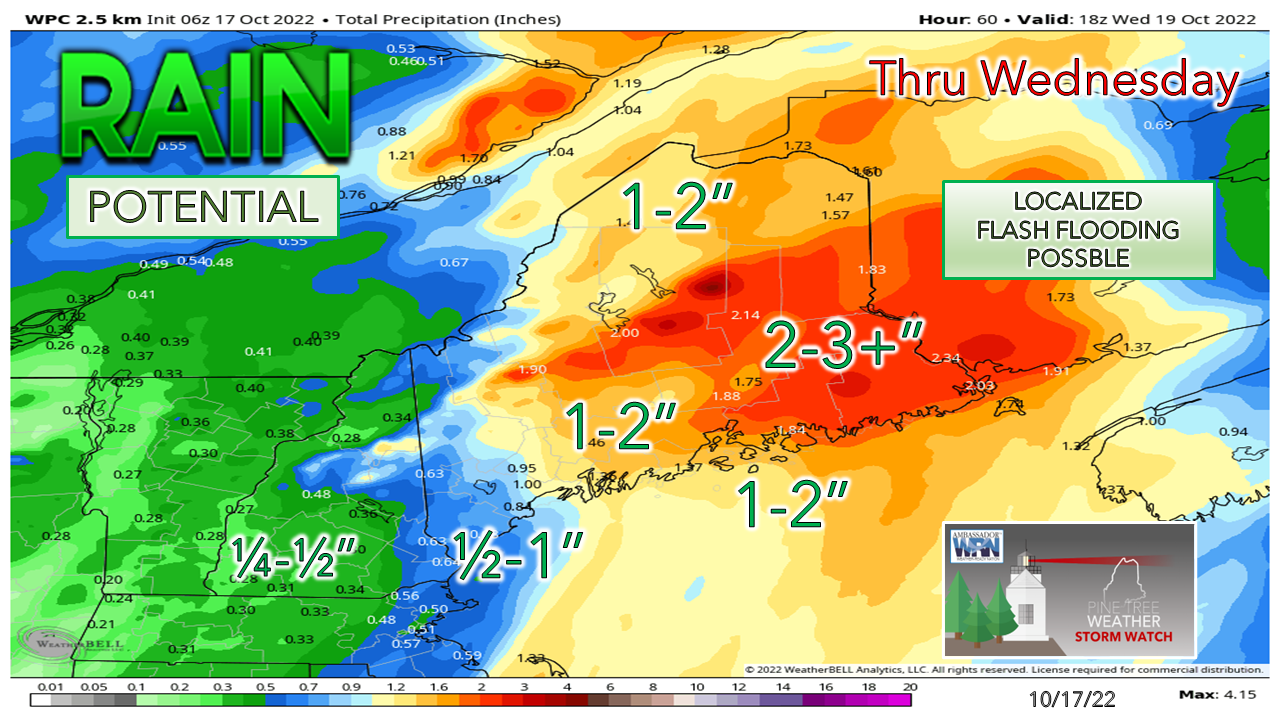 Eastern areas are likely to be the jackpot region for this event. The western mountains could see upwards of a couple inches or more. Baxter / Katahdin region is likely the epicenter for the most rainfall. Bottom line: the trend continues to move heavy rain westward due to the blocking to the northeast. These totals could increase if that idea continues. Flash flooding from run off, urban street flooding from clogged storm drains, reduced visibility from heavy rain and fog are all possible here. Breeze to bring some impact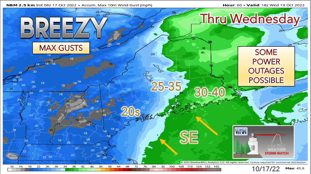 While the stronger gusts appear mainly from Penobscot Bay eastward, this idea has also shifted westward due to the slowdown of the frontal passage. As with the previous storm, the coastal plain and higher elevations saw the highest gusts and is likely to be the case once again here with the southeast wind. With saturated ground and remaining foliage on trees, there are likely to be power outages across the region once again. After the front passes through Wednesday, the breeze is expected to diminish fairly quickly within a few hours and should be relatively calm by Wednesday night. Outlook thru SaturdayAfter this mess passes through, the sky clears out as high pressure moves in and sets up a frost threat Thursday and Friday. The upper-level low and associated trough retreats heading into late week, which sets up the chance for a snow/rain shower as a parting gift. High pressure moves in for the weekend. 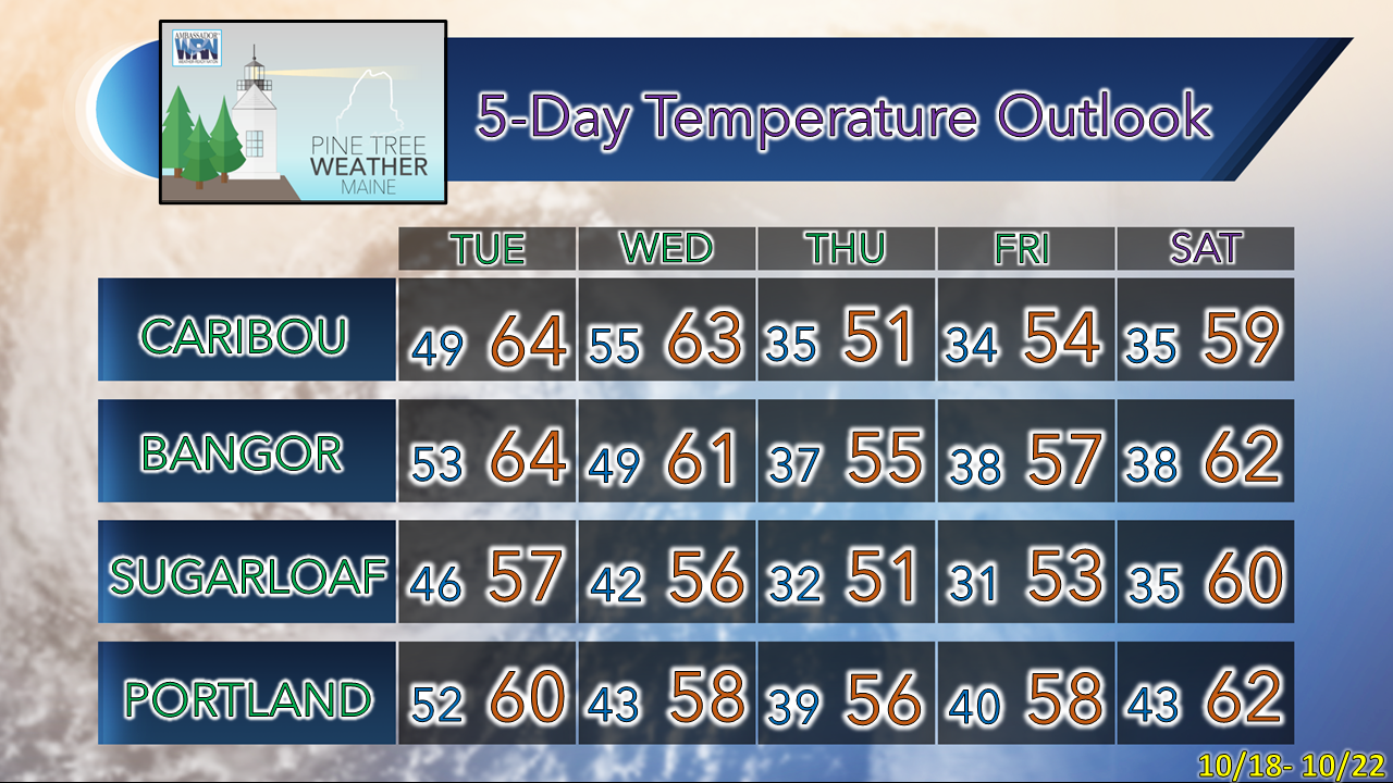  Thank you for supporting this community-based weather information source which operates by financial contributions from people like you. Stay updated, stay on alert, and stay safe! - Mike NOTE: The forecast information depicted on this platform is for general information purposes only for the public and is not designed or intended for commercial use. For those seeking pinpoint weather information for business operations, you should use a private sector source. For information about where to find commercial forecasters to assist your business, please message me and I will be happy to help you. |

Mike Haggett
|


