Less clouds to the north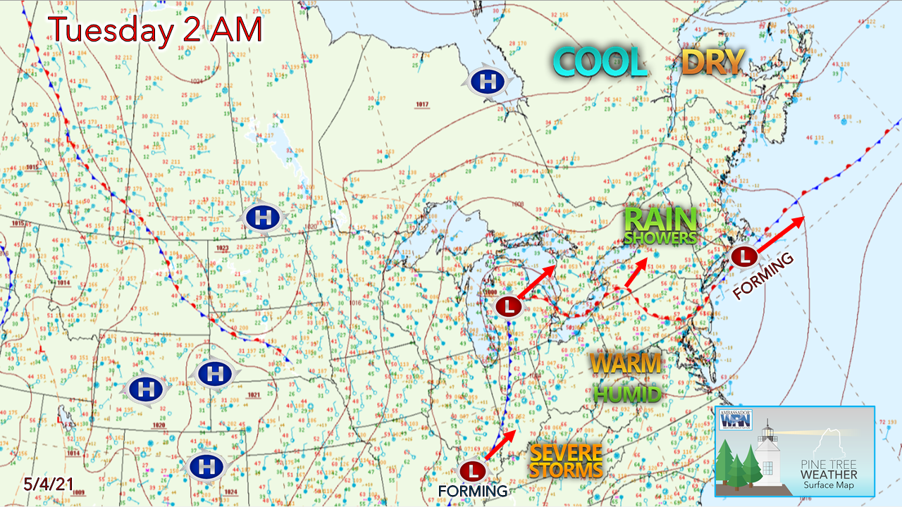 Where there is clear skies over northern Maine is where below freezing temperatures are. As of 5 AM, it was 28° in Houlton under the clear sky, but a few miles to the south/southwest to Millinocket it was cloudy and 41° As the sun comes out and daytime heating takes place, 60s are expected for the clearer north, and 50s are expected over the cloudier south. Low pressure forming over southern New England rides along a stationary front offshore and heads east. Showers develop along it, keeping the coastal plain in the clouds, with showers possible up and down the shorelines, and over southern and western areas. DownEast areas may experience areas of fog as well. Unsettled through Wednesday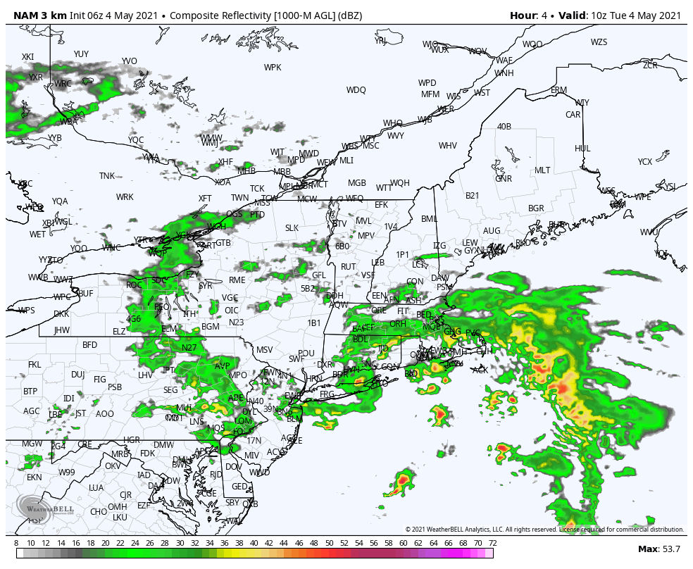 The developing area of low-pressure heads east for Nova Scotia Tuesday. Any rain activity is likely to be spotty over southwestern areas in the morning, then dry out for a few hours this afternoon. A few glimpses of sun are possible over southern areas but are likely to be short lived. A few showers are possible later this afternoon over the western mountains as the upper-level ridge begins to move northeast. Most areas are dry by 8 PM Tuesday evening. 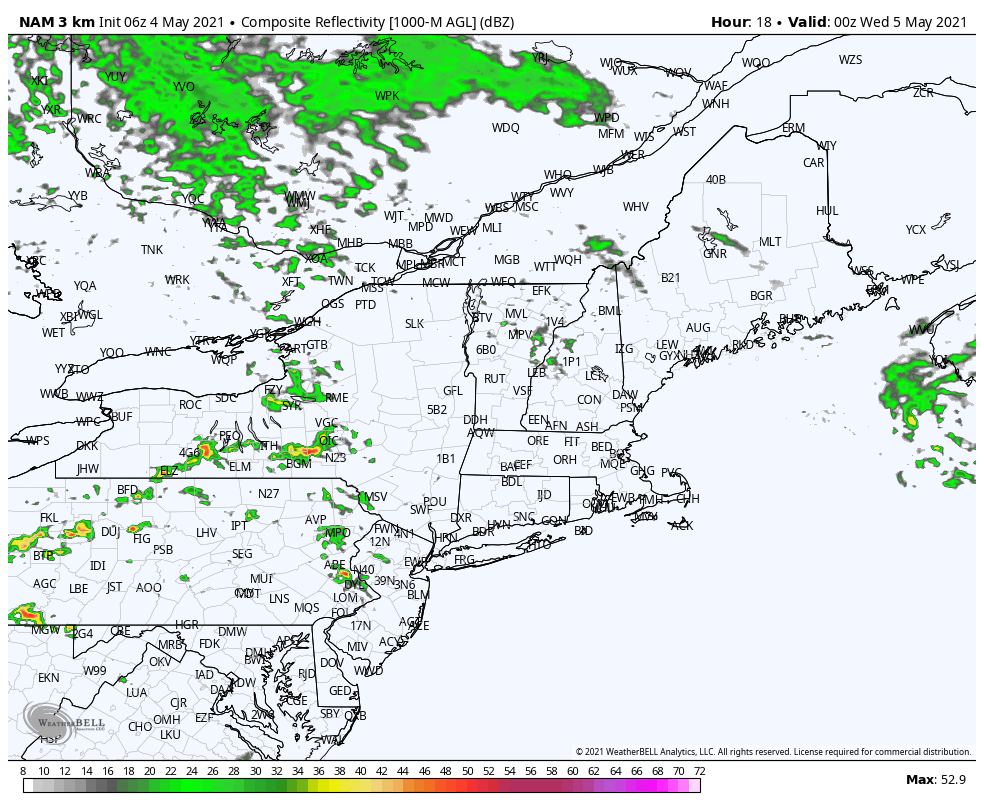 From 8 PM Tuesday to 8 AM Wednesday, clouds increase over northern areas, and showers break out over southwestern areas in time for the morning commute. 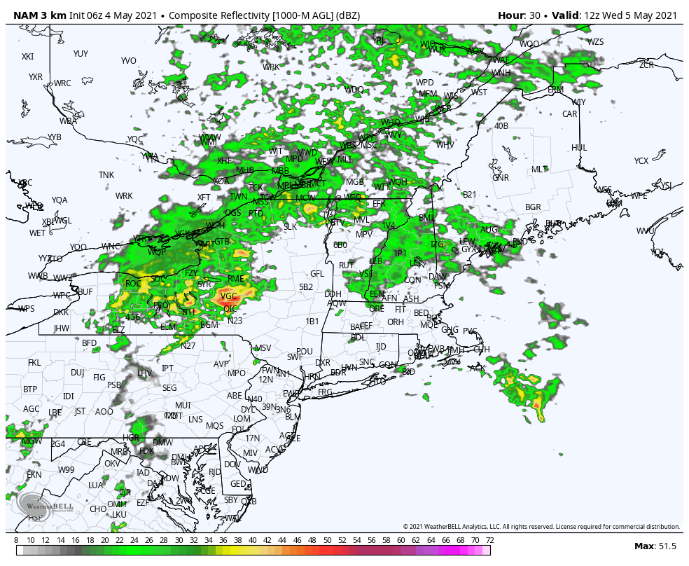 From 8 AM to 8 PM Wednesday, the initial wave of showers moves northeast. As the trough negatively tilts and the surface low begins to intensify, another wave of showers flares up. Southern areas may get a rumble or two of thunder Wednesday afternoon as a cold front approaches. Showers taper off over western and southern areas by 8 PM, eastern region by 10-11 PM, and early Thursday morning for The County. With the departing storm intensifying on its way northeast, expect a breezy and brisk day Thursday, with the wind settling down Thursday night. 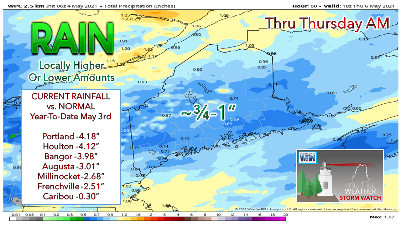 Rainfall estimates remain consistent. There is a chance for overperformance if the storm organizes and develops ahead of schedule. Another solid rain event to cut the deficits down a bit more over much of the region. A peek at the weekend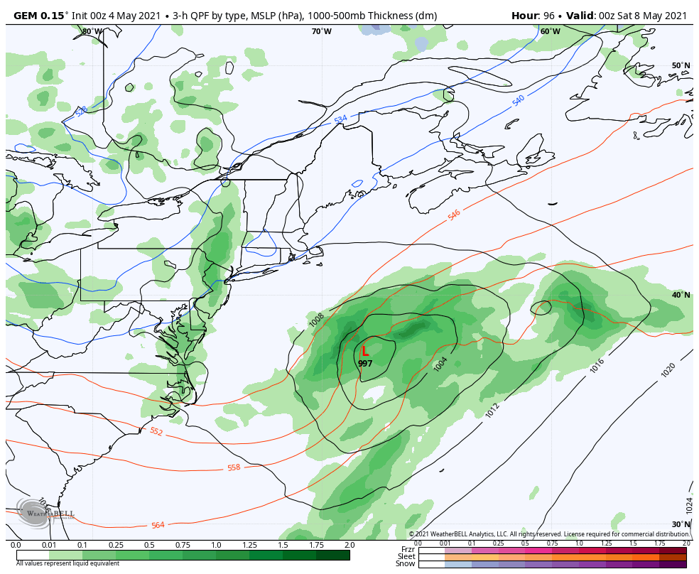 Models are in much better agreement as we head into late week. An ocean storm is expected to form late Thursday then pivot into the Canadian Maritimes on Saturday. The storm would graze DownEast areas with showers Saturday morning and end early in the afternoon. A trailing inverted trough could bring some light showers over southwestern areas Saturday afternoon. 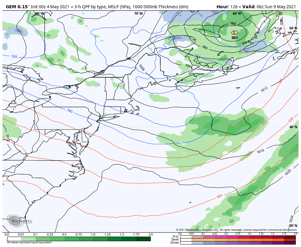 Mother's Day starts off on the cool side. A ridge over the southwest moves northeast during the day which would increase clouds. Southwestern areas may get late afternoon shower. The pattern remains unsettled as another widespread rain event is possible to start next week. Join the weather community as a storm spotter! Here's a wonderful way to become active in the weather community and help the US National Weather Service Gray ME, broadcast media and forecasters like myself with storm reports. This information is vital during and after an event for forecasting and alerting purposes. I can't tell you how many times I have seen the importance of these reports in the past 9+ years I have been involved. Pine Tree Weather followers have stepped up in the past and participated, and with the readership base continuing to grow, I know there are more out there. This is the spring/summer session which discusses severe weather, what to look for, and how to report it. These sessions run for about 90 minutes. They are fact filled, educational and interesting. You can get the whole family involved from the comfort and safety of home. Once completed, you will get your spotter ID, and will be ready for the season ahead. For those who trained for the winter session, this will complete your full year training. It's important to have both sessions done. The link to register is here ► https://www.weather.gov/gyx/skywarn#fragment-2a If you need more information, please contact Donald Dumont, the Warning Coordinating Meteorologist at NWS Gray via email [email protected] or message me directly. Ten-day temperature outlook through May 14th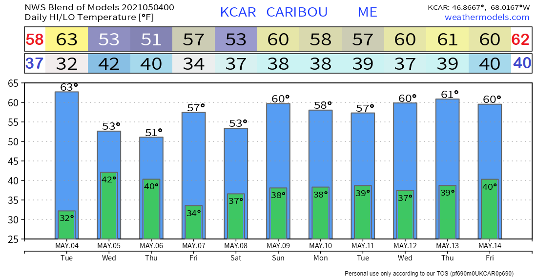 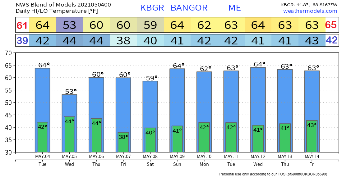 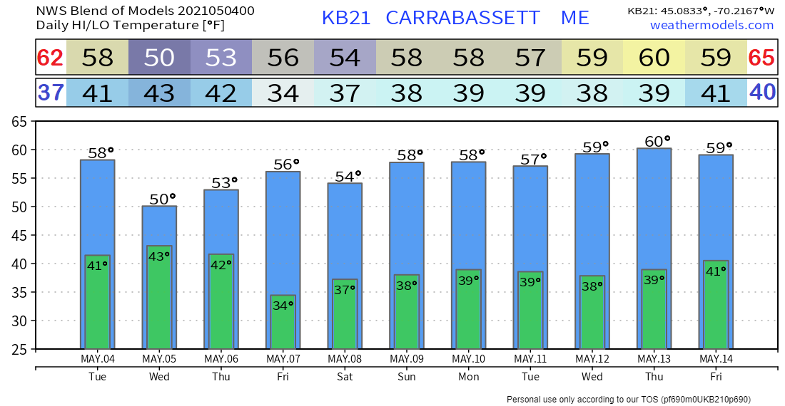 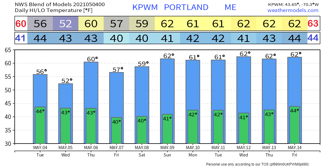 Be prepared to receive alerts and stay updated!
For more information in between posts, please follow Pine Tree Weather on Facebook and Twitter.
Thank you for supporting this community-based weather information source which operates by reader supported financial contributions. Stay updated, stay on alert, and stay safe! Thank you as always for your support! - Mike |

Mike Haggett
|