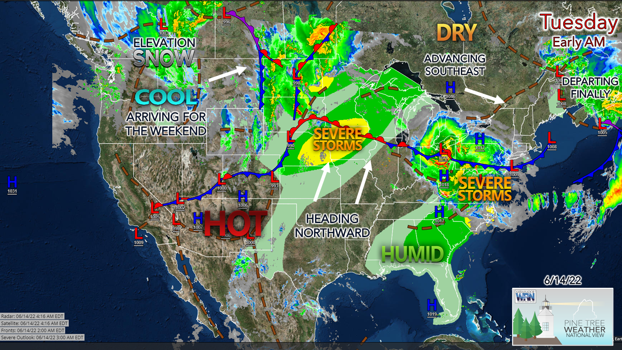
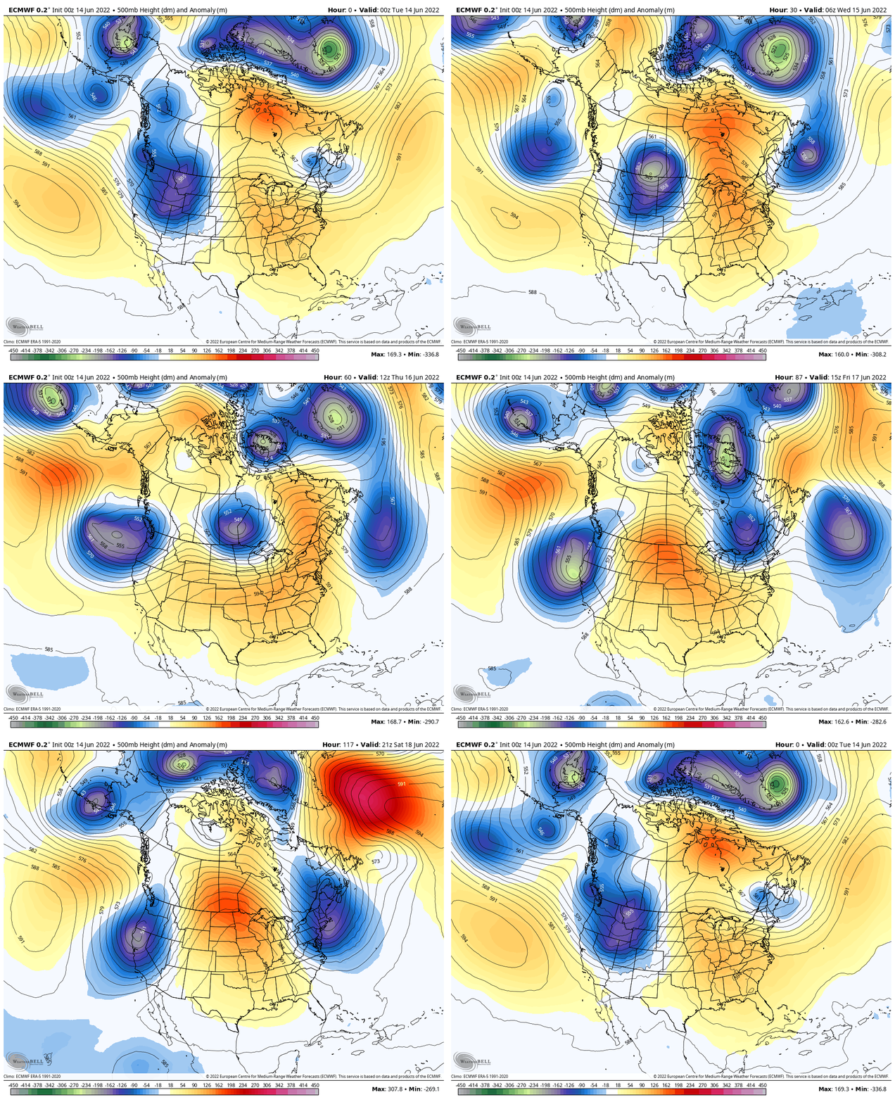
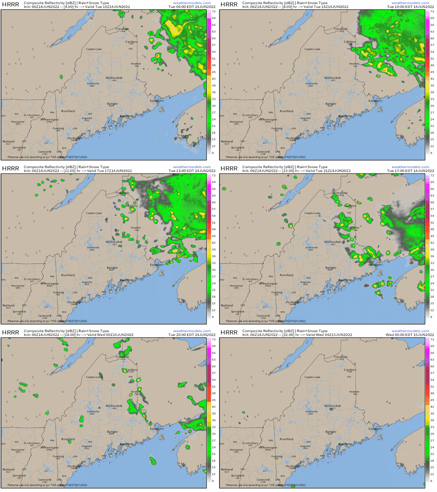
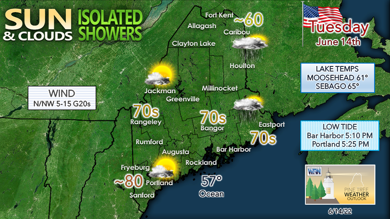
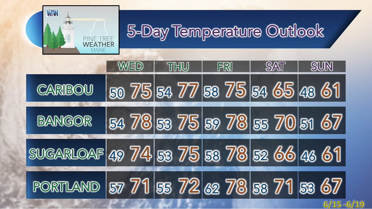
Dry window remains narrow for the regionThe upper-level low that has hung around the region like an annoying housefly for the past few days is heading east, with high pressure moving in behind it for Wednesday. Summer heat and humidity continues to be held at bay to the south. Low pressure over the northern plains tracks east and brings rain back into the forecast for Thursday night into Friday. An upper-low behind the front controls the weather for the weekend into early next week. Monday 8 PM to Sunday 8 PM - A look at the 500mb (~18,300 ft) steering level of the atmosphere through the weekend shows the upper low out west that cuts off the ridge building to the south and thus keeps the heat and most of the humidity away from the area through the period. The tradeoff for that is a pattern of slightly cooler than normal temperatures and chances for precipitation, which sums up June for the region to this point. Blocking in the higher latitudes is keeping the trend going for now. Shower chances better for eastern areasTuesday 6 AM to Wednesday Midnight - The upper low that has been in the area over the past five days pinwheels a few parting showers as it heads to the east. There is a slight chance for a thunderstorm over areas east of Bangor / Millinocket in the afternoon. Showers diminish heading into Tuesday night as the heating of the day cools off and the disturbances associated with the upper low head out into the north Atlantic. Western and southern areas may see a pop-up shower in the afternoon, but it appears to be an isolated chance. It appears to be a cool and chilly day for The County with temperatures struggling to get to 60°. A northwest breeze keeps the ocean influence away, allowing southwestern areas to reach highs around 80° all the way to the beaches. If you are headed that way, the tide heads out before noon and creates plenty of room to perch by early afternoon. Temperature outlook through the weekendThe average high and low for June 14th for Caribou is 72° and 50°. For Portland, 73° and 55°. Temperatures rise slightly above normal Wednesday to Friday before cooling to below average for the weekend. Thank you for supporting this community-based weather information source which operates by financial contributions from people like you. Stay updated, stay on alert, and stay safe! - Mike NOTE: The forecast information depicted on this platform is for general information purposes only for the public and is not designed or intended for commercial use. For those seeking pinpoint weather information for business operations, you should use a private sector source. For information about where to find commercial forecasters to assist your business, please message me and I will be happy to help you. |
Mike Haggett
|

