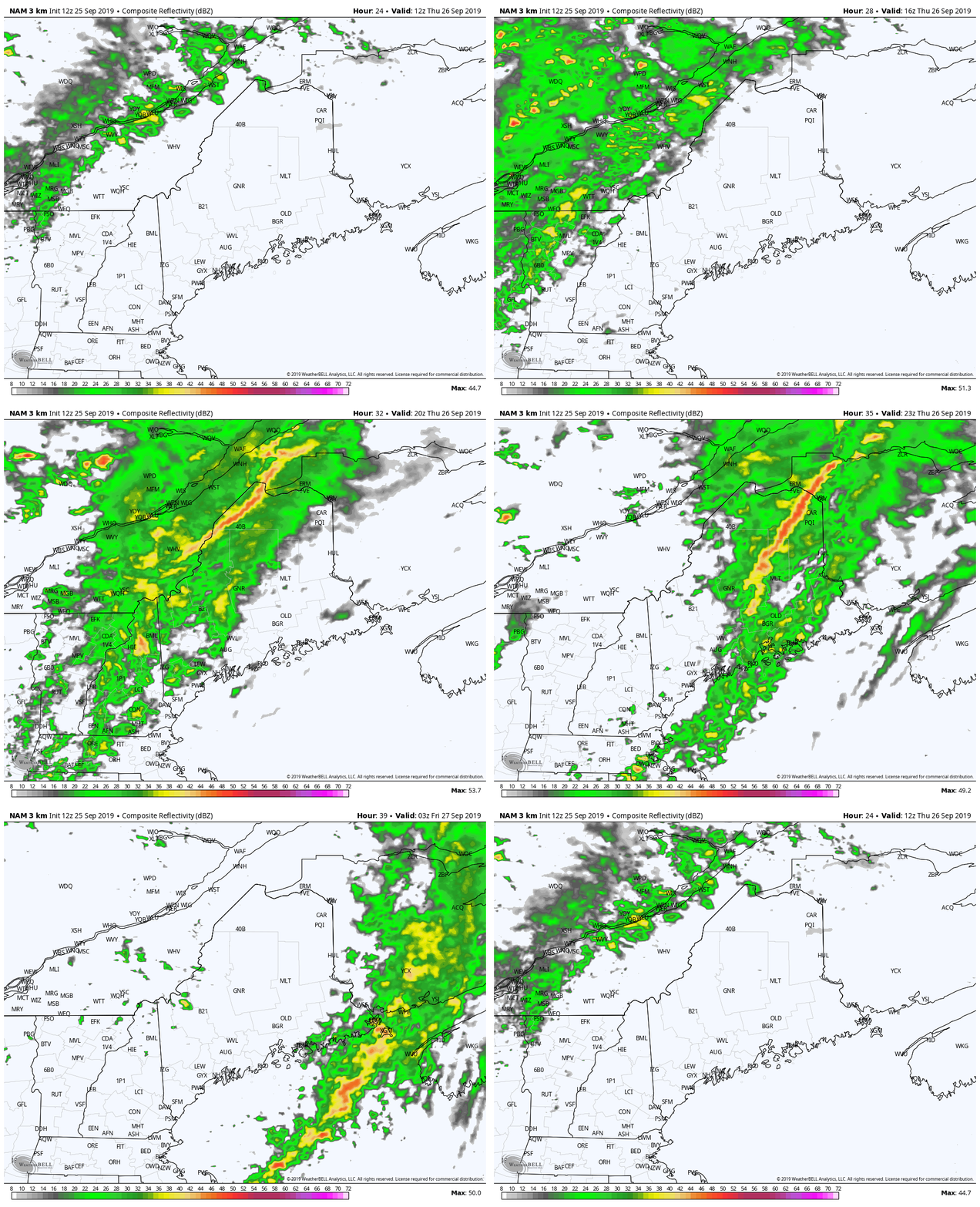
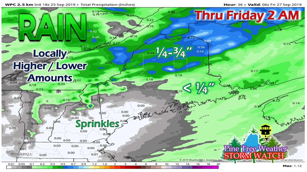
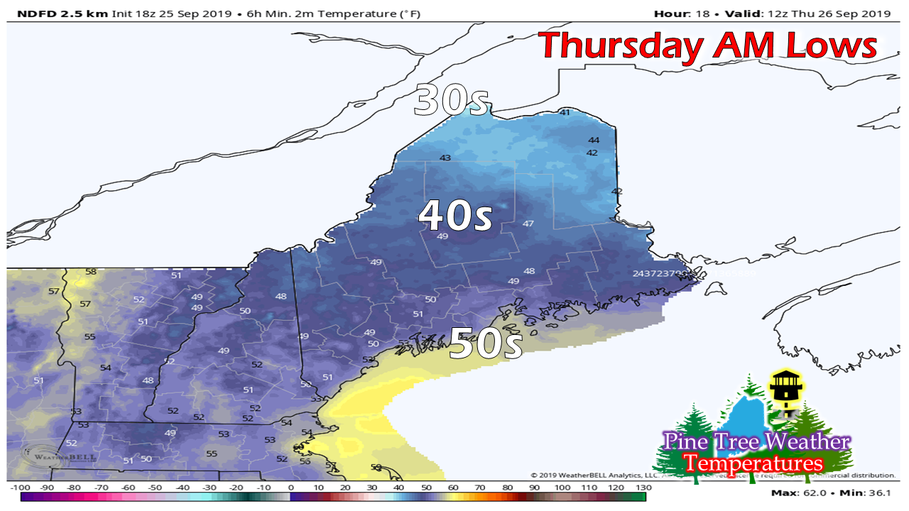
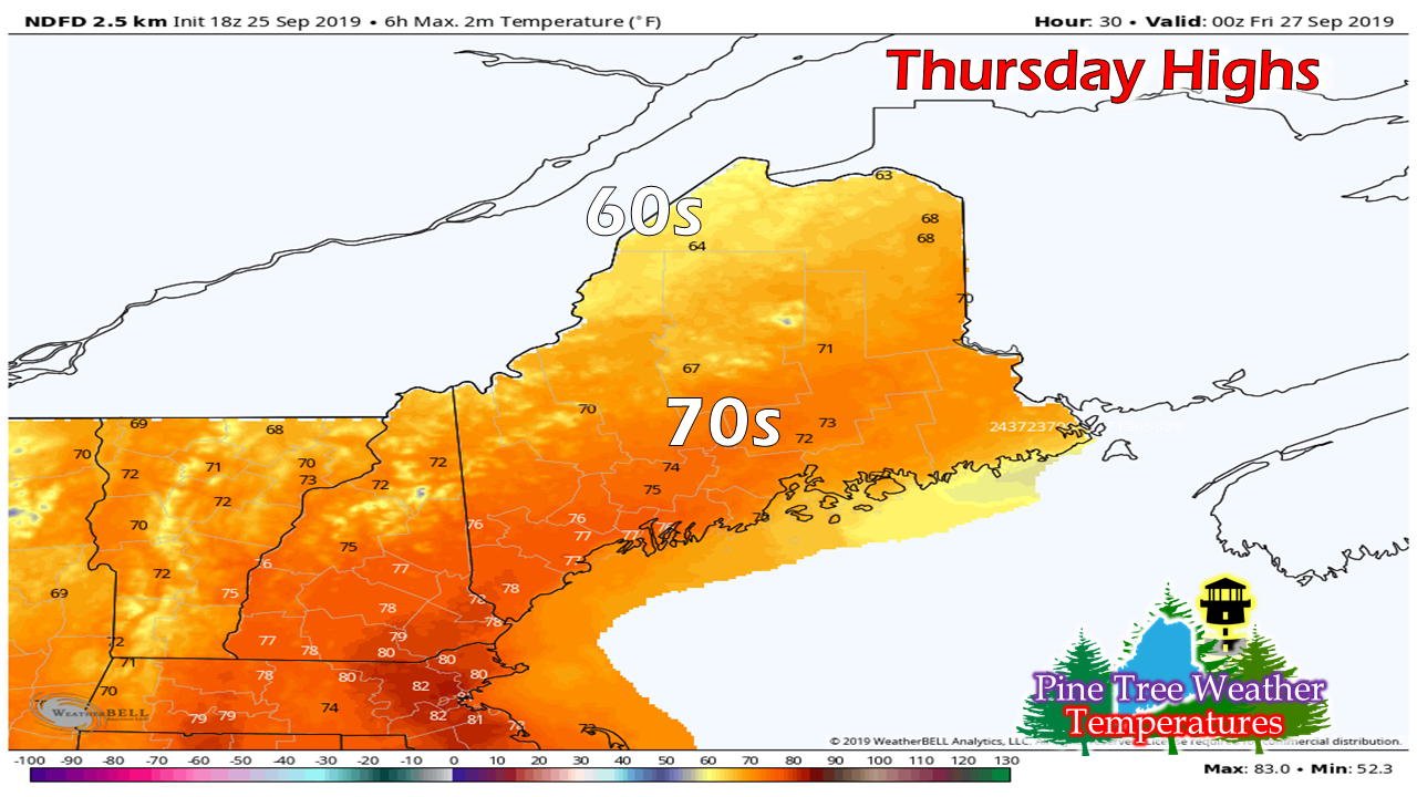
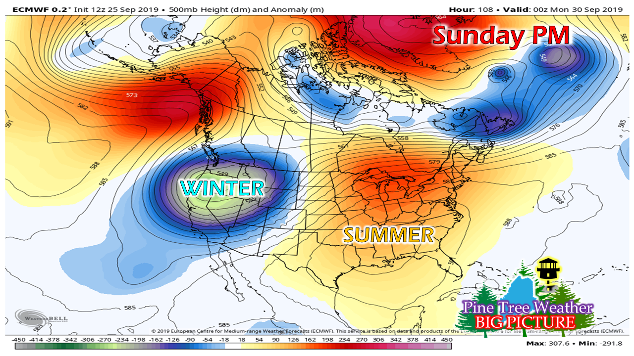
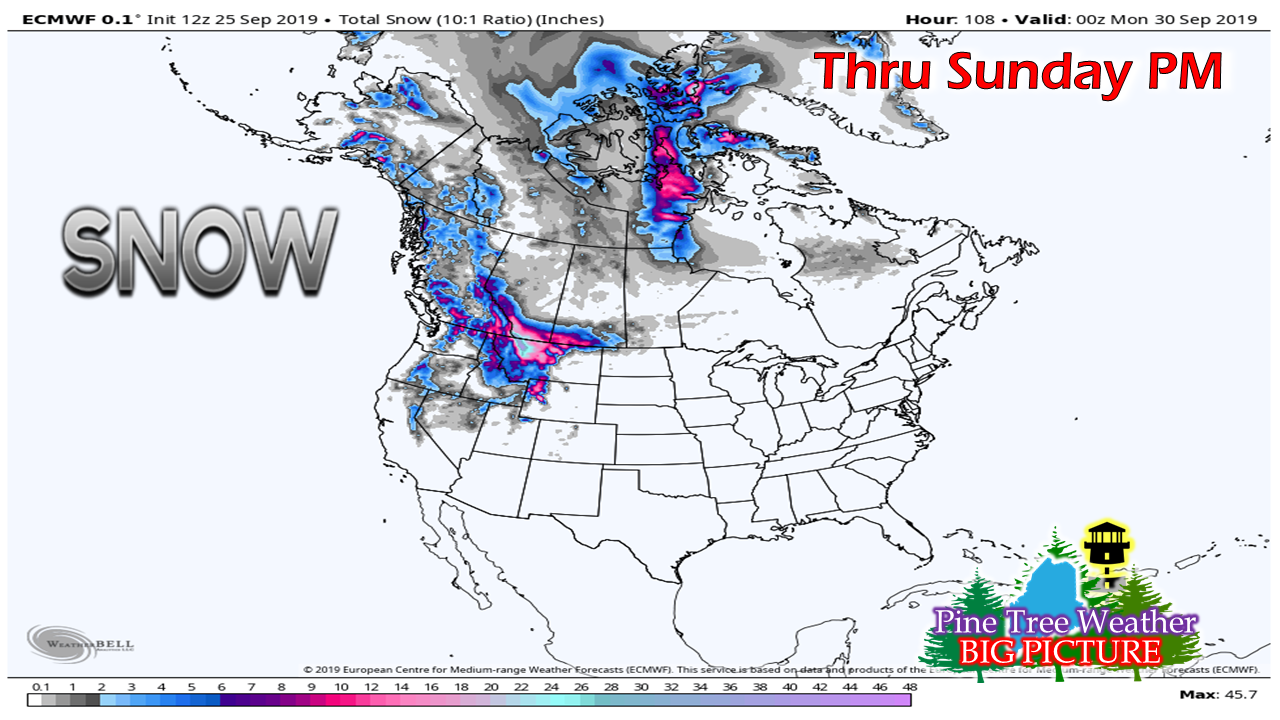
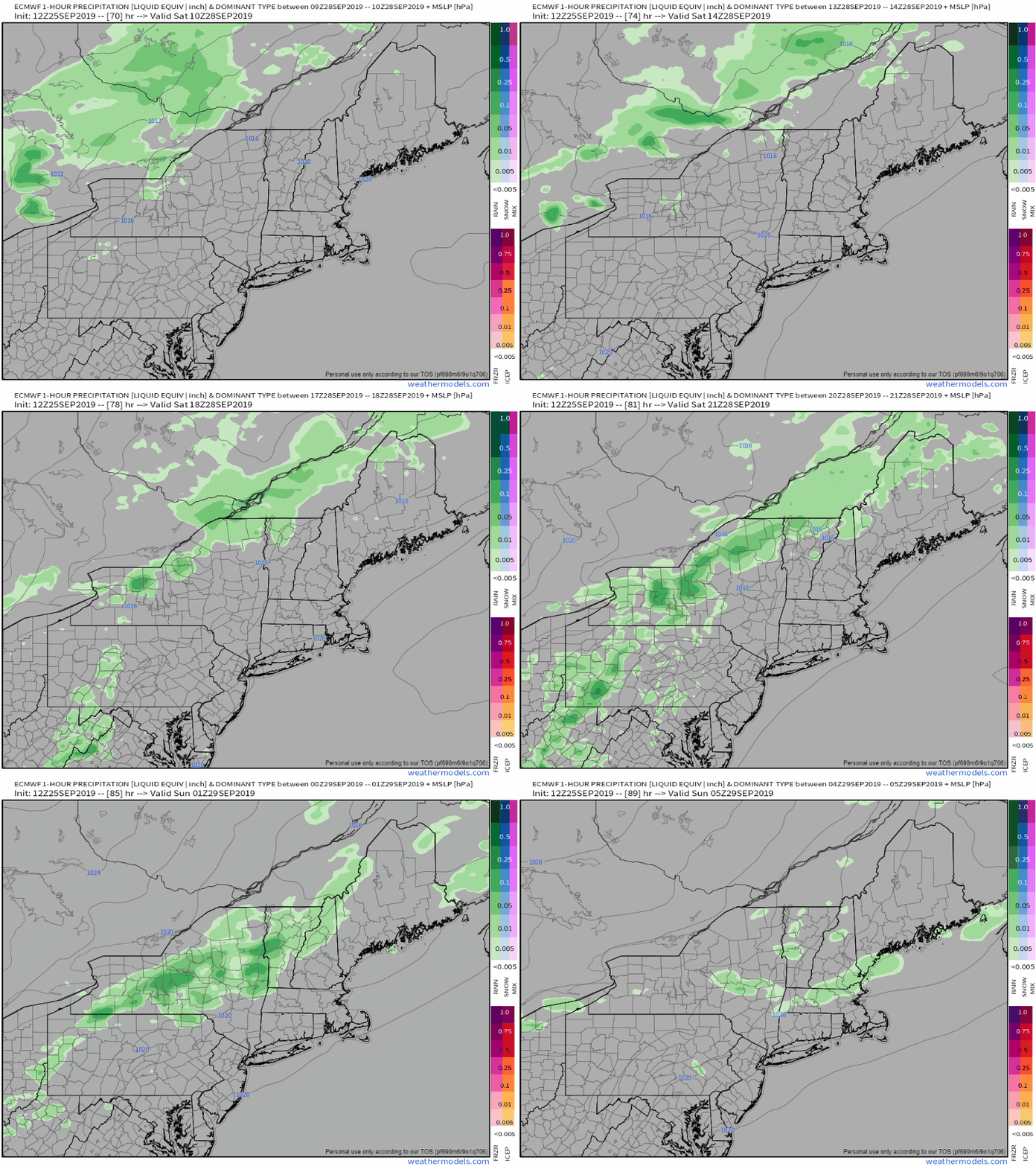
No major storms in sightThe weather pattern continues to be rather mundane over the next week plus. A ridge to the south keeps cold air to the north. Waves will pass over the ridge which may bring some shower activity to the north and mountains primarily Thursday and Saturday. For southern areas looking for meaningful rain, outside of isolated showers that may bring a bit of rainfall, I am not seeing it. Tuesday may be the next chance for some liquid to accumulate in the rain collector, but I have my doubts on if that will even happen at this point. These west to east zonal patterns are not helpful for any rain of any benefit south of Route 2 in western areas, and south of the Airline in eastern areas. It may take something tropical to switch the gears for rain along the southwest coast. For now, all the storms brewing in the Atlantic appear to be steering well away from the shorelines. A few showers Thursday, maybe a thunderstormThe frontal boundary approaches the region Thursday morning. Showers enter northern areas by midday, the western mountains early afternoon. The coastal plain stays dry until later in the afternoon, where a few showers may be around in time for the evening drive. The front exits the coast Thursday evening, with rain ending before midnight. There is a very low chance for a thunderstorm over the western mountains with this system, which may bring gusty wind if any develop. With the bulk of the rain staying to the north, southwestern areas won't get much relief from drought conditions. Portland's total accumulation of 0.17" for September may stay at that level as the month closes out on Monday. If that indeed happens, it will be the driest September on record, with 0.30" in 1948 holding that crown for the time being. Far northwestern areas of The County may dip into the 30s overnight. The rest of the state starts mainly in the 40s, with low 50s for southwest and MidCoast areas. Temperatures will rebound into the 60s for northern areas and 70s elsewhere. Wind may be a bit gusty as times in the 15-25 mph range from the southwest ahead of the frontal boundary. Weekend outlook and beyondThe impressive ridge over the southern part of the country which has roasted that area for most of the summer enlarges and moves northward for the weekend. For the western part of the country, some folks may have envy as a deep trough settles in, offsetting the ridge. With the trough comes cold air, and with that... We're talking snow. It may be a full-on blizzard in the mountains of Montana and southern Alberta. While winter is coming for Maine, it's not coming any time soon. The region can expect above normal temperatures into October. The only blip on the radar screen for the weekend is a weak front passing through Saturday into Saturday night. The mountains and north may see showers Saturday afternoon. As the front approaches the coast Saturday evening, it may wash out, bringing little, if any rain to southern areas, and only a low chance for a shower for DownEast areas. Please support Pine Tree Weather!A special thank you to those that have signed up to be monthly contributors on my Patreon page and to those who have mailed checks to me. This a labor of love here. I don't mind the 4 AM wake up calls (2 AM for snow days) to formulate a forecast, create graphics then write it all out for your consumption, so long as I have the financial support from you to continue to do so. There is no media or marketing influence here. No model forecast bias. No political or scientific agenda. It's just Maine weather, plain and simple. I would appreciate your support to continue this for 2020. Contributors are donation on average of $5 per month / $60 per year either through Patreon or by check. No amount is too small. This is Maine, most of us are on tight budgets, and having been there myself, I understand the struggle. All I ask is to do what you can. If you can't do anything financially right now, that is totally understandable. Please pass along what I do to others and help this site to grow!
Thank you for your support! ► ► For the latest official forecasts, bulletins and advisories, please check in with the National Weather Service in Gray for western and southern areas, or Caribou for northern and eastern parts of Maine. For more information from me, please check the Pine Tree Weather Facebook page as well as my Twitter feed. Always stay weather aware! - Mike |
Mike Haggett
|

