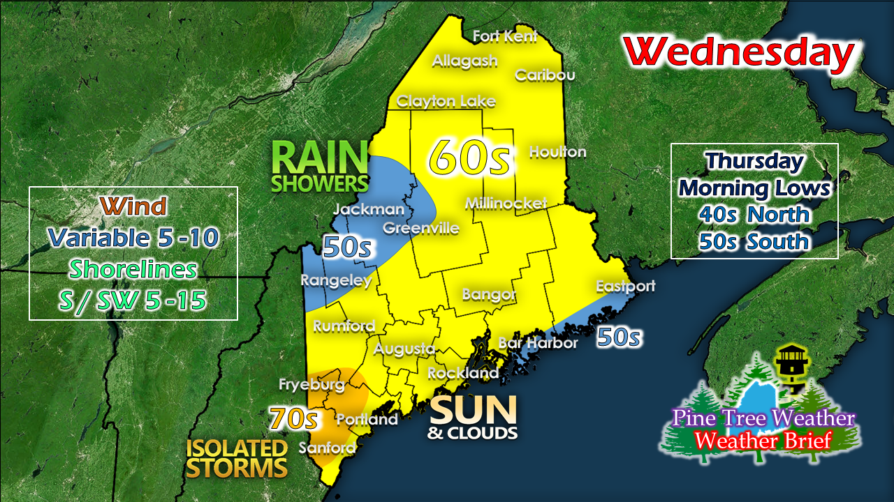
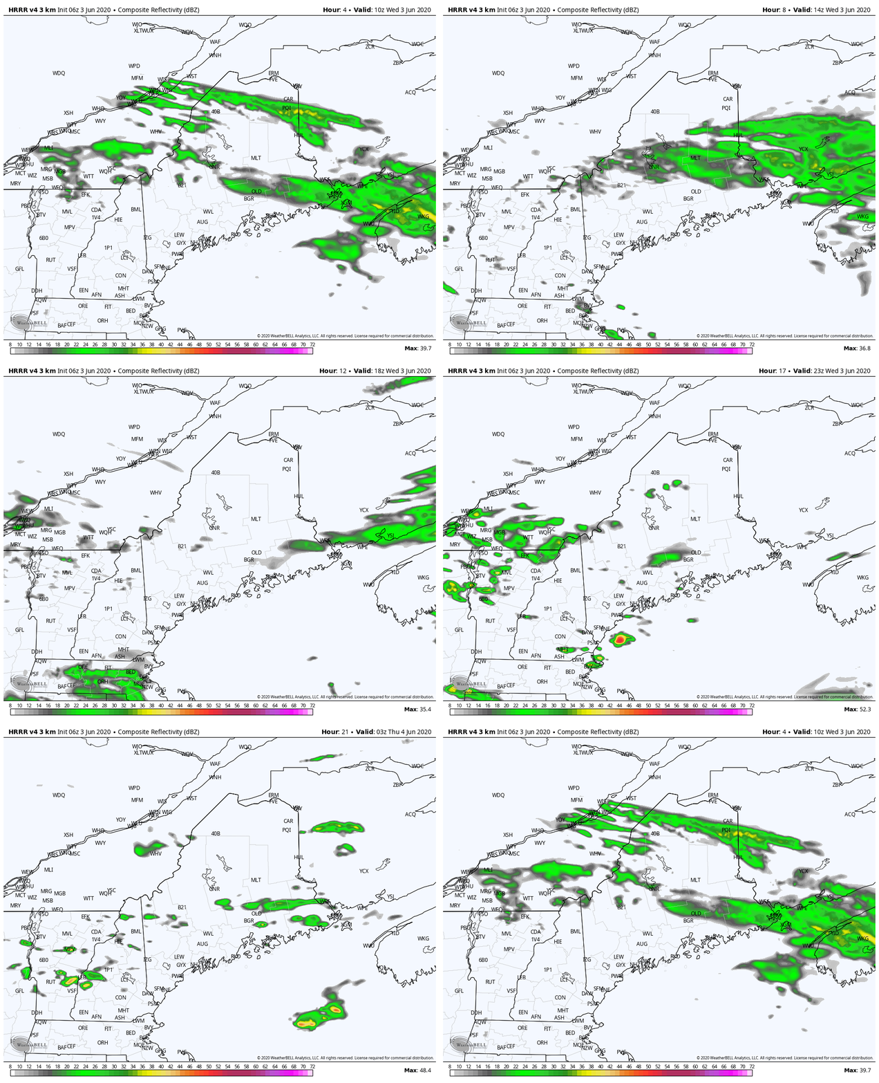
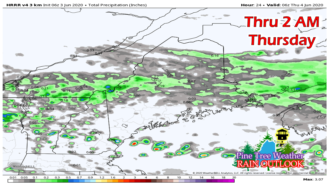
A bit of rain, but not muchAn area of low pressure tracks along a warm front across the region Wednesday. Where you are located indicates who gets what weather wise, and for how long. Most of the rain showers appear to generate across the western mountains through central areas. With less cloud cover to the south and an uptick in humidity under the warm front, a late day shower or thunderstorm could pop before sunset. NOTE: For those tracking rainfall, the NWS Gray radar is offline due to motor failure. As soon as parts arrive, it will be fixed, which may be Thursday. Pending on location, you can use the Caribou or Boston radar as a source. Any measurable amounts of rain are likely to the north, western mountains and eastern areas. To look ahead to future rainfall estimates out to 7 days and drought information, please check the RAIN OUTLOOK page here on the website. Check back for an update on the weekend forecast later today. Stay informed!
For more information, please follow Pine Tree Weather on Facebook and Twitter.
Thank you for supporting this community based weather information source that is funded by your financial contributions. Have a great day! - Mike |
Mike Haggett
|


