
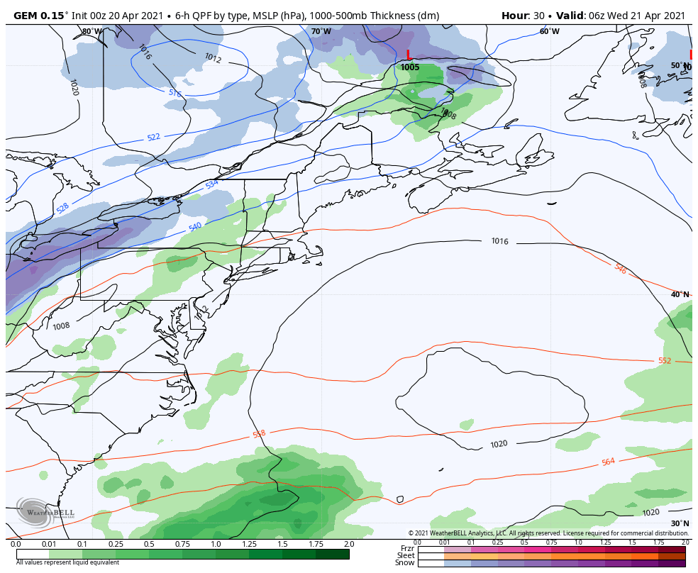
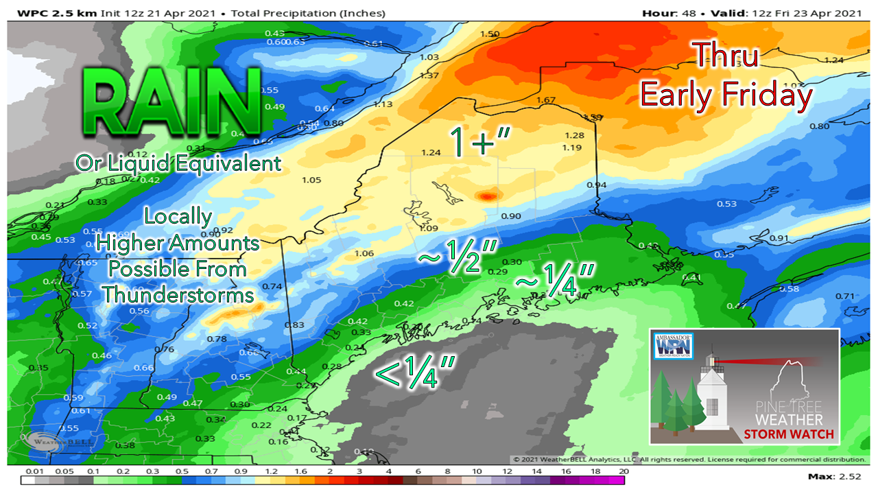
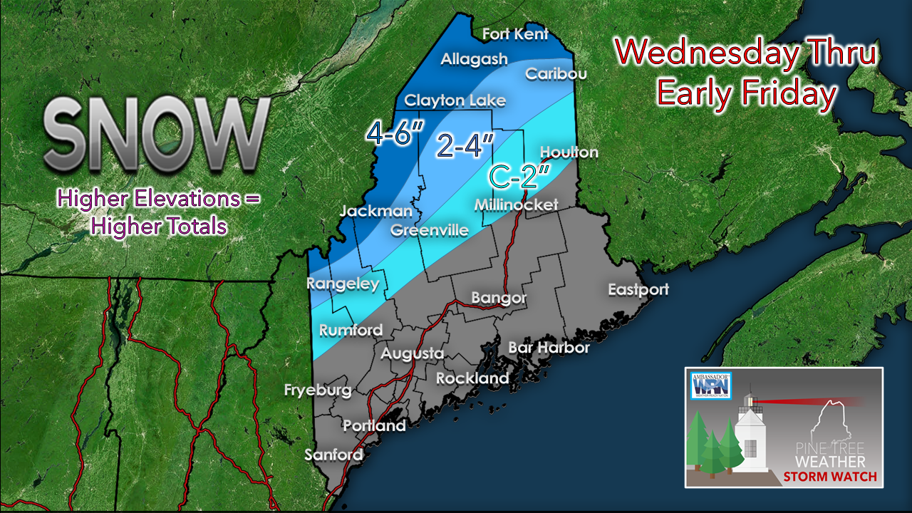
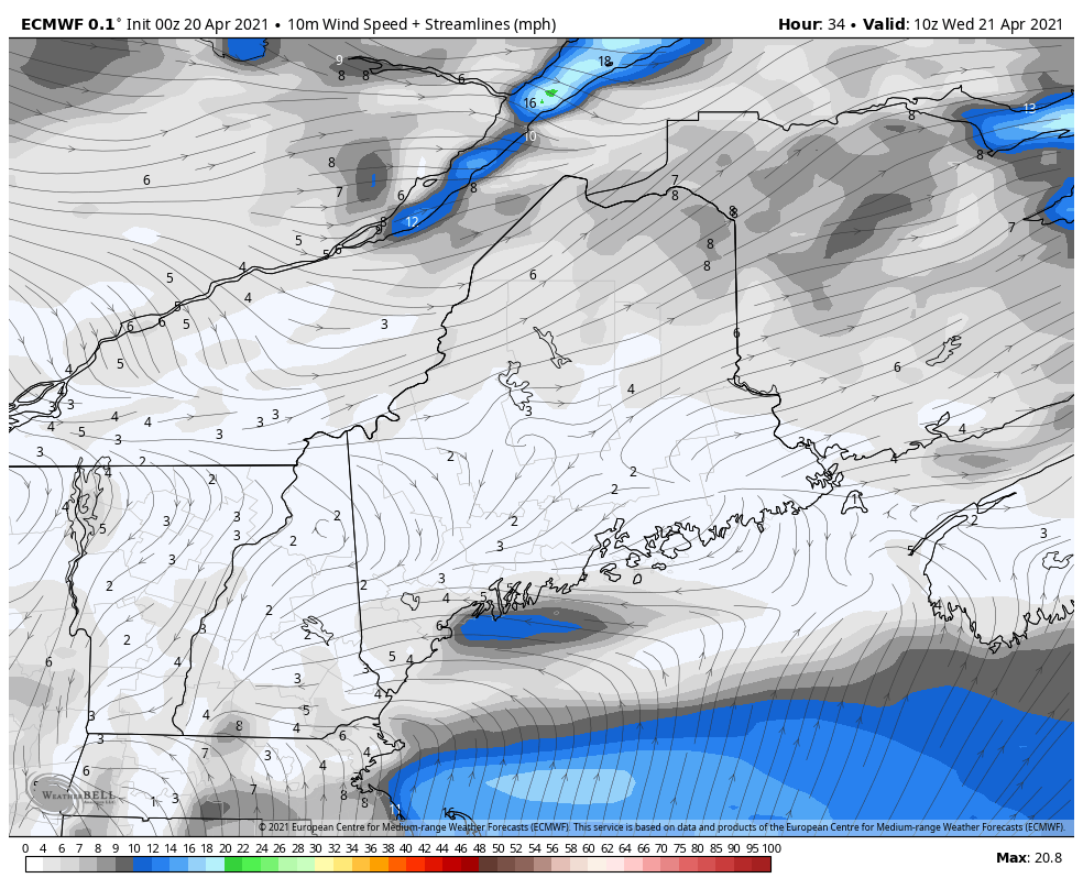
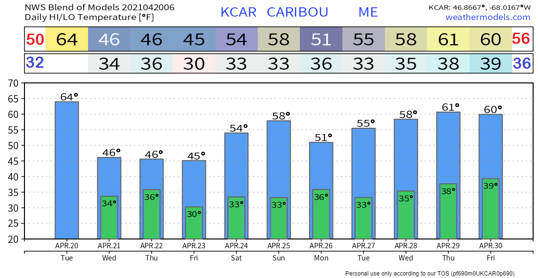
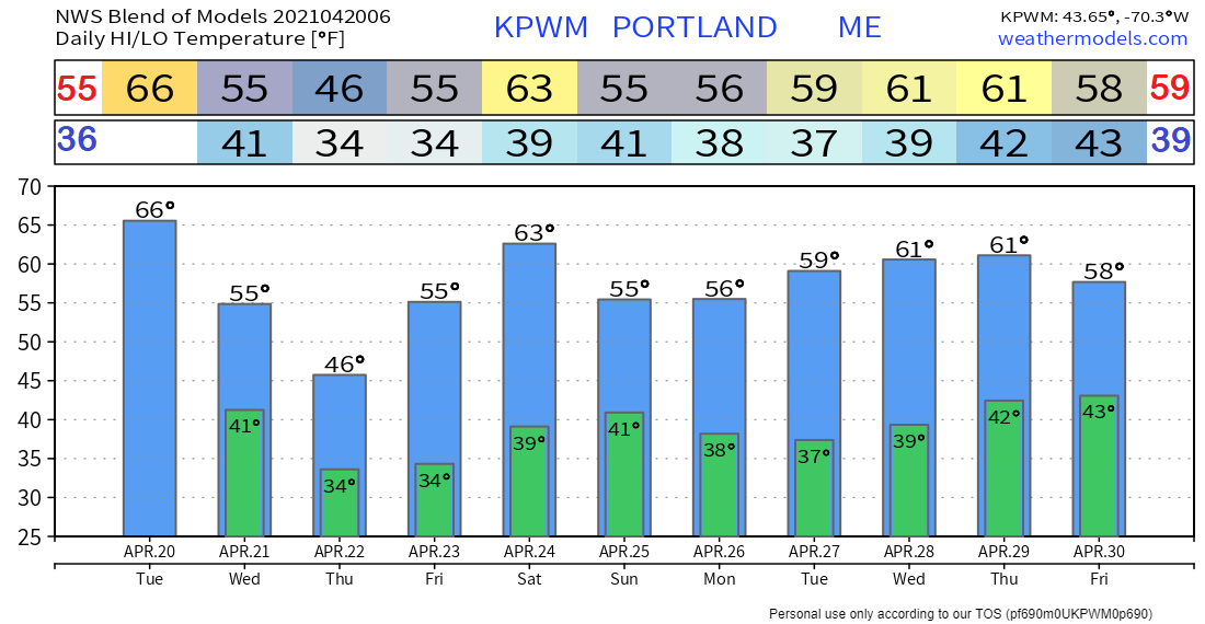
Cold front passes through Tuesday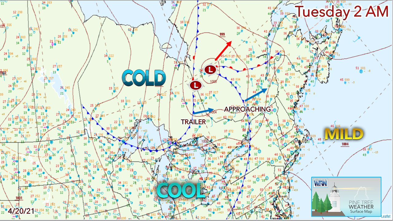 Here we are on April 20th, and I still can't quite declare winter over just yet. There is still plenty of cold air lurking to the northwest that will need to modify before we can say goodbye to the flakes for interior areas. The coastal plain is about done for the flakes after this storm. Frost will continue to be a possibility, however. The average last frost date for southern areas is May 1st, for northern areas May 13th. For those itching to plant, you can do so, but keep the covers on the ready just in case. 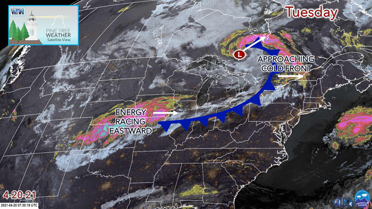 A cold front approaches the region Tuesday as low pressure over central Ontario moves northeast. Clouds will be on the increase in the morning, and showers over interior areas break out Tuesday afternoon. Along the front comes the energy associated with our next widespread event moving in on Wednesday. 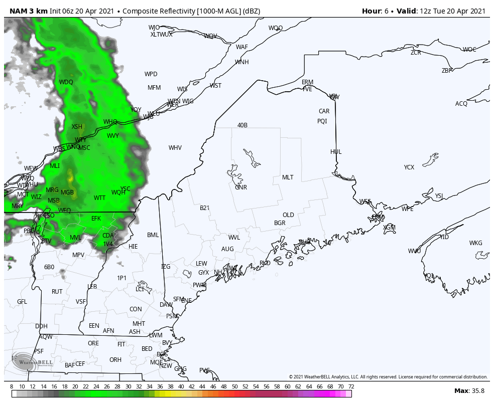 Showers move into western areas by around mid-morning Tuesday and clear northern and eastern areas by early evening. There is a chance for a rumble of thunder as the cold front moves east in the afternoon. Southern areas may get a sprinkle or a spot shower, but that is about it. High temperatures range from the 50s for the north and mountains to the 60s for the coast. Interior southwestern areas may get into the low 70s. Wind from the southwest shifting to the west after the frontal passage could bring gusts up to 30 mph before briefly settling Tuesday night. Another spring mixed bag event on the way |
| | BE PREPARED WITH A NOAA Weather Radio. For $20-$40, it could provide vital information to you when you need it. The weather bands are standard on most public safety scanners, and newer scanner models. Weather radios can be programmed for auto alert. Click here for more information. |
| ► ► For the latest official forecasts, bulletins, and advisories, please check in with the National Weather Service in Gray for western and southern areas, or Caribou for northern and eastern parts of Maine |  |
Thank you for supporting this community-based weather information source which operates by reader supported financial contributions.
Stay updated, stay on alert, and stay safe!
Thank you as always for your support!
- Mike

Mike Haggett
Kennebunk, ME
Weather-Ready Nation
Ambassador
Certified Weather
Forecaster
Penn State '21
American Meteorological Society
National Weather Association
SKYWARN-CWOP
Matthew 19:26
Please
Support
Pine Tree Weather
In 2024


Archives
July 2024
June 2024
May 2024
April 2024
March 2024
February 2024
January 2024
December 2023
November 2023
October 2023
September 2023
August 2023
July 2023
June 2023
May 2023
April 2023
March 2023
February 2023
January 2023
December 2022
November 2022
October 2022
September 2022
August 2022
July 2022
June 2022
May 2022
April 2022
March 2022
February 2022
January 2022
December 2021
November 2021
October 2021
September 2021
August 2021
July 2021
June 2021
May 2021
April 2021
March 2021
February 2021
January 2021
December 2020
November 2020
October 2020
September 2020
August 2020
July 2020
June 2020
May 2020
April 2020
March 2020
February 2020
January 2020
December 2019
November 2019
October 2019
September 2019
August 2019
July 2019
June 2019
May 2019
April 2019
March 2019
February 2019
January 2019
December 2018
November 2018
October 2018
September 2018
August 2018
July 2018
June 2018
May 2018
April 2018
March 2018
February 2018
January 2018
December 2017
November 2017
October 2017