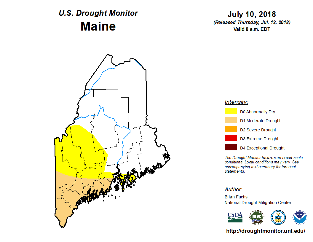
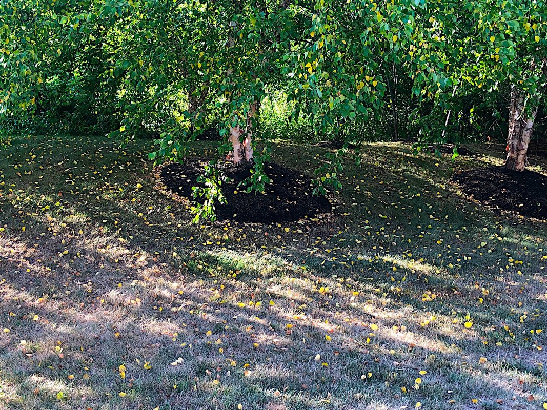
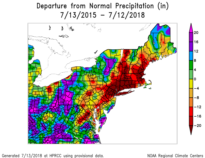
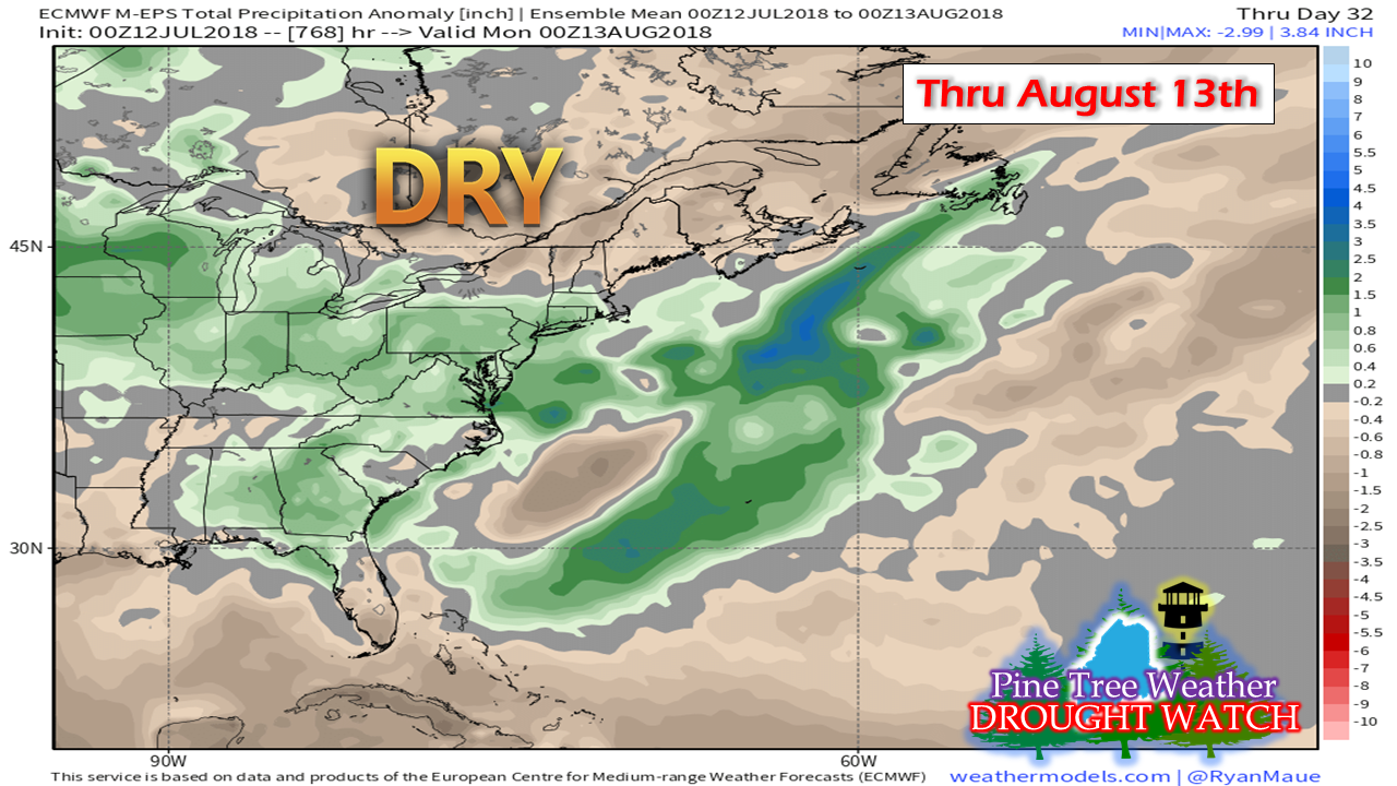
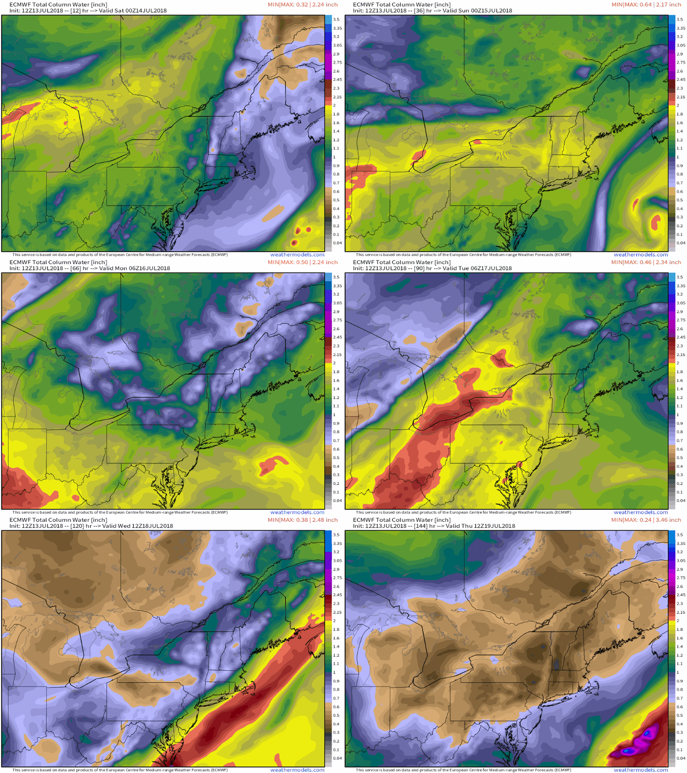
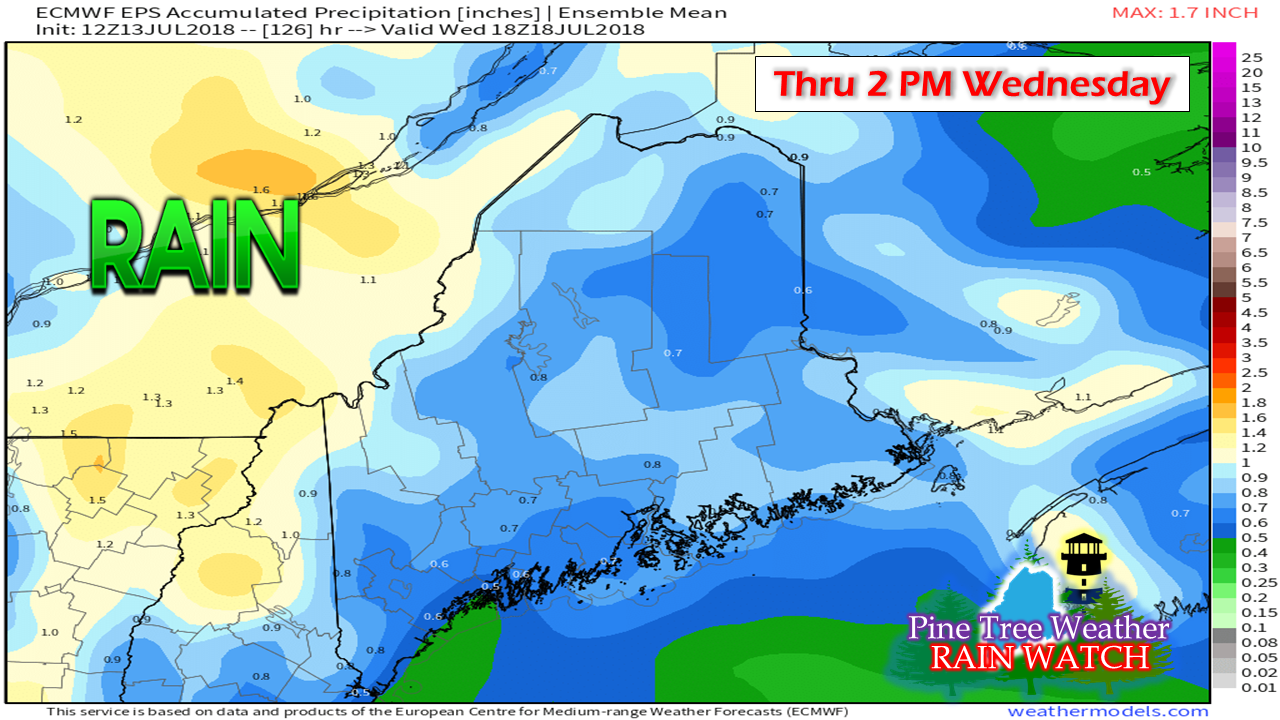
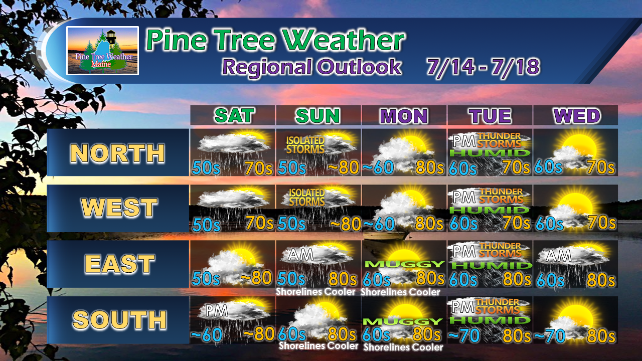
An incredible summer continuesFrom a temperature and humidity standpoint, this has been a classic Maine summer so far. The tropical heat has come in spurts, but it hasn't lasted long. The absence of a Bermuda high pressure system has kept the region comfortable. It's also kept the area dry, and in some cases, very dry. Whether it has been coffee maker talk, emails, Facebook or Twitter messages, the main concern continues to be the drought. Outside of a smattering of showers and a few thunderstorms, dry times are going to continue for awhile yet. Drought Monitor tells us what we already knowNo real surprise with this recent update from Drought Monitor. Much of western and southern Maine is parched right now. Lawns are pretty much a lost cause. Rivers, streams and brooks are at a virtual standstill, and have been for awhile. Lake levels have slowly dropped. Farmers and recreational gardeners concerns continue to elevate. Scenes like this in my backyard in Kennebunk are cropping up. Scorched grass. My birch trees are checking out on the year already, with leaves turning color and dropping... and this is July 13th. The vegetation is stressed out from several years of well below normal precipitation amounts. Severe storms that pack downburst wind are hammering mature trees. As we saw with the Late October Gale last fall, a strong storm can have major impacts on the area. While the long term drought isn't the sole reason, it definitely plays a factor in the outcome with tree damage and power outages. This isn't changing anytime soon. Dry times into mid-August... at leastOutside of showers and storms and the occasional Gulf of Mexico induced front, the outlook continues to be below normal through the middle part of next month. What offers some hope is long term guidance improves rain chances as we head towards September. I certainly would not take that idea to the bank just yet, but it is the first real signal since spring began. Until then, it's pot luck showers and storms and whatever rainfall the region can get. Humidity ticks up as we head into next weekHumidity levels increase a bit over the weekend as a weak front passes through from the northwest. A southwest flow begins on Monday which will increase dew points for the coastal plain. By Tuesday, it gets sticky everywhere, and by Tuesday evening, it is weather-you-can-wear for much of the region. After the frontal passage early Wednesday, airflow from the northwest brings a return to drier air for the late part of next week. Rainfall outlook through midweekThis includes the shower activity over the weekend, with the bulk of this falling in the Tuesday / early Wednesday time frame. This is a rough estimate of what to expect. This could be locally higher in any storms that develop, and lesser where they don't. It certainly isn't a drought buster, but it's something. Regional outlook through WednesdayThe northern and western areas have the best chance for light rain shower and thunderstorm activity over the weekend. Southern areas have their best chance for a shower Saturday, eastern areas on Sunday. The closer to the coast, rainfall chances diminish. All areas get in on some rainfall Tuesday.
Stay in touch with the National Weather Service in Gray for western and southern Maine, or Caribou for eastern and northern areas for the latest forecasts, bulletins and advisories. For more information from me over the weekend, please check Facebook and Twitter. Thanks as always for your support! - Mike |
Mike Haggett
|


