Overnight into tomorrow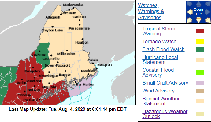 A Tropical Storm Warning has been issued for western and some of coastal Maine, while the tropical storm watch has been removed for the rest of the state. The track of Tropical Storm Isaias has shifted west, so much of Maine was able to be removed from the tropical storm watch. A flash flood watch still exists for parts of western Maine. Currently, there's a few tornado warnings across Massachusetts, New Hampshire and and Connecticut. There's a tornado watch for southern NH, all of Massachusetts, southern Vermont, northern Connecticut and all of Rhode Island. Though Maine is not included in the watch as of the moment, that can change and people of Maine should be prepared for the chance of a few brief tornadoes overnight!. They've been popping up rapidly throughout the day, so please stay up to date with local news and weather apps. Have your weather radio on or your cell phone ringers on so you'll be able to hear if a tornado warning is issued for your area! 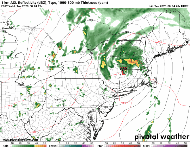 As a recap on timing of Isaias, the system will produce heavy rainfall across Maine this evening and into the overnight hours but will make its way out of the area rapidly. Wind speeds up to 35 mph are likely throughout the state, with the coast seeing up to 40 mph as it travels west of the state. The strongest winds will mainly stay confined to western regions and coastal regions, but will die down by the afternoon hours of Wednesday. The system will move out of the area by the afternoon hours and will leave behind the chance for a few lingering showers and storms. 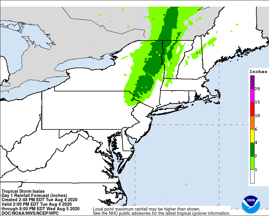 As an update on rainfall totals, I believe they can be brought down to about 2 inches for areas that see heavy rain (western Maine and mountainous regions) with about an inch throughout the rest of the state. The reason for bringing rainfall totals down has to do with the fact of how fast the storms and system as a whole are moving, and how the track of the system has shifted farther west. That's not to say that flash flooding and street flooding are not still a threat, because they are. The rain will still be heavy and you may not be able to see flooded roadways, so try to stay indoors tonight if you can. A look at the rest of the week and into the weekend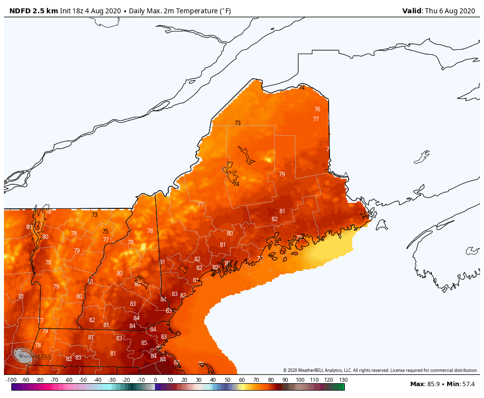 Temperatures will warm back up into the mid 80s by Saturday. High pressure moves into the area, so mainly clear skies are expected tomorrow, with some clouds building in for Friday. Otherwise, there is no rain in the forecast so any clean-up efforts that have to take place, can do so without the threat of more bad weather. 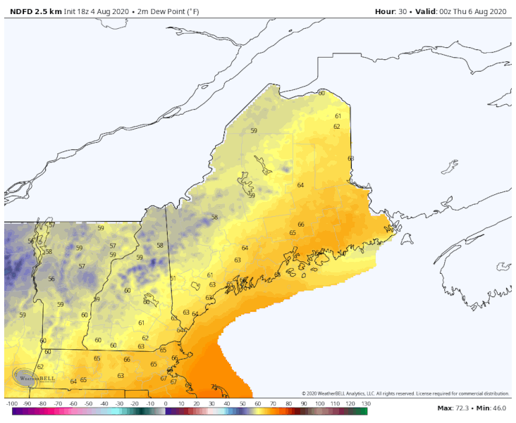 It will also be very comfortable across the region for the next few days. Most of the state will see dew points in the 50s and low 60s through Saturday. Dew points on Sunday will climb back up itno the 60s, but nothing too uncomfortable. After this storm, it looks like we will have fairly pleasant weather through the weekend. 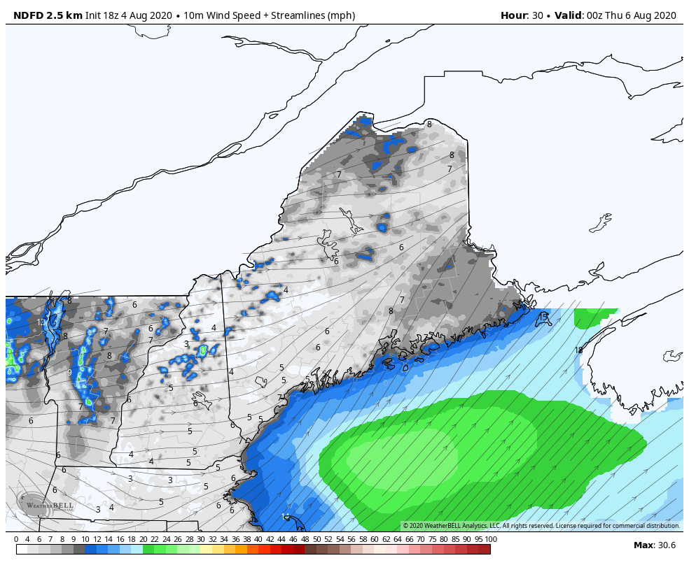 Some lingering winds will be present for Thursday however, with the chance for northern and Downeast coastal regions to reach 15 mph. Winds will be generally from the west and northwest and linger around 10mph for other regions of the state. Like I mentioned though, Thursday will be fairly pleasant besides some breezy conditions. Help forecast verification, and stay informed!
For more information, please follow Pine Tree Weather on Facebook and Twitter.
Thank you for supporting this community based weather information source that is funded by your financial contributions. Stay updated, stay on alert, and stay safe! Thank you so much for all of your continued support! This is my Venmo if you'd like to contribute: @Alex-Hatfield-7 - Alex :) |

Mike Haggett
|