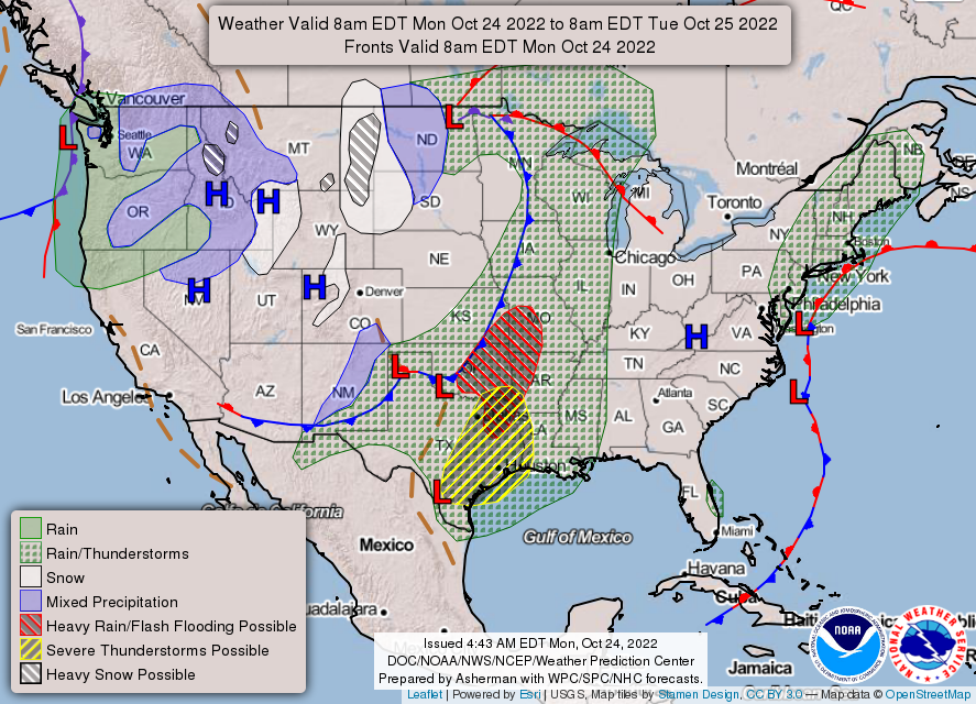
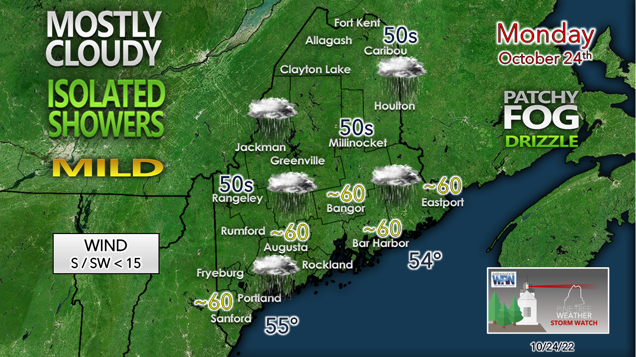
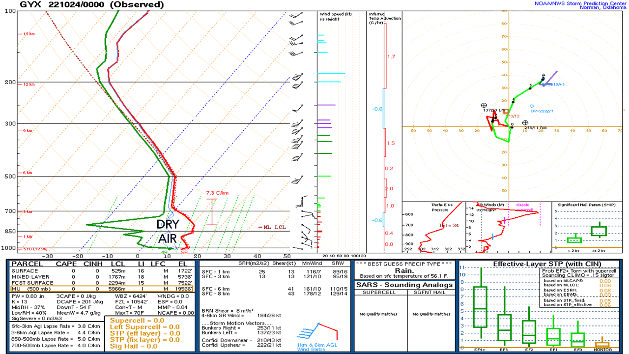
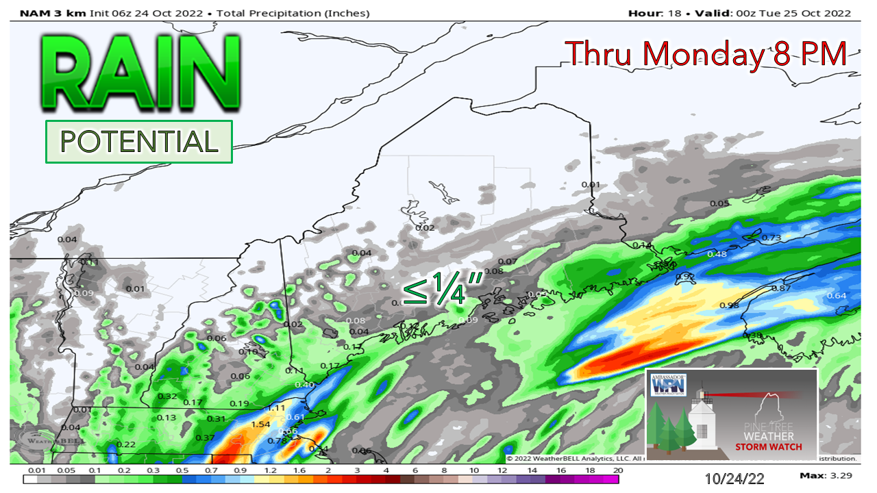
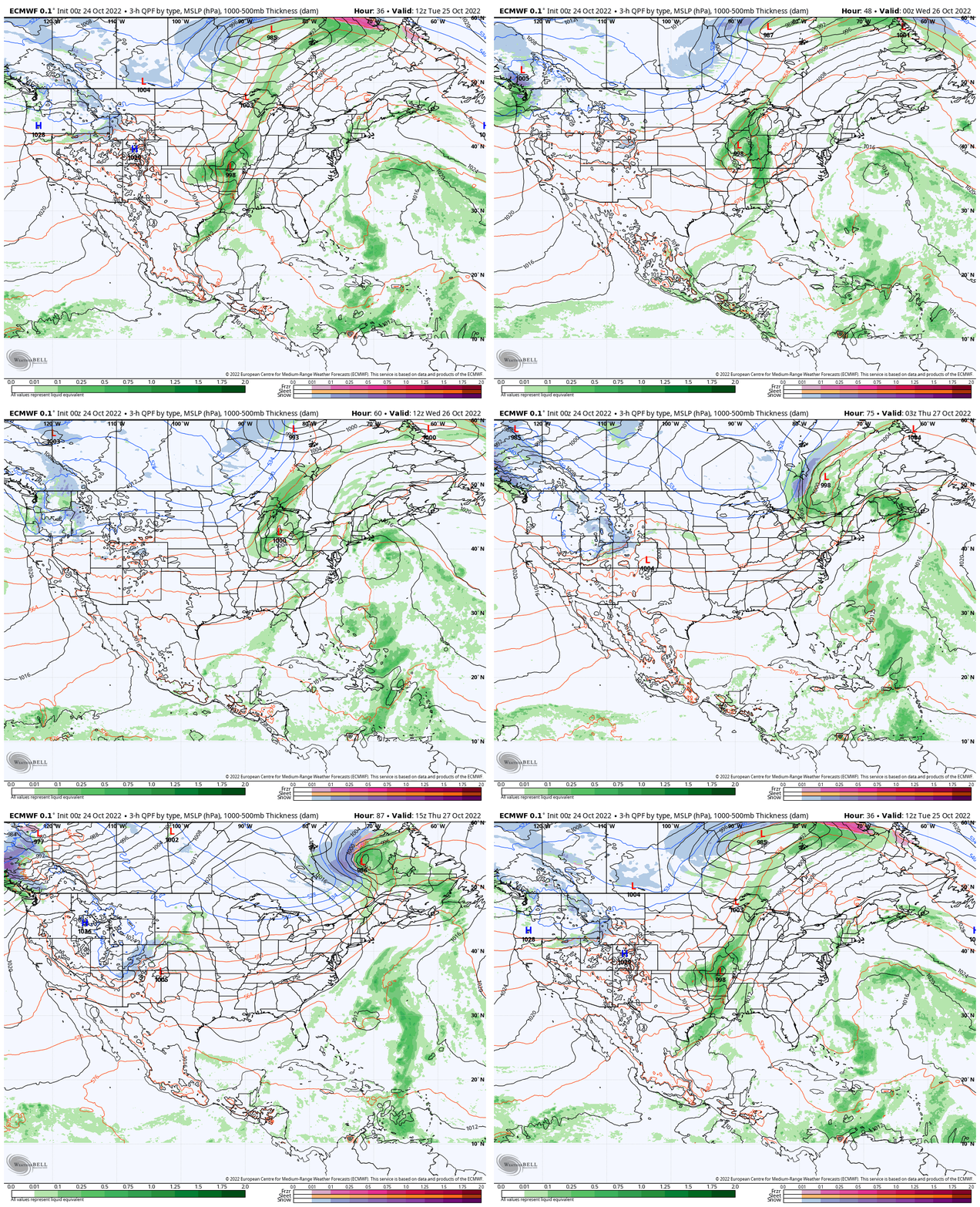
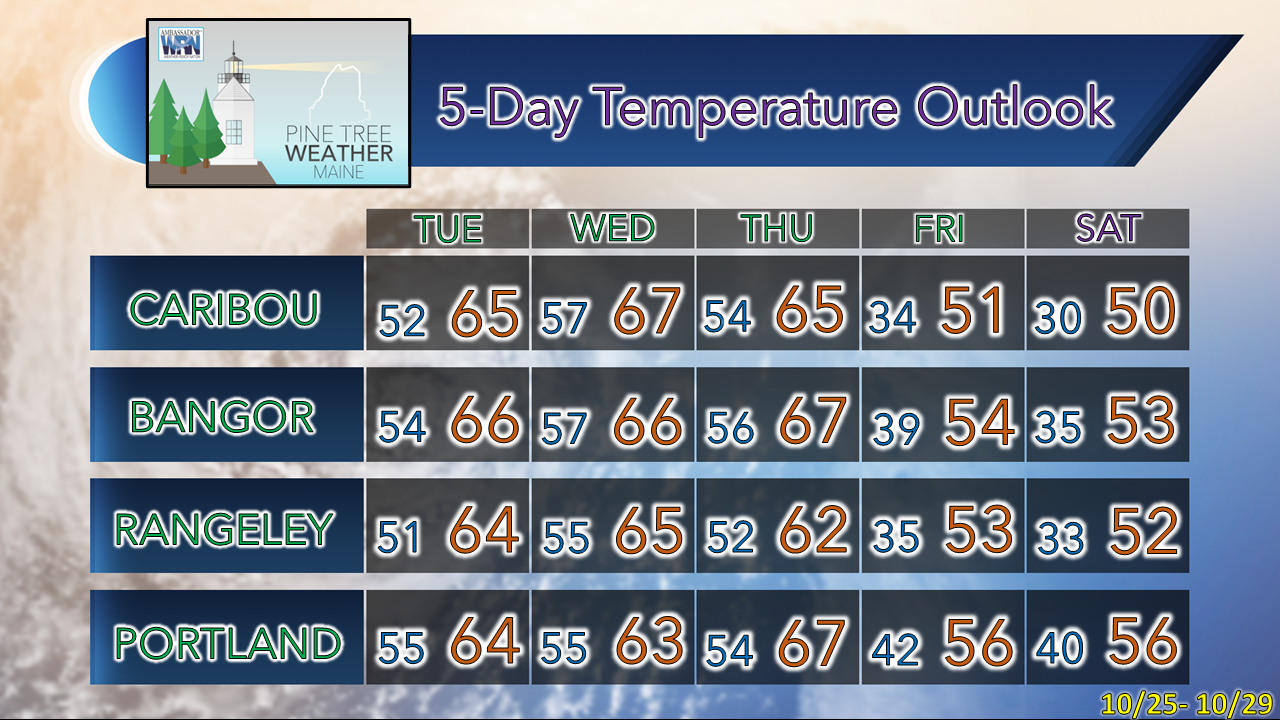
National viewAn area of low pressure and attendant warm front works northeast for the day bring isolated showers, areas of fog, and pockets of drizzle to Maine. High pressure near the Ohio River valley slowly moves eastward for the day. Low pressure over the northern plains brings a wintry mix and snow as it tracks northeast toward Hudson Bay. Low pressure over Texas is expected to bring heavy rain and severe weather over the south tracks northeast towards the Great Lakes and will be a feature to watch for Maine by Wednesday. A gray fall dayThe one bright side of this gloomy day is the temperatures are mild over the region. High pressure to the northeast is holding tough and it appears likely that it will prevent the warm front from the south from entering the region. I mentioned yesterday that warm fronts I interpret as "warning fronts" for the potential for overperformance or a bust. The latter appears appropriate as it appears early Monday morning. The upper air sounding from NWS Gray from 8 PM Sunday night showed the high pressure in action. Dry air at the mid and low levels ate up overnight rain potential, and thus cut the forecast rainfall amounts dramatically. Some short-term model ideas try to bring the rain more to the north, but I am not buying it given the high pressure. I am going with the under on rainfall and looking ahead to Wednesday for the next chance for rain. Outlook for the remainder of the weekTuesday 8 AM to Thursday 8 PM - The area of low pressure over the south treks to the northeast ahead of a trough approaching from the northwest. High pressure offshore pinwheels in an area of low pressure from the southeast. The low intensifies in its journey towards Labrador and captures moisture from the ocean low in the process. This will be intriguing to watch to see if an inverted trough set up may enhance rain that comes from it on Wednesday. Once that passes through, dryer and more seasonable air works in as an upper-level trough brings high pressure into the region, keeping the area dry through the weekend. Temperature outlook through SaturdayThank you for supporting this community-based weather information source which operates by financial contributions from people like you. PLEASE DONATE FOR 2023! THANK YOU! Stay updated, stay on alert, and stay safe! - Mike NOTE: The forecast information depicted on this platform is for general information purposes only for the public and is not designed or intended for commercial use. For those seeking pinpoint weather information for business operations, you should use a private sector source. For information about where to find commercial forecasters to assist your business, please message me and I will be happy to help you. |
Mike Haggett
|

