|
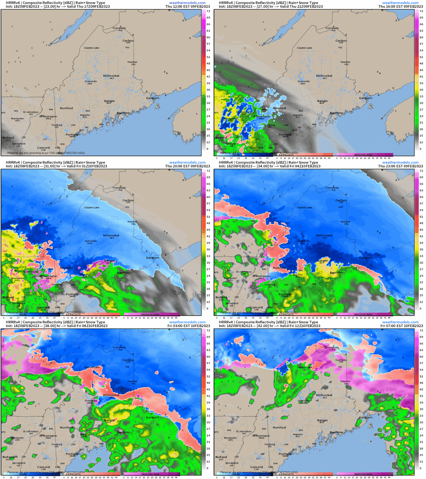
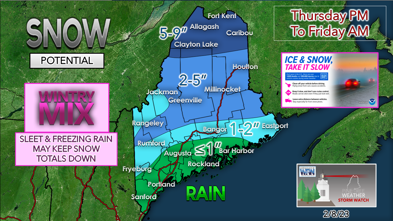
Apologies in advance for the short update. Wednesday's are going to be challenge for me until spring as I have things going on. Winter weather advisories are posted for the western mountains (starting at 3 PM) and north (starting at 7 PM). All four food groups on the wayThursday Noon to Friday 7 AM - The system is a bit more progressive, so this moves projected start times up as well. Most areas to the south and west will deal with this mess during the evening drive. Bangor and points east may see it start around 6 PM. Northern areas see precipitation start mid to late evening. Outside of some scattered activity, this is over for the south and west between 1-3 AM, and Bangor and eastern areas just before daylight. Northern areas are likely to deal with the mess all day in some form as the low passes across the north end of the state. A cold front works through in the afternoon which may bring a mix of rain and/or snow showers over interior areas. Since this starts in the afternoon, it does help cut down on the cold air damming effect somewhat over western areas. I am still not sold that the foothills escape all together. Sleet and ice from freezing rain are a concern for the mountains on up into the north. Outside of the coastal plain west of Washington County, the junk effect is game on everywhere less outside of the green zone. I can't rule out a sloppy inch or less for the coastal interior, but is about it.
This system is coming in a bit juicer with a general ½ - ¾" of liquid equivalent out this. WIND is going to be concern as the storm spins off a secondary low over the Canadian Maritimes. Gusts could reach 30-40 mph. While the general idea is for all but the far north to climb above freezing as the region sits in the warm sector, we'll see if that happens, and how far inland that goes. For more information, please check in with the National Weather Service or the local TV station of your choice. - Mike |
Mike Haggett
|


