
|
At the time of this post Thursday afternoon, it appears that all but 3,000 have seen power restored for the storm on Wednesday, which is great news. If you are reading this and still in the dark, hopefully it won't be too much longer. A reminder that I am heading out of town Friday for the weekend and may not update again until Monday. The status on funding for 2023 remains the same, currently short $1,900 to cover the bills. Any help here would be appreciated to keep this going, and thanks to those who have already chipped in. Third verse same as the firstFor the snow lovers, the early season disappointment continues. From what I could pick up from reports on Twitter the ski hills took a beating as expected but all was not lost. Snowmakers will have time to rebuild a bit before this next system arrives on Saturday. The pattern is not good into next week. The pattern shifts cooler mid-month, but I am skeptical about if it will be a snowier pattern. For now, the best process is to take it week-by-week and see what happens. 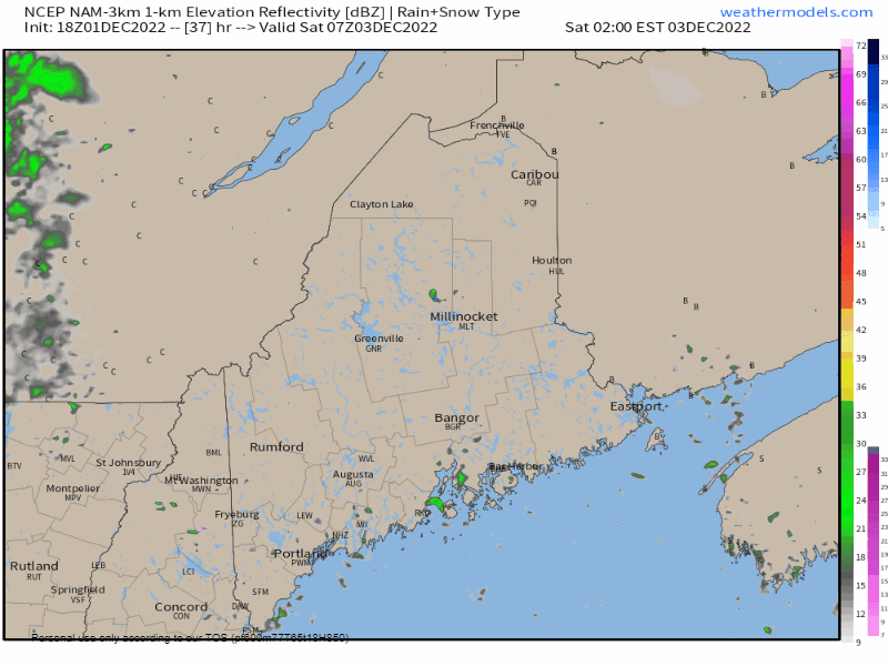 Saturday 2 AM to 8 PM - I am going to preface this by saying the NAM loop I am presenting here has a warm bias, which means the precipitation idea this is generating early in the morning could come in the form of light snow, sleet, and/or freezing drizzle or freezing rain to start off the day over the interior. A south-southwest wind flow helps pump warm air into the region, and whatever form of wintry precipitation may occur early will flip to rain everywhere by mid to late morning. Unlike the last event that had a nasty squall line and big wind, this set up appears rather tame. I do expect breezy conditions with gusts 25-35 mph ahead of the front from the south-southwest. The direction flips to the northwest with gusts in the same range preceding the frontal passage, but at this point wind tapers off rather quickly and settles Saturday evening. 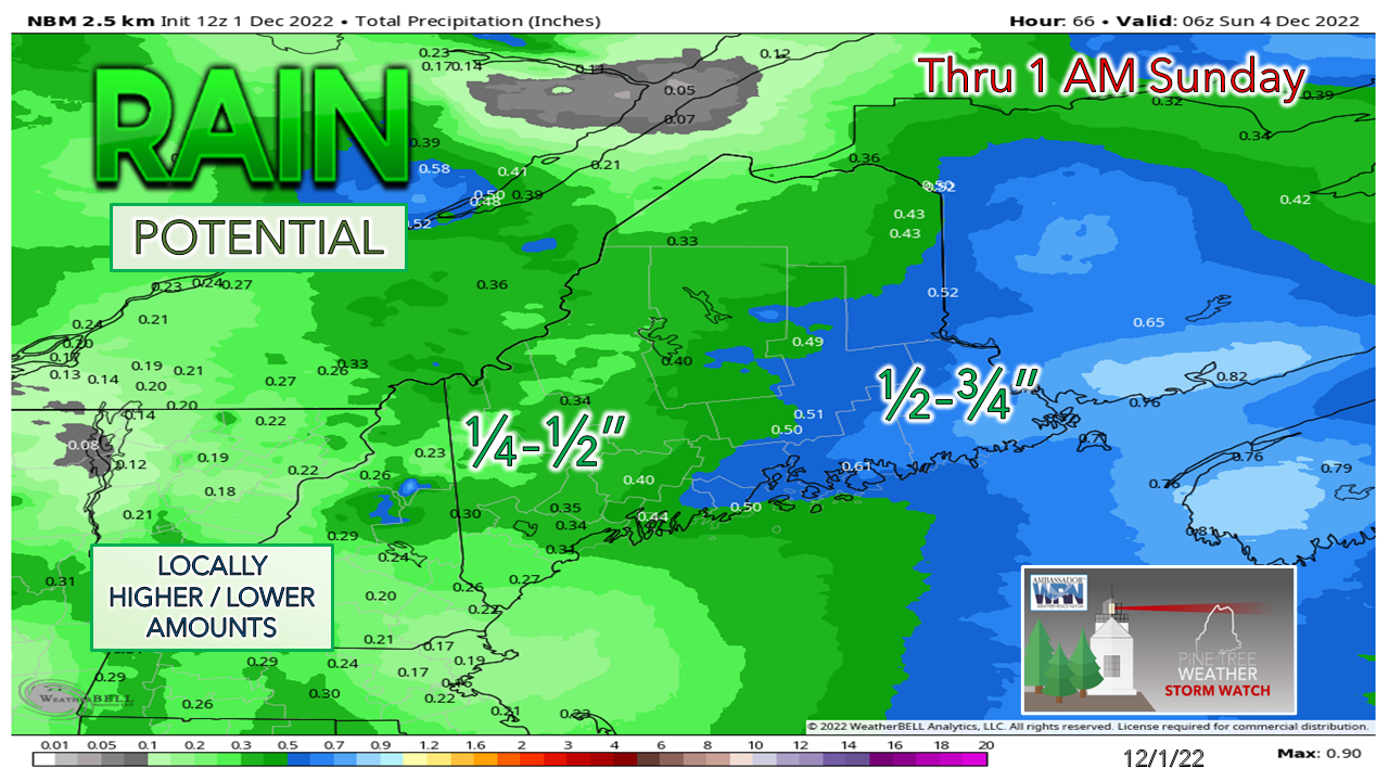 The amount of liquid here is not nearly as much as the previous storm, which cuts down on further damage for the ski trails. A general ¼-¾" range of rainfall is a fair bet for much of the region.  Outlook into next week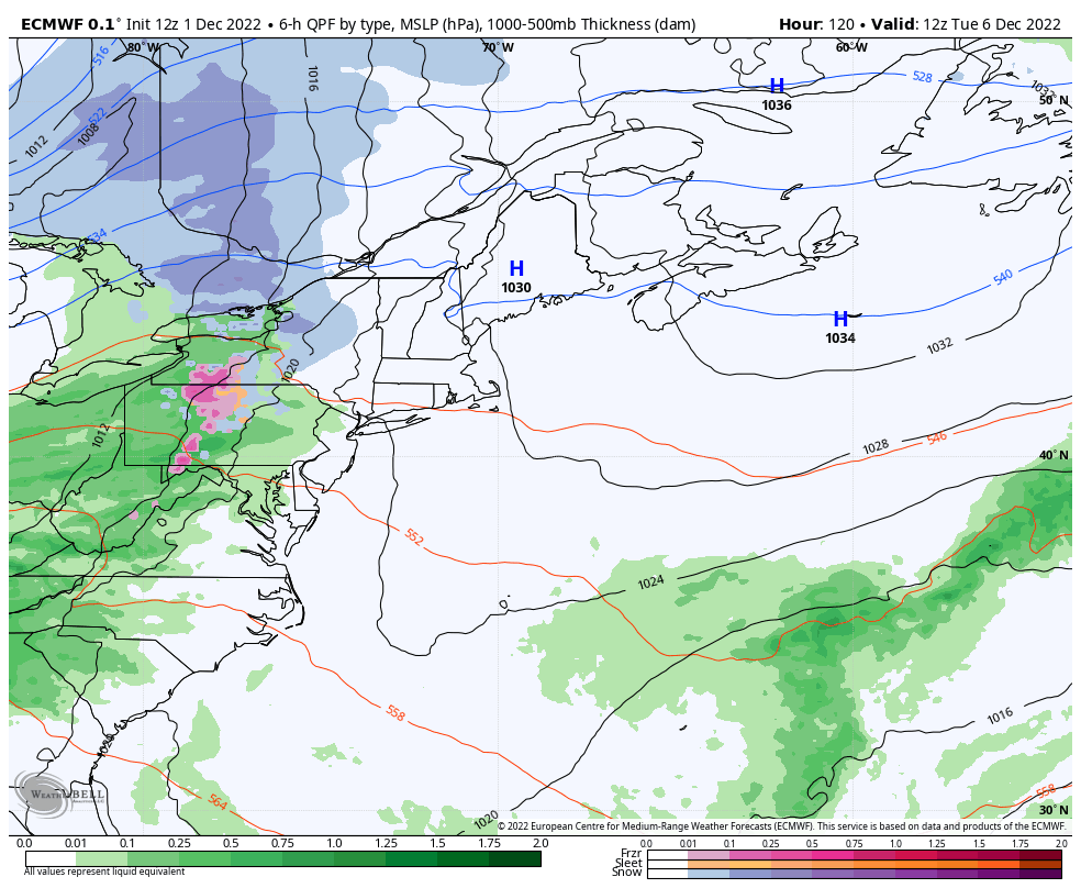 Tuesday 7 AM to Wednesday 7 PM - A similar set up as Saturday, but with rain potential well into the overnight hours and clearing out during the day on Wednesday. A rough idea on liquid with this system is similar to Saturday as well, but too early to know for sure if it ends up that way. Stay tuned.  Thank you as always for your support! Stay updated, stay on alert, and stay safe! - Mike NOTE: The forecast information depicted on this platform is for general information purposes only for the public and is not designed or intended for commercial use. For those seeking pinpoint weather information for business operations, you should use a private sector source. For information about where to find commercial forecasters to assist your business, please message me and I will be happy to help you. |

Mike Haggett
|


