
|
Over the weekend I have kept watch on this potential storm and ideas remain scattered. Given the timeframe here and watching how this is unfolding, it is important for me to say a few things about it. For the prayer warriors out there seeking some sort of drought relief I would suggest you keep up the petition. As I mentioned in my previous update, I mentioned that Lucy could steal the football away from Charlie Brown, and for now, that is what appears for Portland-Fryeburg south. There is still time for changes on that, but I am not bullish on the possibility of a solid rain event there as of Monday morning. Best chance for beneficial rain for the east and north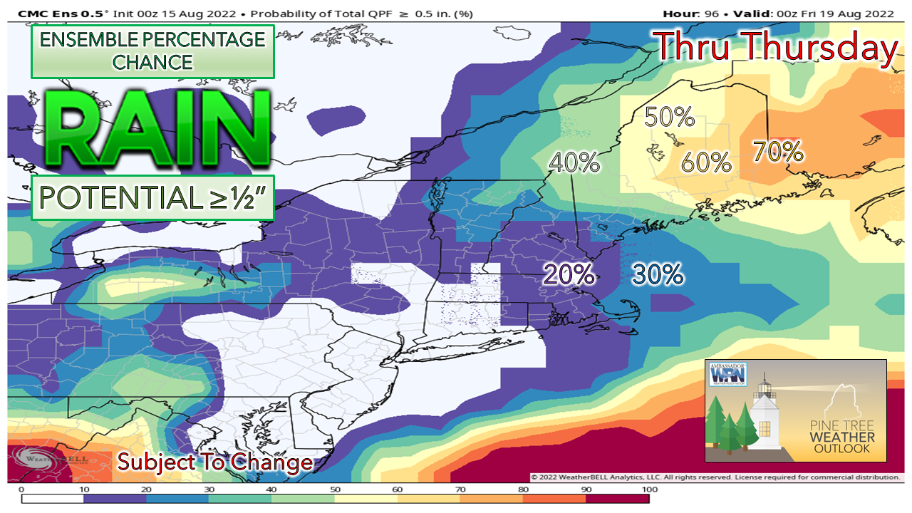 With the trough digging in and an upper-level low forming, the question all along here is where and when a surface low would develop and where would it track. The consensus over the weekend was a more easterly development, and that general idea continues, but there are outliers that are pitching the idea of storm generation closer to the benchmark (40° N / 70° W) south of Nantucket. That would be the best-case scenario for southern areas to get into the game. Most ideas are to the southeast of that, which takes southern Maine out of the mix. 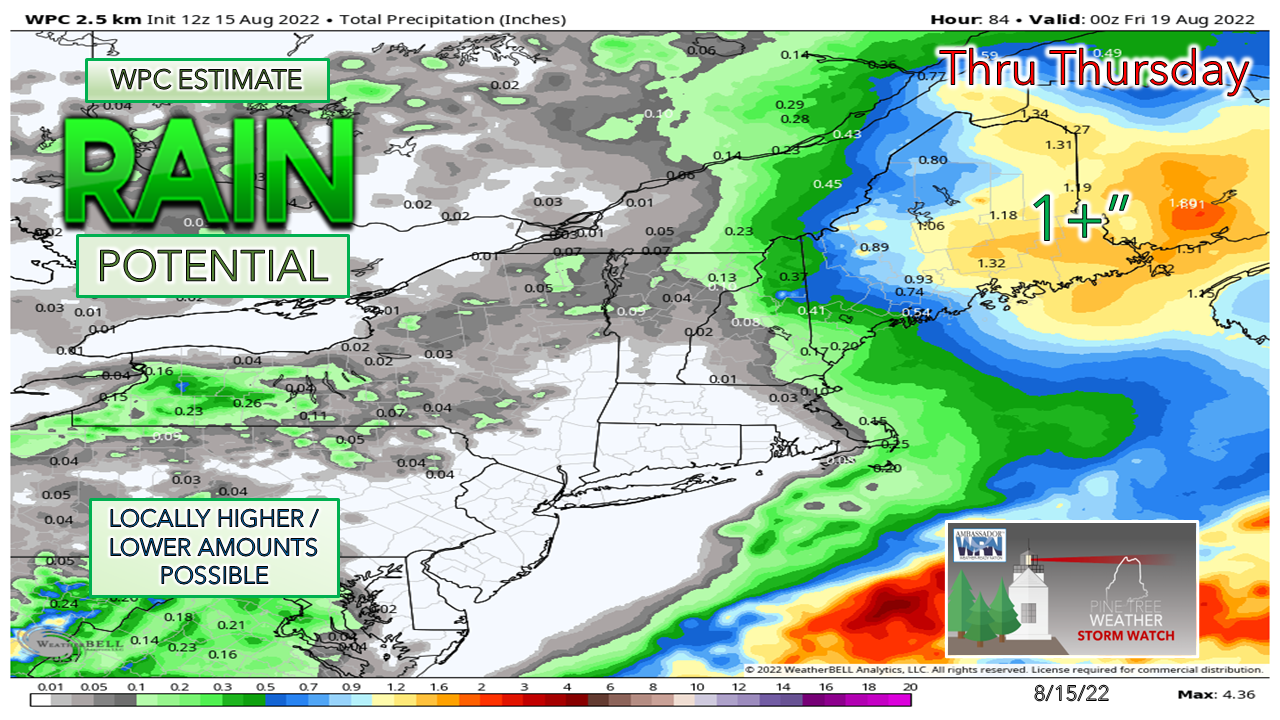 The general idea is that once the storm forms, it retrogrades north over Nova Scotia and into New Brunswick and could bring a solid rain event for eastern and northern areas. If the upper-low gets organized early and spins the surface low up earlier, that shifts higher amounts to west, but that is on the low end of probability at this point. The big question mark is for MidCoast and the Capital District of the state where I think the bust or boom line resides with a 50/50 chance of going to 1"+ or ± ½". While this storm has NorEaster characteristics, I do not expect a strong storm here. Models are consistent with a pressure level around 1005mb which may bring wind gusts to 30ish mph along the coast, stir the ocean up enough to cool it off a bit, and may set up a rip current risk. Timing is still to be ironed out here, but it appears that coastal areas see rain break out Wednesday morning, continuing northward into Wednesday night, when most of the rain falls, Rain tapers off on Thursday from southwest to northeast as the storm heads for the Gulf of St. Lawrence. Stay tuned. Thank you for supporting this community-based weather information source which operates by financial contributions from people like you. NEXT UPDATE: TUESDAY AFTERNOON Stay updated, stay on alert, and stay safe! - Mike NOTE: The forecast information depicted on this platform is for general information purposes only for the public and is not designed or intended for commercial use. For those seeking pinpoint weather information for business operations, you should use a private sector source. For information about where to find commercial forecasters to assist your business, please message me and I will be happy to help you. |

Mike Haggett
|


