
|
When I first began discussing this storm on Wednesday, I stressed that these cut off upper level lows are tricky to forecast, and that models were going to have hard time handling it. Both have proven correct with this storm. As we approach the beginning of the event, it may not quite be done yet. Storm ideas continue to get warmer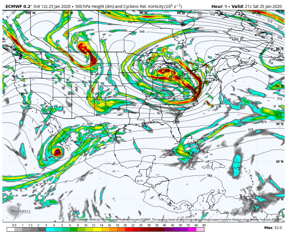 This is a busy chart sequence looking at upper level energy. First thing to focus on the energy over the Great Lakes spinning eastward, which is part of a trough. The ridge to the north begins to weaken, and allows the upper level low to nudge in the same direction. If you look to the west over Montana and North Dakota at the beginning of the loop there is another piece of energy. This is the kicker. If the kicker came earlier, this may have been a snowier affair. This will make it snowier for eastern Quebec and Labrador, but for Maine it's a sloppy mess. 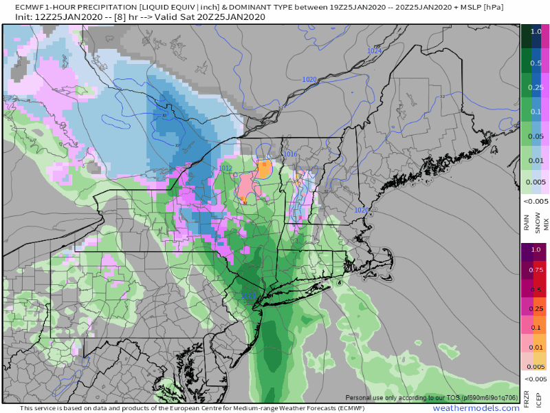 As far as timing goes, the storm is moving a bit quicker. It will be all but over for western and southern areas by daybreak, and by around noon for northern and eastern areas. The only other slight change has been the window of very heavy precipitation has narrowed down to a three hour window. Chances are good you will know when it begins, and know when it ends in your area. If you are travelling overnight in the interior areas, watch the vehicle thermometer, and take 5° off to consider actual surface temperatures. For coastal areas, expect heavy downpours to cause standing water with potential hydroplaning, reduced visibility from the rain, and any fog that may form. 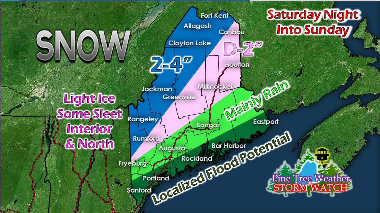 This could be bust on snow all together, so I will be right upfront about that. I am concerned for northern areas that ice from freezing rain may be more than light. Since the upper low appears to flatten out, I see snow showers for the mountains, but I can't see anything more than a fluffy inch out of it as the backside rolls through on Monday. For coastal areas, expect snowmelt to cause some urban street flooding. The heavy rain could agitate ice covered tributaries, which may cause ice jams and flood roads. If you come across a flooded roadway TURN AROUND, DON'T DROWN. We're about a week away from our next storm. Will it be a snowy one or will it turn into something like this? Stay tuned. ► ► For the latest official forecasts, bulletins and advisories, please check in with the National Weather Service in Gray for western and southern areas, or Caribou for northern and eastern parts of Maine. Your help is needed to wrap up funding needs! ► ► Due to a revised budget there is a $125 shortfall for the year ahead! You can help keep Pine Tree Weather going with a donation of ANY amount now through VENMO @PineTreeWeather, a monthly donation on Patreon or messaging me on Facebook or Twitter to send a check in the mail. Thank you for your support!
For more information from me, please check the Pine Tree Weather Facebook page as well as my Twitter feed. Always stay weather aware! - Mike |

Mike Haggett
|


