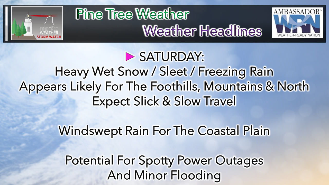
 Tough call for interior areas with mixingAt this point, the forecast appears to be honing in on two possible scenarios: one that is colder and brings more snow, the other is a bit warmer and brings more of a mix. Track and timing is the key in all of this. I am going to use deterministic output here to make a point, but be advised there is room for change here. 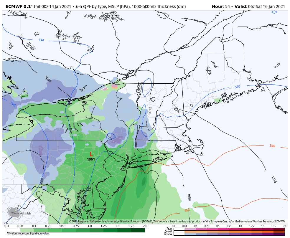 The colder solution depicted here by the European would minimize the threat for mixing, would bring more snow to the higher elevations and would mix some pockets of sleet in. This brings a chance for snow from Fryeburg to Calais north at the onset. How far into the interior areas the warm air column gets will dictate precipitation outcome. 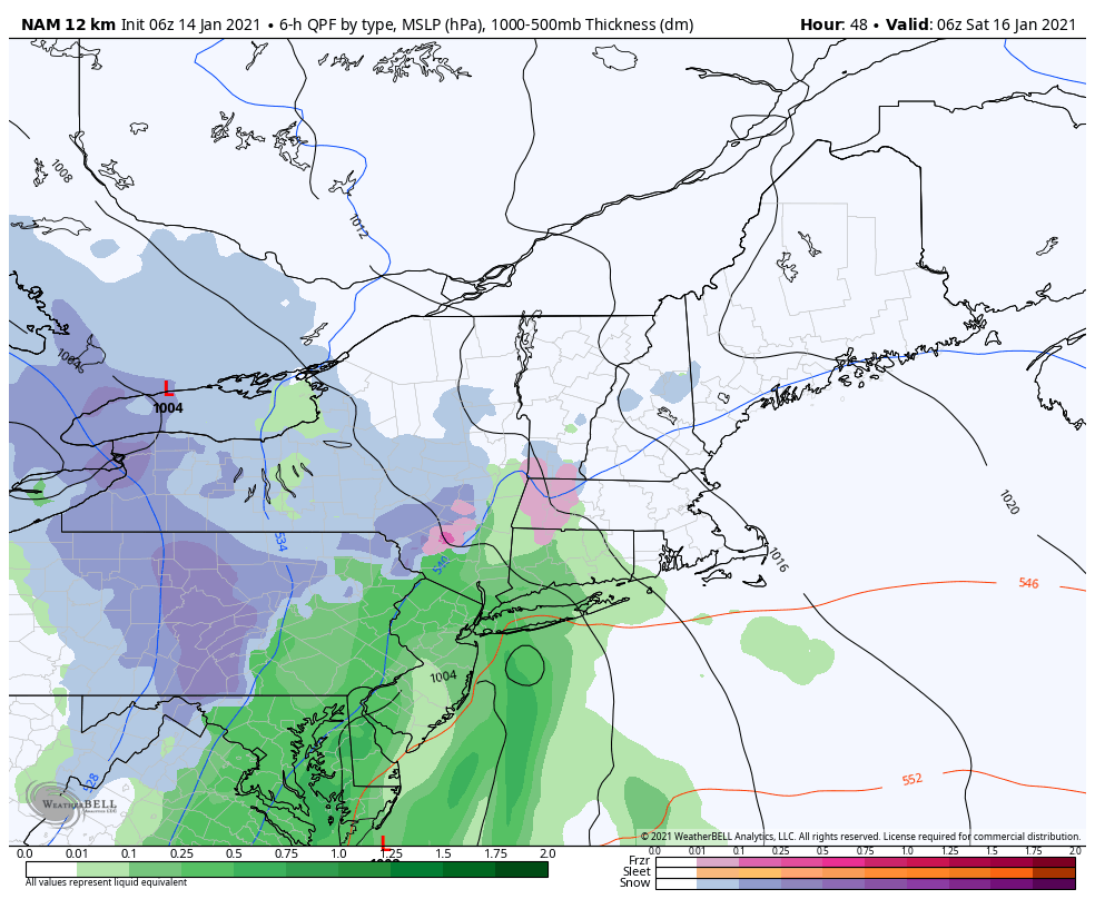 The NAM idea, which traditionally has a warm bias associated with it, shows the threat for the mix of sleet and freezing rain very well. While this appears stark in contrast, the bottom line is that there is only a degree or two difference warmer in the air column which creates this possible scenario. Ultimately, the timing , track, air column temperature, intensification and amount of moisture associated with the storm will dictate the outcome. There is a tropical influence here where the moisture comes in from the south. There is cold from the north which could create the damming effect in areas. As I mentioned here previously, there is the factor of a secondary low forming offshore which would cut off the warm air flow, thus yielding a more frozen type of precipitation. 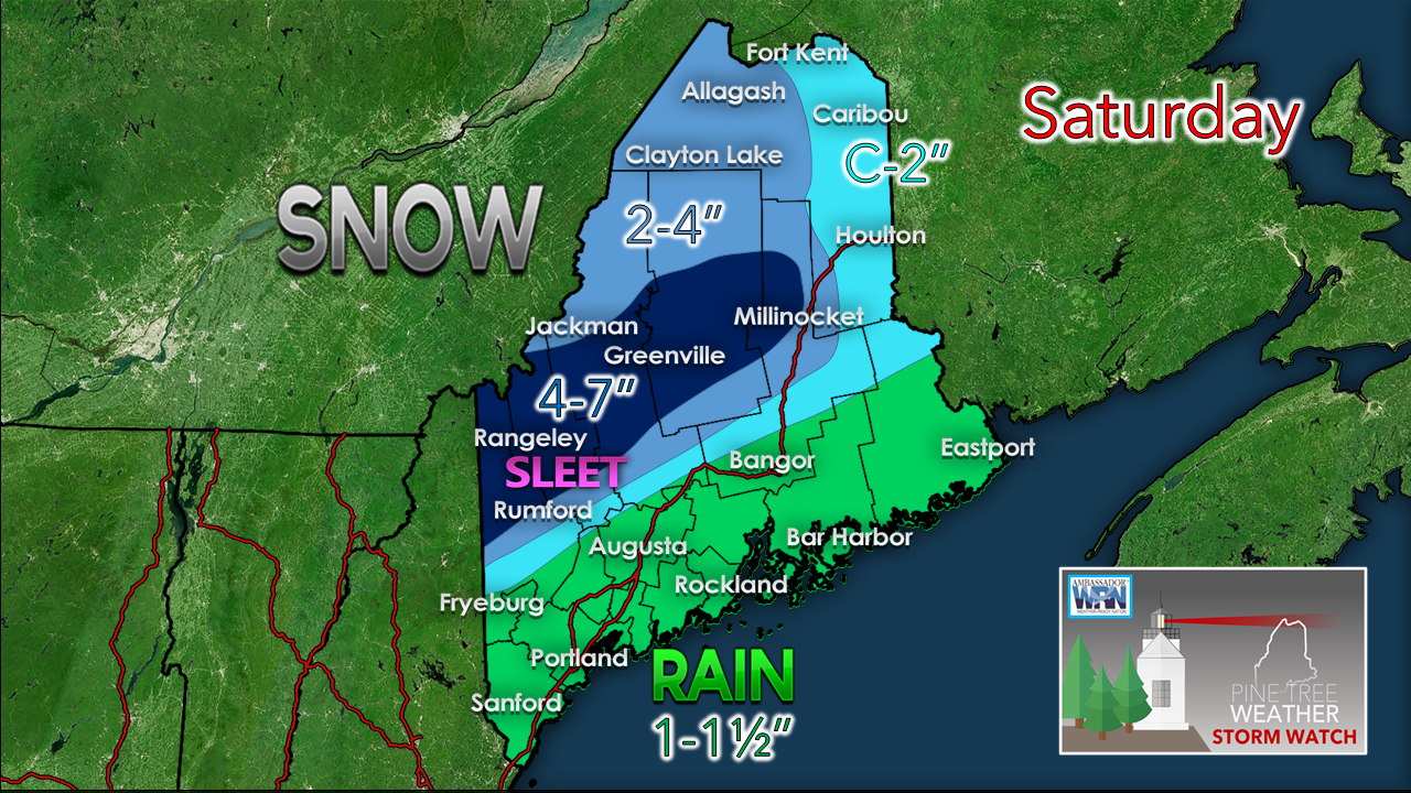 This appears to be a heavy wet snow event for the interior. Snow to water ratios appear to be in the 5-6:1 range, which makes it slushy. If the warmer solution prevails, the higher peaks appear to stay snow with possible sleet mixed in, but under 2000 feet could bring ice if a warm slot comes into play at lower level. The other wrench that could play a factor in the outcome is dry slotting from the rapid intensification. That would cut off the moisture, thus reducing precipitation amounts. Where there is rain in areas where there is snow. there is the threat for some minor flooding from snow melt and run off. An inch of rain is fair bet for the coastal plain. Areas of downpours may bring that total to 1½ to isolated amounts around 2". Expect backside snow as cold air ushers in behind this system. Ski country should be happy with a few bonus inches on Sunday. 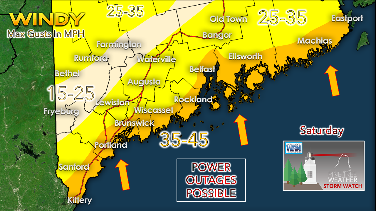 With wet snow sticking to everything where it accumulates, that is the main area of concern for power outages for the interior. Coastal areas could see the wind threat from both horizontal and vertical ranges between the surface low and downpours. Temperature outlook through Wednesday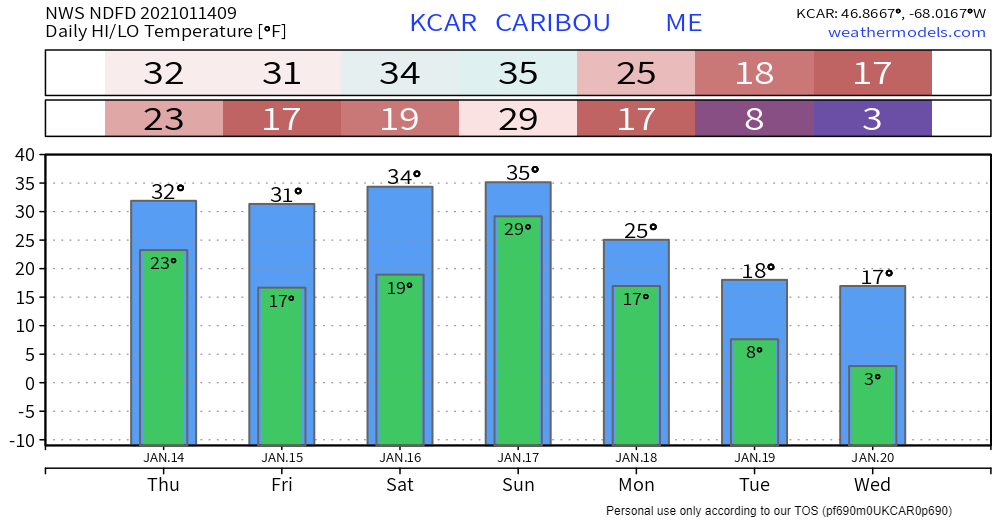 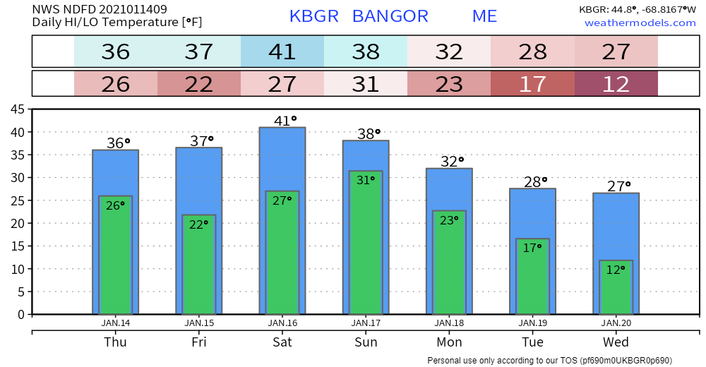 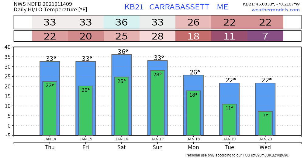 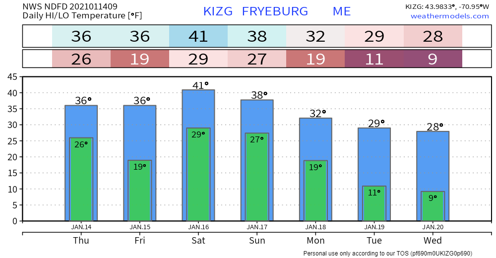 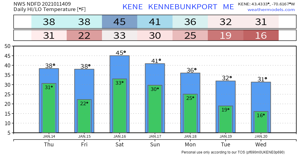 Be prepared to receive alerts and stay updated!
For more information in between posts,
please follow Pine Tree Weather on Facebook and Twitter. Thank you for supporting this community based weather information source operates by financial contributions. Stay updated, stay on alert, and stay safe! - Mike |

Mike Haggett
|