|
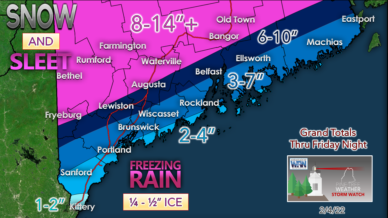
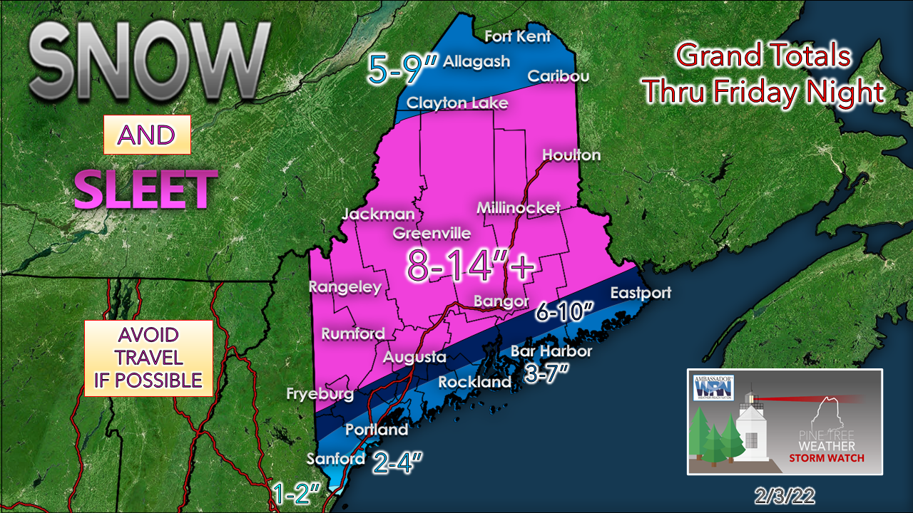
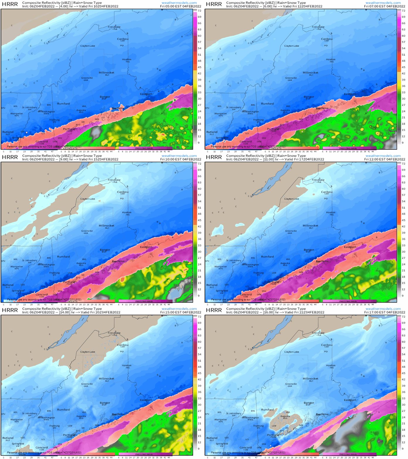
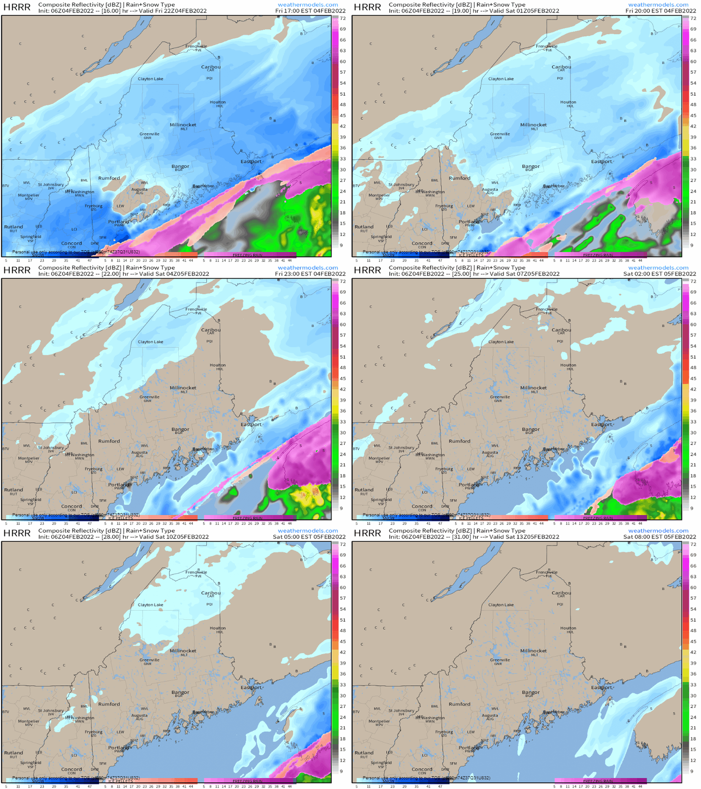
This is a great day to avoid travel, if possible, especially along the coastal plain where sleet, freezing rain and eventually snow will be problematic throughout Friday. If you do travel, make sure you're prepared with a full tank of gas and allow for plenty of extra time. Mixed precipitation events are always a challengeThis has been a tough storm to figure out in many ways and conveying that message to the public has made it even more difficult. When heavy amounts of sleet are potentially involved, models view the warm nose aloft that creates it differently. As I mentioned here on Thursday, there is a razor-sharp gradient cut-off between those who have snow and where the mixed precipitation begins. When this happens, forecast ideas shift often, snowfall ideas bust, and forecasters get ridiculed for it. The bottom line is when there is mixed precipitation, the atmosphere is constipated, and it brings plenty of uncertainty as a result. In the ten years I have been doing this, there is nothing for frustrating than these types of long wave slow movers that have a mind of their own. Closer the coastline, the more the uncertainty increases. While the image above indicates 3-7", 2-4" and 1-2", and may not look bad, there is potential for severe travel impacts. Ice is building up in Kennebunk as I type this at 5 AM where it is 28° and has been raining steadily since I got out of bed at 2:15 AM. One inch of water could equal 3" of sleet. It's miserable to shovel, plow, and drive in. The winter storm warning is there for a reason. A solid snow event for ski country. Feel free to send me a tip of thanks via Venmo. You will have a great weekend to enjoy it, also. You're welcome! Friday 5 AM to 5 PM - Precipitation falls across much of the region most of the day. Weak disturbances riding along the boundary will pulse the frequency of amounts as they pass by. The front gradually moves southeast and mixed precipitation changes to snow. Friday 5 PM to Saturday 8 AM - One more disturbance brings another round of light to moderate snow shower activity as a parting gift before ending over most of the area. A weak cold front bringing in the arctic air for the weekend may bring a few snow showers over the north and the mountains heading into Saturday morning. The sun comes out to start a quiet stretch of weather through the weekend. Please mPING your precipitation type!Check out the mPING (Meteorological Phenomena Identification Near the Ground) project. Weird name, cool app! You can report the type of precipitation you see where you are. No need to measure! Use the free mobile app to send reports anonymously. Reports are automatically recorded into a database, which improves weather computer models. The information is even used by road maintenance operations and the aviation industry to diagnose areas of icing. mping.nssl.noaa.gov #CitizenScience LIVE UPDATES ON TWITTERNext update on the website will be next week. Be prepared to receive alerts and stay updated!
For more information in between posts, please follow Pine Tree Weather on Facebook and Twitter. Thank you for supporting this community-based weather information source which operates by reader supported financial contributions. Thank you as always for your support! - Mike NOTE: The forecast information depicted on this platform is for general information purposes only for the public and is not designed or intended for commercial use. For those seeking pinpoint weather information for business operations should use a private sector source. For information about where to find commercial forecasters to assist your business, please message me and I will be happy to help you. |
Mike Haggett
|

