|
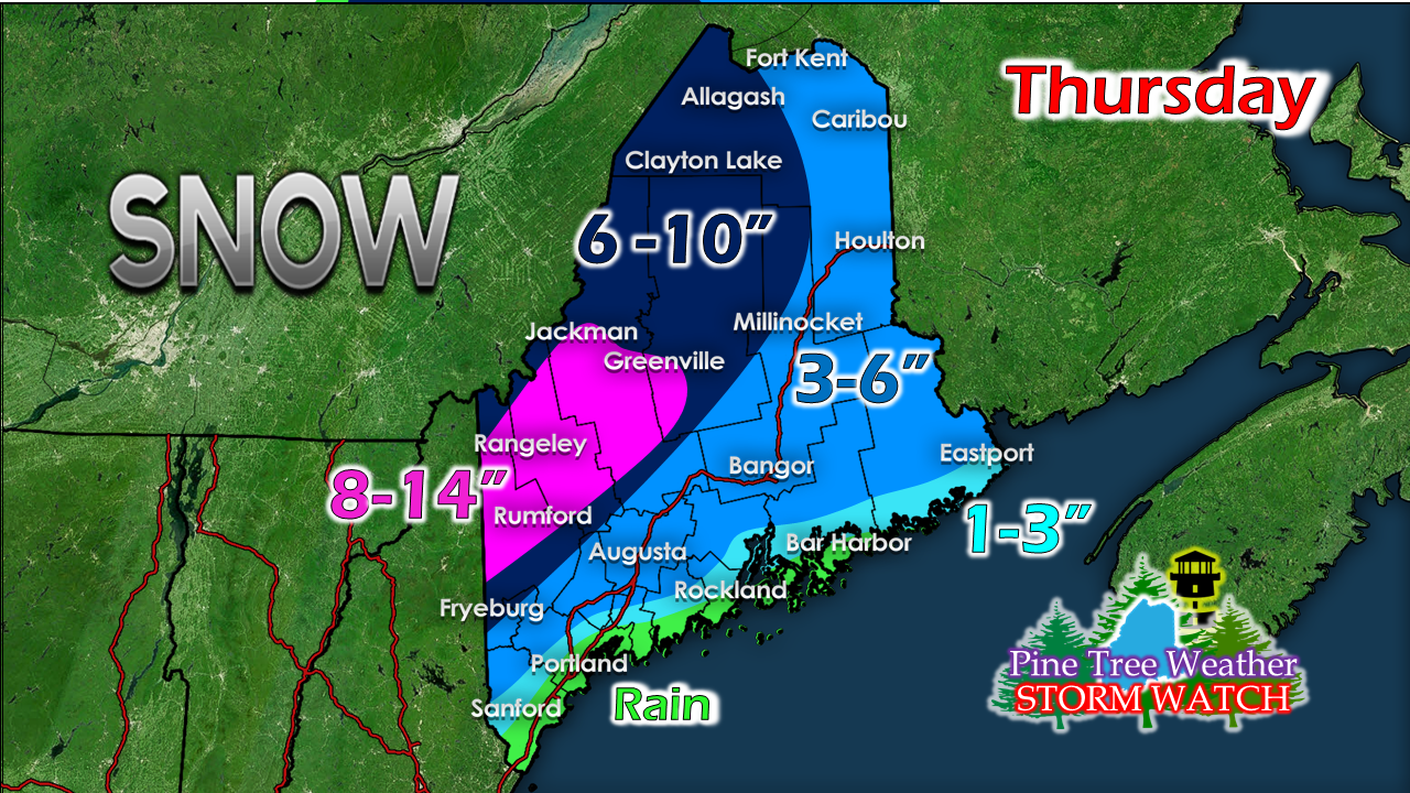
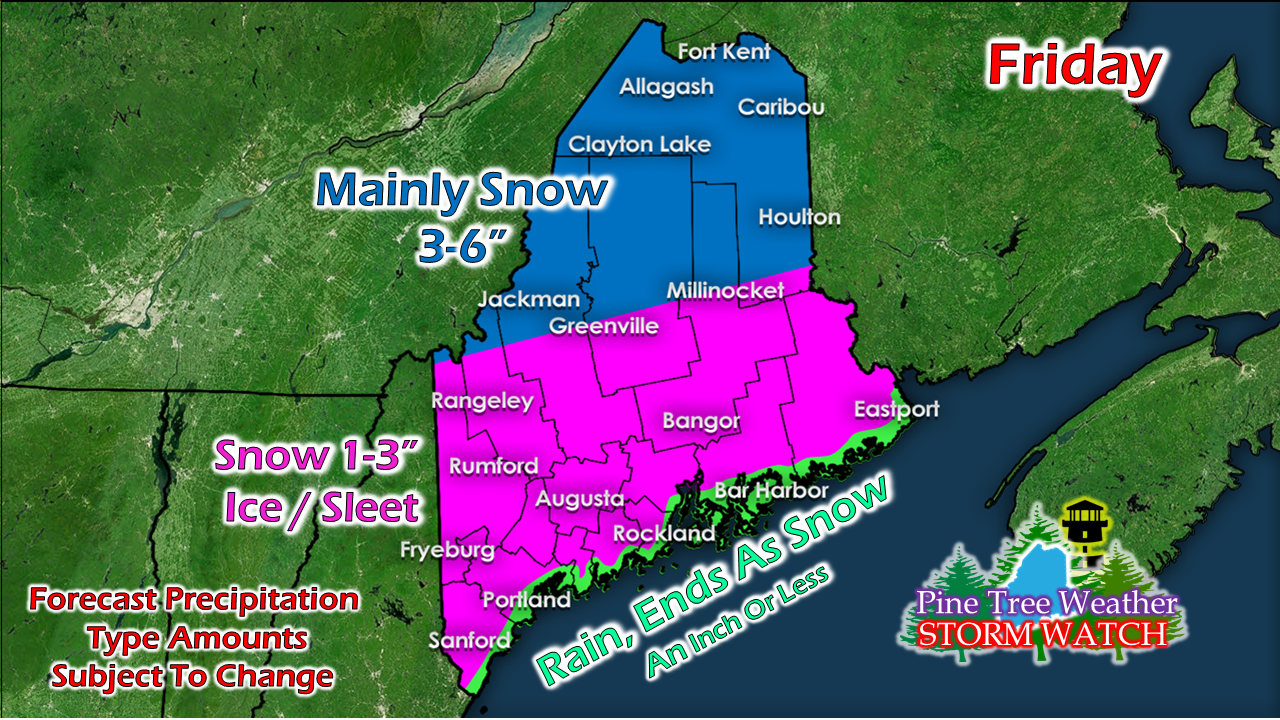
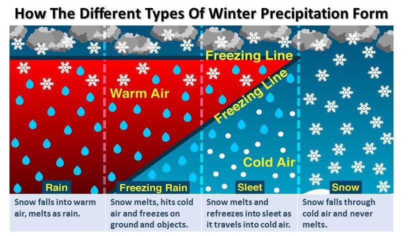
I am having some technical difficulties with the GIF machine so you'll have to bear with me on that. School is demanding quite a bit of my attention, along with family, so I am trying to do the best I can to update you folks as I juggle multiple balls. Thanks for hanging in there with me. Expect travel impacts Thursday & FridayAs I said on Facebook Monday, prepare for possible school and business delays or cancellations Thursday and Friday. Thursday will bring some slick conditions, but it does not appear to be anything that can't be handled on the roads with driving in respect to the conditions. Thursday night into Friday may be a different matter, however. I've adjusted snow amounts a bit given timing and potential track. NOTE that the mixing will begin over southern and western areas Thursday night and will continue to head north Friday morning. There are still some questions as far as how far the warm nose works into interior areas. This is where the mixing is going to take place. Models are in complete agreement on cold air damming, which actually astonishes me. Where they vary is how far inland the mixing goes. I have fair confidence that northern areas are likely to see mainly snow. It's gets dicey around Greenville and Millinocket on how that will play out. The further south appears to be more of a mix scenario, with freezing rain more of a concern for interior parts of the coastal plain. The margin of error along the shorelines from rain to freezing rain could be a scant handful of miles. I've seen some ugly ideas of 21° for a near surface temperature with rain, which that is not a good combination. For now, anywhere between a trace to 0.25" of ice is possible. Expect areas of freezing drizzle Thursday night into Friday morning. Remember, freezing drizzle clings to everything, and will freeze quickly. All in all, it appears to be about 1" of liquid equivalent we are dealing with. How that makes landfall will depend on your region. I will do my best to provide updates on this storm as time permits. Please check the other tabs on this website for other information.
► ► For the latest official forecasts, bulletins and advisories, please check in with the National Weather Service in Gray for western and southern areas, or Caribou for northern and eastern parts of Maine. ► ► Due to a revised budget there is a $125 shortfall for the year ahead! You can help keep Pine Tree Weather going with a donation of ANY amount now through VENMO @PineTreeWeather, a monthly donation on Patreon or messaging me on Facebook or Twitter to send a check in the mail. Thank you for your support! For more information from me, please check the Pine Tree Weather Facebook page as well as my Twitter feed. Always stay weather aware! - Mike |
Mike Haggett
|


