
Synopsis Outlook Through The Week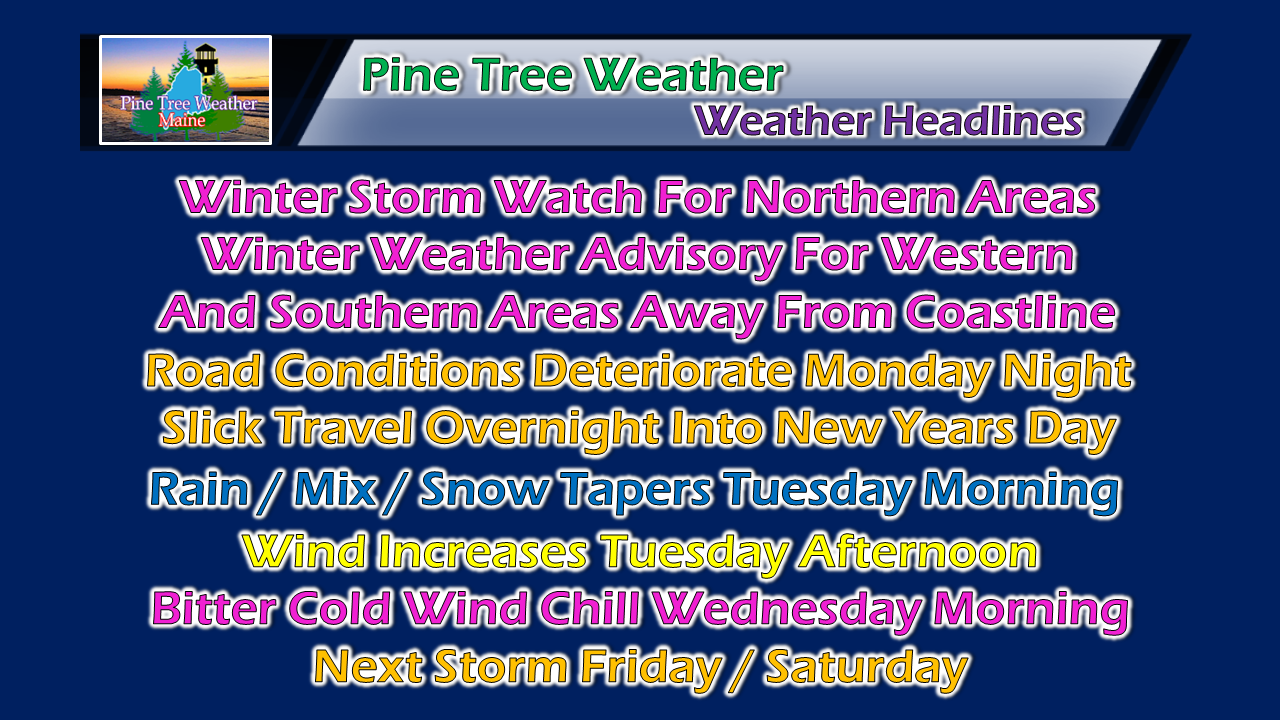 Folks with New Years Eve plans are once again urged to find a safe place for the evening and stay put as driving conditions will deteriorate from southwest to northeast through the evening and into the overnight. Conditions will improve as the storm leaves the region Tuesday morning. A gusty northwest wind increases Tuesday afternoon ushering another round of arctic air for Wednesday. As we have seen over the past few weeks, another storm is on tap to affect the region as we head into next weekend. Timing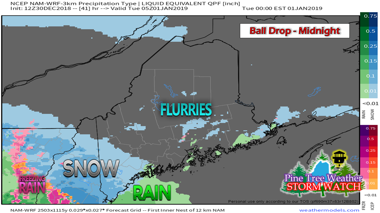 New Years Eve daytime Monday appears to be clear of any measurable precipitation. Once the sun sets, some snow flurries may pop up ahead of the system early Monday night. Shorelines may see a touch of snow to start off, but appear to change to a brief mix then to rain as the evening progresses. Interior western and southern zones will likely see accumulating snow by midnight. 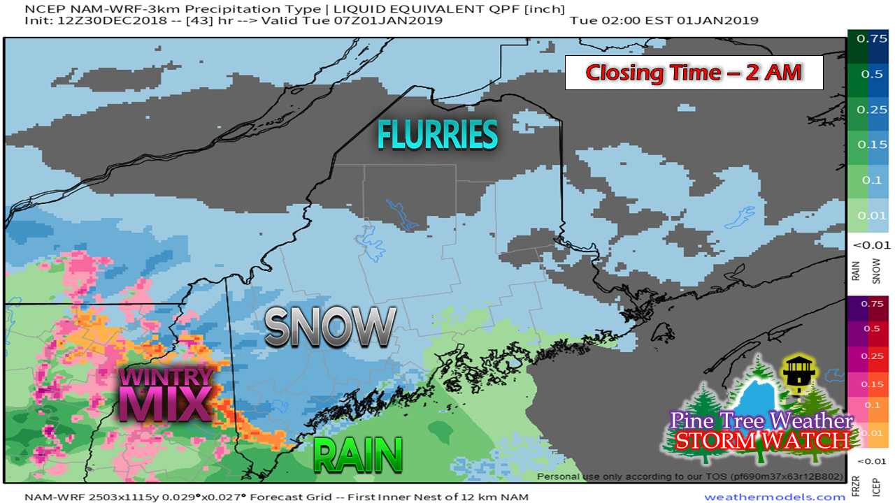 By the time the liquor establishments officially close, much of the state appears to see some form of accumulating precipitation occurring. 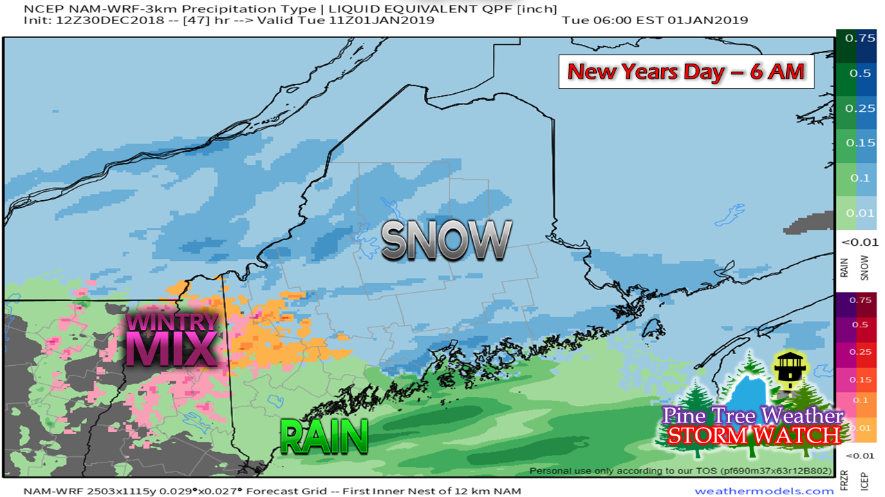 By around daybreak Tuesday, precipitation appears to overspread the entire region. Cold air damming may play a factor in travel conditions in western areas, with freezing rain potential over the Lakes Region / Fryeburg area. 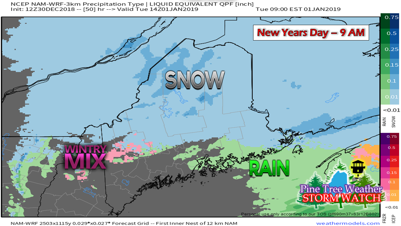 Precipitation appears to end for southern and MidCoast areas by mid-morning Tuesday. 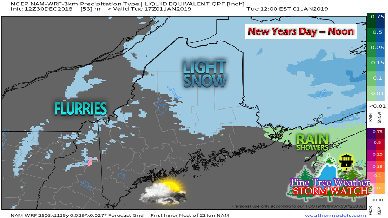 By noon Tuesday, snow showers are likely for the ski hills. Light snow over northern areas appears to taper by mid-afternoon. Snowfall forecast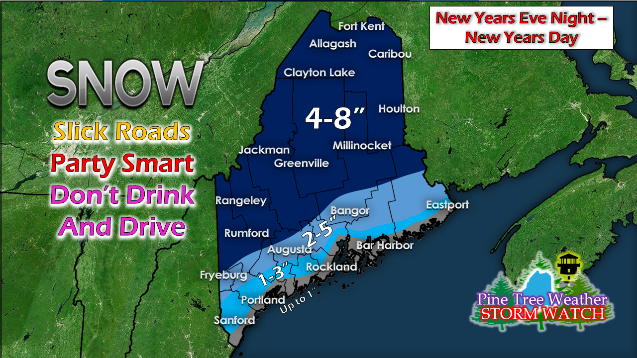 The ski hills and interior areas will pick up a fair amount of this event with 4-8" expected. Amounts drop from the foothills and central highlands to the coast. The breeze returns Monday night through Wednesday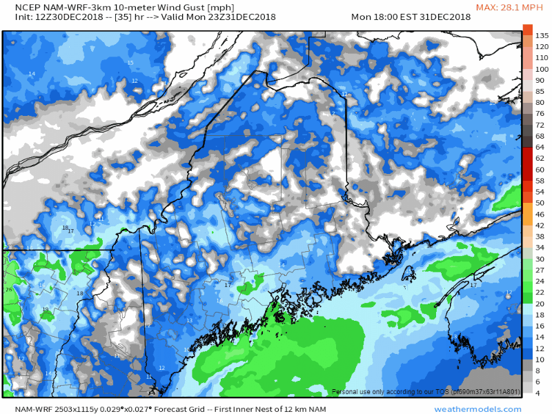 As the storm approaches, wind speeds pick up from the southwest Monday night into early Tuesday. A cold front works through the region Tuesday morning, and the wind shifts to the northwest Tuesday afternoon into the evening. Gusts 25-35 mph are possible (30-40 mph for higher elevations), which may bring spotty power outages over interior areas. 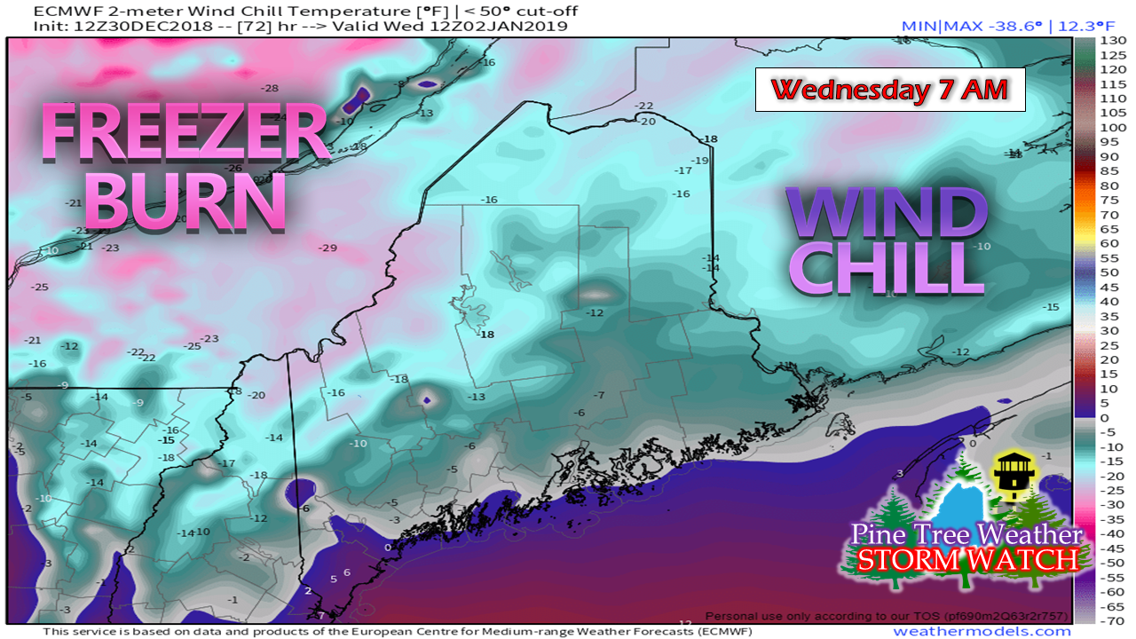 The return to work and school after the holiday break will be a bitter cold one. Be prepared to bundle up as much of the region will be dealing with below zero wind chill values to start Wednesday. The wind appears to drop during the day as high pressure settles in over the state. As the wind settles, the bite in the air will reduce as the day progresses. Outlook through Friday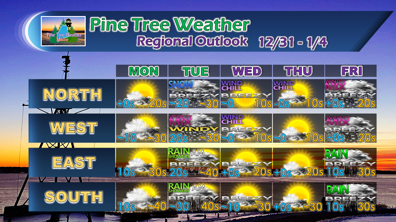 After mild temperatures Tuesday, temperature whiplash returns once again as the arctic high settles in for the middle part of the week. Another storm approaches the region later in the week. Stay tuned for updates on that. For the latest official forecasts, bulletins and advisories, please check in with the National Weather Service in Gray for western and southern areas, or Caribou for northern and eastern parts of Maine. Pine Tree Weather Appreciates Your Support! I am sincerely blessed and humbled by your financial contributions, cards, and messages of encouragement. It's been an amazing journey over the past 7 years, and to see my efforts appreciated by those that follow is a wonderful reward for my work.
My request is for $1 per month / $12.00 per year through my Patreon page or by sending me a message on Facebook or Twitter to mail a check. The popular contribution has been $5 per month / $60 per year on Patreon, and the check donations average out to same amount as well. For those who have already donated, I sincerely thank you. For those who have yet to, I would sincerely appreciate your support in order to be fully funded as soon as possible. For more information from me, please follow the Pine Tree Weather Facebook page and my Twitter feed. Always stay weather aware! Onward to year number 8 in 2019! - Mike |

Mike Haggett
|


