
Snowy to start everywhere So you are looking here for information on the storm, and then you look elsewhere and get a different idea. Maybe you check a third place and see something else. How you process this is that this a complex storm. The closer to the coast, the more complex it gets. Monday is rather straightforward. Tuesday, for interior areas, is straightforward. Tuesday for the coastal plain gets complicated due to the track of the storm and various ideas of how warm air aloft and cold air near the surface is going to play out. This is a two stage event for southwestern areas. Sunday into Monday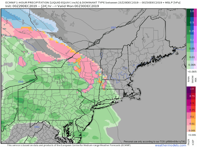 This loop is from 7 PM Sunday into 7 AM Monday. Chances are good that southern York County wakes up with some light accumulation of snow on the ground, which may cause some slick spots for the morning commute. 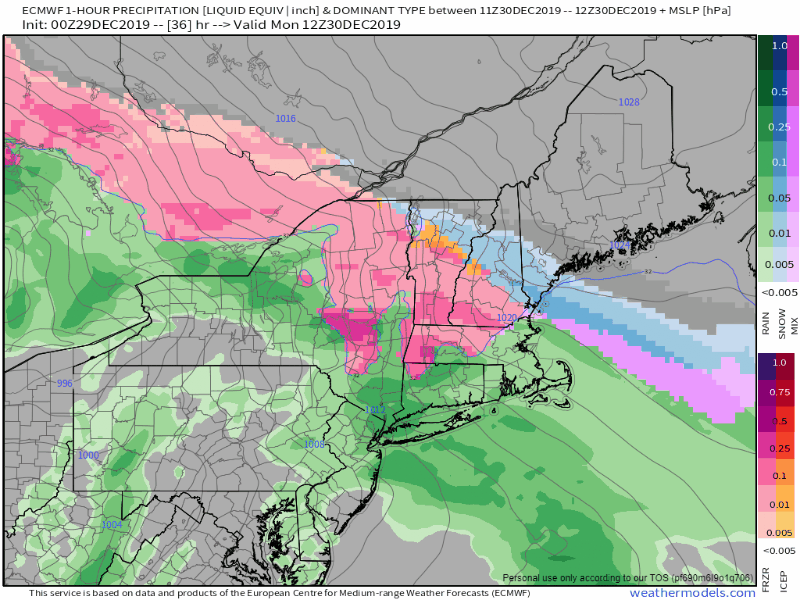 High pressure to the north holds the cards as to how far precipitation works into southern and western areas. With this area of the state on the fringe of the storm, York County has the best chance to see most accumulation during the first leg of the storm. As the precipitation shield noses north and east, this will also expand areas of slick travel concerns along with it. 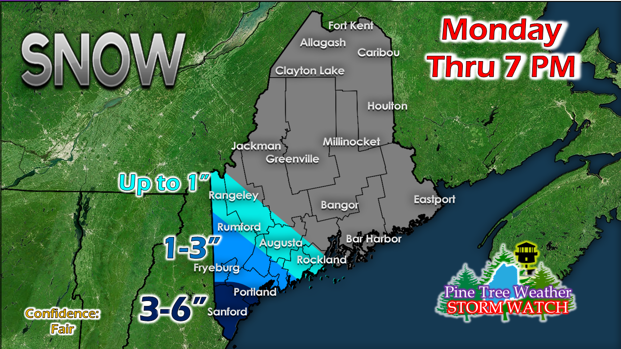 While the chance for mix exists, I think most of that stays out of the southwestern portion of the state until Monday afternoon up to the 7 PM point. It may knock down totals a hair, but 3-6" is a fair bet for York County, with lesser amounts to the north and east. A messy Monday night into Tuesday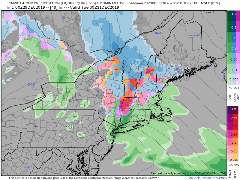 This loop from 7 PM Monday to 7 AM Tuesday shows the coastal storm forming and approaching the Gulf of Maine. A coastal front near the surface and warm air aloft will bring mixing and rain into the picture. Southwest coastal areas can expect sleet and perhaps a period of light ice. Cold air damming will dictate how long the icing will go on. 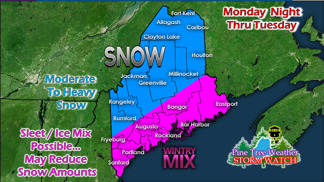 Any deviations in storm track in conjunction with cold air damming will dictate precipitation type. Shoreline areas have the best chance to change to straight rain. How far inland the rain goes depends on storm track. A deviation of a handful of miles makes a difference for places like Fryeburg, Livermore Falls, Waterville on up into northern Washington County. 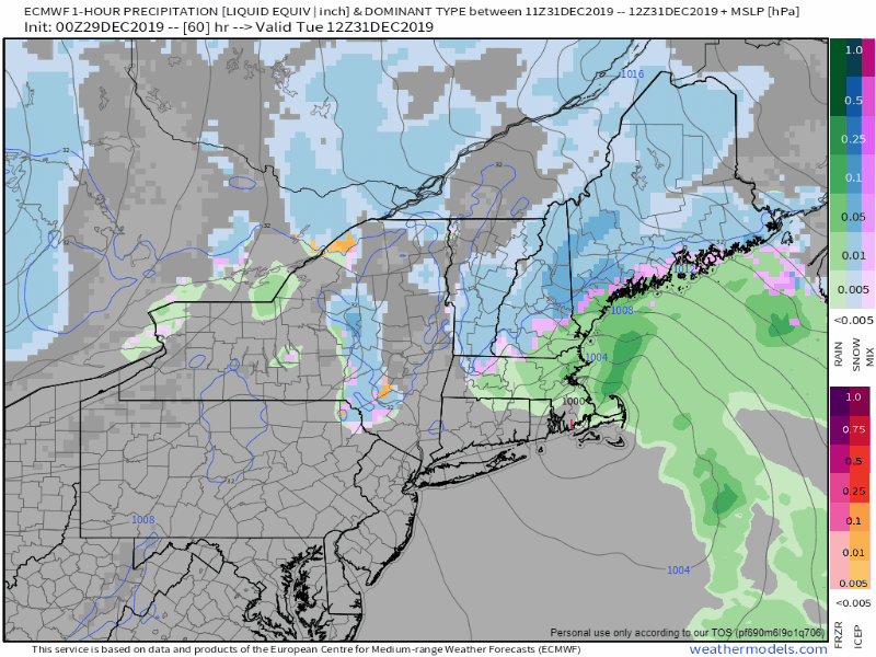 A look here from 7 AM Tuesday to midnight Wednesday shows the storm pulling away. Southwestern areas begin to see precipitation end around early afternoon, eastern areas early Tuesday evening, and it will be early Wednesday before the last of the steadier precipitation ends in The County, Snow showers are likely to persist in the mountains and north New Years Day. 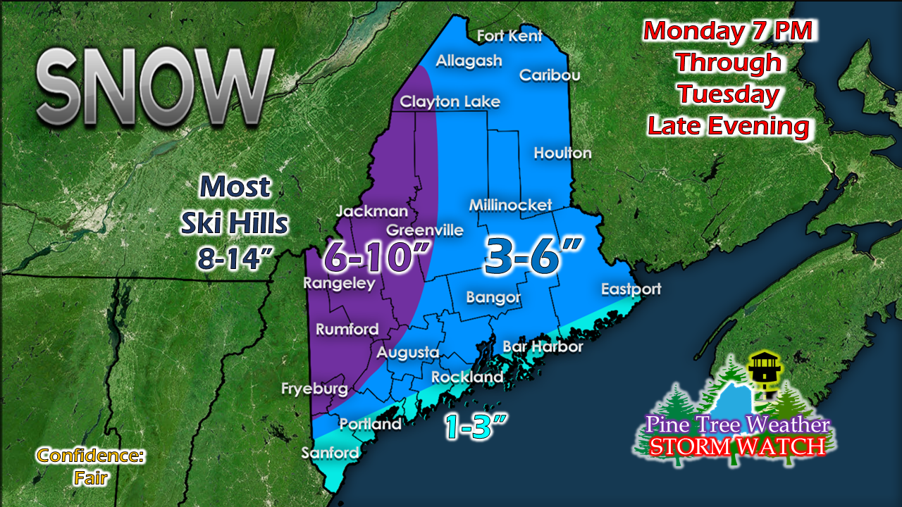 This is a good storm for ski country. If you are headed north to enjoy it, do so either Sunday or Monday. Like in similar storm trend scenario early in the month, there is a mix/rain threat later in the week which may impact snow depth and quality. We'll figure that out as the week unfolds. 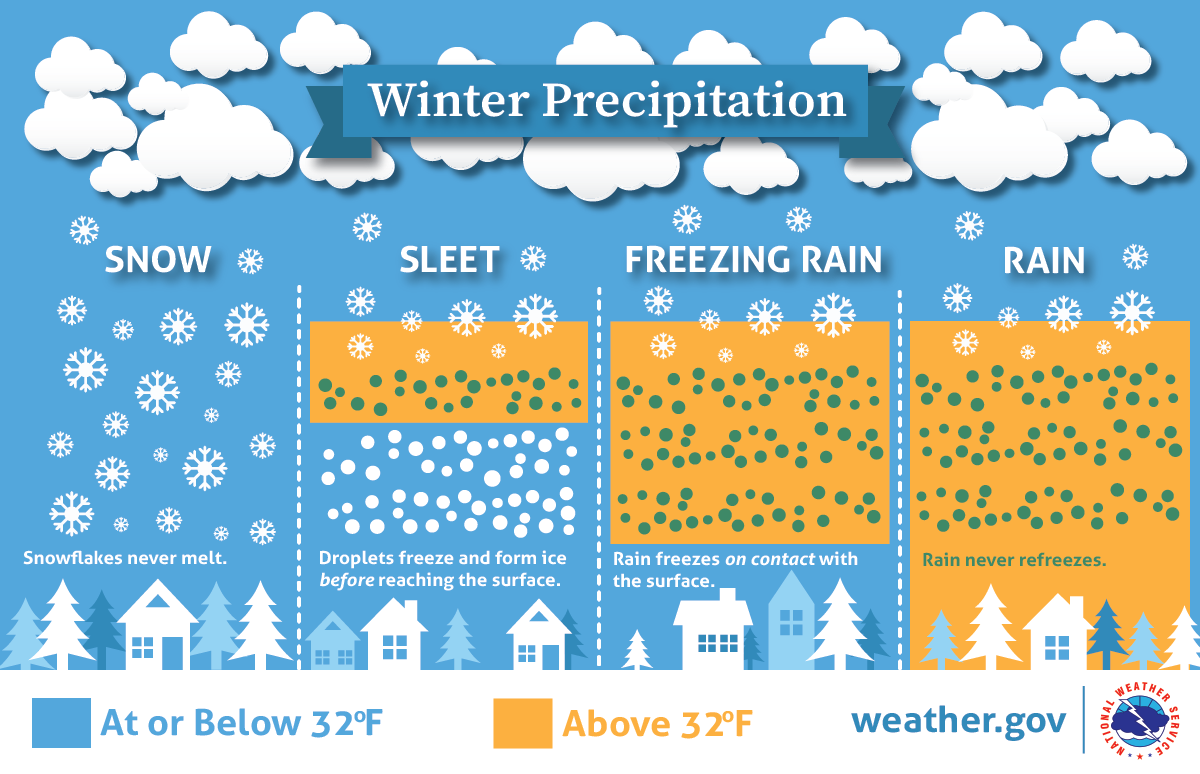 ► ► For the latest official forecasts, bulletins and advisories, please check in with the National Weather Service in Gray for western and southern areas, or Caribou for northern and eastern parts of Maine. Please help me get fully funded in order to continue! ► ► $200 shortfall for the year ahead! You can help keep Pine Tree Weather going with a donation of ANY amount now through VENMO @PineTreeWeather, a monthly donation on Patreon or messaging me on Facebook or Twitter to send a check in the mail. Thank you for your support!
For more information from me, please check the Pine Tree Weather Facebook page as well as my Twitter feed. Always stay weather aware! - Mike |

Mike Haggett
|


