
Heavy precipitation amounts everywhere I've been saying it and I will keep saying it, their is a sharp gradient here on who gets snow and who won't, which means bust potential. Confidence remains good for snow for the mountains and north, but to the south and east of there, it all depends on how low the cold goes in the atmosphere. That will ultimately determine who shovels and who does not. All areas can expect gusty wind. With that comes a chance for power outages. Main threat for higher elevations and coastal areas through mid-afternoon. Regardless if wet snow or heavy rain, travel will take extra time today. In areas of rain, there is potential for fog and hydroplaning. For where there is snow, this will be a sloppy, greasy storm. Quick and impactful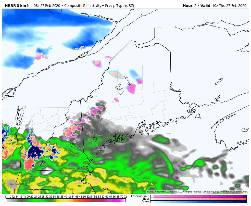 Storm expands to the north Thursday morning. By the time the action gears up in northern areas, it's over for southern areas. Folks in southern parts of the state may see the sun set. Last of the steady flakes end over northern areas around midnight. In between, a solid thump of rain or snow. 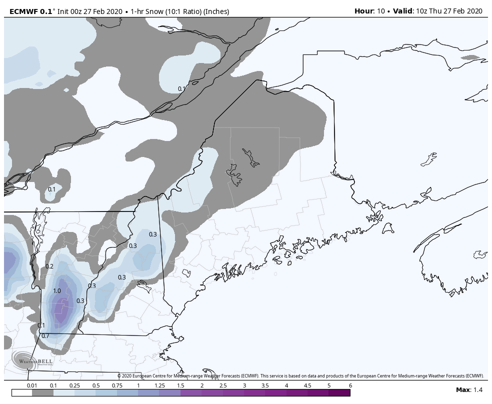 Snowfall rates of 1" per hour over are likely over western areas through early afternoon, and for northern areas through late afternoon. Where there is rain, expect areas of downpours. 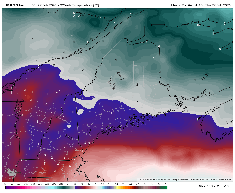 A look at temperatures in Celsius around 2500 feet shows the picture. Temperatures are expected to fall as the storm works through, which cools the atmosphere to support snow over the interior. By the time it cools off everywhere, the bulk of the precipitation will be over. Don't think if your thermometer reads 35° in Rumford or Millinocket that this will be a rain event. Temps at this level need to be warmer than that to get that kind of result. 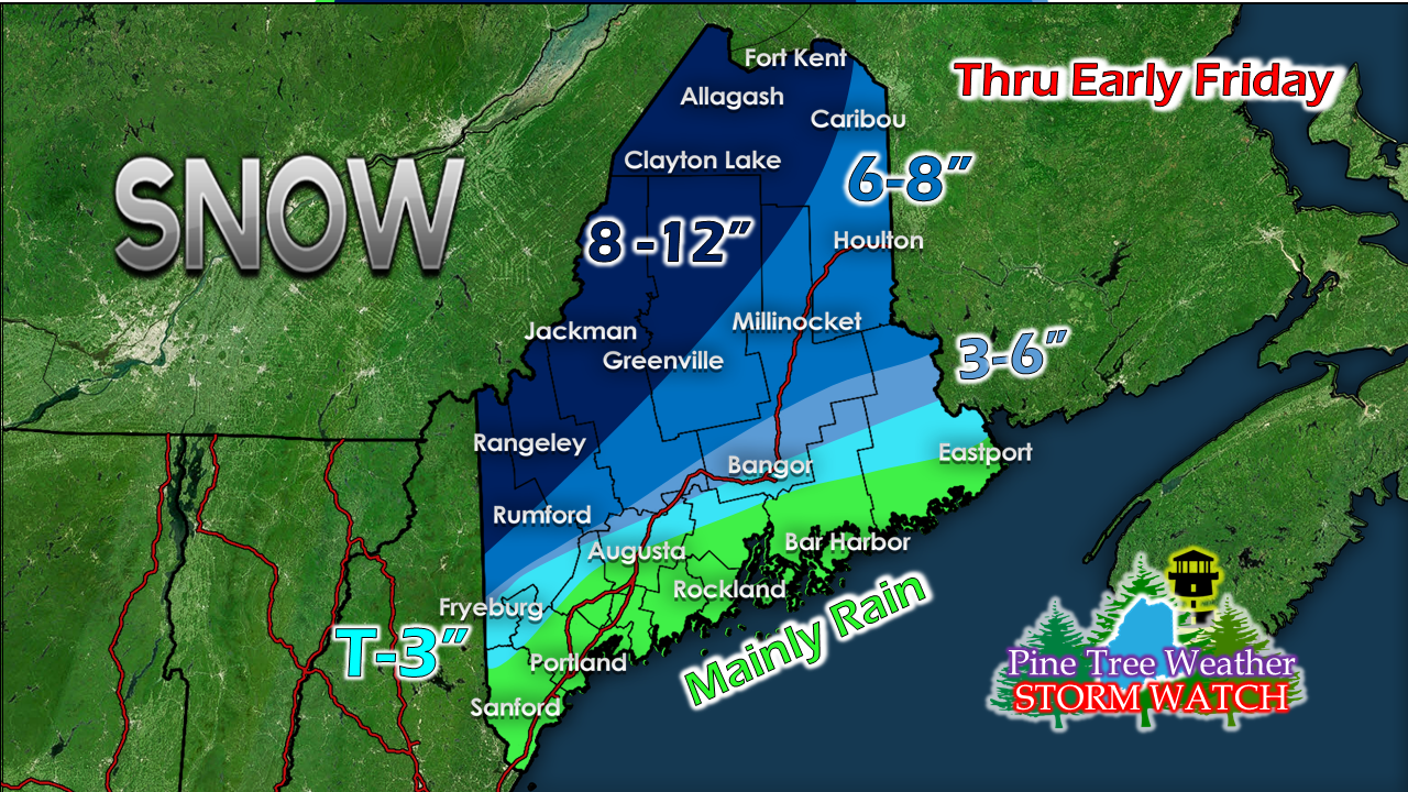 A bit of an adjustment to the snowfall map. The idea for the interior has been rather consistent. South and east of there, it's a bit of a crapshoot pending on how the temps in the low levels of the atmosphere end up.
Many coastal areas will pick up 1" of rain or more from this. Expect urban street flooding, runoff from melted snow, and minor flooding from it. Stay on alert and stay safe today. ► ► For the latest official forecasts, bulletins and advisories, please check in with the National Weather Service in Gray for western and southern areas, or Caribou for northern and eastern parts of Maine. You can help keep Pine Tree Weather going into the future with a donation of ANY amount now through VENMO @PineTreeWeather, a monthly donation on Patreon or messaging me on Facebook or Twitter to send a check in the mail. Thank you for your support! Always stay weather aware! - Mike |

Mike Haggett
|


