
A nasty day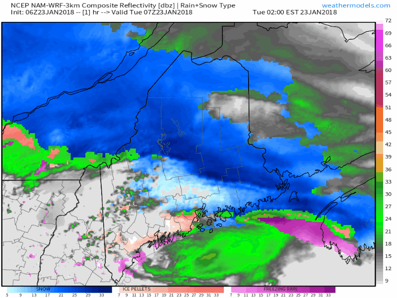 All four food groups from the precipitation buffet line are on tap for the state for Tuesday. Winter storm warnings are posted for the Crown, winter weather advisories are on tap for rest of the state. Wind advisories are posted for Knox, coastal Waldo, coastal Hancock and coastal Washington counties. Precipitation type will be all dependent upon what goes on in the atmosphere, along with temperature at the surface. Heavier precipitation arrives this afternoon. Most areas are likely to change to plain rain, with the possible exception of the tip of Aroostook. Most areas are expected to see freezing rain / drizzle, with some sleet mixed in. Areas of both freezing fog and mild fog are possible. This is a complicated and complex forecast. Heavy snow for northern areas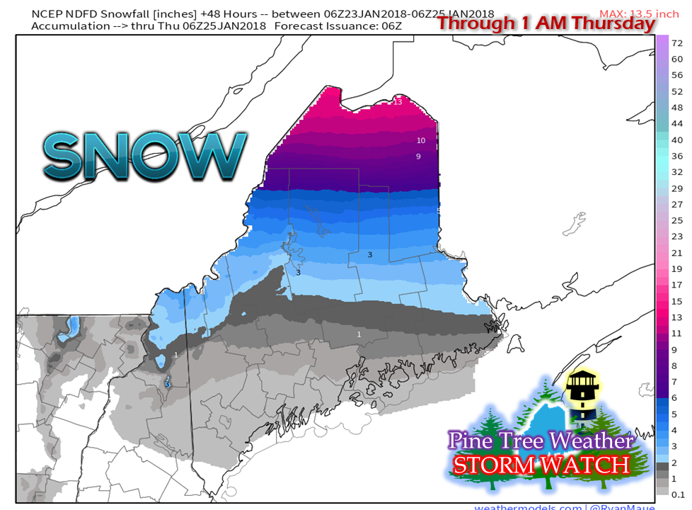 National Weather Service estimates of snowfall for the region through early Thursday show Aroostook County get crowned, literally, with as much as a foot of snow or more along the international border. This total also includes backside snow showers with the arrival of a cold front early Wednesday, which brings snow to the western mountains through the morning. Ice on tap for most of the state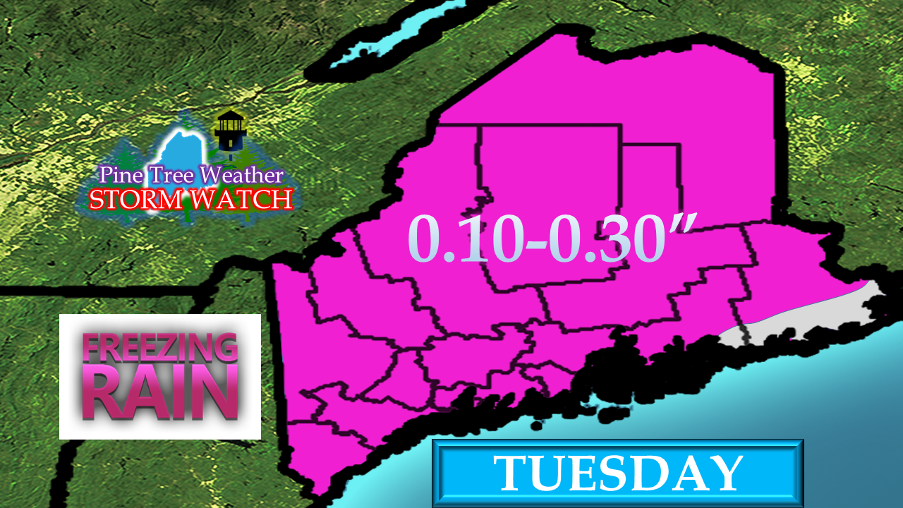 With the possible exception of DownEast coastal areas, all areas of the state will get ice accretion from freezing rain. The most accretion is likely to come from freezing drizzle and fog ahead of the heavier rain moving in through the morning into the afternoon. A windy afternoon for much of the coast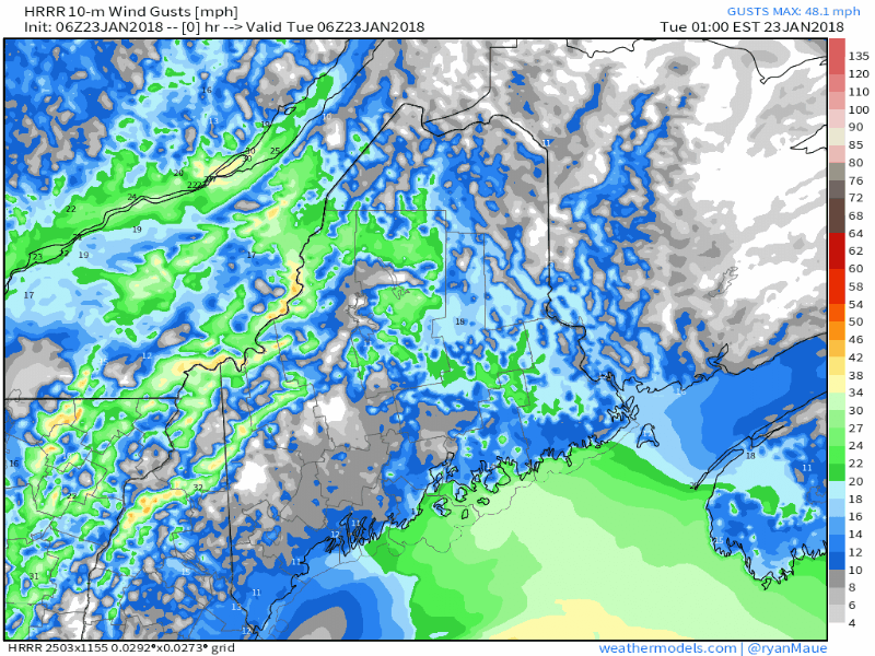 As the warm air gains the upper hand, wind will come along with it. Southerly winds gusting in the 40-50 mph range are possible, with the stronger gusts for the Penobscot Bay region eastward to into the Bay of Fundy. By the time the wind arrives, warmer temperatures arrive and will melt off any ice. Spotty power outages are possible, but I do not expect any widespread issues. Flood potential from ice jams a real concern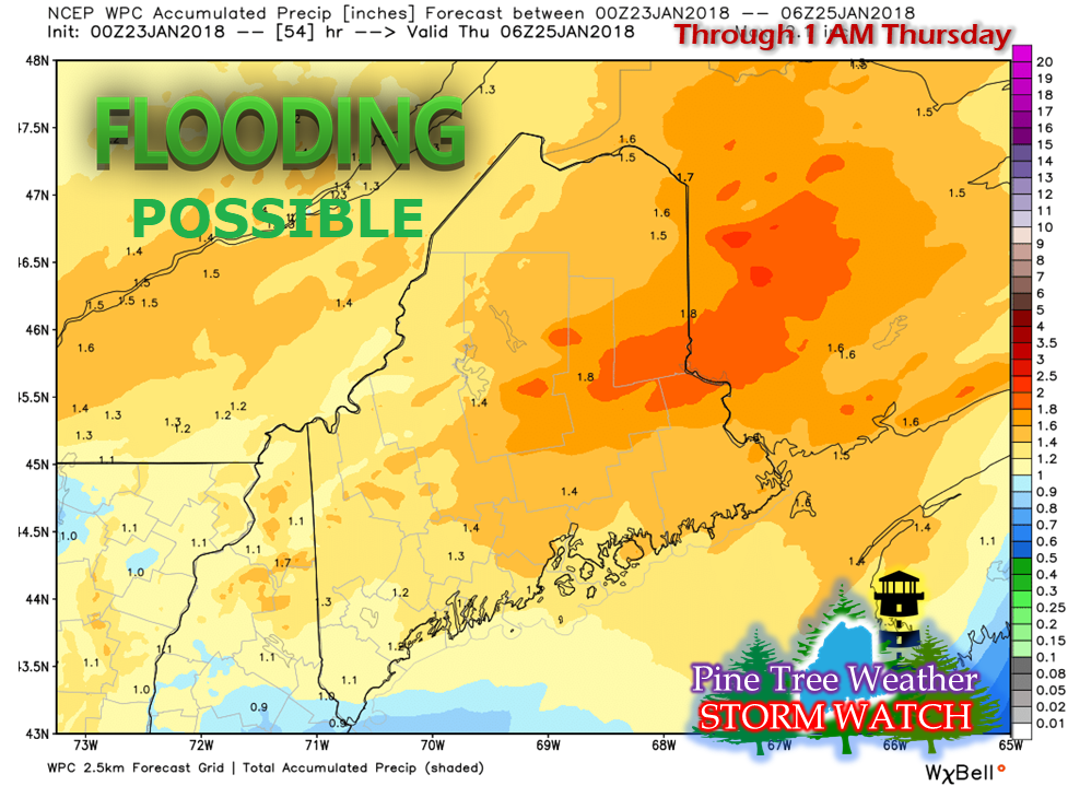 Estimates from the Weather Prediction Center indicate a 1-2" total precipitation outlook for this storm. Ice jams already in place from last week's warm up could see more another ice jam build up on what already exists. Eastern Maine is especially concerning for this event given the higher precipitation and warmer temperatures. Urban street flooding, hydroplaning on highways and byways are likely with the heavier showers in the afternoon into the evening. Temperature roller coaster ride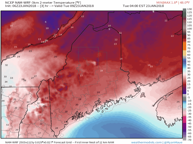 Models have captured the idea of cold air damming very well over southwestern areas. That said, it may hang on a bit longer than what is suggested. High temperatures for Wednesday are likely to be set around midnight. As the cold front passes through the area in the morning, temperatures crash to the teens for most areas by Wednesday evening. This will freeze up any liquid that is around, and could cause patchy ice to form where it pools up.
For those traveling, allow for plenty of extra time and drive carefully. - Mike |

Mike Haggett
|


