|
Two low pressure systems, approaching from the west and south, will interact over Maine on Wednesday resulting in a corridor of enhanced precipitation that will bring a mixed bag of wintry precipitation to the state. Up to a foot of snow in the north and a quarter of an inch of ice farther south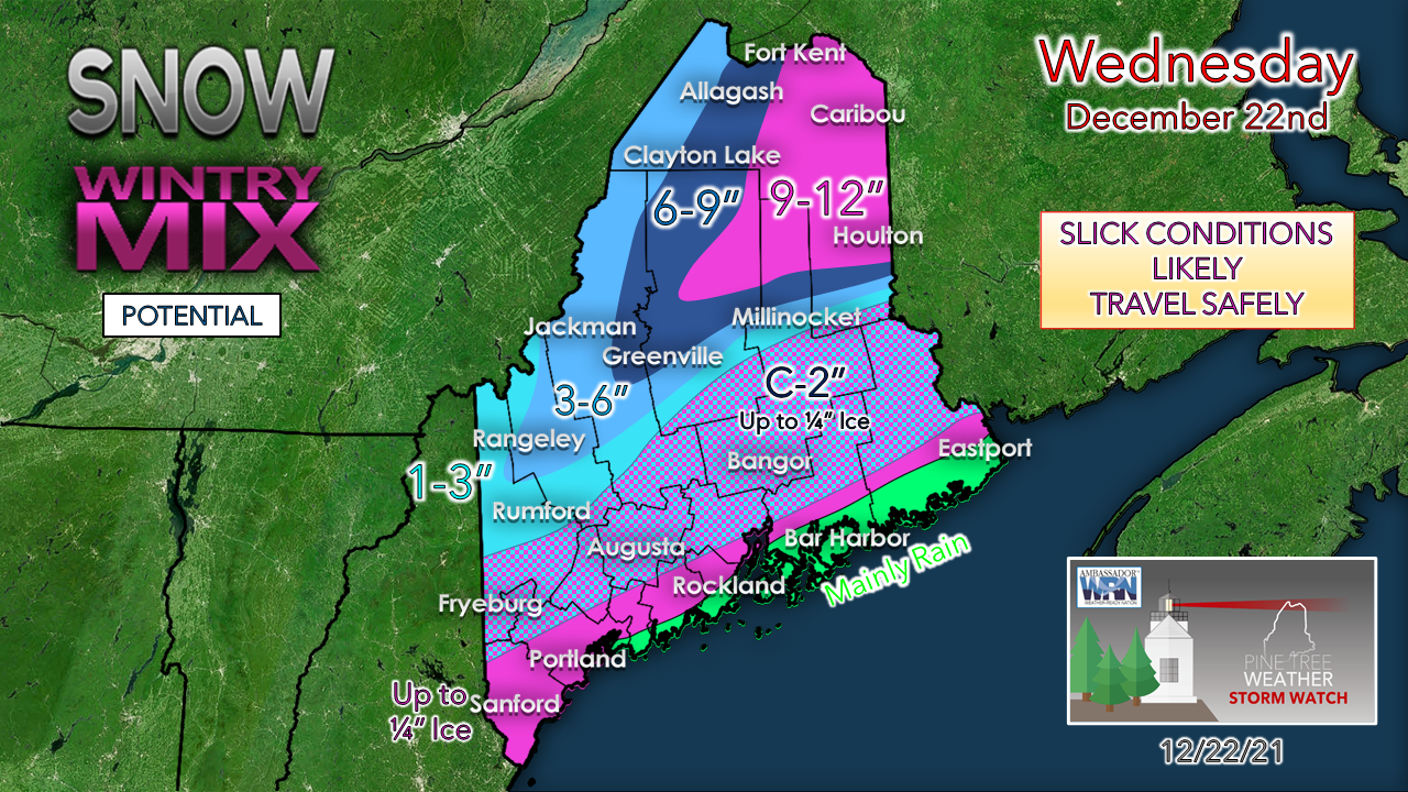 Towards the north, precipitation is likely to be primarily snow, with some of the heaviest snow occurring in the northeast region of the state. Conditions may be a bit blustery with some blowing snow possible. Most areas are likely to see accumulations under a foot, but a few localized areas may see snow over 12”. Some sleet may mix in especially later in the day which could hinder accumulations. Farther south, precipitation is likely to be a bit messier with a mix of snow, sleet, and freezing rain. The rain/snow line is likely to be just east of the mountains as a result of stubborn cold air damming. Precipitation should begin as snow right along the base of the western mountains before transitioning to sleet later. Just inland, precipitation is likely to start as sleet/freezing rain. This should result in some ice accumulation of up to 0.25" so be sure to watch out for some slippery spots if travelling. Primarily rain looks to be in store for the Downeast region as sufficiently warm air is transported over the area, although a few isolated spots of ice cannot be ruled out. Snow to liquid ratios are forecast to be somewhat high towards the north resulting in a fluffy and powdery snow. The farther south you are the less fluffy and the more wet the snow will be, eventually becoming slushy just inland of the coast. Wintry precipitation arrives early and departs this evening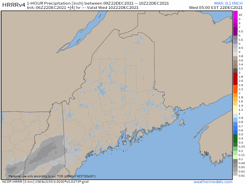 Precipitation is already ongoing in the southwest part of the state and will continue to spread across the state by noon with snowy conditions in the north and a wintry mix farther south. Precipitation begins to clear out mid-afternoon beginning in the west before eventually leaving the state by evening. Temperatures should reach the low 20’s in the north and the low 30’s in the southwest. The Downeast region should be a bit warmer, possibly getting to 40, especially closer to the coast. Frigid wind chills behind the low on Thursday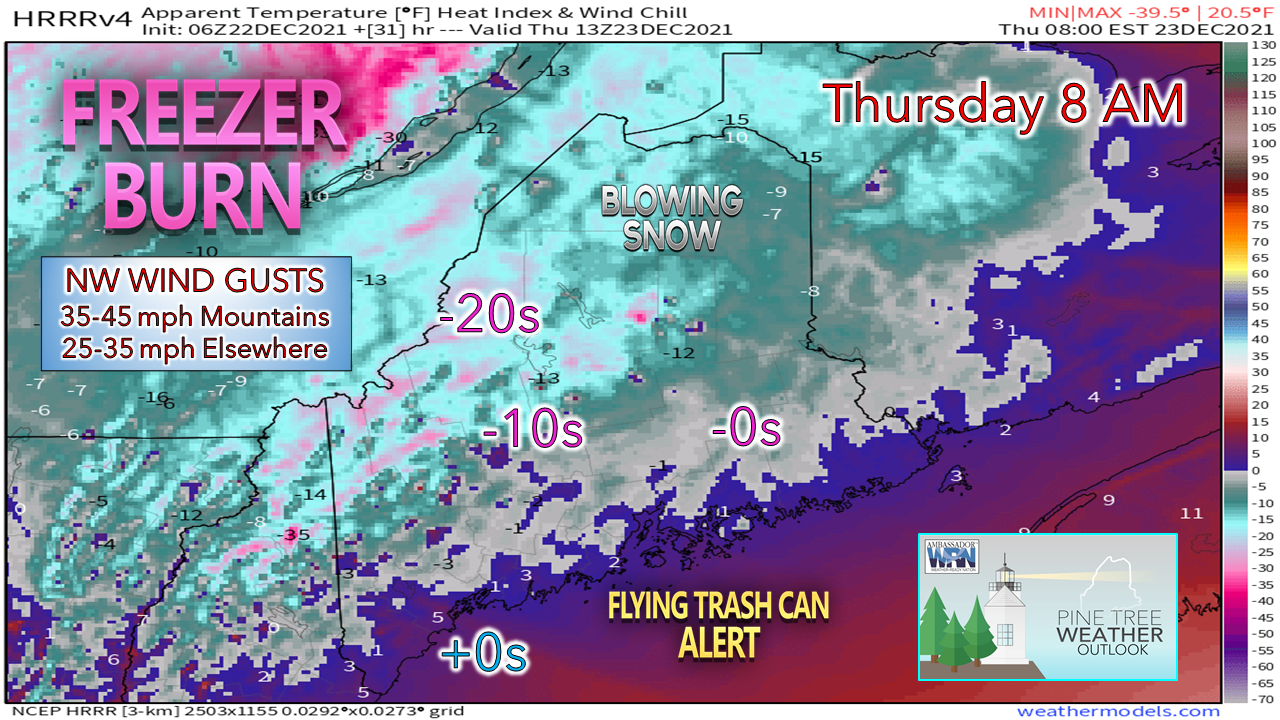 A windy, frigid day is on tap for Thursday with wind chill values well below zero for the mountains and north and single digits above zero south. Wind gusts in the 25-35 mph range are likely to tip over a few trash cans in urban areas and cause blowing and drifting snow over the north. Be sure to stay bundled up and use caution when driving.  Temperature outlook through Christmas and early next weekHigh pressure settles in on Thursday night, the wind slacks off and temperatures plummet with the far north starting Christmas Eve below zero with a blue bird sky on tap for the day. Christmas Day, Sunday and Monday brings a chance for snow showers for southwestern areas as waves pass through. 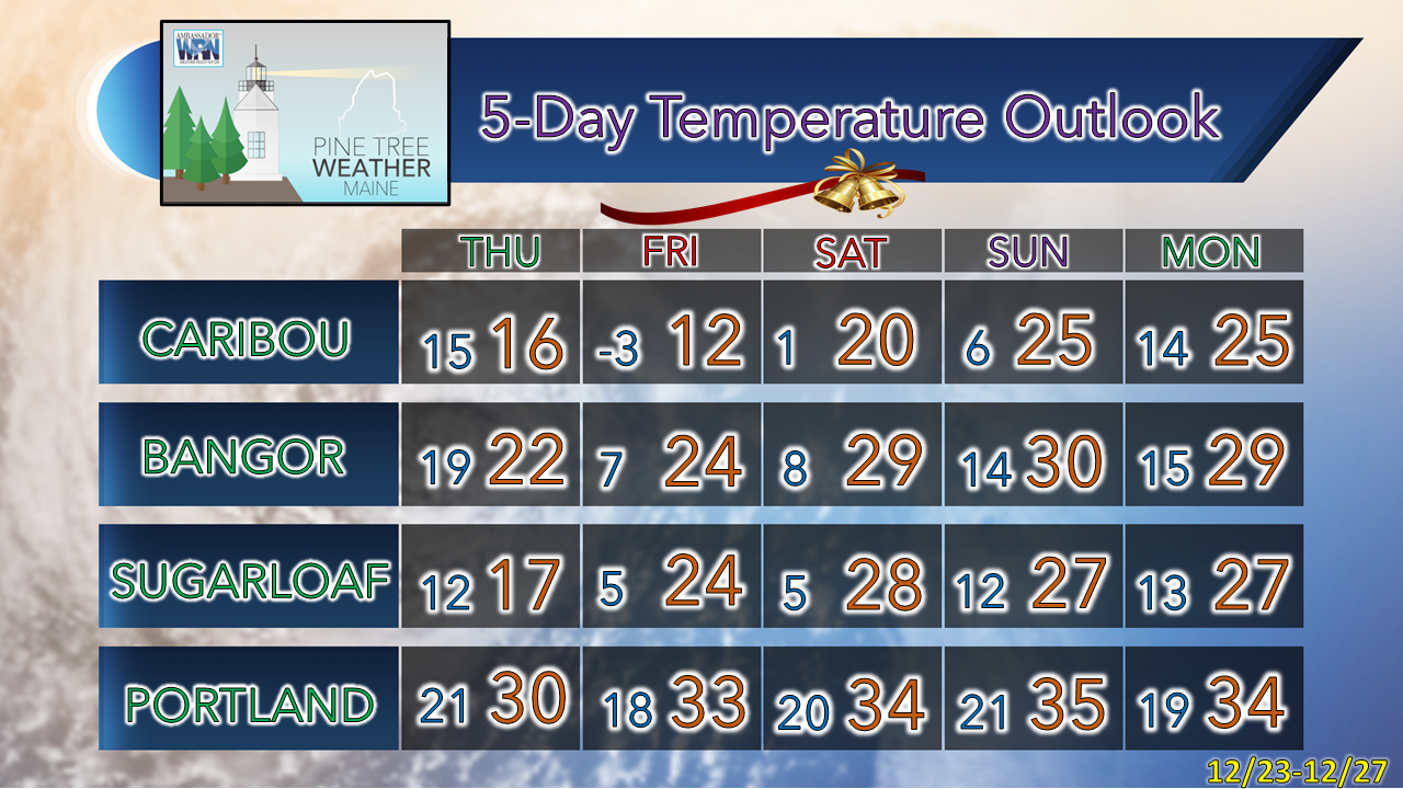 Freezing rain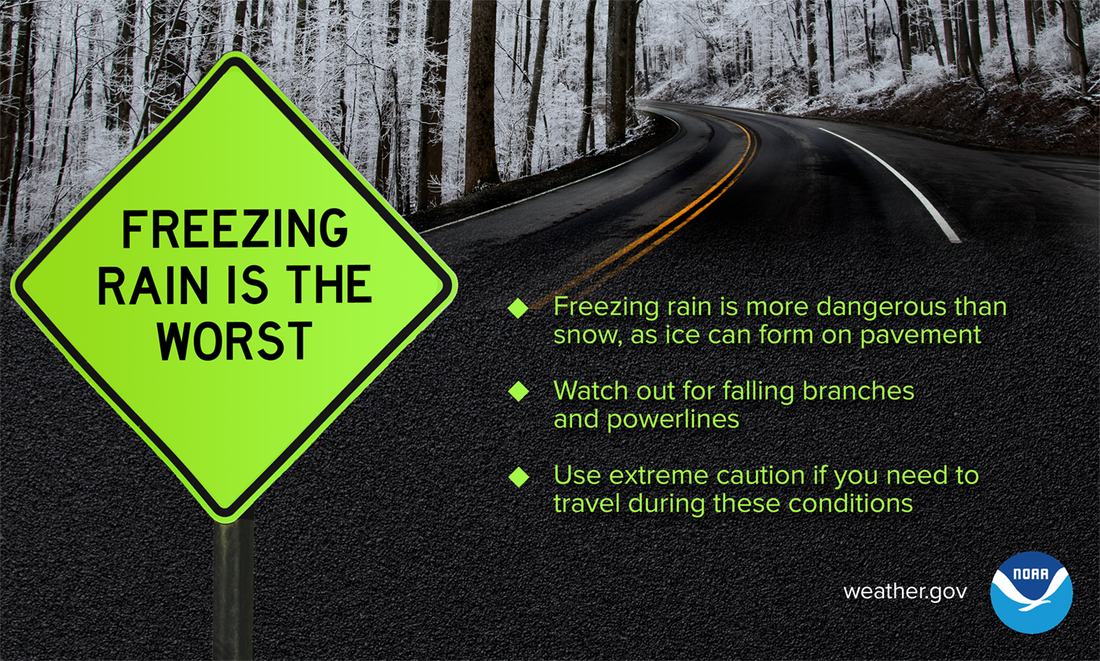 Compared to a typical snowstorm, freezing rain is much more hazardous — especially on the road. While both are dangerous, it’s far easier to lose control of your vehicle on icy pavement, not to mention the increased risk of falling branches and powerlines. Bottom line: use extreme caution if there is, or recently was, freezing rain. weather.gov/safety/winter Be prepared to receive alerts and stay updated!
 For more information in between posts, please follow Pine Tree Weather on Facebook and Twitter. Thank you for supporting this community-based weather information source which operates by reader supported financial contributions.
|

Mike Haggett
|