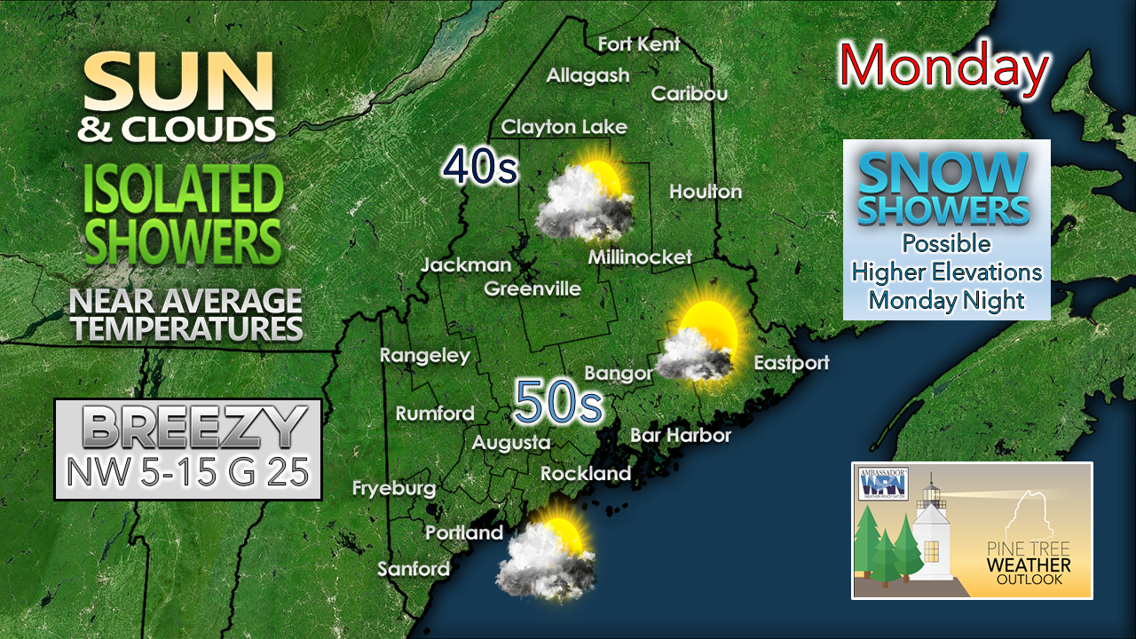
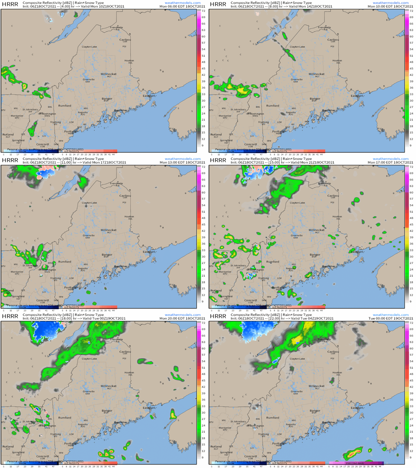
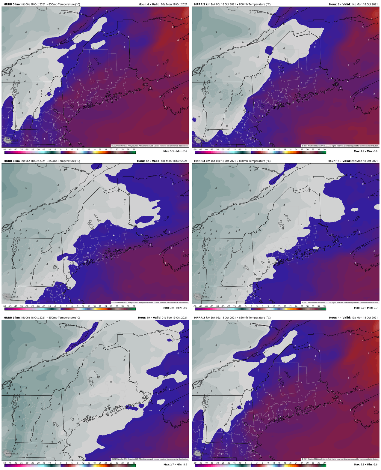
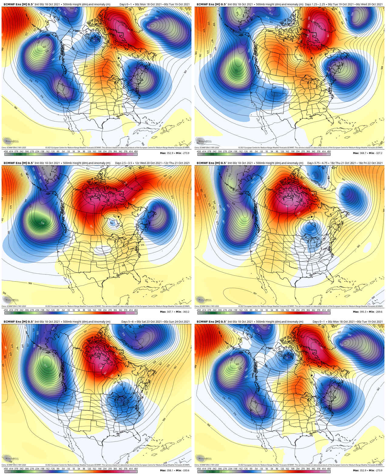
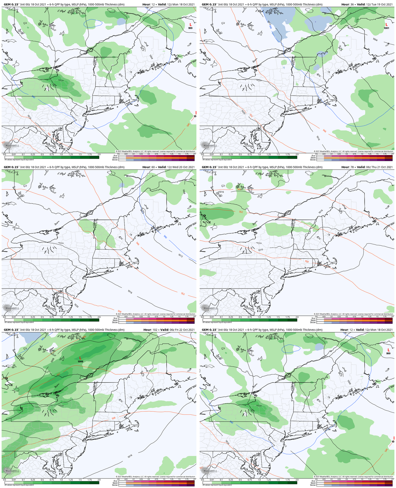
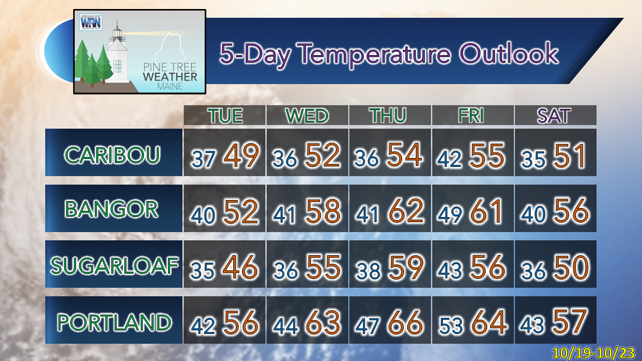
Upper-low to keep the sky unsettledWeak disturbances are pinwheeling around an upper-low over the region and will continue to do so through Tuesday. As a result, varying amounts of clouds will be the key sky feature, along with a risk of an isolated rain shower during the day, with snow showers possible for the mountains Monday night into Tuesday with light accumulation. Monday 6 AM - Tuesday Midnight: Best chance for light shower activity appears for northern and southwestern regions through the day and into the evening. Eastern areas appear to stay mainly dry and have the best chance for sun. Monday 6 AM - Tuesday Midnight: Looking at forecast temperatures for the 850mb (~5000 ft) level shows cold air falling below freezing aloft during the day Monday into Monday night. With the energy of the upper-low around, this sets up potential for snow showers for the higher peaks in New Hampshire, the western mountains on up into Baxter State Park and the Allagash overnight into Tuesday. Outlook for the weekMonday to Sunday: Blocking over northern Canada appears to control the upper air pattern through the week. The steering of the strong ridge keeps the eastern parts of the hemisphere unsettled to start and end the week. Monday 8 AM - Friday 8 PM: The upper-low over the region which starts the week moves to the northeast on Tuesday. High pressure moves in on Wednesday, then slides east early Thursday. Low pressure moves into the Great Lakes and bring the risk for showers over the mountains and north Thursday into Friday, the cold front associated with the surface low passes through the region by Friday night and brings a breezy start to the weekend. Temperature outlook through SaturdayThe overall trend through the week is for slightly above normal temperatures and below average precipitation through Sunday. Be prepared to receive alerts and stay updated!
For more information in between posts, please follow Pine Tree Weather on Facebook and Twitter.
Thank you for supporting this community-based weather information source which operates by reader supported financial contributions. Stay updated, stay on alert, and stay safe! - Mike |
Mike Haggett
|

