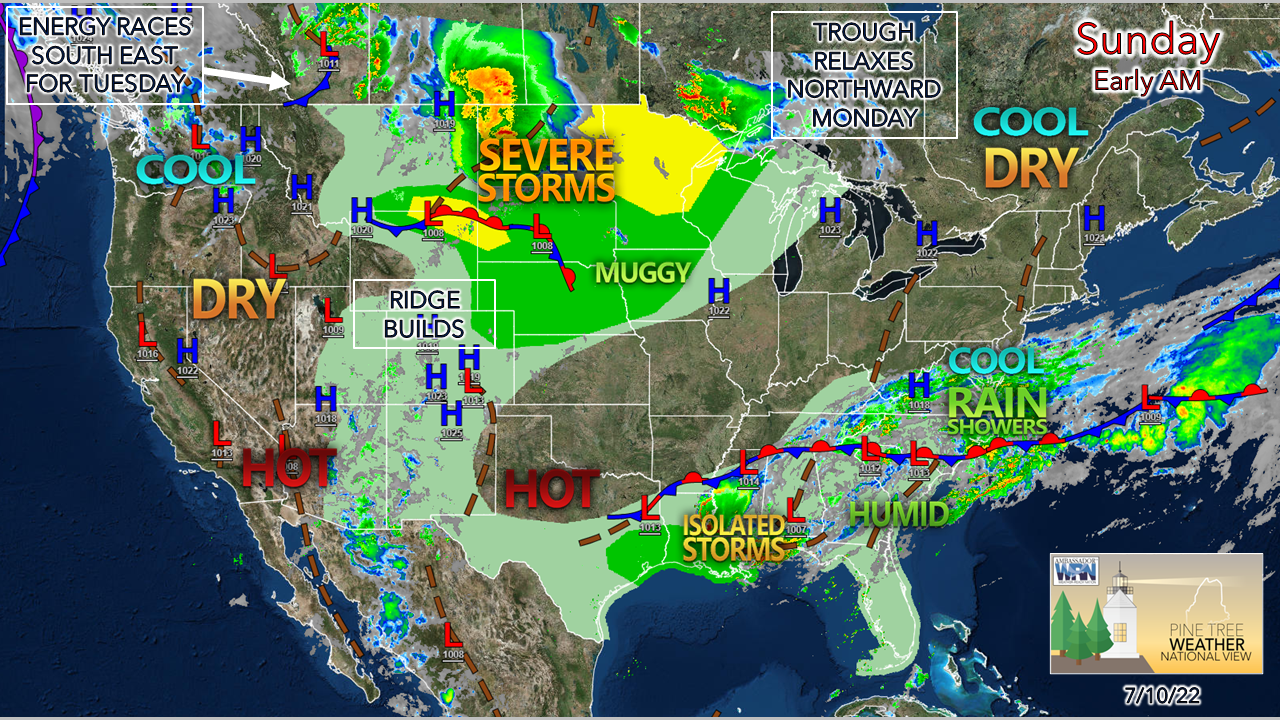
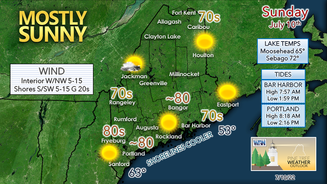
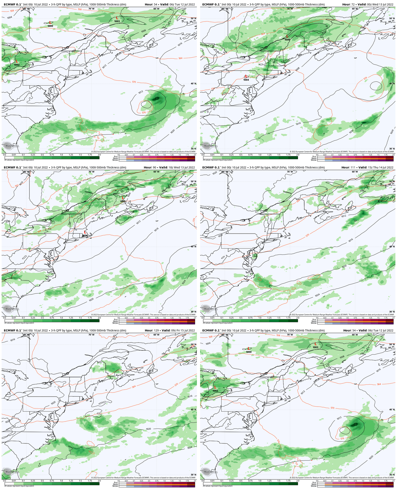
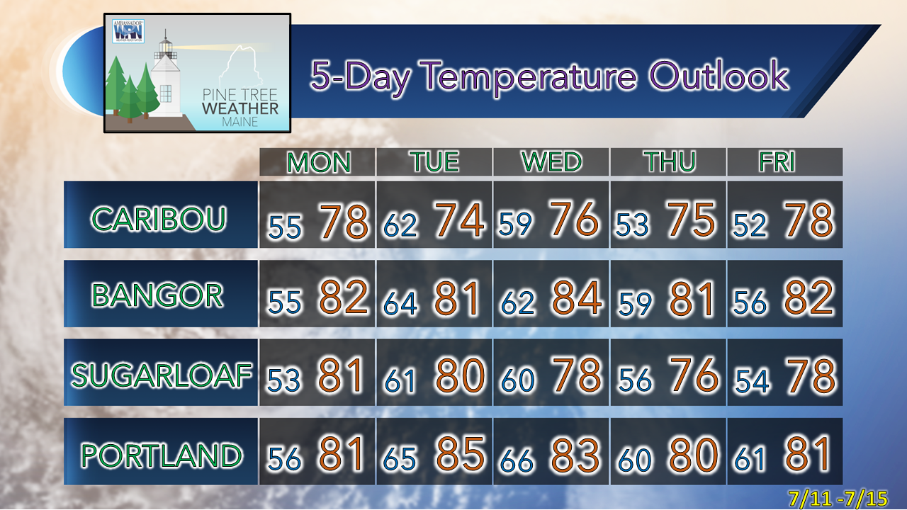
Pattern to become unsettled, warmer, and muggierFor what has been a summer that has seen little in the way of heat and humidity, that trend is about to change. It appears to be short-lived, however, with Tuesday and Wednesday the warmer and on the sticky side, with dew points falling heading into the latter part of the week. While it is shaping up to be a bit uncomfortable, it does not appear oppressive. While the cooling systems see a bit a workout for a couple days, this touch of summer won't impact the electric bills that much. For those escaping to the mountains and north to camp out this week, you should be prepared. With showers and thunderstorms in the forecast, it is wise that you stay updated on any potential threats for severe weather, wind, and localized flash flooding. Pick your location with that in mind. While your mission may be to unplug, at the very least have a NOAA weather radio with you that you can check in with and get alerts from, especially in areas where cell phone service is limited. A perfect SundayI am a fan of contemporary jazz music, which I give credit to my late sister-in-law who played an endless stream of it at her art gallery. One artist I found in my exploration of the genre is Carol Albert. She composed this song "Perfect Sunday" on her most recent release, and it came to mind while I put the forecast together. Sunday, like Saturday, will be tough to beat weather wise. Tides are timed perfectly for the ocean beaches, albeit a bit cool as the sea breeze picks up around midday. A few high clouds stream in later in the day as warm air moves in aloft. Monday sees an uptick in temperatures with humidity levels remaining comfortable. It will be breezier as the southwest flow cranks up, keeping the shorelines east of Portland cooler. Showers and storms possible Tuesday through FridayTuesday 2 AM to Friday 8 PM - The upper-level trough that has kept the heat and humidity away relaxes northward which allows for temperatures to rise and dew points to creep up. The trough hangs around over northern Quebec. Upper-level energy rides in between the cooler trough and the warmer ridge, which puts Maine in the crosshairs. With the difference in temperatures to the north and south and a cold front which tries to force itself in, the result are chances for showers and storms. The front appears to become quasi-stationary through Tuesday night and into Wednesday, keeping showers and storms in the forecast, then works through the region Wednesday night. Dew points begin to drop Thursday for most areas, with the southwest coast possibly being the exception at the onset. The front may stall just offshore and as an upper-level disturbance rides along that, keeps shower and storm potential through the day. Friday may end up being dry for most, but it's a bit early to get in on specifics there. Shower and storm potential favors the north and mountains throughout the period, but widely scattered showers and storms are possible for the coastal plain. Any drought relief is likely to be localized as best from downpours. With the rise of humidity, the threat of strong to severe storms is there Tuesday and Wednesday. Temperature outlook through FridayThe normal high and low temperature for Caribou for July 10th is 77° and 56°. For Portland, 79° and 61°. Forecast temperatures are expected to be slightly above normal for most areas except for the north through the end of the week. Thank you for supporting this community-based weather information source which operates by financial contributions from people like you. Stay updated, stay on alert, and stay safe! - Mike NOTE: The forecast information depicted on this platform is for general information purposes only for the public and is not designed or intended for commercial use. For those seeking pinpoint weather information for business operations, you should use a private sector source. For information about where to find commercial forecasters to assist your business, please message me and I will be happy to help you. |
Mike Haggett
|


