A nasty 8-10 hour event Loop from 10 AM Tuesday to 8 PM Wednesday It'll be mainly dry to start off Tuesday, but that appears to change as an aggressive cold front works through the region Tuesday afternoon into the evening. While this is a quick hitter, it will bring a punch along with it. 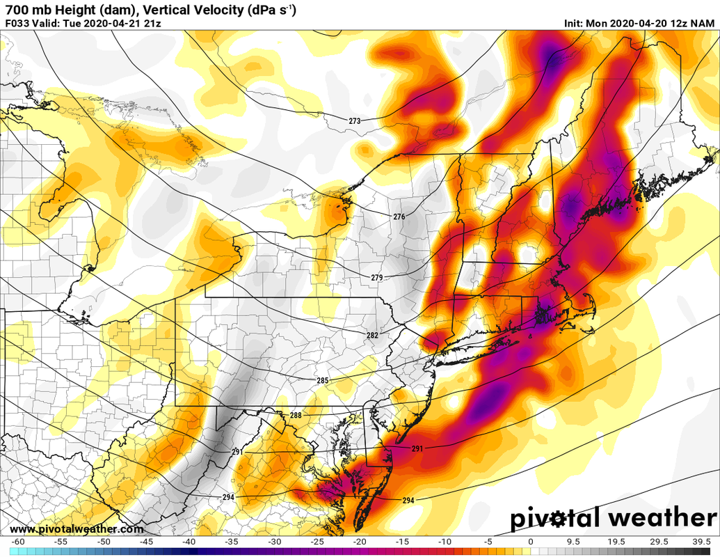 Vertical energy in the middle troposphere at 5 PM I use these vertical velocity charts once in awhile to indicate potential heavy amounts of precipitation, and this model idea gives a clear indication of that idea. Heavy rain for the coastal plain, a quick thump of snow for the mountains and north is what to expect out this. 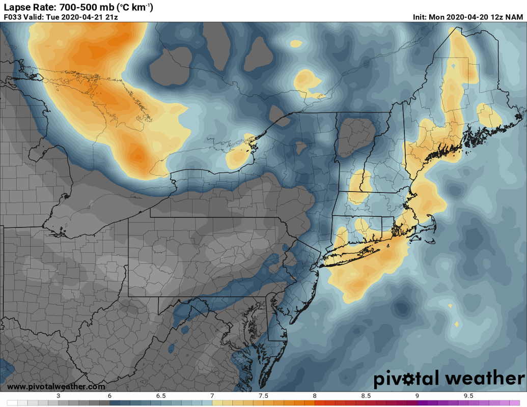 Temperature falls in the middle troposphere, model suggested at 5 PM Tuesday Since the storm is feeding off moisture from the south, it brings a chance for either thunderstorms and/or thunder snow along with it. As of Tuesday evening, Storm Prediction Center keeps the main threat of severe storms to southern New England and the MidAtlantic region. The main concern for Maine will be the downdrafts of gusty winds along with the heavy precipitation. The low level wind shear at 50-70kts may cause some spotty damage in areas and isolated power outages where the heavy rain/snow falls. (NEW for Summer 2020 - check out my new severe weather outlook page here on the website for 3 day outlooks to help you plan ahead. If you are reading this update Tuesday morning, click on that link to see the latest from SPC.) 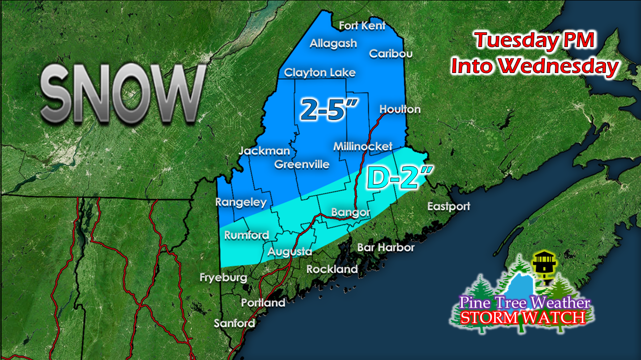 As far as precipitation goes, for the mountains and north, a general 2-5" of snow is possible, with the higher elevations receiving the higher amounts. For the western foothills over to interior Washington County, it's the same situation, with around 2" for the higher hills in the region. There is a chance for a brief period of sleet. For the coastal plain 0.25"-0.75" of rain is expected. Precipitation amounts could be higher in heavier bursts of snow and rainfall. 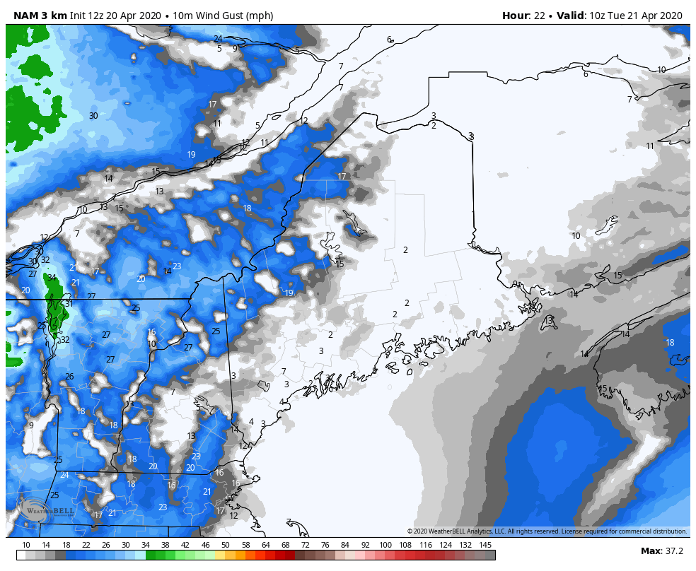 Loop from 6 AM Tuesday to 8 PM Wednesday It appears to be a Flying Trash Can Alert day for the state as wind gusts in the 30-45 mph range are possible. The breeze will steadily increase ahead of the front from the south, then flip to the northwest after the front passes through. The breeze continues through Wednesday. 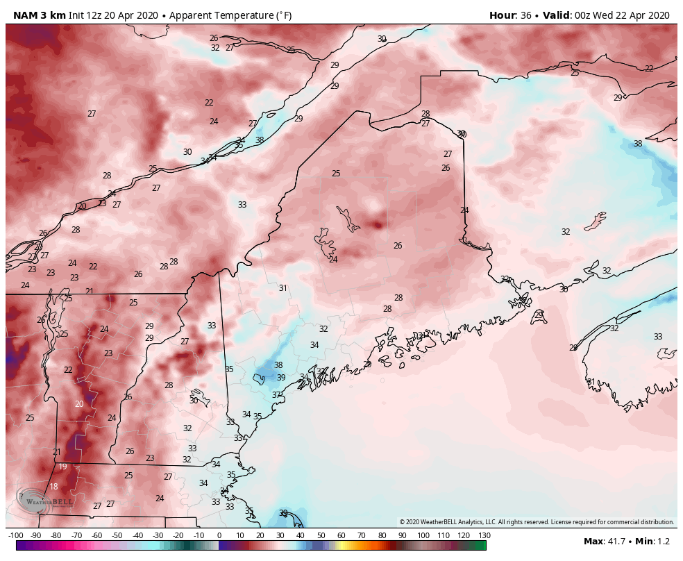 Loop from 8 PM Tuesday to 8 PM Wednesday After the cold front passes through, the "feels like" temperatures plummet as wind chill values in the single digits / teens for the north and 20s south and east to start Wednesday. Temperatures modify a bit during the day Wednesday, but the wind will have a bite to it everywhere through Wednesday night. Help the weather community and stay informed!
► ► For the latest official forecasts, bulletins and advisories, please check in with the National Weather Service in Gray for western and southern areas, or Caribou for northern and eastern parts of Maine.
Thanks as always for your support! - Mike |

Mike Haggett
|