A quiet mid-week on the way Wednesday looks to be a wonderful day. High pressure to the south of us continues to keep us dry as a weak low-pressure system to our north and west continues to dissipate. Sunny skies are likely throughout much of the morning and into the early afternoon on Wednesday. It's not until later in the afternoon that southern and western parts of the state see the best chance of clouds building in. Wednesday evening has the better chance of seeing more clouds move in through the central part of the state.  High temperatures tomorrow have a great chance of making it into the mid 70s across much of the state. This is thanks to the sunshine, and the light winds through much of the morning hours. Coastal areas have a good chance of cooling off heading throughout the afternoon as winds become more southerly. This likely keeps temperatures at the coastline in the 60s through the afternoon on Wednesday. Cloudy skies return Thursday Thursday appears to feature more clouds as the high-pressure system to our south continues to slowly make its way to the east. This allows for an unorganized and weak area of energy to work its way into the area heading towards the end of the week. Places north of Bangor have the best chance of seeing some sunshine during the morning hours on Thursday, but once the clouds move in, the day appears to remain cloudy. We have a chance of seeing showers Thursday, with places along the coast having the best chance of seeing any rain, but I think the activity will likely be more scattered in nature.  High temperatures on Thursday will likely be around the average high for this time of year thanks to the cloud cover. Most places across the state will only make it into the upper 60s and lower 70s. With winds likely from the south gusting at times between 20-25 mph, temperatures along the coast will once again be cooler than places inland, with highs only making it into the mid 50s. Warm and wet weather for Friday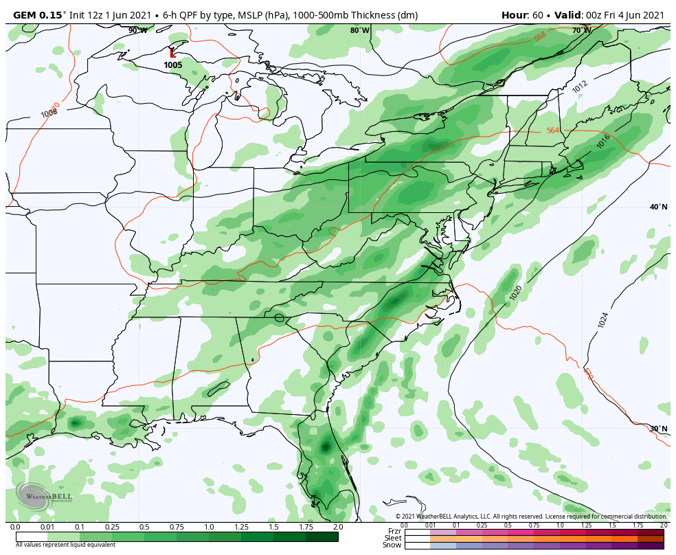 Heading into the early morning hours on Friday we have the best chance of seeing rain showers move through the area. I think everyone has a good chance of getting wet, however at this point it looks unlikely that we'll receive as much rain as we saw out of our previous storm. High temperatures will likely climb into the mid 70s for most places inland during the afternoon. Winds likely start off out of the south-southwest during the morning hours but shift into the northwest heading into the afternoon Friday. The rain likely wraps up through the early afternoon which could lead to some breaks in the clouds late in the day Friday for places further north and west. Weekend Warmup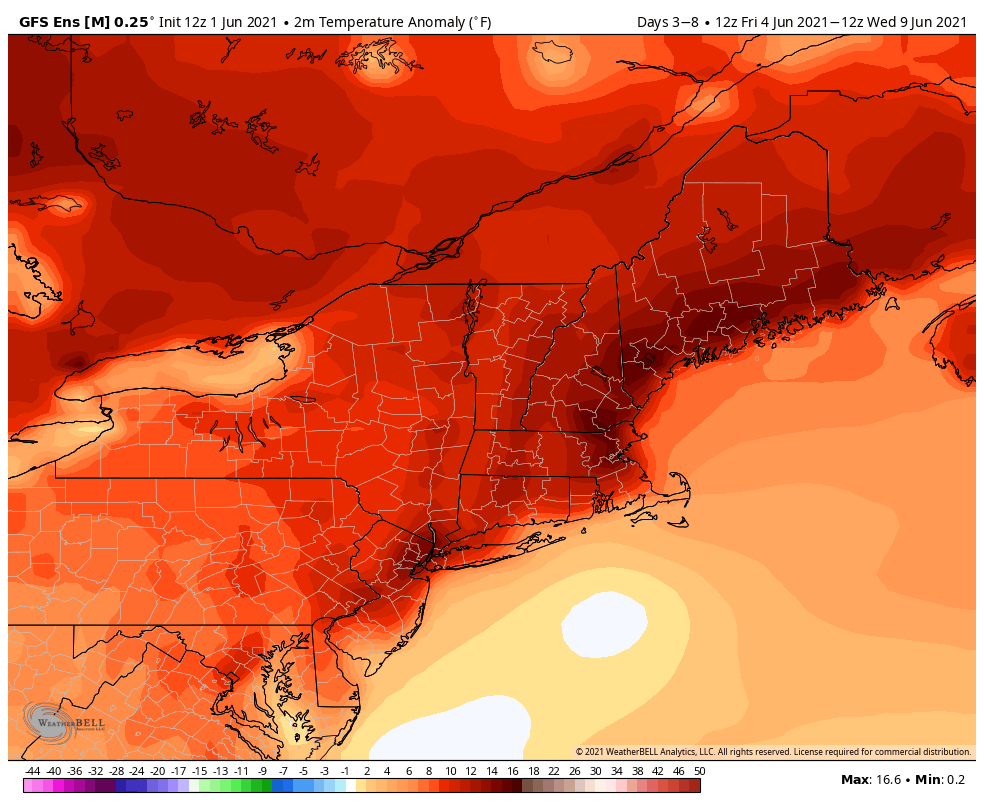 Looking ahead at the weekend, an upper-level ridge sets up over the eastern half of the United States. This will allow for warmer air to work its way into our region as we head throughout the weekend and into early next week. The above map shows how much warmer we're expected to be throughout the weekend heading into next week compared to our average temperature. The darker shades of red show where parts of the state have a better chance of being well above average, with lighter shades of red indicating where temperatures might be closer to average. Temperature outlook through MondayThe temperature outlooks certainly reflect what I discussed above, with temperatures warming into the 80s heading throughout the weekend. Keep in mind that with the warming temperatures also comes the humidity, with dew points climbing back into the 60s by early next week. 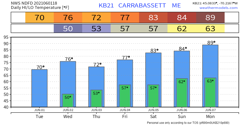 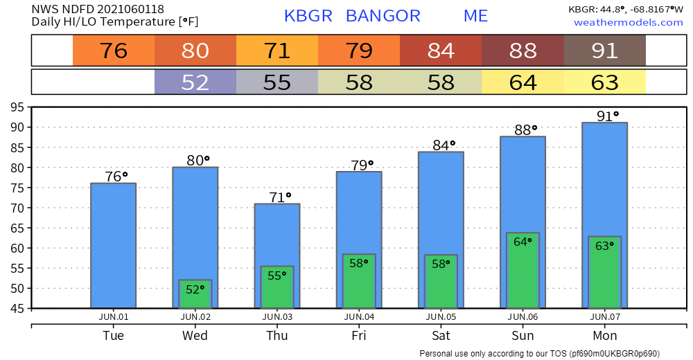 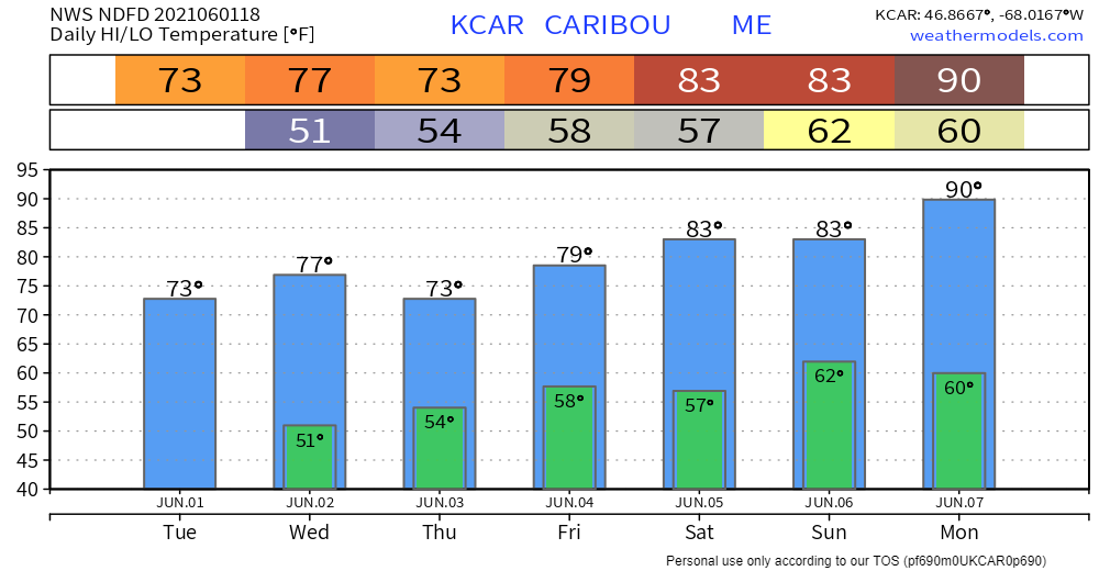 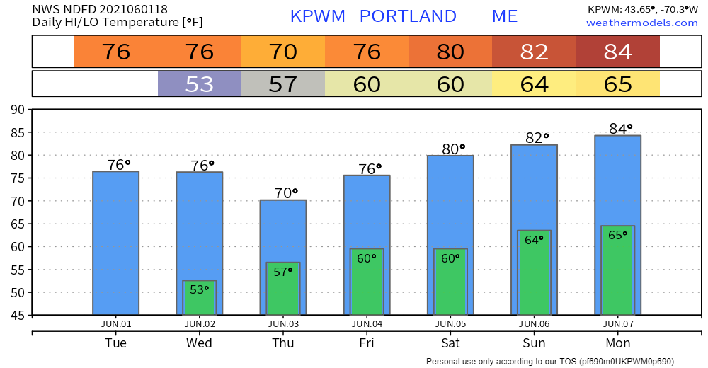 Join the weather community as a storm spotter!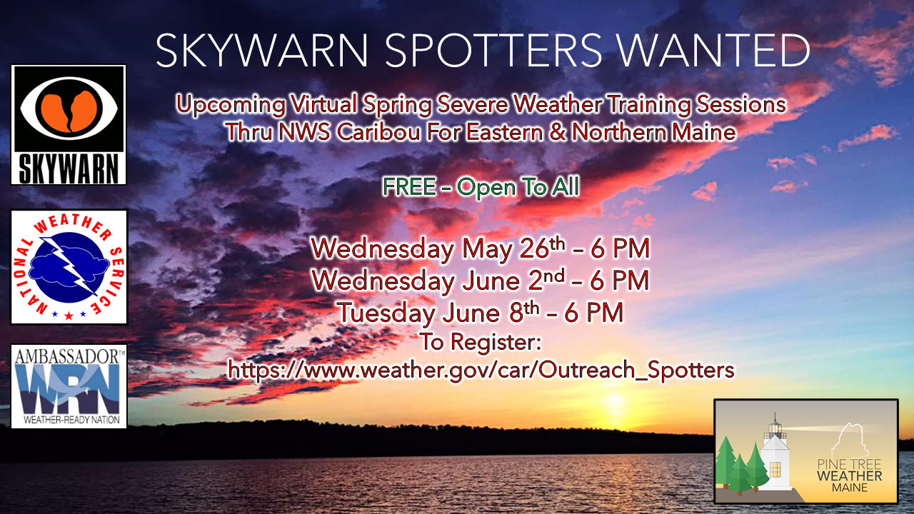 Here's a wonderful way to become active in the weather community and help the broadcast media and forecasters like myself with storm reports. This information is vital during and after an event for forecasting and alerting purposes. I can't tell you how many times I have seen the importance of these reports in the past 9+ years I have been involved. Pine Tree Weather followers have stepped up in the past and participated, and with the readership base continuing to grow, I know there are more out there. This is the spring/summer session which discusses severe weather, what to look for, and how to report it. These sessions run for about 90 minutes. They are fact filled, educational and interesting. You can get the whole family involved from the comfort and safety of home. Once completed, you will get your spotter ID, and will be ready for the season ahead. For those who trained for the winter session, this will complete your full year training. It's important to have both sessions done. The link to register is here ► https://www.weather.gov/car/Outreach_Spotters Be prepared to receive alerts and stay updated
For more information in between posts, please follow Pine Tree Weather on Facebook and Twitter.
Thank you for supporting this community-based weather information source which operates by reader supported financial contributions. Stay updated, stay on alert, and stay safe! |

Mike Haggett
|