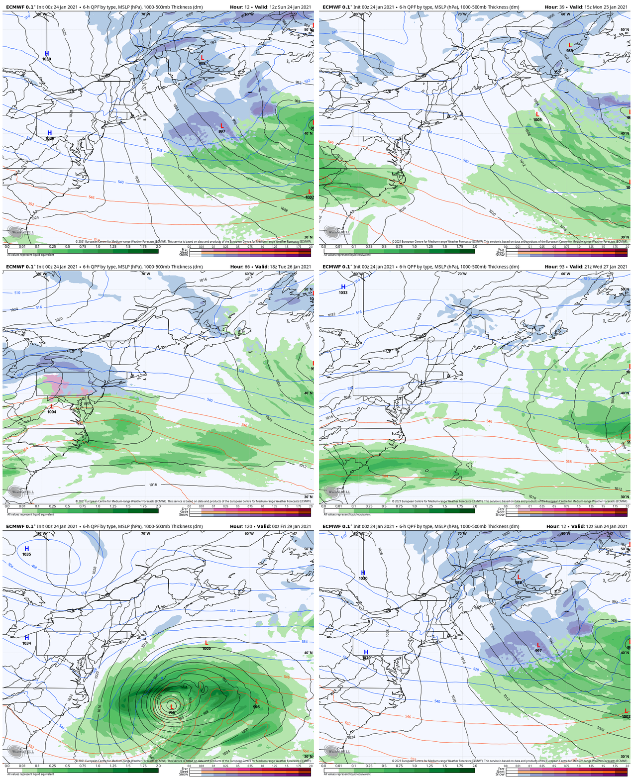
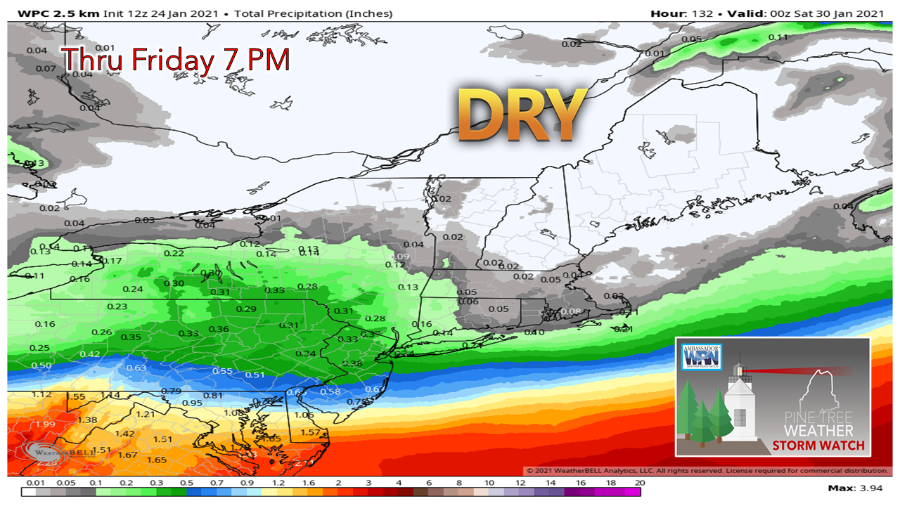
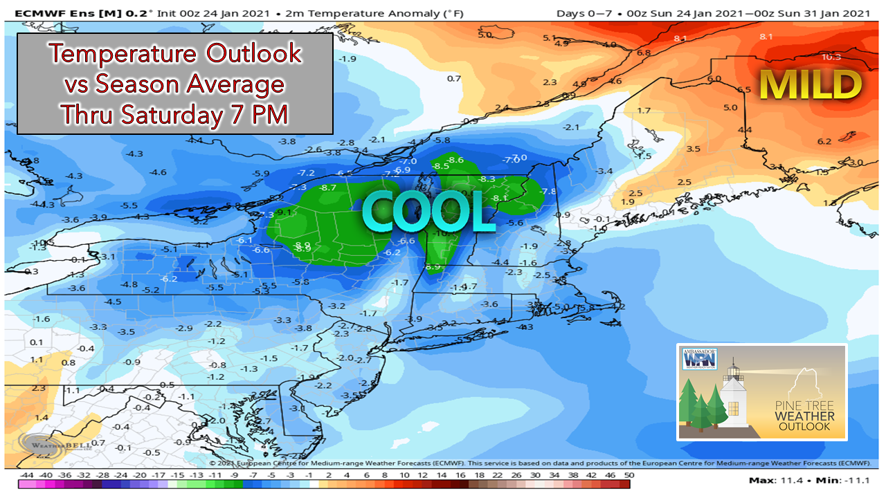
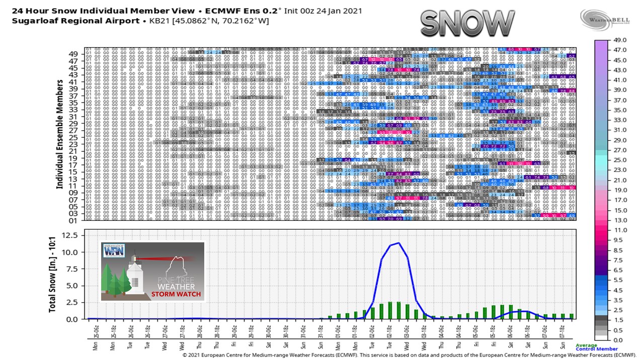
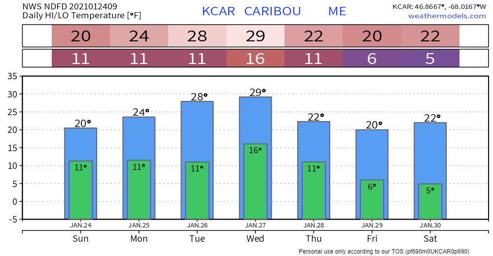
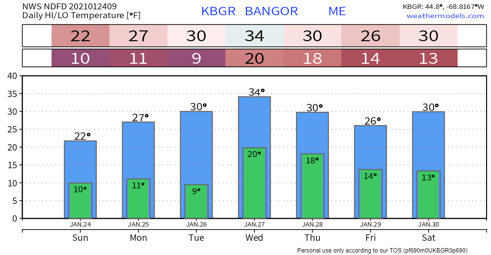
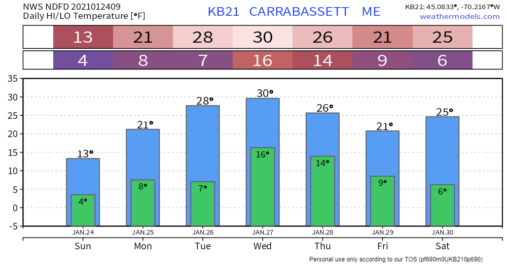
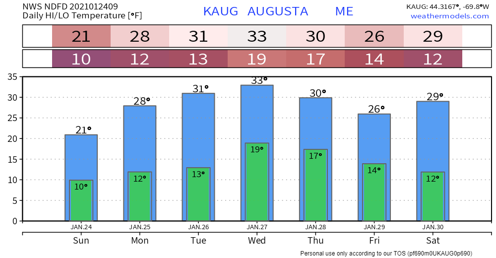
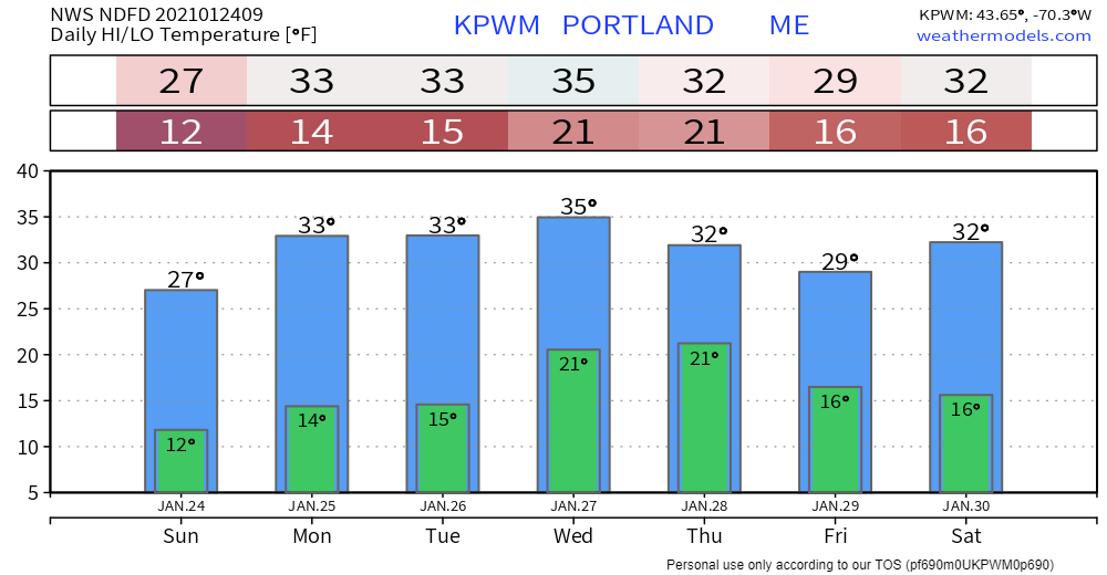
Storms stay well south through the end of the weekOur weather pattern can be summed up by two words for the week: high pressure. That appears to be the dominant feature over the region. A flat system skirts by to the south on Tuesday, and what could be a major ocean storm passes well south later in the week. The windy conditions Sunday settle down as we head into Monday. Tuesday appears to be the best day for widespread sunshine. The breeze is expected to return later in the week as the ocean storm cranks up to the south. Weather Prediction Center's outlook for precipitation shows next to none over the region through Friday evening. Outside of the slight risk of light snow showers from passing zonal waves for the mountains, that appears to be the only chance for disagreement with this idea. The average temperature outlook through Saturday indicates slightly mild conditions overall for the north and east, and near normal to slightly below normal over the west and south. Digging deeper on the extended outlook looking specifically here at Sugarloaf, there is a chance for a more active pattern beginning next week. Deterministics are playing around with a potential storm 8-9 days out and there is some ensemble support for that. We'll see how the ideas unfold for that later on in the week. Temperature outlook through SaturdayThe normal high and low for Caribou is 19° and 0° and for Portland, 31° and 13°. The one upside with the quiet pattern is ice gets a chance to form on our lakes. It's hard to believe we are near the end of January, and many bodies of water have little to no ice to speak of. Speaking from my experience as an ice fisherman, please use caution around the ponds until thickness improves by later on in the week. Website update status for the weekSince it is quiet, I am going to focus on my continuing course work and gets some rest. I may drop some information on Facebook or Twitter. I will update here off and on through the end of the week. Be prepared to receive alerts and stay updated!
For more information in between posts,
please follow Pine Tree Weather on Facebook and Twitter. Thank you for supporting this community based weather information source operates by financial contributions. Stay updated, stay on alert, and stay safe! Thank you as always for your support! - Mike |
Mike Haggett
|

