Temperatures increase, and so do the clouds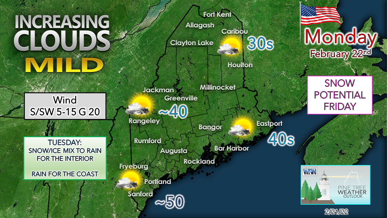 High pressure to the south that was responsible for the weekend cool down slides to the east and a southwesterly flow develops. Temperatures begin to increase, along with cloud cover. The coastal plain enjoys a mainly sunny day, with more clouds in the mountains and northern areas. The wind appears generally light over the interior, a bit breezier along the shorelines and far north. Clouds increase everywhere by late afternoon ahead of the next system on the way for Tuesday. Cold air damming concerns for Tuesday mix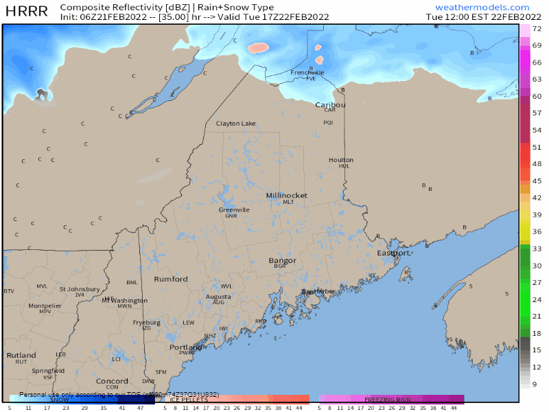 Tuesday Noon to Wednesday 1 AM - The day starts off with clouds but mainly dry across the state to start off. Precipitation breaks out in the afternoon, and this is where the forecast gets a bit tricky. Old friend "Cold Air Damming" may make an appearance, and if it does, it could make travel tricky for areas away from the coast during the afternoon through the evening commute. The HRRR model idea shown here picks up the potential for a period of ice quite well. It may be a bit cool, but as we've seen over the years, cold air damming has made many fools out of models and forecasters. I think there is enough cold to the north that could bleed south at the low level where a period of freezing rain could go on for several hours over the interior. While I do not expect much in the way of accumulating ice (one to two tenths) it will be enough to cause slick spots on roads, sidewalks and parking lots. 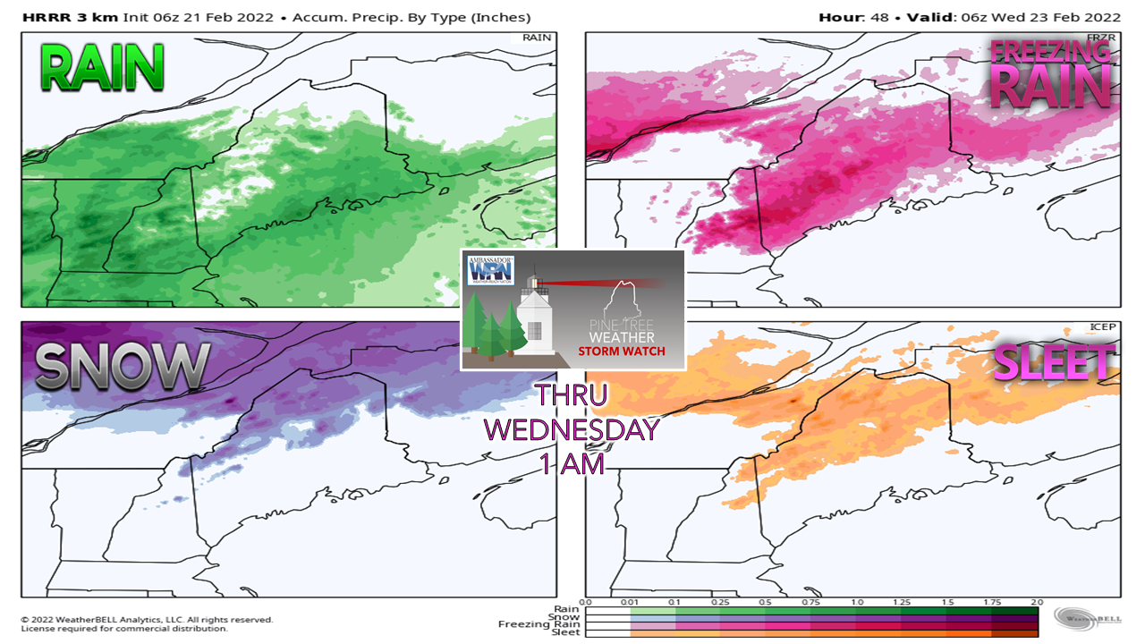 For much of the far interior, a little bit of everything is possible. I do expect warm air to win out eventually for all areas but the far north. Any ice that accumulates over the western interior up into the north woods melts off as the warm pocket moves northeastward. 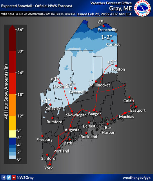 As with last week's storm, the result here is similar for snowfall amounts. Northwestern parts of The County see the higher end amounts. 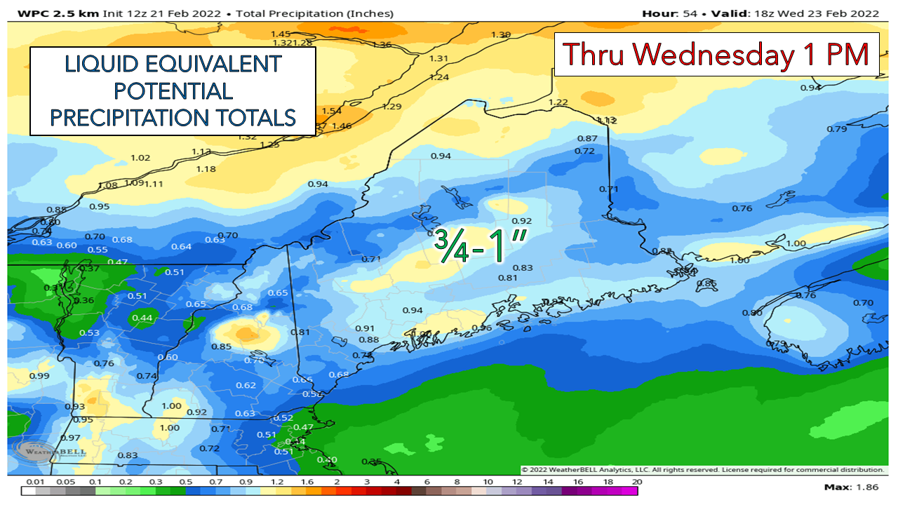 A general ¾-1" of liquid is expected to be associated with this system. With temperatures expected to be well above freezing on Wednesday statewide, melting ensues. A moisture-starved cold front passes through Wednesday evening, and what is liquid becomes ice by Thursday morning. Tracking snow potential for Friday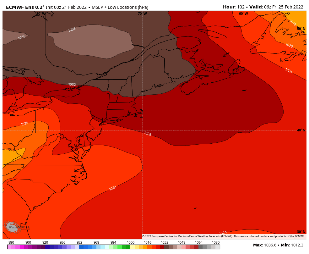 Friday 1 AM to Saturday 1 AM - A look at European ensemble mean sea level pressure along with individual member pressure ideas brings two things in mind based on ideas as of Monday morning. For one, the storm could be in the early stages of development, indicated by the rather flat pressure contours. The other, a due east direction with phasing of the northern and southern streams occurring a bit late to bring big snow. I will say this, if the system becomes organized six hours earlier, it could be a different outcome, with higher snowfall amounts possible. At this point in the forecast window, the idea of the timing of guidance being off by that amount is certainly possible. It could also go the other way and develop later, which means a lesser amount of snow. 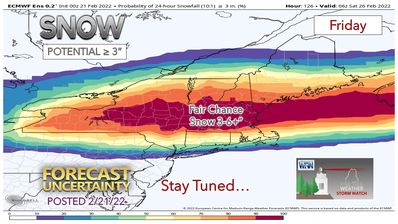 As of Monday morning, there is a solid chance the coastal plain could see plowable amounts of snow. Southern areas may see the most. It may snow all day and impact both morning and evening commutes. Bottom line is there are many questions to get answers for. It will be something to stay updated on. Stay tuned.  Temperature outlook through SaturdayTemperatures rise through Wednesday, then fall below normal through the latter part of the week. After Friday's storm, the weekend looks cool and precipitation free. 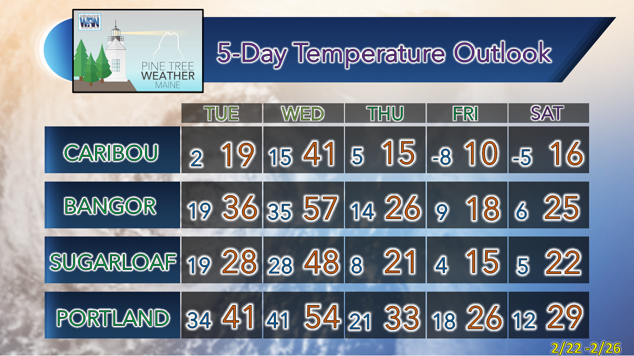 Winter Precipitation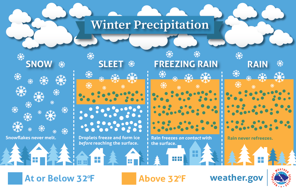 Will there be rain, ice, or snow? This graphic explains how having different layers of warm and cold air between the clouds and the ground determines the type of precipitation that hits the ground. nssl.noaa.gov/education/svrwx101/winter/types/ Be prepared to receive alerts and stay updated!
 For more information in between posts, please follow Pine Tree Weather on Facebook and Twitter. Thank you for supporting this community-based weather information source which operates by reader supported financial contributions. Thank you as always for your support! - Mike NOTE: The forecast information depicted on this platform is for general information purposes only for the public and is not designed or intended for commercial use. For those seeking pinpoint weather information for business operations should use a private sector source. For information about where to find commercial forecasters to assist your business, please message me and I will be happy to help you. |

Mike Haggett
|