|
A couple things here to mention before I get into the forecast. First off, I am close to finishing off fundraising for the year. I am $400 short to this point. Many thanks and gratitude to those who have mailed checks and sent donations via VENMO, as well as those who scheduled a monthly contribution through Patreon. If you can help me cross the finish line here I would greatly appreciate it. Thank you in advance for your support here. The other thing I wanted to mention is the weather phenomena known as cold air damming. I should have known that it would show up in the interior on Thursday, and that is on me. Models struggle mightily with it and always have. The wind at the low level was not strong enough to wash out the low-level cold, which that was a big bust. Usually with a southeast wind direction it has a better chance to clear out. I'll keep a better eye on it now that I have seen the results of what happened. The first test of this comes Monday. A quiet Sunday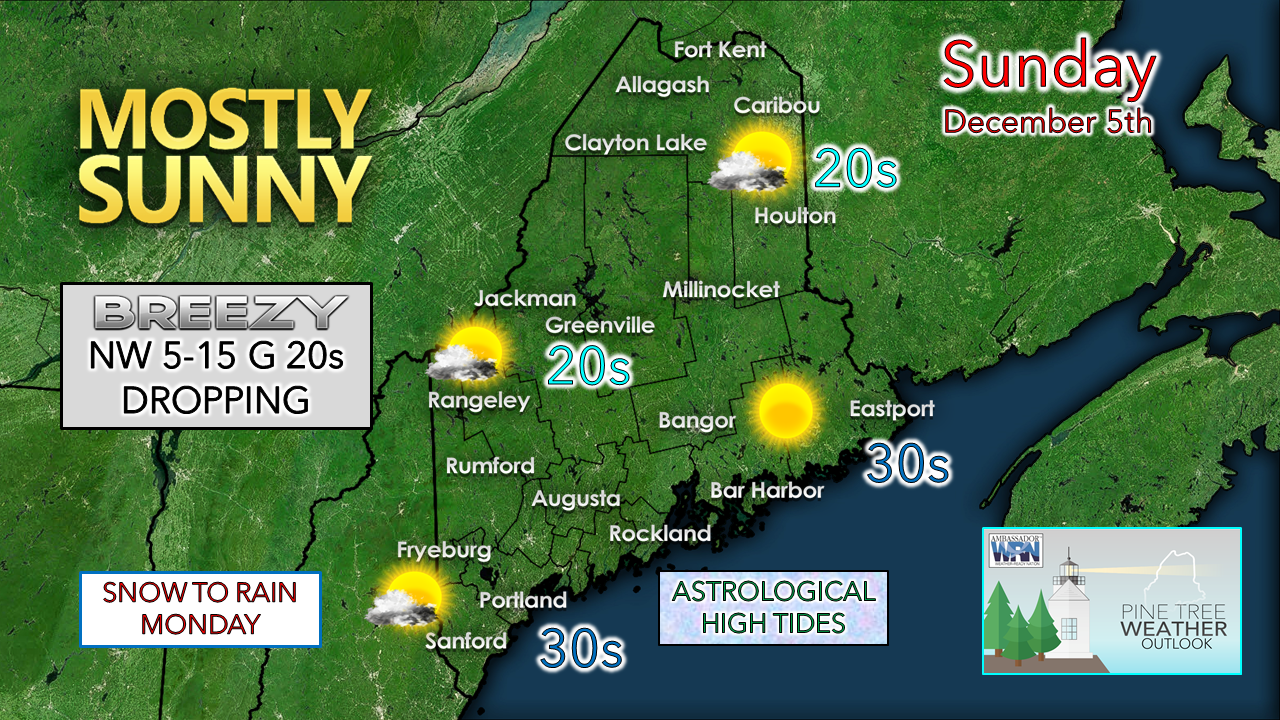 A few mid- and high-level clouds are expected for the day. A bit of a breeze is expected for western, eastern and northern areas which may bring gusts in the 20-25 mph range and drop in the afternoon. Southern areas have a chance to run for the mid-30s with the breeze on the light side. Monday messy to start for interior areas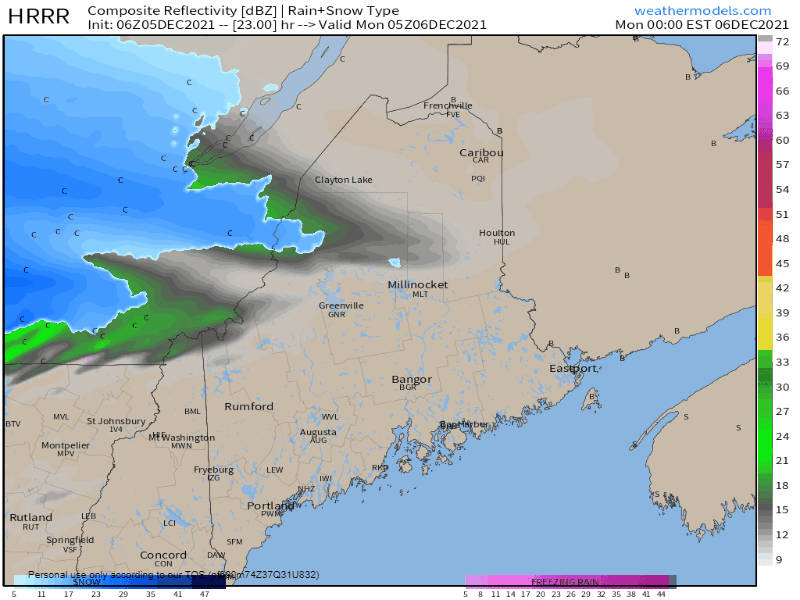 Monday Midnight to Tuesday Midnight - A warm front enters the region from the southwest Sunday night which may bring some light snow over the southern half of the state, and accumulation of a couple inches to the north. The western foothills over into central areas may experience a light mix of sleet and/or freezing rain Monday morning. While the precipitation amounts are expected to be light, it may be enough for a few slick spots on the roads less traveled. Most areas are expected to transition to rain by afternoon, so long as the forecast winds from the southeast do their job. I am a bit concerned that the parent low over northern Quebec may be a bit too far the north, which may cut down on the wind on the warm side of this. The coastal plain region should see rain and temperatures make a run into the 50s. Monday night a cold front comes through. Any liquid is likely to freeze which may cause black ice issues, especially over the interior. Temperatures are expected to fall all day Tuesday. 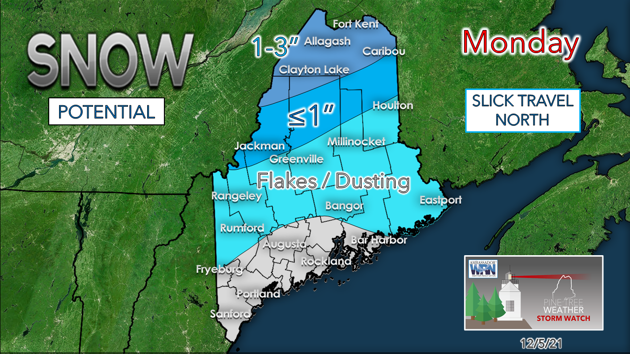 The projected snowfall idea is associated with the warm front through Monday morning. The rooftop of the state sees the higher amounts. On the backside of the front Monday night into early Tuesday, there is potential for a sloppy inch or two for the high peaks of western mountains up into the Allagash, and perhaps a coating over the valleys. 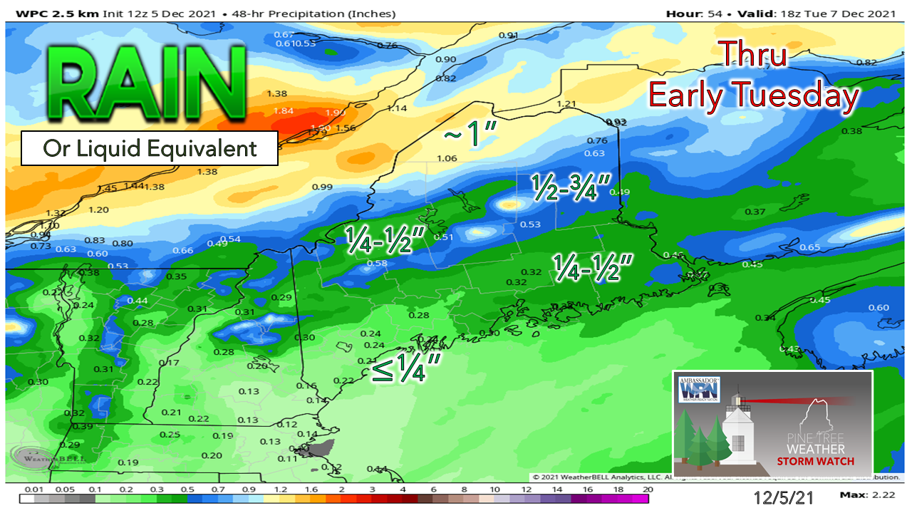 The high-end liquid equivalent amounts are expected for the higher elevations in the mountains and Allagash region. The further south, the lesser amounts. 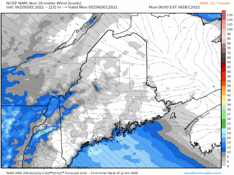 Midnight Monday to Midnight Tuesday - Wind from the south / southeast could gust in the 20-30 mph range with higher gusts possible for MidCoast & DownEast areas (30-35 mph). Once the wind shifts to the west / northwest behind the front, wind gusts could reach 40+ mph for the mountains Monday night into early Tuesday. For Tuesday, expect a breezy and cold day with winds gradually diminishing. Snow potential Wednesday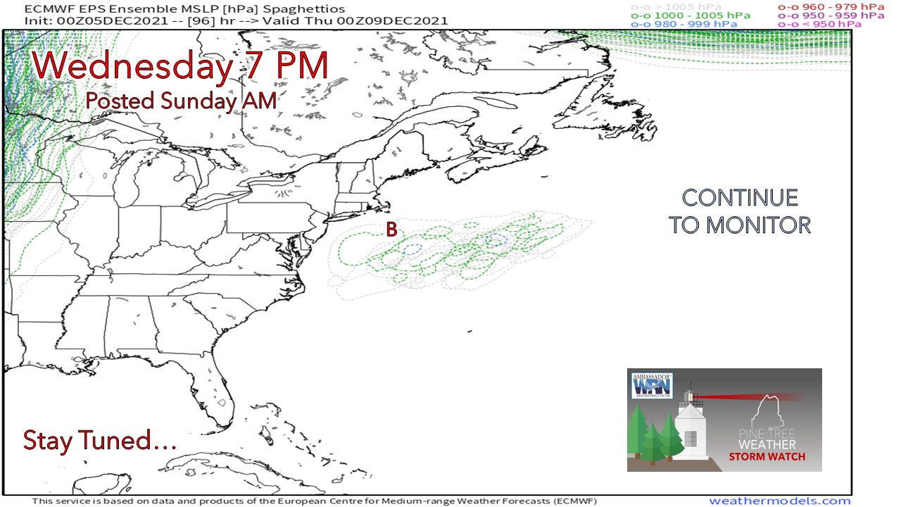 Models have backed off on the idea of a strong coastal storm. The trend is less amplified and flatter, but with cold air in place, any precipitation that does come is likely to be in frozen form. Ensemble ideas above indicate areas of low pressure are likely to south and east of the benchmark "B" 40° N / 70°W point, which backs up the idea of snow with the cold in place. While the projected lows by ensembles and deterministic ideas are relatively weak, there is potential for an inverted trough set up, which could bring plowable snow for coastal areas pending on the strength of it. 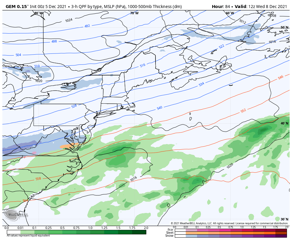 Wednesday 7 AM to Thursday 7 PM - Low pressure is expected to form well to the southeast of the region and intensify as it heads northeast. A southeasterly wind fetches out ahead off the low could pump moisture in along the shorelines and bring the chance for measurable amounts of snow. While MidCoast and DownEast areas appear to have the best chance to see snow of impact for now, all areas along the coastal plain have potential to see flakes. Track will be key here. Stay tuned. Temperature outlook through Friday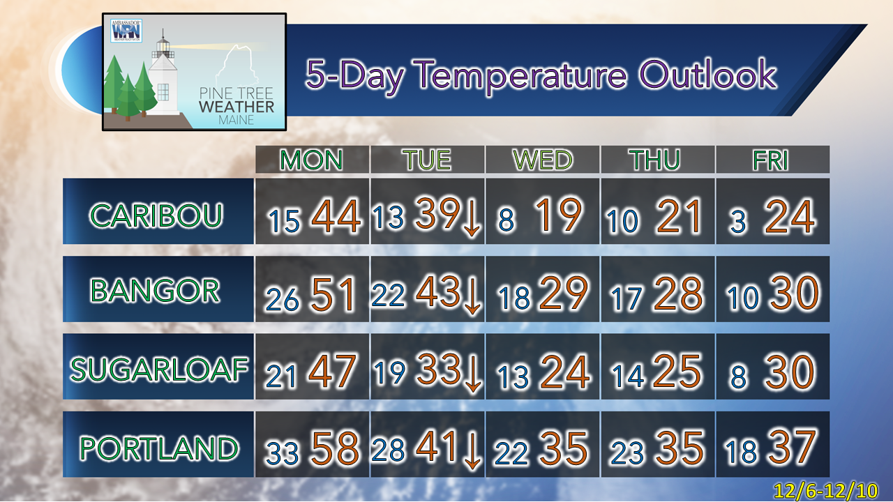 After a warmup on Monday, high temperatures for Tuesday reach their high point at midnight and fall through the day. Projected thermometer readings are expected to be below normal through the remainder of the week, with a warm up potentially on the way next weekend. Funding deficit for 2022 - $400 Winter Precipitation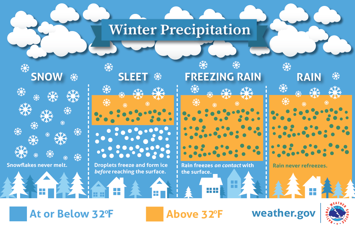 Will there be rain, ice, or snow? This graphic explains how having different layers of warm and cold air between the clouds and the ground determines the type of precipitation that hits the ground. nssl.noaa.gov/education/svrwx101/winter/types/ Be prepared to receive alerts and stay updated!
 For more information in between posts, please follow Pine Tree Weather on Facebook and Twitter.
Thank you for supporting this community-based weather information source which operates by reader supported financial contributions. - Mike |

Mike Haggett
|