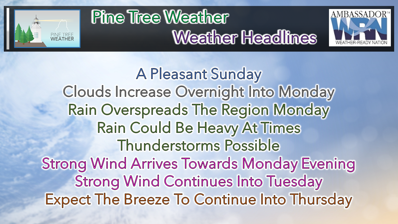
 Sunny and seasonably mild for Sunday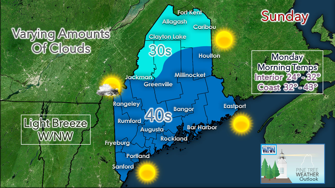 Any early morning clouds or areas of patchy fog clear out. Clouds may hang in the western mountains, but for most, it appears to be a bluebird sky day. This will be a good day to survey the yard, tie down any objects that could go airborne, and gather any necessary storm supplies that may be needed ahead of the storm on the way starting Monday. Heavy rain and strong wind Monday into Tuesday A look at what to expect here through 7 PM Wednesday. Rain and wind impact the area Monday and Tuesday. Cold air creeps back in as the storm occludes into Wednesday, which could bring snow showers to the western mountains.  Looking at this with a bit more detail. it appears western and southern areas get the heavy rain Monday afternoon into Tuesday morning. Northern and eastern areas get in on the action Monday afternoon. The storm appears that it could stall for a few hours, and continue the rain well into Tuesday afternoon. 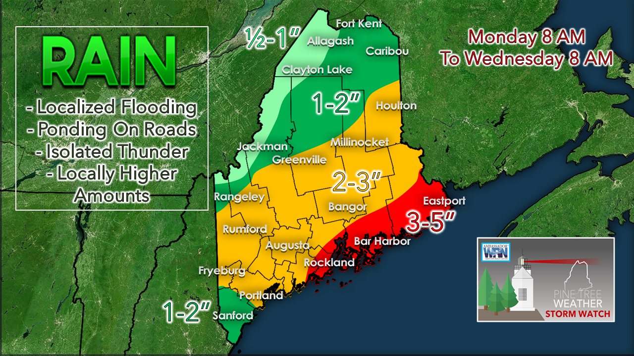 With that idea in mind, I expect the heavier amounts of rain to fall over the MidCoast and DownEast areas. Totals of 1-3" appear to be widespread with this event, with the exception along the international border with Quebec. As mentioned here yesterday, I do expect dry slotting to help shut the faucet off, but at this point it appears the storm intensity will have been strong enough and long enough to bring a good soaker by that point. It will be the dry slot that will taper off the rain as the day progresses Tuesday. What will drive the rain, will be the wind.  The intensity of the low level jet will hold the cards on intensity of rainfall, as well as strong to damaging wind gusts. Where rain is the heaviest in downpours or thunderstorms, that brings potential for damaging straight line wind as the rain carries the strong wind to the surface. The potential for stronger wind speeds with this event is higher than our recent storms. 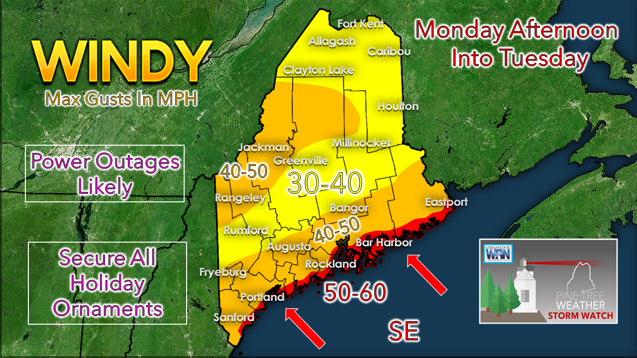 The southeast winds will affect the shorelines the strongest. Since those areas are more populated, I expect more impacts. The higher elevations inland and more open areas get stronger surface gusts. It's important to understand here that the wind impacts come from two directions: the surface, and the low levels of the atmosphere above in heavy rain and thunderstorms. The strongest winds begin to impact southwestern areas Monday afternoon and continue into Tuesday morning. MidCoast and DownEast areas get in on the wind Monday night, and may hang on into Tuesday afternoon, clearing way DownEast by mid to late afternoon. With the storm stalling out over Quebec, expect a stiff breeze Tuesday night continuing into Wednesday. The wind appears to gradually diminish ever so slowly into Thursday.  Temperature outlook through SaturdayThe normal high and low for Caribou is 33° and 20°. For Portland, 44° and 28°. Temperatures appear to run above those seasonal averages through the week, cooling down towards the weekend, but remaining above normal. Our next storm to watch could impact the region Saturday. At this point, it is a similar situation as we've seen with inside runners bringing rain and wind from the southeast. Stay tuned on that. 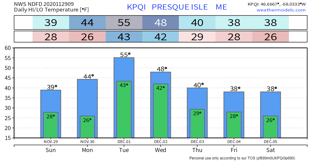 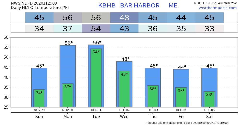 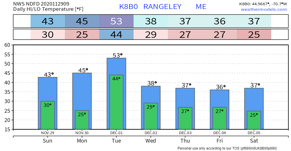 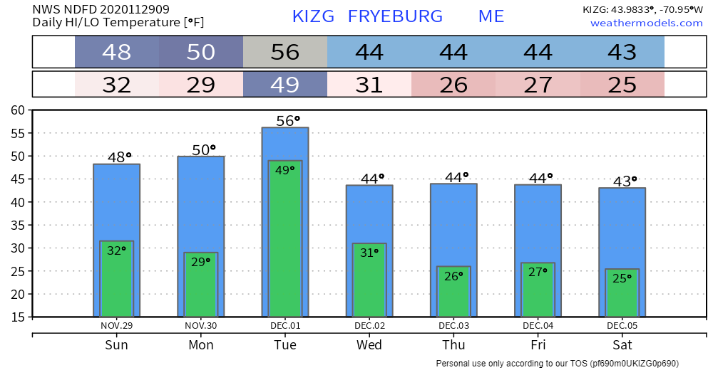 Tree danger in high wind events During high winds, trees can become dangerous objects. Stay safe by avoiding exterior rooms and windows, and by staying off the road. Prevent damage to your property by trimming loose branches and parking away from trees. weather.gov/safety/wind Be prepared to receive alerts and stay updated!
For more information, please follow Pine Tree Weather on Facebook and Twitter.
** FUNDING NEEDED FOR 2021 ** Thank you for supporting this community based weather information source that is funded by your financial contributions. Stay updated, stay on alert, and stay safe! - Mike |

Mike Haggett
|