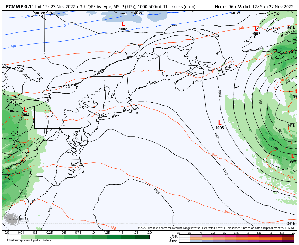
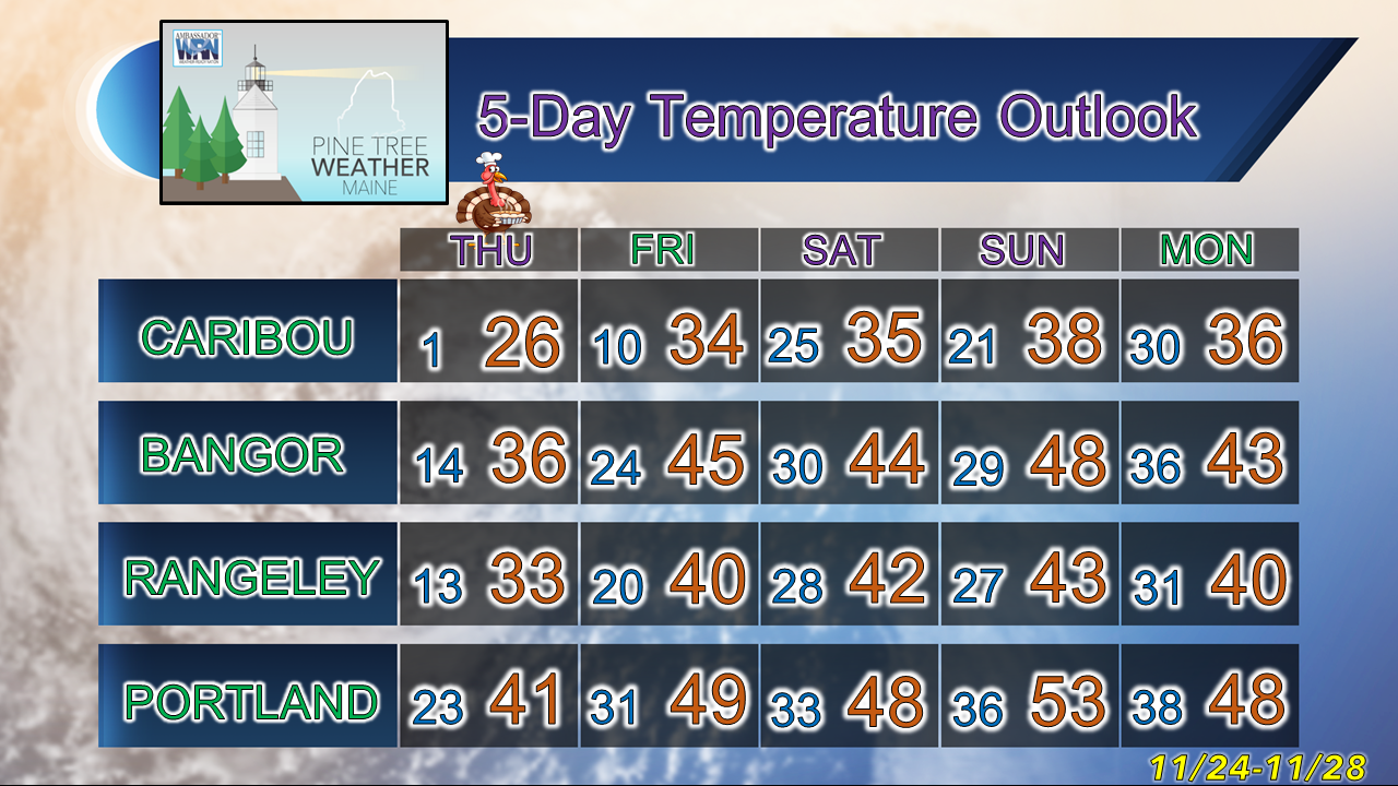
Pine Tree Weather
  • DISCUSSIONS
  • DONATE
  • MAPS
  • NWS BRIEFINGS
  • SATRAD
  • MARINE
  • SNOW / ICE OUTLOOK
  • RAIN OUTLOOK
  • CPC OUTLOOK
  • Kennebunk
  • OBSERVING WEATHER
  • Who We Are
  • My Photography
  • DISCUSSIONS
  • DONATE
  • MAPS
  • NWS BRIEFINGS
  • SATRAD
  • MARINE
  • SNOW / ICE OUTLOOK
  • RAIN OUTLOOK
  • CPC OUTLOOK
  • Kennebunk
  • OBSERVING WEATHER
  • Who We Are
  • My Photography

A quiet Thanksgiving, unsettled off and on through Sunday

11/23/2022

Comments


Time for a holiday

Picture
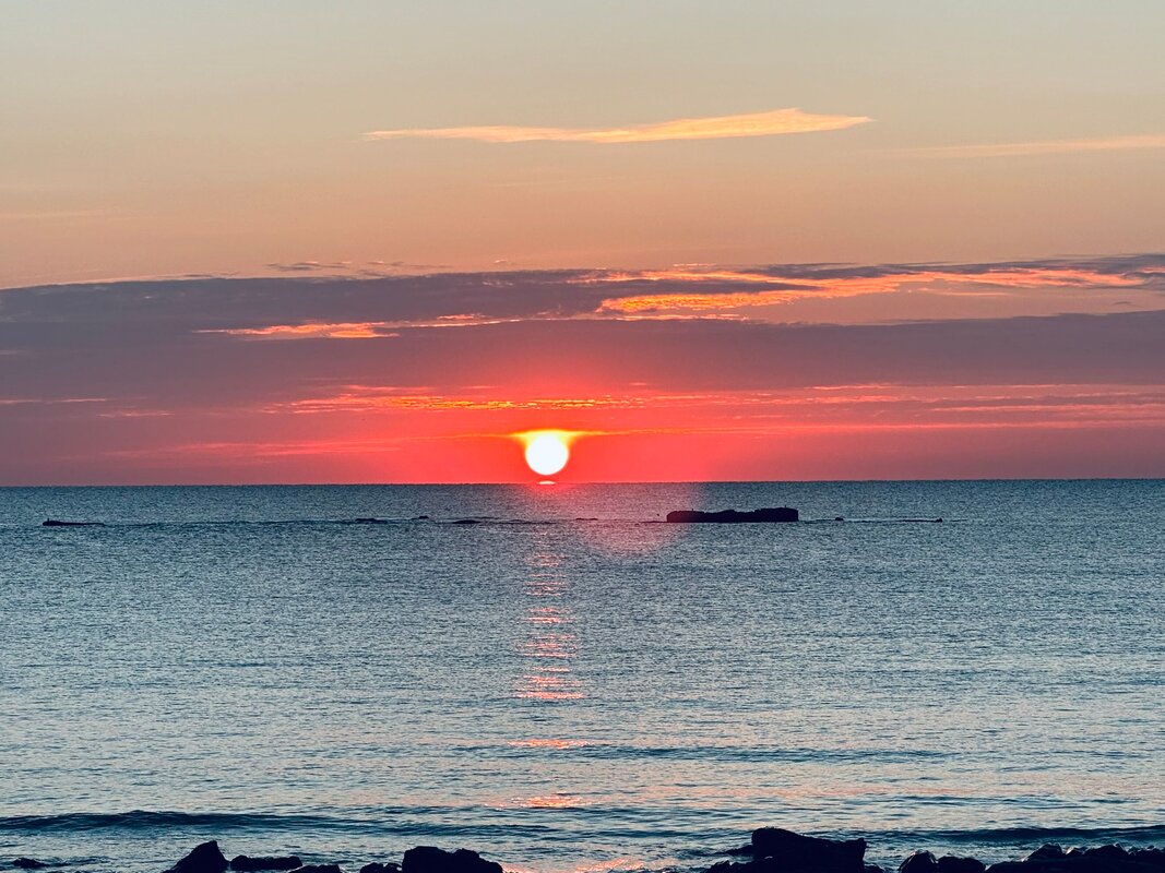
The holidays have arrived. This time of year, it can bring joy and excitement, as well as sorrow and pain. I can say for myself, the once large family I was a part of is now down to just four of us. It's surreal to think of all the people we have lost since 2016. One of the things I have learned over the years is I don't make the rules of life, I just try to do my best to live with whatever cards are dealt to me. I recently celebrated 31 years of recovery from alcohol and drug addiction. The one thought that I continue to hold close, even through the harshest of times is that gratitude isn't a thought; it is a way of life. While I could focus on what is wrong, I work hard to see the glass of life half full. My prayer and hope for you that blessings cover you and sustain you through holidays and into the new year. Thank you for being part of my journey! 

High pressure moving in for Thanksgiving

Picture
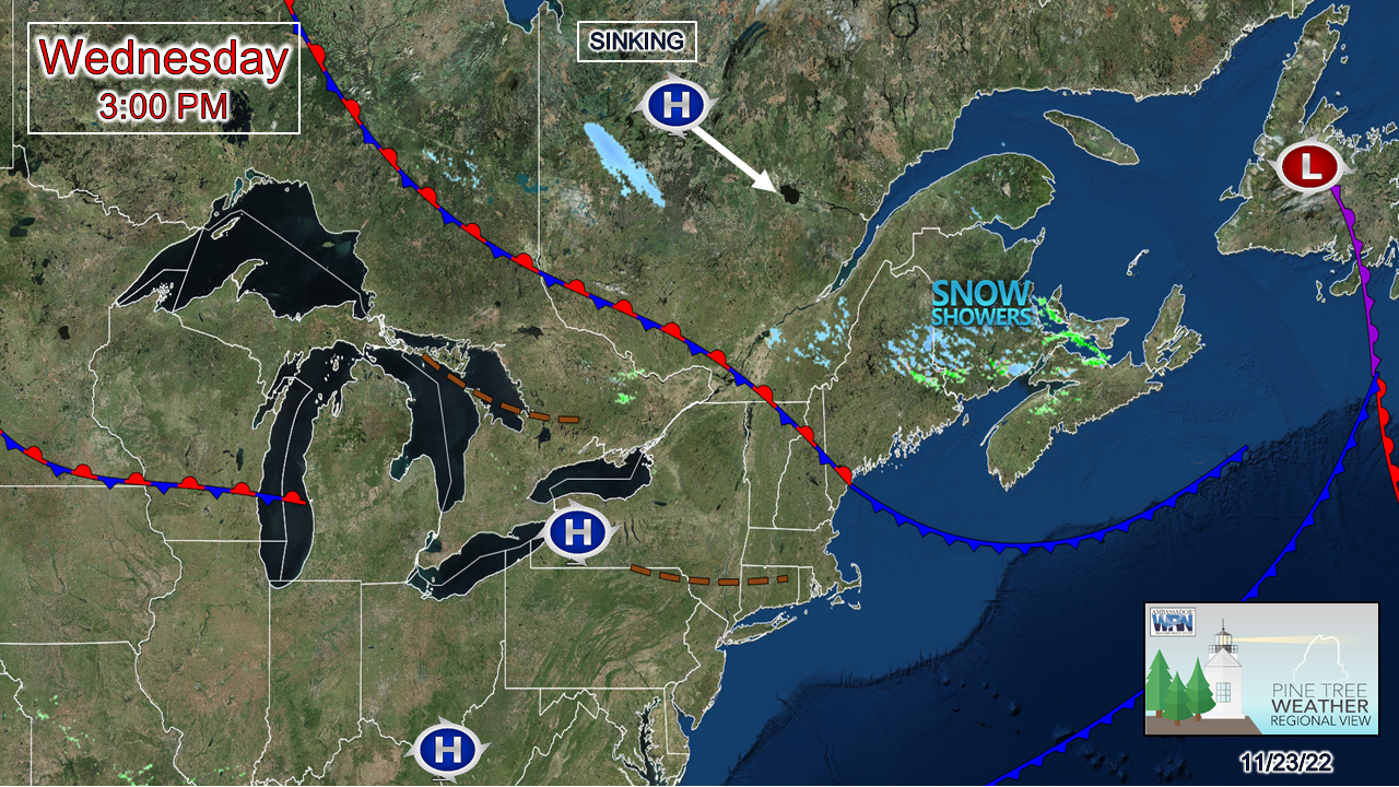
An occluded (weakening) area of low pressure over Newfoundland spinning upper-level disturbances over the region Wednesday is responsible for the snow shower activity over the north. Another weak disturbance may bring some snow showers to the mountains overnight. High pressure is expected to settle in by Thanksgiving morning and bring a peaceful day with sun and cool temperatures. 

A light mixed bag of precipitation Friday

Picture
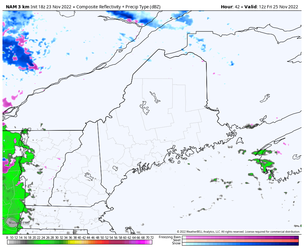
Friday 7 AM to Saturday 1 AM - Black Friday starts off dry, but rain and snow shower activity is expected to move in over western and southern areas before noon, and eastern and northern areas by late morning to early afternoon. Travel may be a bit dicey in spots north of Route 2, but not a big concern at this point. The mountains and north may pick up a couple inches of snow, the coastal plain a tenth or two of an inch of rain. 

The storm is expected to intensify as it heads into the Gulf of St. Lawrence, and bring breezy conditions to the region for Saturday, with wind gust potential 25-40 mph with the higher gusts possible for the mountains and shorelines.  

High pressure moves into the region Saturday afternoon and settles the wind by Saturday night. 

Another potential mixed bag event
​Sunday into early Monday

Picture
Sunday 7 AM to Monday 7 PM - Guidance has finally come up with a better read on the emergence of a cut-off upper-level low from the Four Corners in the southwest and its forecast track northeast. There is a fair amount of similarity in track and potential precipitation type as to Friday's system. A rough estimate on precipitation is a bit more than Friday (~½" liquid) and with the timing later in the day, snow appears possible over the mountains and north, with rain showers along the coastal plain, and some mixing possible over the foothills.

​My only concern at this point is for travel on Monday morning as areas that see liquid may see it freeze as cold air filters in on the backside of the system, thanks to a northwest wind the flows in the storms wake. Expect another breezy day on Monday, with wind chills ranging from the teens to around 30 at the coast. 

Current funding deficit for 2023 at $2,145

Picture

Temperature outlook through Monday

The normal high and low for Caribou is 36° and 23°. For Portland, 46° and 29°. Temperatures are predicted to rise towards average over the north over the weekend, and slightly above normal over the south.
Picture
Thank you as always for your support!

Stay updated, stay on alert, and stay safe!

Happy Thanksgiving!

- Mike

​NOTE: The forecast information depicted on this platform is for general information purposes only for the public and is not designed or intended for commercial use. For those seeking pinpoint weather information for business operations, you should use a private sector source. For information about where to find commercial forecasters to assist your business, please message me and I will be happy to help you.

Comments
    Picture

    Mike Haggett
    Kennebunk, ME

    Certified Weather
    Forecaster
    Penn State '21

    American Meteorological Society

    National Weather Association

    Weather-Ready Nation 
    Ambassador
    ​
    ​SKYWARN-CWOP

    Matthew 19:26


    Support
    Pine Tree Weather

    DONATE

    Picture

    Picture

    Picture

    Picture

    Picture

    Picture

    Picture

    Picture

    Picture

    Picture

    Archives

    January 2023
    December 2022
    November 2022
    October 2022
    September 2022
    August 2022
    July 2022
    June 2022
    May 2022
    April 2022
    March 2022
    February 2022
    January 2022
    December 2021
    November 2021
    October 2021
    September 2021
    August 2021
    July 2021
    June 2021
    May 2021
    April 2021
    March 2021
    February 2021
    January 2021
    December 2020
    November 2020
    October 2020
    September 2020
    August 2020
    July 2020
    June 2020
    May 2020
    April 2020
    March 2020
    February 2020
    January 2020
    December 2019
    November 2019
    October 2019
    September 2019
    August 2019
    July 2019
    June 2019
    May 2019
    April 2019
    March 2019
    February 2019
    January 2019
    December 2018
    November 2018
    October 2018
    September 2018
    August 2018
    July 2018
    June 2018
    May 2018
    April 2018
    March 2018
    February 2018
    January 2018
    December 2017
    November 2017
    October 2017

    RSS Feed

Proudly powered by Weebly