Back to reality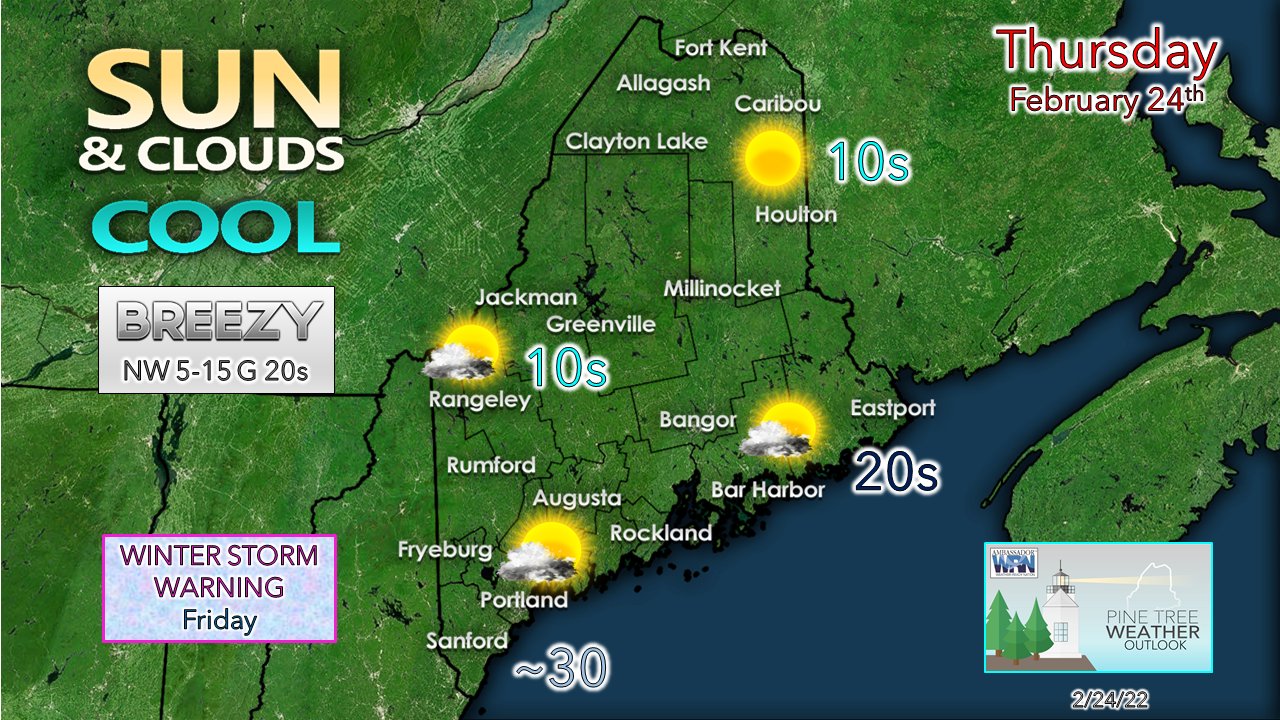 After the departure of fake spring that brought record high temperatures to some locales, winter settles back in. The areas that are feeling a breeze to start off see it settle down as the day progresses and a Canadian high makes a brief visit. It is the cold from this area of high pressure that sets the table for snow to end the work week. Snow through the day Friday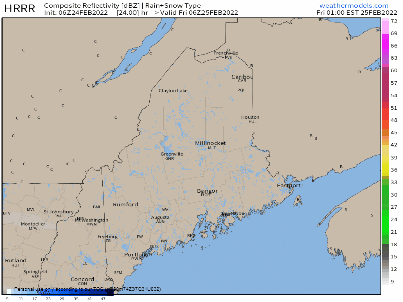 Friday 1 AM to Saturday Midnight - The storm remains on track to be a quick hitter, and where it will pack the most punch appears to be the coastal plain. Both the morning and evening commute are likely to be affected travel wise in the major towns, so allow for plenty of extra time to get to where you need to be. Snow winds down Friday night. Outside of a fleeting snow shower, it should be over and done everywhere by midnight Saturday. 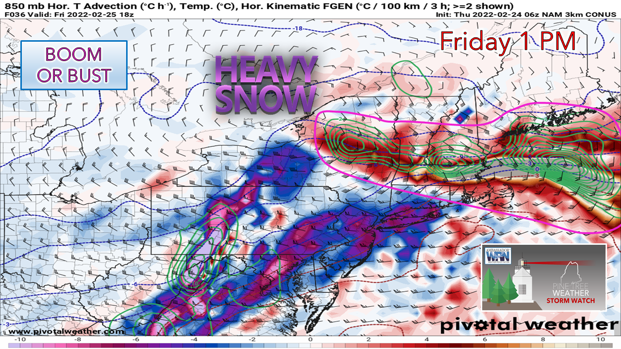 The focal point for much of the week for heavy snow has been along the coastal plain, and with good reason. The idea of banding associated with the developing storm has been difficult to nail down with any certainty given the windshield wiper effect of guidance (in this case, a north/south variation in ideas from run to run). There is still some variation here due to high pressure over east central Quebec which could throw a wrench into this, especially for the north country. The cutoff between winter storm warning level snow (6") and lesser amounts could be sharp. On the flip side, southern areas could see accumulations boom if the banding edges more to the north and dumps for a while. The heaviest accumulation chance appears around mid-morning through mid-afternoon as it appears from this vantage point Thursday morning. 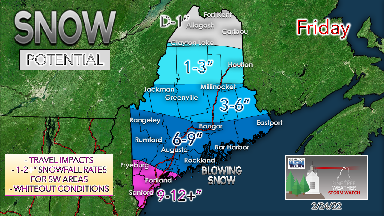 The sum of all ideas continues to focus on southern areas, York County specifically, as the jackpot area for this storm. If banding sets up along the coast, the 6-9" for MidCoast and DownEast areas could bust high, and most of York County / Portland area gets a foot or more. For areas north of Rumford-Bangor-Calais, the proximity and strength of high pressure over Quebec and how much dry air associated with it that could eat up precipitable water values could bring lesser amounts there. The powdery snow could blow around and drift as northeasterly winds increase with gusts in the 20-30 mph range. This would bring whiteout conditions and a challenge for snow removal crews where heavy snow occurs. If you can avoid travelling during midday, it would be wise to stay put wherever you are. Conditions are expected to improve later in the afternoon.  Weekend outlook and temperatures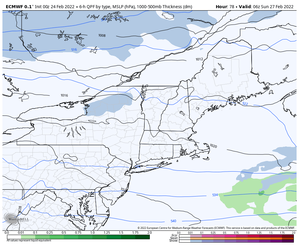 Sunday 1 AM to Monday 1 AM - Saturday starts off with a bit of breeze as the storm from Friday moves eastward, but the wind settles with high pressure taking control giving the region a cool but a mainly sunny and fair day. A clipper system approaches the region Sunday which brings a chance for light snow and/or snow showers which may drop an inch or two in spots. The clipper intensifies as it moves eastward Sunday night, the wind picks up in its wake and brings a bitter cold wind chill to the region for Monday to wrap up February. Another clipper system may bring snow and/or rain showers to the region Tuesday afternoon into Wednesday to start off meteorological spring. 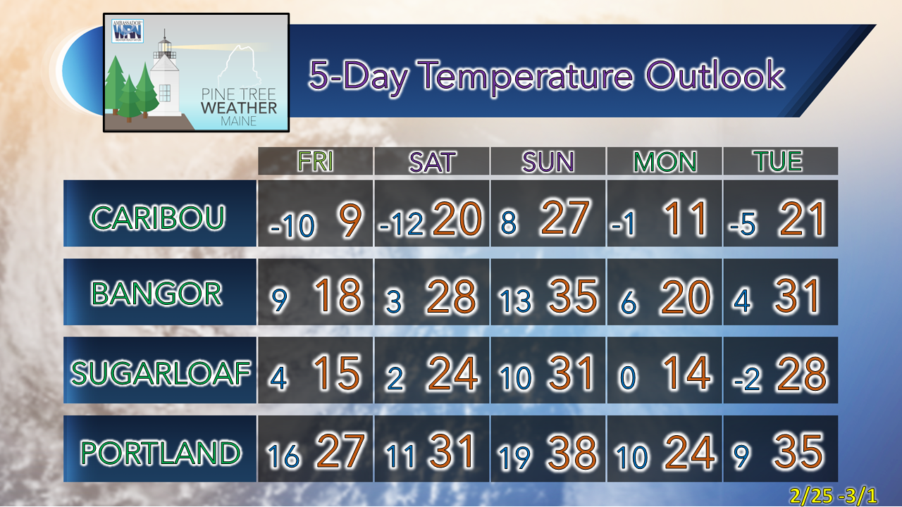 Science of Snowflakes Did you know that, while no two snowflakes are exactly the same, they are all six-sided? Snowflakes’ hexagonal shapes are due to the molecular structure of ice. Learn more about the science behind snowflakes: noaa.gov/stories/how-do-snowflakes-form-science-behind-snow Be prepared to receive alerts and stay updated!
 For more information in between posts, please follow Pine Tree Weather on Facebook and Twitter. Thank you for supporting this community-based weather information source which operates by reader supported financial contributions. Thank you as always for your support! - Mike NOTE: The forecast information depicted on this platform is for general information purposes only for the public and is not designed or intended for commercial use. For those seeking pinpoint weather information for business operations should use a private sector source. For information about where to find commercial forecasters to assist your business, please message me and I will be happy to help you. |

Mike Haggett
|