A bluebird sky for most today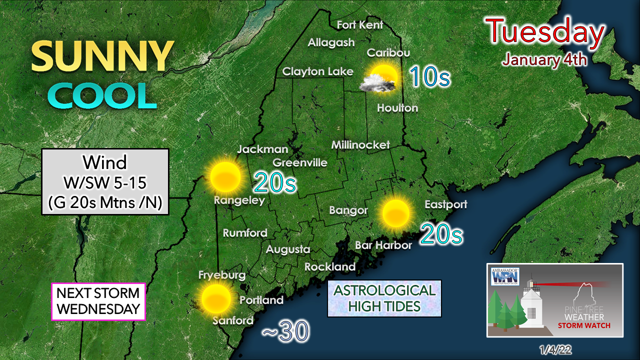 Cold Canadian high pressure owns the start of the day for the region. A few clouds filter in over northern areas as the high shifts to the east in the afternoon. A bit of a breeze is expected to form over the mountains and north as a ridge from the southwest moves in. King tides continue with coastal flood statements ongoing. The shorelines are escaping a battering for now, but tides will remain on the high end through the end of the week with a coastal storm potential lurking. The sun will be short lived as clouds increase Tuesday night as warmer air moves in aloft ahead of our next system for Wednesday. Overnight lows are expected to be 20° warmer to start Wednesday. Rain for the coast, mixed bag for the interior Wednesday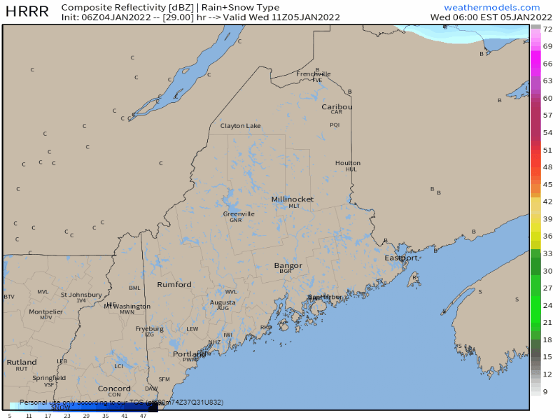 Wednesday 6 AM to 11 PM - Interior areas may see a period of light freezing rain during the morning hours but amounts and impacts appear minimal. Most of the precipitation comes in the form of rain, with eastern areas likely to see the most of that. As quickly as the warm front surges to the north, a cold front slides through from the northwest Wednesday night, bringing a quick hit of snow along with it. Some patchy fog is possible in areas during the lull between the two boundaries Wednesday afternoon into the evening. 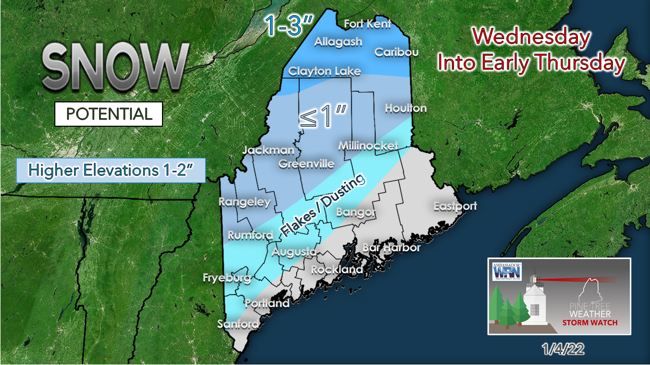 The ski hills may get an inch or two of fluff out of the frontal passage. Northern areas deal with the mixed bag of precipitation during the day, so what snow falls there may be on the sticky side at first before it dries out Wednesday night. Sun returns on Thursday as the cold front passes to the east by morning. So what is going on with the NorEaster for Friday?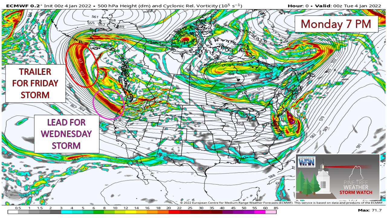 Model ideas are nuts between a blizzard and nothing. Why? Two key pieces of upper-level energy are offshore in the Pacific and radiosondes (weather balloons) can't read it. The lead piece for Wednesday's storm made landfall over southern Oregon Monday night. The sampling from that caused some shifting in model ideas, but the trailing piece that holds the cards for Friday's potential won't make landfall until Tuesday night. The two pieces split off, with the lead piece racing eastward, and the trailer working in behind it. 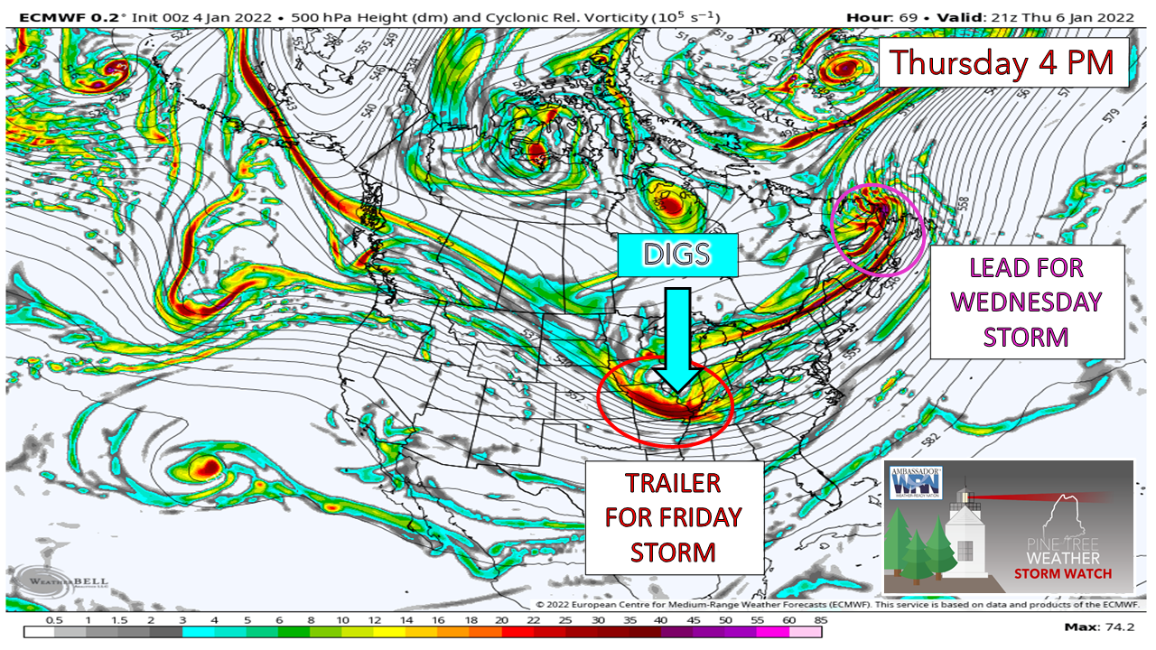 As the energy from the lead buries Labrador and parts of the Avalon of Newfoundland with snow on Thursday, the trailer digs in over the Midwest. How far south it digs and where it digs is the entire ballgame on what happens for Friday. The further south it digs, the greater the chance the storm stays offshore. However, if it happens to dig in more to the west over the central plains, that sets up potential for a more impactful storm here. 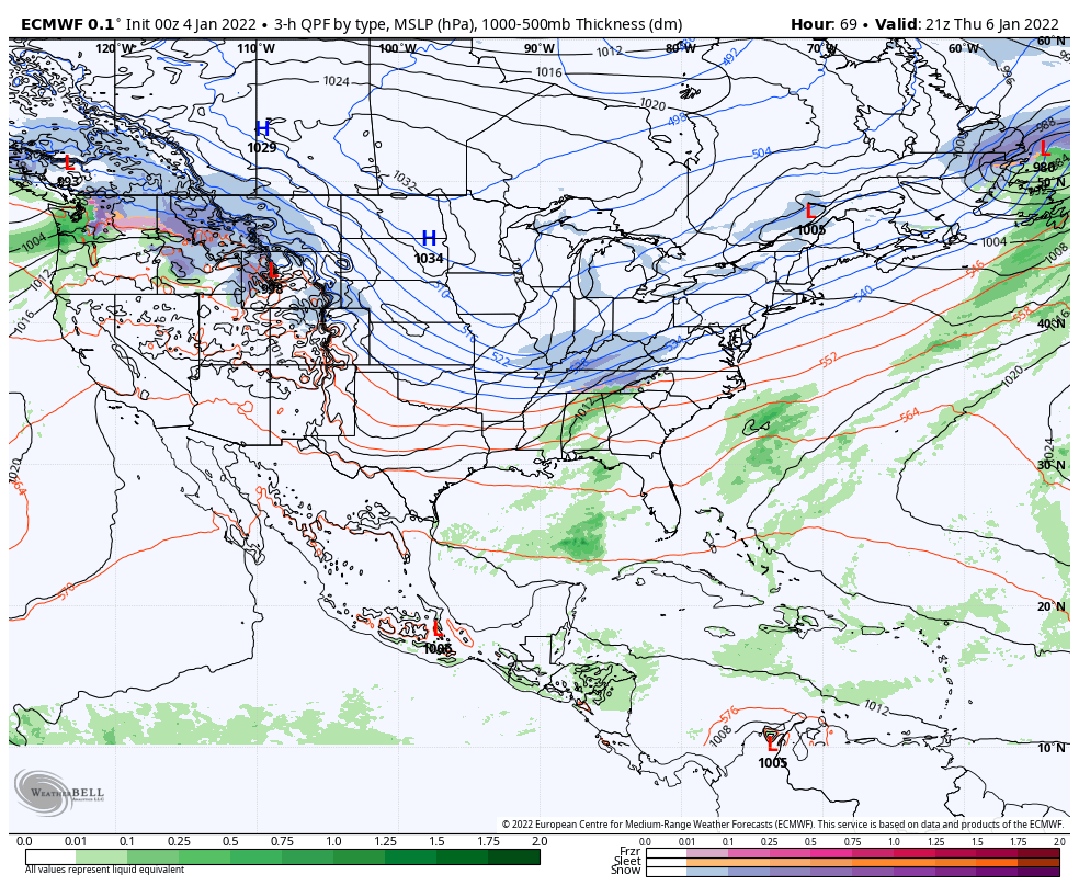 As the trailing trough energy digs to the south, it taps into Gulf of Mexico moisture, and as it tilts negatively to east, then rapid intensification takes place. The European and Canadian operational model ideas have shifted east, the GFS has shifted west which keeps the chance for snow potential for coastal areas, but questions remain for the mountains and north. 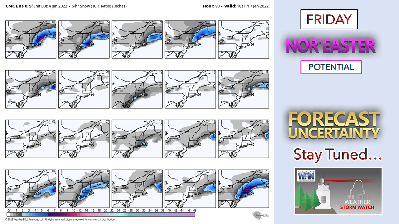 A look here at 20 members of the Canadian ensemble from Monday night's model run continues to show a great deal of uncertainty with various outcomes. Coastal areas should be prepared for snow and shoreline impacts. A better idea will be had on how widespread and how big of an impact comes with the model runs Tuesday night as the trailing energy arrives over the Pacific northwest.  Temperature outlook through SundayRegardless of what impacts that Friday's storm brings, another shot of cold air is in its wake for Saturday. High pressure associated with that quickly moves to the east overnight into Sunday, with a warm front to bring a potential mixed bag for Sunday. After that, a trip to the freezer for a prolonged period is expected next week. 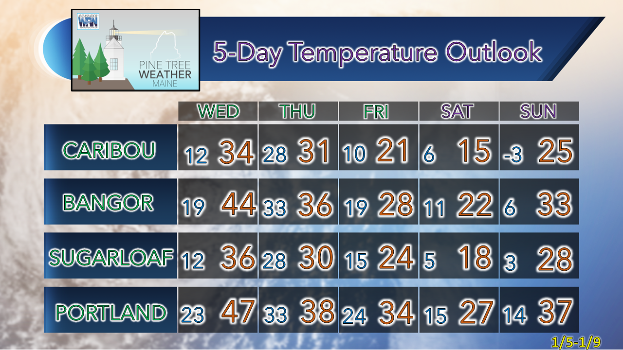 Nor’easter Safety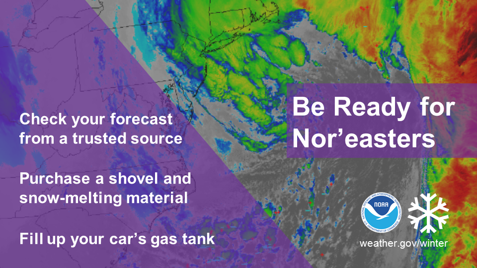 Nor’easters impact millions of people in the eastern U.S. with heavy snow and strong winds. What will you do if one approaches your region? weather.gov/safety/winter-noreaster Be prepared to receive alerts and stay updated!
 For more information in between posts, please follow Pine Tree Weather on Facebook and Twitter.
Thank you for supporting this community-based weather information source which operates by reader supported financial contributions. Stay weather aware, stay on alert, and stay safe! - Mike |

Mike Haggett
|